|
Argentario
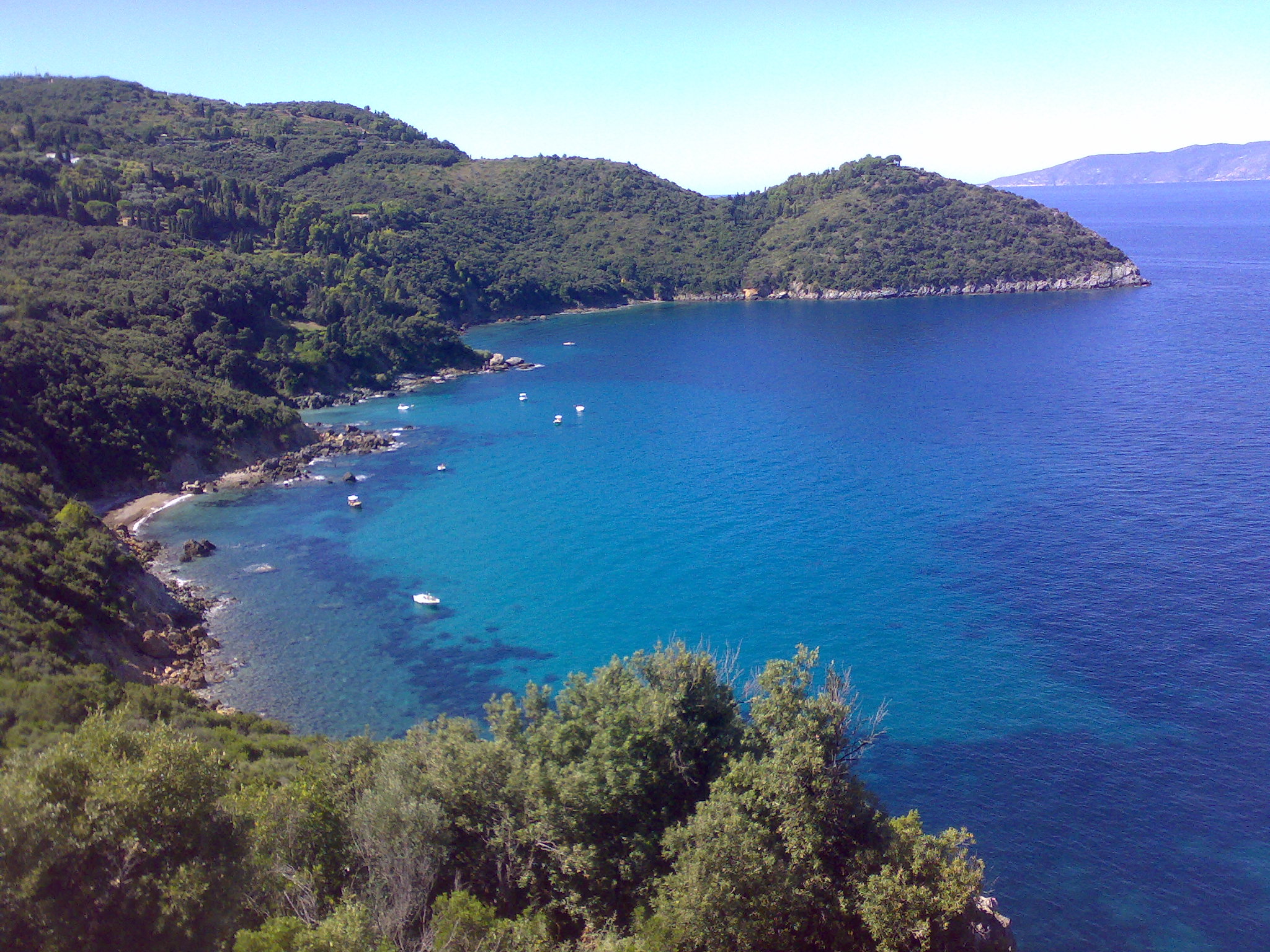
Monte Argentario is a '' comune'' (municipality) and a peninsula belonging to the Province of Grosseto in the Italian region Tuscany, located about south of Florence and about south of Grosseto. The peninsula is connected with the mainland by three spits of land which form two lagoons, the ''Laguna di Ponente'' on the west side and the ''Laguna di Levante'' on the east side of the middle dam. The two main villages on Monte Argentario are Porto Santo Stefano, chief town, facing north, and Porto Ercole facing south. The panoramic road ''Strada panoramica'' starts in Porto Santo Stefano allowing splendid views of the coast and the Tuscan Archipelago. Monte Argentario borders the ''comune'' of Orbetello, which is located on the middle dam between the two lagoons. Geography Monte Argentario is a promontory stretching towards the Tyrrhenian Sea in correspondence of the two southernmost islands of the Tuscan Archipelago, Giglio and Giannutri. The promontory was an island ... [...More Info...] [...Related Items...] OR: [Wikipedia] [Google] [Baidu] |
Porto Santo Stefano
Porto Santo Stefano () is a seaport town on the west coast of Italy, in the municipality of Monte Argentario, in the Province of Grosseto, Tuscany. It is the municipal seat of Monte Argentario and one of the two major towns that form the township, along with Porto Ercole. The region is on the slopes of Mount Argentario, which dominates the whole area. Porto Santo Stefano is 150 kilometres (95 miles) northwest of Rome. Geography Position The resort is located on the northwestern promontory of Monte Argentario, a little more than southeast of Grosseto, about southwest of Orbetello and about from Porto Ercole. Subdivisions The town is divided into four historical districts, each with its own coat of arms (''gonfalone'') banner: *Croce (''Cross''), whose nobles are called ''crociaioli'', its coat of arms depicts a gray seagull on a red background, above the red cross of Saint Andrew on a white background. *Fortezza (''Fortress''), whose nobles are called ''fortezzaioli''; its coa ... [...More Info...] [...Related Items...] OR: [Wikipedia] [Google] [Baidu] |
Porto Ercole
Porto Ercole () is an Italian town located in the municipality of Monte Argentario, in the Province of Grosseto, Tuscany. It is one of the two major towns that form the township, along with Porto Santo Stefano. Its name means "Port Hercules". Geography The resort is located on the eastern side of Monte Argentario promontory, and is from Grosseto, from Orbetello and about from Porto Santo Stefano. To the north of Porto Ercole are located the Laguna di Orbetello and the Tombolo della Feniglia. History Porto Ercole was first mentioned in 1296, when Margherita Aldobrandeschi, countess of Sovana, ordered the construction of a tower named ''Torre di Terra'', the oldest core of the town. In 1610, the Italian Baroque painter Caravaggio, exiled by the Pope, died in Porto Ercole on his way back to Rome and was buried in a local church. The Dutch Royal Family maintained a summer residence here in the latter half of the twentieth century. Transportation Porto Ercole was once conne ... [...More Info...] [...Related Items...] OR: [Wikipedia] [Google] [Baidu] |
Tuscany
Tuscany ( ; it, Toscana ) is a Regions of Italy, region in central Italy with an area of about and a population of about 3.8 million inhabitants. The regional capital is Florence (''Firenze''). Tuscany is known for its landscapes, history, artistic legacy, and its influence on high culture. It is regarded as the birthplace of the Italian Renaissance and of the foundations of the Italian language. The prestige established by the Tuscan dialect's use in literature by Dante Alighieri, Petrarch, Giovanni Boccaccio, Niccolò Machiavelli and Francesco Guicciardini led to its subsequent elaboration as the language of culture throughout Italy. It has been home to many figures influential in the history of art and science, and contains well-known museums such as the Uffizi and the Palazzo Pitti. Tuscany is also known for its wines, including Chianti, Vino Nobile di Montepulciano, Morellino di Scansano, Brunello di Montalcino and white Vernaccia di San Gimignano. Having a strong linguisti ... [...More Info...] [...Related Items...] OR: [Wikipedia] [Google] [Baidu] |
Province Of Grosseto
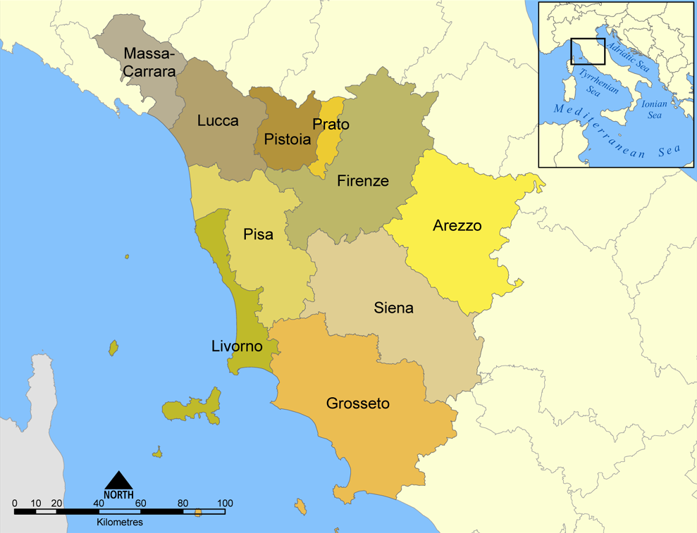
The province of Grosseto ( it, links=no, provincia di Grosseto) is a province in the Tuscany region of Italy. Its capital is the city of Grosseto. As of 2013 the province had a total population of 225,098 people. Geography The Province of Grosseto completely occupies the southern end of Tuscany, and with a territorial area of , it is the most extensive in the region and one of the least dense in population in Italy. The province is bordered to the northwest by the Province of Livorno, to the north by the Province of Pisa, to the northeast by the Province of Siena, and to the southeast by the Province of Viterbo in Lazio. To the south is the Tyrrhenian Sea, which includes the southern islands of the Tuscan archipelago, including Isola del Giglio and the smaller Giannutri islands and Formiche di Grosseto and Formica di Burano. The Arcipelago Toscano National Park spans both the provinces of Grosseto and Livorno, and includes the seven main islands of the Tuscan Archipelago: Elba ... [...More Info...] [...Related Items...] OR: [Wikipedia] [Google] [Baidu] |
Giannutri
Giannutri () is a small island in the Tyrrhenian Sea off the coast of Tuscany, Italy; it is the southernmost island of the Tuscan Archipelago and it is a ''frazione'' of the ''comune'' of Isola del Giglio in the Province of Grosseto. Geography Giannutri was known as ''Dianium'' by the Romans and ''Artemisia'', ''Αρτεμησία'' by the Greeks; it has a crescent moon shape which forms the Gulf of Spalmatoio and is placed at south east from the Isola del Giglio and from Porto Ercole. The island has a coastal perimeter of , is stretched approximately from ''Punta del Capo Rosso'' to ''Punta Secca'' (north-south) and from ''Punta San Francesco'' to ''Punta della Salvezza'' (west-east). The soil is calcareous and has a rocky and rugged coasts with inlets and caves mainly in the southern part interrupted only by two beaches called '' Cala dello Spalmatoio'' (on the north-east) and ''Cala Maestra'' (on the north-west) where the dockings are. The island landscape has three hill ... [...More Info...] [...Related Items...] OR: [Wikipedia] [Google] [Baidu] |
Giannella
Giannella is a village in Tuscany, central Italy, administratively a frazione of the comune of Orbetello, province of Grosseto, in the Tuscan Maremma. At the time of the 2001 census its population amounted to 160. . Geography The hamlet of Giannella is located along the strip of land ('''') which connects the mainland with the promontory of ...[...More Info...] [...Related Items...] OR: [Wikipedia] [Google] [Baidu] |
Tombolo
A tombolo is a sandy or shingle isthmus. A tombolo, from the Italian ', meaning 'pillow' or 'cushion', and sometimes translated incorrectly as ''ayre'' (an ayre is a shingle beach of any kind), is a deposition landform by which an island becomes attached to the mainland by a narrow piece of land such as a spit or bar. Once attached, the island is then known as a tied island. Several islands tied together by bars which rise above the water level are called a tombolo cluster. Two or more tombolos may form an enclosure (called a lagoon) that can eventually fill with sediment. Formation The shoreline moves toward the island (or detached breakwater) due to accretion of sand in the lee of the island, where wave energy and longshore drift are reduced and therefore deposition of sand occurs. Wave diffraction and refraction True tombolos are formed by wave refraction and diffraction. As waves near an island, they are slowed by the shallow water surrounding it. These waves th ... [...More Info...] [...Related Items...] OR: [Wikipedia] [Google] [Baidu] |
Isola Del Giglio
Isola del Giglio (; en, Giglio Island, lat, Igilium) is an Italian island and comune in the Tyrrhenian Sea, off the coast of Tuscany, and is part of the Province of Grosseto. The island is one of seven that form the Tuscan Archipelago, lying within the Arcipelago Toscano National Park. ''Giglio'' means "lily" in Italian, and though the name would appear consistent with the insignia of Medici Florence, it originally derives from the Latin name of the island, ''Igilium'', which in turn could be related to the Ancient Greek name of the neighbouring Capraia, ''Αἰγύλιον'' (''Aigýlion'', Latinized as ''Aegilium''), from grc, αἴξ, , goat, translit=aíx. In 2012, the cruise ship ''Costa Concordia'' foundered off the coast of the island. Geography The island is separated by a stretch of sea from the nearest point of the mainland, the promontory of Monte Argentario. Mainly mountainous, it consists almost entirely of granite, culminating in the Poggio della Pagana, whic ... [...More Info...] [...Related Items...] OR: [Wikipedia] [Google] [Baidu] |
Tyrrhenian Sea
The Tyrrhenian Sea (; it, Mar Tirreno , french: Mer Tyrrhénienne , sc, Mare Tirrenu, co, Mari Tirrenu, scn, Mari Tirrenu, nap, Mare Tirreno) is part of the Mediterranean Sea off the western coast of Italy. It is named for the Tyrrhenian people identified with the Etruscans of Italy. Geography The sea is bounded by the islands of Corsica and Sardinia (to the west), the Italian Peninsula (regions of Tuscany, Lazio, Campania, Basilicata, and Calabria) to the north and east, and the island of Sicily (to the south). The Tyrrhenian Sea also includes a number of smaller islands like Capri, Elba, Ischia, and Ustica. The maximum depth of the sea is . The Tyrrhenian Sea is situated near where the African and Eurasian Plates meet; therefore mountain chains and active volcanoes such as Mount Marsili are found in its depths. The eight Aeolian Islands and Ustica are located in the southern part of the sea, north of Sicily. Extent The International Hydrographic Organization define ... [...More Info...] [...Related Items...] OR: [Wikipedia] [Google] [Baidu] |
Albegna
The Albegna is a river in southern Tuscany, the sources of which are located in province of Grosseto on the southern side of Monte Buceto, the southwestern part of the volcanic cone of Mount Amiata, along with the northern side of Monte Aquilaia, and the Riserva Poggio all'Olmo. The river goes downstream initially heading south, passing first from the town of Roccalbegna and moving later into the western part of the municipality of Semproniano, downstream to Rocchette di Fazio, and crossing the Bosco dei Rocconi Natural Reserve. Soon after, it enters the town of Manciano and, near the village of Saturnia, it turns right towards the south-west. Once it reaches the town of Marsiliana, it forms the dell'Albegna plain. The river flows into the Tyrrhenian Sea near the town of Albinia, bordered on the north by the tombolo of Giannella which combines Monte Argentario Monte Argentario is a ''comune'' (municipality) and a peninsula belonging to the Province of Grosseto in the Italian ... [...More Info...] [...Related Items...] OR: [Wikipedia] [Google] [Baidu] |
Etruscans
The Etruscan civilization () was developed by a people of Etruria in ancient Italy with a common language and culture who formed a federation of city-states. After conquering adjacent lands, its territory covered, at its greatest extent, roughly what is now Tuscany, western Umbria, and northern Lazio, as well as what are now the Po Valley, Emilia-Romagna, south-eastern Lombardy, southern Veneto, and western Campania. The earliest evidence of a culture that is identifiably Etruscan dates from about 900BC. This is the period of the Iron Age Villanovan culture, considered to be the earliest phase of Etruscan civilization, which itself developed from the previous late Bronze Age Proto-Villanovan culture in the same region. Etruscan civilization endured until it was assimilated into Roman society. Assimilation began in the late 4thcenturyBC as a result of the Roman–Etruscan Wars; it accelerated with the grant of Roman citizenship in 90 BC, and became complete in 27 BC, ... [...More Info...] [...Related Items...] OR: [Wikipedia] [Google] [Baidu] |


.jpg)


