|
Arcadia, Florida
Arcadia is a city and county seat of DeSoto County, Florida, United States. Its population was 7,637 as of the 2010 census, with an estimated population of 7,722 in 2014. Arcadia's Historic District is listed on the National Register of Historic Places. History According to ''The Atlas of Florida'', "The Rev. James Madison ("Boss") Hendry (1839–1922) named the town in honor of Arcadia Albritton (1861–1932), a daughter of Thomas H. and Fannie (Waldron) Albritton, pioneer settlers. Arcadia had baked him a cake for his birthday, and he appreciated it so much that he named the city after her." In 1886, transportation improved in Arcadia when the Florida Southern Railway (later the Atlantic Coast Line Railroad) was built through Arcadia on its way from Bartow to Punta Gorda. The railway caused Arcadia to grow significantly, which led to it becoming incorporated a year later. A second railroad line, the Charlotte Harbor and Northern Railway (later the Seaboard Air Line R ... [...More Info...] [...Related Items...] OR: [Wikipedia] [Google] [Baidu] |
City
A city is a human settlement of notable size.Goodall, B. (1987) ''The Penguin Dictionary of Human Geography''. London: Penguin.Kuper, A. and Kuper, J., eds (1996) ''The Social Science Encyclopedia''. 2nd edition. London: Routledge. It can be defined as a permanent and densely settled place with administratively defined boundaries whose members work primarily on non-agricultural tasks. Cities generally have extensive systems for housing, transportation, sanitation, utilities, land use, production of goods, and communication. Their density facilitates interaction between people, government organisations and businesses, sometimes benefiting different parties in the process, such as improving efficiency of goods and service distribution. Historically, city-dwellers have been a small proportion of humanity overall, but following two centuries of unprecedented and rapid urbanization, more than half of the world population now lives in cities, which has had profound consequ ... [...More Info...] [...Related Items...] OR: [Wikipedia] [Google] [Baidu] |
Florida Southern Railway
The Florida Southern Railway (later known as the Florida Southern Railroad) was a railroad that operated in Florida in the late 1800s. It was one of Florida's three notable narrow gauge railway when it was built along with the South Florida Railroad and the Orange Belt Railway. The Florida Southern was originally chartered to run from Lake City south through central Florida to Charlotte Harbor. However, with the influence of Henry B. Plant, it operated with two discontinuous segments that would be part of the Plant System, which would later become part of the Atlantic Coast Line Railroad. History Original Charter The Florida Southern Railway was first chartered as the Gainesville, Ocala, and Charlotte Harbor Railroad in 1879, with a planned route from Lake City to Charlotte Harbor with a branch to Palatka to connect with steamboats on the St. Johns River. The name was then changed to the Florida Southern Railway in 1881. The first segment of the line opened on Augus ... [...More Info...] [...Related Items...] OR: [Wikipedia] [Google] [Baidu] |
Highlands County, Florida
Highlands County is a county located in the Florida Heartland region of the U.S. state of Florida. As of the 2020 census, the population was 101,235. Its county seat is Sebring. Highlands County comprises the Sebring-Avon Park, FL Metropolitan Statistical Area. History Highlands County was created in 1921 along with Charlotte, Glades, and Hardee, when they were separated from DeSoto County. It was named for the terrain of the county. It boasted the fifth-oldest population in America in 2012. Geography According to the U.S. Census Bureau, the county has a total area of , of which is land and (8.1%) is water. In area, it is the 14th largest county in Florida. Highlands County is bounded on the east by the Kissimmee River. Lake Istokpoga, the largest lake in the county, is connected to the Kissimmee River by two canals; the Istokpoga canal, and the C41 (outflow) canal. Adjacent counties * Osceola County, Florida - northeast * Okeechobee County, Florida - east * Glades Cou ... [...More Info...] [...Related Items...] OR: [Wikipedia] [Google] [Baidu] |
Glades County, Florida
Glades County is a county located in the Florida Heartland region of the U.S. state of Florida. As of the 2020 census, the population was 12,126, making it the fourth-least populous county in Florida. Its county seat is Moore Haven. Awards * Gov. Jeb Bush acknowledged Muse winning the Florida's Outstanding Rural Community of the Year 2002 award after "providing a safe community shelter to be used during storms." * Senior Ranger Danny Callahan, of the Florida Forest Service presented Jimmy Cianfrani and the Muse Community with a "10 Year Firewise Service Award" for "its diligence and commitment to the National Firewise Communities USA program. From the smallest project of cleaning the debris off their roofs to the largest undertaking of clearing flammable vegetation 30 feet away from their houses, the Muse Community’s dedication to reducing wildfire risk is commendable." History Indigenous people lived in this area for thousands of years. Due to warfare and exposure to in ... [...More Info...] [...Related Items...] OR: [Wikipedia] [Google] [Baidu] |
Hardee County, Florida
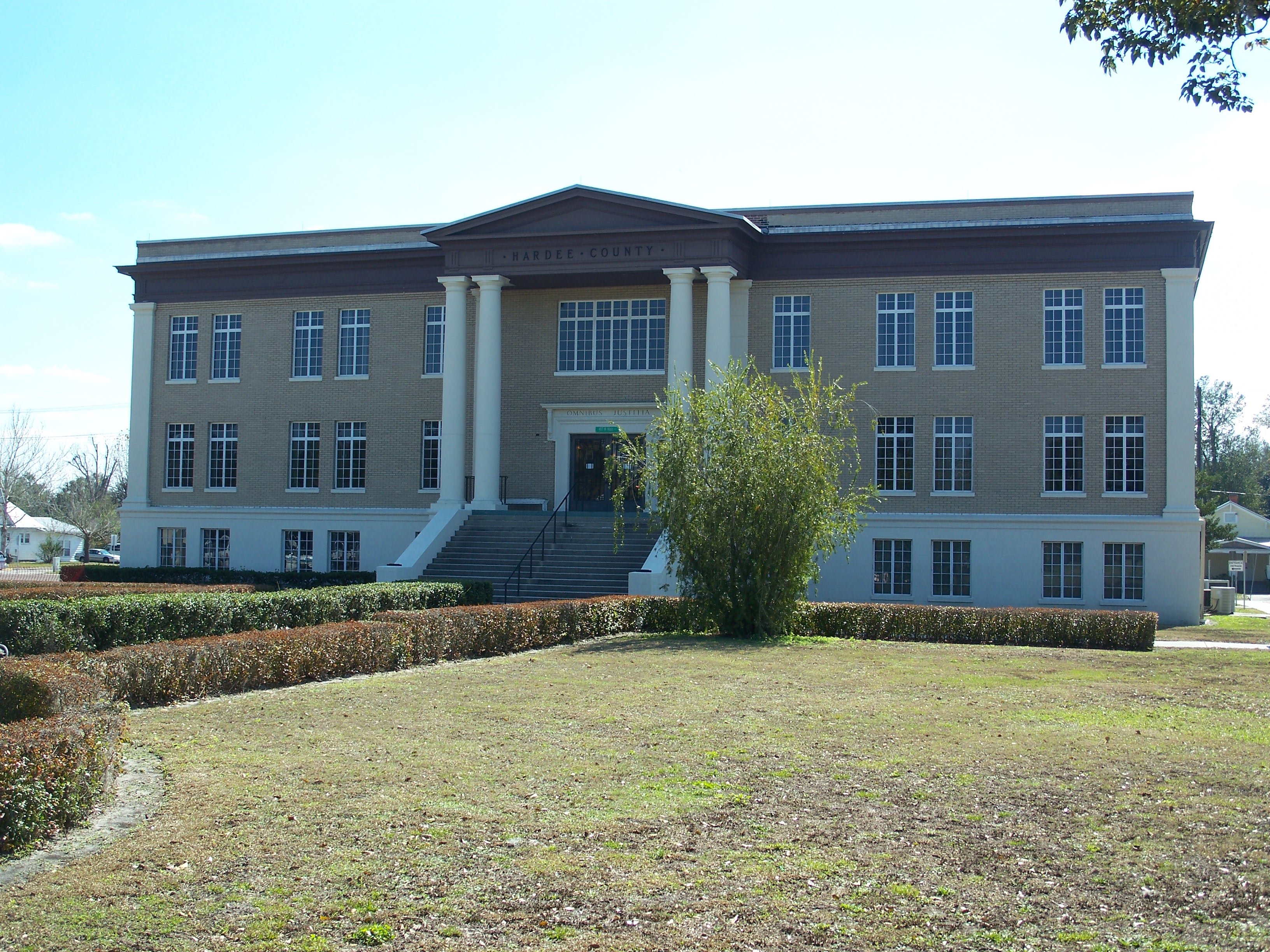
Hardee County is a county located in the Florida Heartland, Central Florida region U.S. state of Florida. As of the 2020 census, the population was 25,327. Its county seat is Wauchula. Hardee County comprises the Wauchula, FL Micropolitan Statistical Area. History It was named for Cary A. Hardee, Governor of Florida from 1921 to 1925. Hardee County was created in 1921. On August 13, 2004, Hurricane Charley went directly through Hardee County. Maximum sustained winds in downtown Wauchula were clocked at with higher gusts. Most buildings in the county sustained damage, and many were totally destroyed. Geography According to the U.S. Census Bureau, the county has a total area of , of which is land and (0.1%) is water. Hardee County is located in what is known as the " Bone Valley" which contains most of North America's phosphate deposits and a large portion of the world's deposits. Phosphate is mined in large open pit mines with massive settling ponds that contain many ... [...More Info...] [...Related Items...] OR: [Wikipedia] [Google] [Baidu] |
Charlotte County, Florida
Charlotte County is a U.S. county located in the U.S. state of Florida. As of the 2020 census, the population was 186,847. Its county seat is Punta Gorda. Charlotte County comprises the Punta Gorda, FL Metropolitan Statistical Area, which is included in the North Port-Sarasota, FL Combined Statistical Area. History Charlotte County was established April 23, 1921. It was named for the Bay of Charlotte Harbor. "Charlotte" came from "Carlota" (Spanish). In 1565, the Spanish named "Bahia de Carlota," followed by the English in 1775 who named the area Charlotte Harbor in tribute to the Queen Charlotte Sophia, wife of King George III. Punta Gorda is the only incorporated city in Charlotte County. On August 13, 2004 Charlotte County was devastated when Hurricane Charley came ashore near Port Charlotte as a Category 4 hurricane. Historic places Historic places in Charlotte County include the Old Charlotte County Courthouse as well as those on the List of Registered Historic ... [...More Info...] [...Related Items...] OR: [Wikipedia] [Google] [Baidu] |
Bradenton, Florida
Bradenton ( ) is a city in and the county seat of Manatee County, Florida, Manatee County, Florida, United States. As of the 2020 United States Census, 2020 census, the city's population is 55,698. History Late 18th and early 19th centuries A settlement established by Maroons or escaped slaves named Angola, Florida, Angola existed in Bradenton's present area starting in the late 1700s and ending in 1821. It is believed to been spread out between the Manatee River (then known as Oyster River) all the way to Sarasota Bay. The community is estimated to have had 600–750 residents in it. Angola was a rather large maroon settlement as the Manatee River at that time was too shallow for US Navy vessels to navigate. The settlement was abandoned after the Muscogee, Creeks who were aligned with Andrew Jackson attacked Angola. When the United States annexed Florida in 1821, there were two known claimants of land in the vicinity of Bradenton but neither of them was confirmed by the US ... [...More Info...] [...Related Items...] OR: [Wikipedia] [Google] [Baidu] |
East And West Coast Railway
The East and West Coast Railway was a railroad line running from Bradenton on the west coast of Florida southeast to Arcadia in the Peace River valley. Despite its name, the line never went all the way to the east coast of Florida. The line was often used to transport mail, lumber, grain and other commodities. Opened on May 3, 1915, the nearly fifty mile line began at the Seaboard Air Line Railroad's line through Bradenton just south of the Manatee River, and ran southeast closely following the current route of State Road 70 via Myakka City to Arcadia. In Arcadia, the line crossed the Charlotte Harbor and Northern Railway and the Atlantic Coast Line Railroad's Lakeland–Fort Myers Line before terminating in the southeast portion of Arcadia. In 1925, the Seaboard Air Line Railroad leased the entire line, who had provided locomotives and rolling stock for the line since its construction. A year later, Seaboard also purchased the Charlotte Harbor and Northern Railway. A ... [...More Info...] [...Related Items...] OR: [Wikipedia] [Google] [Baidu] |
Boca Grande, Florida
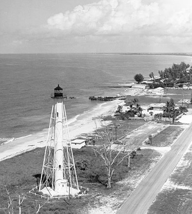
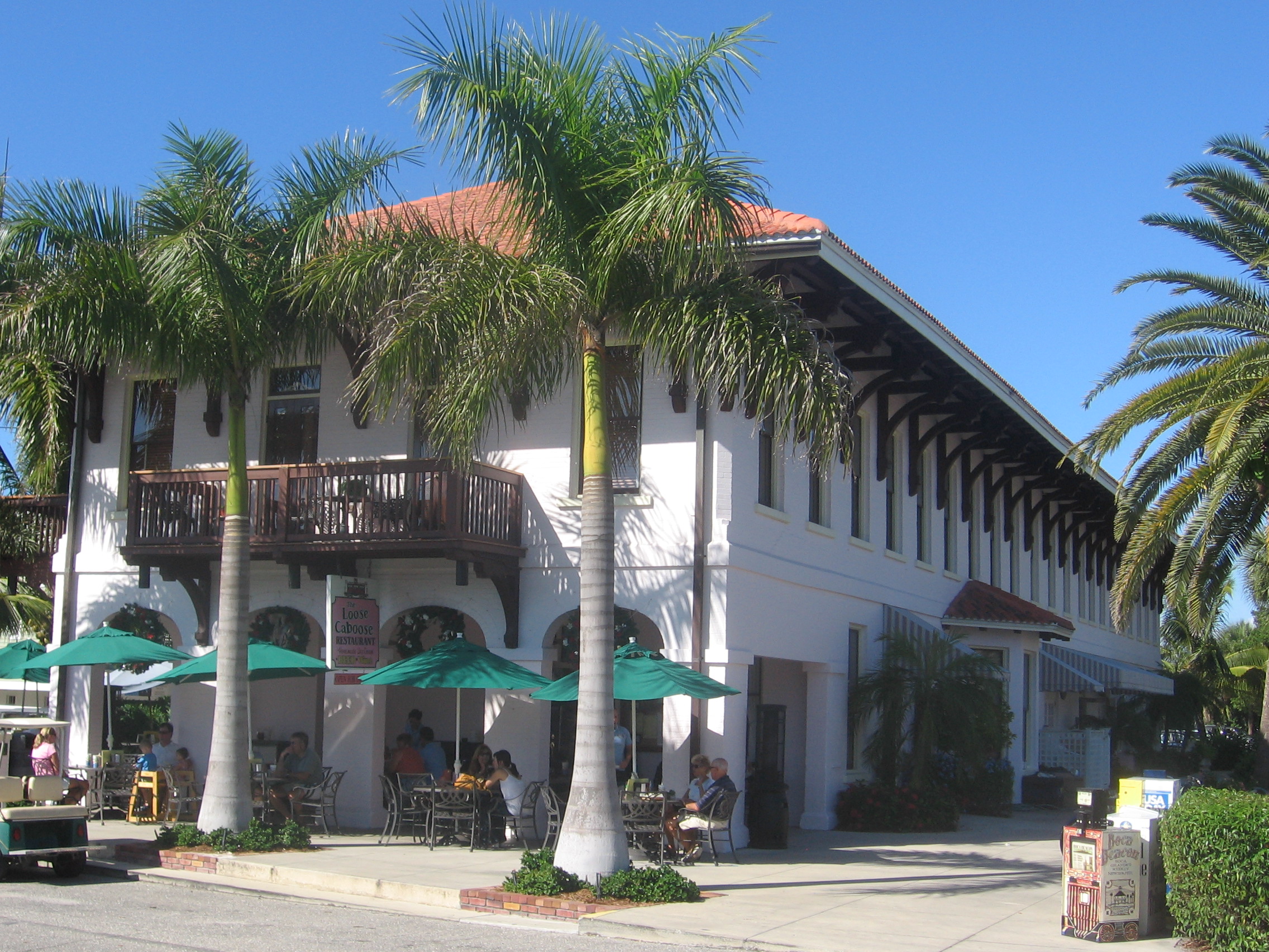
Boca Grande is a small residential community on Gasparilla Island in southwest Florida. Gasparilla Island is a part of both Charlotte and Lee counties, while the actual village of Boca Grande, which is home to many seasonal and some year-round residents, is entirely in the Lee County portion of the island. It is part of the Cape Coral-Fort Myers, Florida Metropolitan Statistical Area. Boca Grande is known for its historic downtown, sugar sand beaches, blue water and world class fishing. Overview Its name - Spanish for "Big Mouth" - comes from the mouth of the waterway, called Boca Grande Pass, separating the southern tip of the island from Cayo Costa. The pass was used as a busy shipping point for many years, as the waters in the pass are naturally deep. Processed phosphate from the Bone Valley region was loaded onto waiting ocean-going cargo vessels via the Seaboard Air Line Railroad at the dock located on the southern tip of the island. Shipping business to the island ... [...More Info...] [...Related Items...] OR: [Wikipedia] [Google] [Baidu] |
Mulberry, Florida
Mulberry is a city in Polk County, Florida, United States. The population was 3,817 at the 2010 census. Mulberry is home to Badcock Home Furniture. It is part of the Lakeland– Winter Haven Metropolitan Statistical Area, with parts of unincorporated Lakeland on its northern boundary. Mulberry is home to the 334-acre Alafia River Reserve. History The first white settlers appeared in the Mulberry area in the 1840s. The first industry in Mulberry was logging the longleaf yellow pine which dominated the area. The town had no official name, but the railroad which came through town stopped at a mulberry tree to let off passengers and drop off the mail. The old mulberry tree became the de facto meeting place in town, and eventually gave the town its name. Several lynchings and hangings took place from this mulberry tree. In 1886, phosphate rock was discovered in the Peace River, and the dominant logging industry gave way to mining operations. The phosphate industry gave the town ... [...More Info...] [...Related Items...] OR: [Wikipedia] [Google] [Baidu] |
Seaboard Air Line Railroad
The Seaboard Air Line Railroad , which styled itself "The Route of Courteous Service," was an American railroad which existed from April 14, 1900, until July 1, 1967, when it merged with the Atlantic Coast Line Railroad, its longtime rival, to form the Seaboard Coast Line Railroad. Predecessor railroads dated from the 1830s and reorganized extensively to rebuild after the American Civil War. The company was headquartered in Norfolk, Virginia, until 1958, when its main offices were relocated to Richmond, Virginia. The Seaboard Air Line Railway Building in Norfolk's historic Freemason District still stands and has been converted into apartments. At the end of 1925 SAL operated 3,929 miles of road, not including its flock of subsidiaries; at the end of 1960 it reported 4,135 miles. The main line ran from Richmond via Raleigh, North Carolina, Columbia, South Carolina, and Savannah, Georgia to Jacksonville, Florida, a major interchange point for passenger trains bringing trav ... [...More Info...] [...Related Items...] OR: [Wikipedia] [Google] [Baidu] |
Charlotte Harbor And Northern Railway
The Charlotte Harbor and Northern Railway is a historic railroad line that at its greatest extent serviced Gasparilla Island in Charlotte Harbor and a major shipping port that once operated there. The railroad's principal purpose was to transport phosphate mined along the Peace River and in the Bone Valley region of Central Florida to the port to be shipped. It also brought passengers to the island community of Boca Grande on Gasparilla Island, and is largely responsible for making Boca Grande the popular tourist destination it is today. Part of the line remains in service today between Mulberry and Arcadia, which is now owned and operated by CSX Transportation. Today, it makes up CSX's Achan Subdivision and part of their Brewster Subdivision. Route At its greatest extent, the Charlotte Harbor and Northern Railway ran from Mulberry to the southern tip of Gasparilla Island, a distance of nearly 100 miles. From Mulberry, the line proceeded south in a mostly straight trajec ... [...More Info...] [...Related Items...] OR: [Wikipedia] [Google] [Baidu] |


