|
Aracar
Aracar is a large conical stratovolcano in northwestern Argentina, just east of the Chilean border. It has a main summit crater about in diameter which sometimes contains crater lakes, and a secondary crater. The volcano has formed, starting during the Pliocene, on top of a lava platform and an older basement. Constructed on a base with an altitude of , it covers a surface area of and has a volume of . The only observed volcanic activity was a possible steam or ash plume on March 28, 1993, seen from the village of Tolar Grande about southeast of the volcano, but with no evidence of deformation of the volcano from satellite observations. Inca archeological sites are found on the volcano. Geology Aracar is located in the Salta province, north of the Salar de Taca Taca and Arizaro and east of the Salar de Incahuasi and the Sierra de Taca Taca, close to the Chilean border. Volcanoes in the territory rise above the endorheic sinks and landscape. Cerro Arizaro (9.0 ± 1.3 mya) i ... [...More Info...] [...Related Items...] OR: [Wikipedia] [Google] [Baidu] |
Volcanic Crater Lake
A volcanic crater lake is a lake in a crater that was formed by explosive activity or a collapse during a volcanic eruption. Formation Lakes in calderas fill large craters formed by the collapse of a volcano during an eruption. Lakes in maars fill medium-sized craters where an eruption deposited debris around a vent. Crater lakes form as the created depression, within the crater rim, is filled by water. The water may come from precipitation, groundwater circulation (often hydrothermal fluids in the case of volcanic craters) or melted ice. Its level rises until an equilibrium is reached between the rates of incoming and outgoing water. Sources of water loss singly or together may include evaporation, subsurface seepage, and, in places, surface leakage or overflow when the lake level reaches the lowest point on its rim. At such a saddle location, the upper portion of the lake is contained only by its adjacent natural volcanic dam; continued leakage through or surface outflow ac ... [...More Info...] [...Related Items...] OR: [Wikipedia] [Google] [Baidu] |
SRTM
The Shuttle Radar Topography Mission (SRTM) is an international research effort that obtained digital elevation models on a near-global scale from 56°S to 60°N, to generate the most complete high-resolution digital topographic database of Earth prior to the release of the ASTER GDEM in 2009. SRTM consisted of a specially modified radar system that flew on board the Space Shuttle Endeavour during the 11-day STS-99 mission in February 2000. The radar system was based on the older '' Spaceborne Imaging Radar-C/X-band Synthetic Aperture Radar'' (SIR-C/X-SAR), previously used on the Shuttle in 1994. To acquire topographic data, the SRTM payload was outfitted with two radar antennas. One antenna was located in the Shuttle's payload bay, the other – a critical change from the SIR-C/X-SAR, allowing single-pass interferometry – on the end of a 60-meter (200-foot) mast that extended from the payload bay once the Shuttle was in space. The technique employed is known as interferomet ... [...More Info...] [...Related Items...] OR: [Wikipedia] [Google] [Baidu] |
Deformation (volcanology)
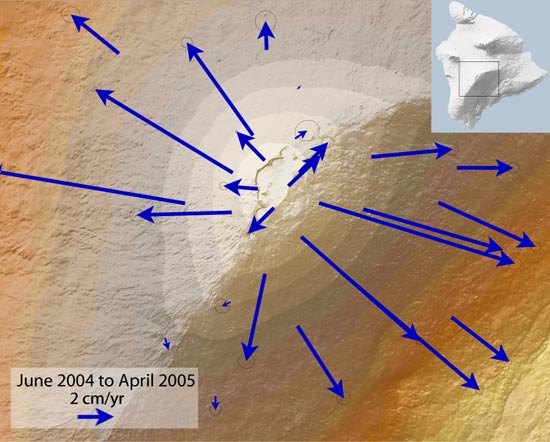
In volcanology, deformation is any change in the shape of a volcano or the land surrounding it. This can be in the form of inflation, which is a response to pressurization, or deflation, which is a response to depressurization. Inflation is represented by swelling of the ground surface, a volcanic edifice, or a subsurface magma body. It can be caused by magma accumulation, exsolution of volatiles, geothermal processes, heating, and tectonic compression. Deflation is represented by shrinking of the ground surface, a volcanic edifice, or a subsurface magma body. It can be caused by magma withdrawal (related to intrusion or eruption), volatile escape, thermal contraction, phase changes during crystallization, and tectonic extension. Deformation is a key indicator of pre-eruptive unrest at many active volcanoes. The term bradyseism is used in the volcanological literature to mean the vertical ground movements associated with the Phlegraean Fields volcanic area west of Naples, Ital ... [...More Info...] [...Related Items...] OR: [Wikipedia] [Google] [Baidu] |
Basaltic Lava
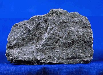
A mafic mineral or rock is a silicate mineral or igneous rock rich in magnesium and iron. Most mafic minerals are dark in color, and common rock-forming mafic minerals include olivine, pyroxene, amphibole, and biotite. Common mafic rocks include basalt, diabase and gabbro. Mafic rocks often also contain calcium-rich varieties of plagioclase feldspar. Mafic materials can also be described as ferromagnesian. History The term ''mafic'' is a portmanteau of "magnesium" and "ferric" and was coined by Charles Whitman Cross, Joseph P. Iddings, Louis Valentine Pirsson, and Henry Stephens Washington in 1912. Cross' group had previously divided the major rock-forming minerals found in igneous rocks into ''salic'' minerals, such as quartz, feldspars, or feldspathoids, and ''femic'' minerals, such as olivine and pyroxene. However, micas and aluminium-rich amphiboles were excluded, while some calcium minerals containing little iron or magnesium, such as wollastonite or apatite, were included in ... [...More Info...] [...Related Items...] OR: [Wikipedia] [Google] [Baidu] |
Lava Domes
In volcanology, a lava dome is a circular mound-shaped protrusion resulting from the slow extrusion of viscous lava from a volcano. Dome-building eruptions are common, particularly in convergent plate boundary settings. Around 6% of eruptions on Earth are lava dome forming. The geochemistry of lava domes can vary from basalt (e.g. Semeru, 1946) to rhyolite (e.g. Chaiten, 2010) although the majority are of intermediate composition (such as Santiaguito, dacite-andesite, present day) The characteristic dome shape is attributed to high viscosity that prevents the lava from flowing very far. This high viscosity can be obtained in two ways: by high levels of silica in the magma, or by degassing of fluid magma. Since viscous basaltic and andesitic domes weather fast and easily break apart by further input of fluid lava, most of the preserved domes have high silica content and consist of rhyolite or dacite. Existence of lava domes has been suggested for some domed structures on the Mo ... [...More Info...] [...Related Items...] OR: [Wikipedia] [Google] [Baidu] |
Arenite
Arenite (Latin: ''arena'', "sand") is a sedimentary clastic rock with sand grain size between 0.0625 mm (0.00246 in) and 2 mm (0.08 in) and contain less than 15% matrix. The related adjective is ''arenaceous''. The equivalent Greek-derived term is psammite, though this is more commonly used for metamorphosed sediments. Since it refers to grain size rather than chemical composition, the term is used for example in the classification of clastic carbonatic limestones, as the granulometrically equivalent term sandstone is not appropriate for limestone. Other arenites include sandstones, arkoses, greensands, and greywackes. Arenites mainly form by erosion of other rocks or turbiditic re-deposition of sands. Some arenites contain a varying amount of carbonatic components and thus belong to the rock-category of carbonatic sandstones or silicatic limestones. Arenites often appear as massive or bedded medium-grained rocks with a middling- to wide-spaced preferred ... [...More Info...] [...Related Items...] OR: [Wikipedia] [Google] [Baidu] |
Tertiary
Tertiary ( ) is a widely used but obsolete term for the geologic period from 66 million to 2.6 million years ago. The period began with the demise of the non-avian dinosaurs in the Cretaceous–Paleogene extinction event, at the start of the Cenozoic Era, and extended to the beginning of the Quaternary glaciation at the end of the Pliocene Epoch. The time span covered by the Tertiary has no exact equivalent in the current geologic time system, but it is essentially the merged Paleogene and Neogene periods, which are informally called the Early Tertiary and the Late Tertiary, respectively. The Tertiary established the Antarctic as an icy island continent. Historical use of the term The term Tertiary was first used by Giovanni Arduino during the mid-18th century. He classified geologic time into primitive (or primary), secondary, and tertiary periods based on observations of geology in Northern Italy. Later a fourth period, the Quaternary, was applied. In the early d ... [...More Info...] [...Related Items...] OR: [Wikipedia] [Google] [Baidu] |
Gondwana
Gondwana () was a large landmass, often referred to as a supercontinent, that formed during the late Neoproterozoic (about 550 million years ago) and began to break up during the Jurassic period (about 180 million years ago). The final stages of break-up, involving the separation of Antarctica from South America (forming the Drake Passage) and Australia, occurred during the Paleogene. Gondwana was not considered a supercontinent by the earliest definition, since the landmasses of Baltica, Laurentia, and Siberia were separated from it. To differentiate it from the Indian region of the same name (see ), it is also commonly called Gondwanaland. Gondwana was formed by the accretion of several cratons. Eventually, Gondwana became the largest piece of continental crust of the Palaeozoic Era, covering an area of about , about one-fifth of the Earth's surface. During the Carboniferous Period, it merged with Laurasia to form a larger supercontinent called Pangaea. Gondwana (and Pan ... [...More Info...] [...Related Items...] OR: [Wikipedia] [Google] [Baidu] |
Laguna De Aracar Formation
Laguna (Italian and Spanish for lagoon) may refer to: People * Abe Laguna (born 1992), American DJ known as Ookay * Andrés Laguna (1499–1559), Spanish physician, pharmacologist, and botanist * Ana Laguna (born 1955), Spanish-Swedish ballet dancer, court dancer and professor * Benjamín Máximo Laguna y Villanueva (1822–1902), Spanish forester * Frederica de Laguna (1906–2004), American anthropologist * Fábio Laguna (born 1977), Brazilian keyboardist * Grace de Laguna (1878–1978), American philosopher * Ieva Lagūna (born 1990), Latvian model * Jorge Laguna (born 1993), Mexican footballer * José Dapena Laguna (1912–1991), Puerto Rican politician - mayor of Ponce, Puerto Rico * José Durand Laguna (1889–1958), Argentine football manager * Justo Oscar Laguna (1929–2011), Argentinian bishop * Kenny Laguna (born 1948), American songwriter and record producer * Ricardo Laguna (born 1982), Mexican-American professional BMX rider and television personality * Theodore de La ... [...More Info...] [...Related Items...] OR: [Wikipedia] [Google] [Baidu] |
Granite
Granite () is a coarse-grained (phaneritic) intrusive igneous rock composed mostly of quartz, alkali feldspar, and plagioclase. It forms from magma with a high content of silica and alkali metal oxides that slowly cools and solidifies underground. It is common in the continental crust of Earth, where it is found in igneous intrusions. These range in size from dikes only a few centimeters across to batholiths exposed over hundreds of square kilometers. Granite is typical of a larger family of ''granitic rocks'', or ''granitoids'', that are composed mostly of coarse-grained quartz and feldspars in varying proportions. These rocks are classified by the relative percentages of quartz, alkali feldspar, and plagioclase (the QAPF classification), with true granite representing granitic rocks rich in quartz and alkali feldspar. Most granitic rocks also contain mica or amphibole minerals, though a few (known as leucogranites) contain almost no dark minerals. Granite is nearly alway ... [...More Info...] [...Related Items...] OR: [Wikipedia] [Google] [Baidu] |
Paleozoic
The Paleozoic (or Palaeozoic) Era is the earliest of three geologic eras of the Phanerozoic Eon. The name ''Paleozoic'' ( ;) was coined by the British geologist Adam Sedgwick in 1838 by combining the Greek words ''palaiós'' (, "old") and ''zōḗ'' (), "life", meaning "ancient life" ). It is the longest of the Phanerozoic eras, lasting from , and is subdivided into six geologic periods (from oldest to youngest): # Cambrian # Ordovician # Silurian # Devonian # Carboniferous # Permian The Paleozoic comes after the Neoproterozoic Era of the Proterozoic Eon and is followed by the Mesozoic Era. The Paleozoic was a time of dramatic geological, climatic, and evolutionary change. The Cambrian witnessed the most rapid and widespread diversification of life in Earth's history, known as the Cambrian explosion, in which most modern phyla first appeared. Arthropods, molluscs, fish, amphibians, reptiles, and synapsids all evolved during the Paleozoic. Life began in the ocean ... [...More Info...] [...Related Items...] OR: [Wikipedia] [Google] [Baidu] |


