|
Antiqua Maneria
The Antiqua maneria (ancient manors), or assessionable manors, were the original 17 manors belonging to the Earldom of Cornwall. After March 1337 these manors passed to the new Duchy of Cornwall which was created by King Edward III to give financial support to his son Edward, the Black Prince (1330–1376). These manors were known as assessionable manors as the manors were to lease under assession leases periodically. The table below shows the 17 Antiqua maneria including the number and status of Customary tenants in the early fourteenth century: the manors vary greatly in size and importance. The parishes stated are the modern parishes rather than those in existence in the 14th century.Hatcher, John (1970) ''Rural Economy and Society in the Duchy of Cornwall 1300-1500''. Cambridge University Press; p. 76 Table of customary tenants in the early fourteenth century Conventionarii = Conventionary tenants; Villani = Villeins; Nativi = Villeins; Liberi Conventionarii = Free tenants ... [...More Info...] [...Related Items...] OR: [Wikipedia] [Google] [Baidu] |
Manorialism
Manorialism, also known as the manor system or manorial system, was the method of land ownership (or "tenure") in parts of Europe, notably France and later England, during the Middle Ages. Its defining features included a large, sometimes fortified manor house in which the lord of the manor and his dependents lived and administered a rural estate, and a population of labourers who worked the surrounding land to support themselves and the lord. These labourers fulfilled their obligations with labour time or in-kind produce at first, and later by cash payment as commercial activity increased. Manorialism is sometimes included as part of the feudal system. Manorialism originated in the Roman villa system of the Late Roman Empire, and was widely practiced in medieval western Europe and parts of central Europe. An essential element of feudal society, manorialism was slowly replaced by the advent of a money-based market economy and new forms of agrarian contract. In examining the o ... [...More Info...] [...Related Items...] OR: [Wikipedia] [Google] [Baidu] |
Penmayne
Penmayne is a hamlet next to Splatt in the civil parish of St Minver Lowlands in north Cornwall, England, UK. In the Middle Ages Penmayne (a sub-manor of Helston-in-Trigg) was one of the Antiqua maneria (ancient manors), the original 17 manors belonging to the Earldom of Cornwall The title of Earl of Cornwall was created several times in the Peerage of England before 1337, when it was superseded by the title Duke of Cornwall, which became attached to heirs-apparent to the throne. Condor of Cornwall * Condor of Cornwall, ....Hatcher, John (1970) ''Rural Economy and Society in the Duchy of Cornwall 1300-1500''. Cambridge University Press; p. 76 References Hamlets in Cornwall Manors in Cornwall {{Cornwall-geo-stub ... [...More Info...] [...Related Items...] OR: [Wikipedia] [Google] [Baidu] |
Royal Charters Applying To Cornwall
This is a list of charters promulgated by kings of England that specifically relate to Cornwall, which was incorporated into the Kingdom of England late in the Anglo-Saxon period. In the 9th and 10th centuries, the kings of Wessex became the rulers of Cornwall, and after a period of independence during the wars with the Danes, this rule by the kings of England became permanent (see History of Cornwall). The charters below relate either to the tin mines of Cornwall and Devon or to the Earldom or Duchy of Cornwall. The stannary charters are dated between 1201 and 1508, the others between 1231 and 1338. In 1337, the earldom of Cornwall was made into a royal duchy to support the heir to the throne. Centralisation in the reign of Henry VIII meant that Cornwall's distinct status was no longer recognised in royal documents; though unlike the situation for Wales, no legislation was enacted to formalise this. The rights of the Duke of Cornwall still rely on medieval legislation. When no on ... [...More Info...] [...Related Items...] OR: [Wikipedia] [Google] [Baidu] |
St Agnes, Cornwall
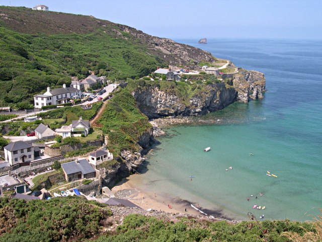
St Agnes ( kw, Breanek) is a civil parish and a large village on the north coast of Cornwall, UK. The village is about five miles (8 km) north of Redruth and ten miles (16 km) southwest of Newquay. ''and'' An electoral ward exists stretching as far south as Blackwater. The population at the 2011 census was 7,565. The village of St Agnes, a popular coastal tourist spot, lies on a main road between Redruth and Perranporth. It was a prehistoric and modern centre for mining of copper, tin and arsenic until the 1920s. Local industry has also included farming, fishing and quarrying, and more recently tourism. The St Agnes district has a heritage of industrial archaeology and much of the landscape is of considerable geological interest. There are also stone-age remains in the parish. The manor of Tywarnhaile was one of the 17 Antiqua maneria of the Duchy of Cornwall. Geography St Agnes, on Cornwall's north coast along the Atlantic Ocean, is in the Pydar hundred ... [...More Info...] [...Related Items...] OR: [Wikipedia] [Google] [Baidu] |
Creed, Cornwall
Creed ( kw, Krid) is a hamlet in mid Cornwall, England, United Kingdom. It is roughly midway between Truro and St Austell, about two miles (3 km) east of Probus. Creed is in the civil parish of Grampound with Creed (where the population was included) and the name comes from Saint Cride (''Sancta Crida''), the patron of the church. The manor of Tybesta was the head manor of the hundred of Powder in the time of Domesday and later one of the 17 Antiqua maneria of the Duchy of Cornwall. It included the whole of the parish of Creed and parts of other parishes. Parish Church The church of St Crida was of Norman foundation but in its existing form is more or less of the 15th century (the tower which had already been built in 1447 however was rebuilt in 1734). Between 1869 and 1906 the church was unused. It has a tower of three stages, a fine south aisle and a south porch. Parts of the old woodwork have been preserved. By 1291 the church was cruciform; of this the north transept ... [...More Info...] [...Related Items...] OR: [Wikipedia] [Google] [Baidu] |
Trematon
Trematon is a village in Cornwall, England, UK, accessible via the A38 and about two miles (3 km) from the town of Saltash and part of the civil parish of St Stephens-by-Saltash. History Trematon appears in the Domesday Book (1086) as the manor of "Tremetone",St Stephens-by-Saltash at genuki.org.uk at 100 households it was one of the very largest settlements in Cornwall and West Devon, larger even than nearby St Germans. says of Trematon , one and a half miles south-east of the village, stands in a sentinel position overlo ... [...More Info...] [...Related Items...] OR: [Wikipedia] [Google] [Baidu] |
Tintagel
Tintagel () or Trevena ( kw, Tre war Venydh, meaning ''Village on a Mountain'') is a civil parish and village situated on the Atlantic coast of Cornwall, England. The village and nearby Tintagel Castle are associated with the legends surrounding King Arthur and in recent times has become a tourist attraction. Toponymy Toponymists have had difficulty explaining the origin of 'Tintagel': the probability is that it is Norman French, as the Cornish of the 13th century would have lacked the soft 'g' ('i/j' in the earliest forms: see also Tintagel Castle). If it is Cornish then 'Dun' would mean ''Fort''. Oliver Padel proposes 'Dun' '-tagell' meaning ''narrow place'' in his book on place names. There is a possible cognate in the Channel Islands named ''Tente d'Agel'', but that still leaves the question subject to doubt. The name first occurs in Geoffrey of Monmouth's ''Historia Regum Britanniae'' (c. 1136, in Latin) as ''Tintagol'', implying pronunciation with a hard sound as in ... [...More Info...] [...Related Items...] OR: [Wikipedia] [Google] [Baidu] |
Treverbyn
Treverbyn is a civil parish and village in mid-Cornwall, England, United Kingdom. The church of St Peter is modern as the medieval chapel was closed at the time of the Reformation. The parish was formed from part of St Austell parish in 1847. Treverbyn parish includes the villages of Treverbyn, Carclaze, Stenalees, Penwithick, Bugle (the largest of these), Rescorla, Kerrow Moor, Carthew, Ruddlemoor, Bowling Green, Resugga Green, Scredda and parts of Trethurgy. The parish population at the 2011 census including Carluddon, Greensplatt, Knightor, Lavrean and Lower Menadue was 8,016. Hensbarrow Beacon near Stenalees is the highest point of the St Austell Downs. There is a railway station at Bugle. History The Manor of Treverbyn was recorded in the Domesday Book (1086) when it was one of 28 manors held by Richard from Robert, Count of Mortain. There was one virgate of land and land for 3 ploughs. There were one and a half ploughs, 2 serfs, 2 villeins, 4 smallholders, 2 ac ... [...More Info...] [...Related Items...] OR: [Wikipedia] [Google] [Baidu] |
St Columb Major
St Columb Major is a town and civil parish in Cornwall, England, United Kingdom. Often referred to locally as ''St Columb'', it is approximately southwest of Wadebridge and east of Newquay Ordnance Survey: Landranger map sheet 200 ''Newquay & Bodmin'' The designation ''Major'' distinguishes it from the nearby settlement and parish of St Columb Minor on the coast. An electoral ward simply named ''St Columb'' exists with a population at the 2011 census of 5,050. The town is named after the 6th-century AD Saint Columba of Cornwall, also known as Columb. Twice a year the town plays host to "hurling", a medieval game once common throughout Cornwall but now only played in St Columb and St Ives.It is also played irregularly and less frequently at Bodmin, but nowhere else. It is played on Shrove Tuesday and again on the Saturday eleven days later. The game involves two teams of unlimited numbers (the 'townsmen' and the 'countrymen' of St Columb parish) who endeavour to carry a sil ... [...More Info...] [...Related Items...] OR: [Wikipedia] [Google] [Baidu] |
Talskiddy
Talskiddy is a small rural village about two miles north of St Columb Major in Cornwall, England, United Kingdom. Originally a manorial settlement belonging to the Earldom of Cornwall, the place prospered in the 19th century as a centre of the wool-combing industry. History Talskiddy was once an ancient manor belonging to the Duchy of Cornwall. Previous to the formation of the Duchy, it was one of 17 manors belonging to the Earl of Cornwall. It is recorded that Richard, Earl of Cornwall purchased three Cornish acres at Talskiddy. These seventeen 'ancient manors' were known collectively as the Antiqua maneria. The manorial custom of "Free Bench" was practised here. It was once a centre for the woolcombing industry. Many of the older houses in the village are built of cob. Etymology The meaning of the name is supposed to be ''brow of the hill of shadows'', from ''Tal'' the Cornish word for ''brow'', and ''skeusy'' the Cornish word for ''shady'' or ''shadows'', but could incl ... [...More Info...] [...Related Items...] OR: [Wikipedia] [Google] [Baidu] |
Linkinhorne
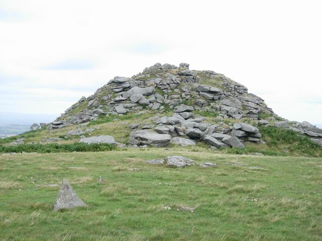
Linkinhorne (in Cornish ''Lanngynhorn'') is a civil parish and village in southeast Cornwall, England, United Kingdom. The village itself is situated at and is approximately four miles (6.5 km) northwest of Callington and seven miles (11 km) south of Launceston.Ordnance Survey: Landranger map sheet 201 ''Plymouth & Launceston'' The parish population at the 2011 census including Downgate was 1,541 Geography As well as Linkinhorne village, other settlements in the parish include (in alphabetical order) Bray Shop, Caradon Town, Downgate, Henwood, Ley Mill, Minions, Plushabridge, Rilla Mill and Upton Cross. The area is bordered by the River Inny in the north-east and Bodmin Moor to the west. The valley of the River Lynher runs through the parish. History Linkinhorne parish is within the Deanery and Hundred of East and is bounded on the north by North Hill and Lezant, on the east by Stoke Climsland and South Hill, on the south and west by St Ive and St Cleer. ... [...More Info...] [...Related Items...] OR: [Wikipedia] [Google] [Baidu] |


_(9458675814).jpg)


