|
Angels Rest Cluster
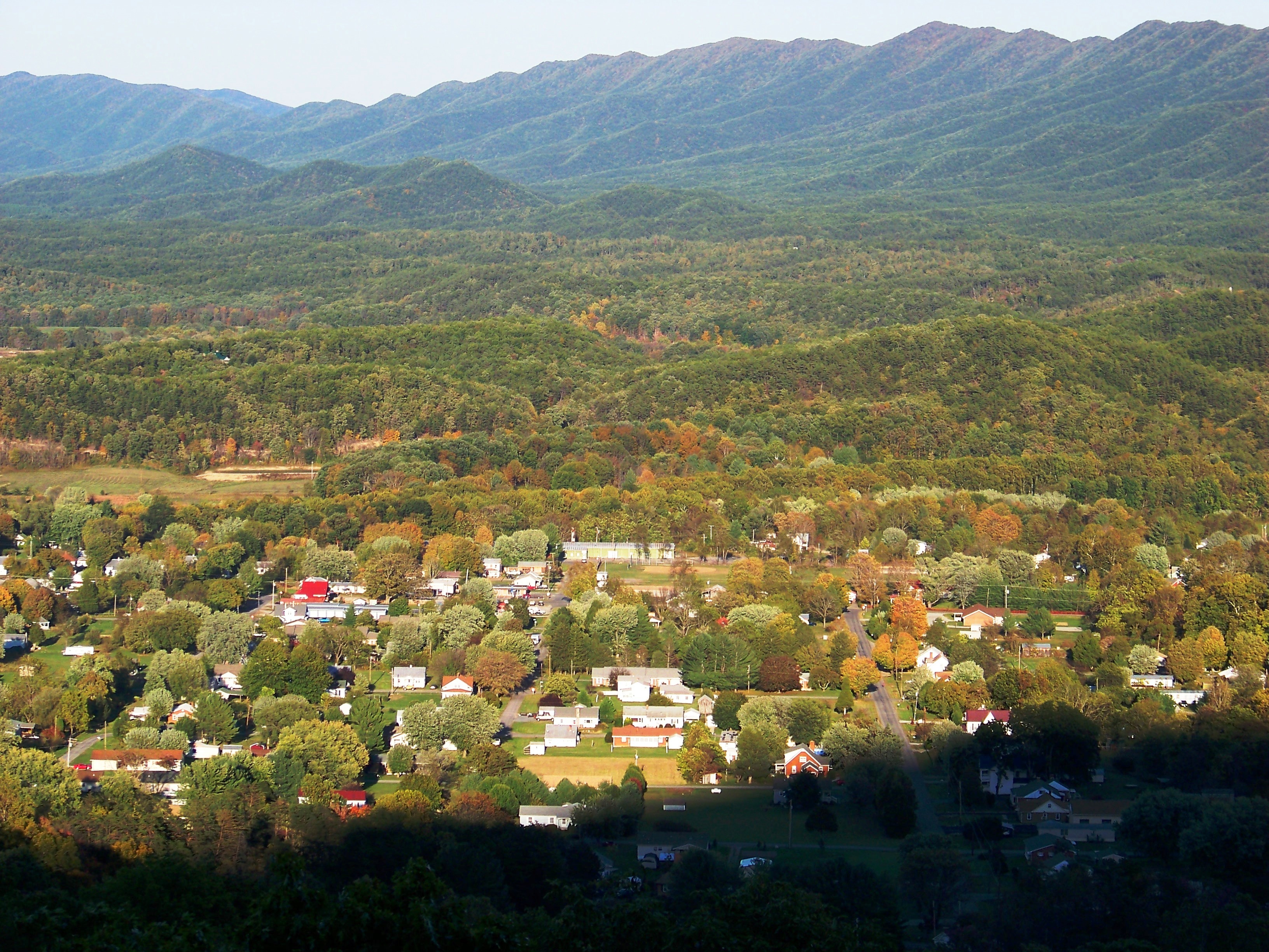
The Angels Rest Cluster is a region in the Jefferson National Forest recognized by The Wilderness Society for its diversity of habitats with steep mountains, an isolated valley, a waterfall and wetlands. It is named after a high point on Pearis Mountain with views of the New River and surrounding area. It contains two large wild areas connected by the Appalachian Trail. Description The Angels Rest Cluster contains two wildlands recognized by the Wilderness Society as “Mountain Treasures”, areas that are worthy of protection from logging and road construction. The areas in the cluster are: * Mill Creek (conservation area) * Dismal Creek Location and access The northeast end of the cluster is about one mile south of Pearisburg, Virginia. Roads and trails in the cluster are shown on National Geographic Map 787 (Blacksburg, New River Valley). A great variety of information, including topographic maps, aerial views, satellite data and weather information, is obtained by sele ... [...More Info...] [...Related Items...] OR: [Wikipedia] [Google] [Baidu] |
Giles County, Virginia
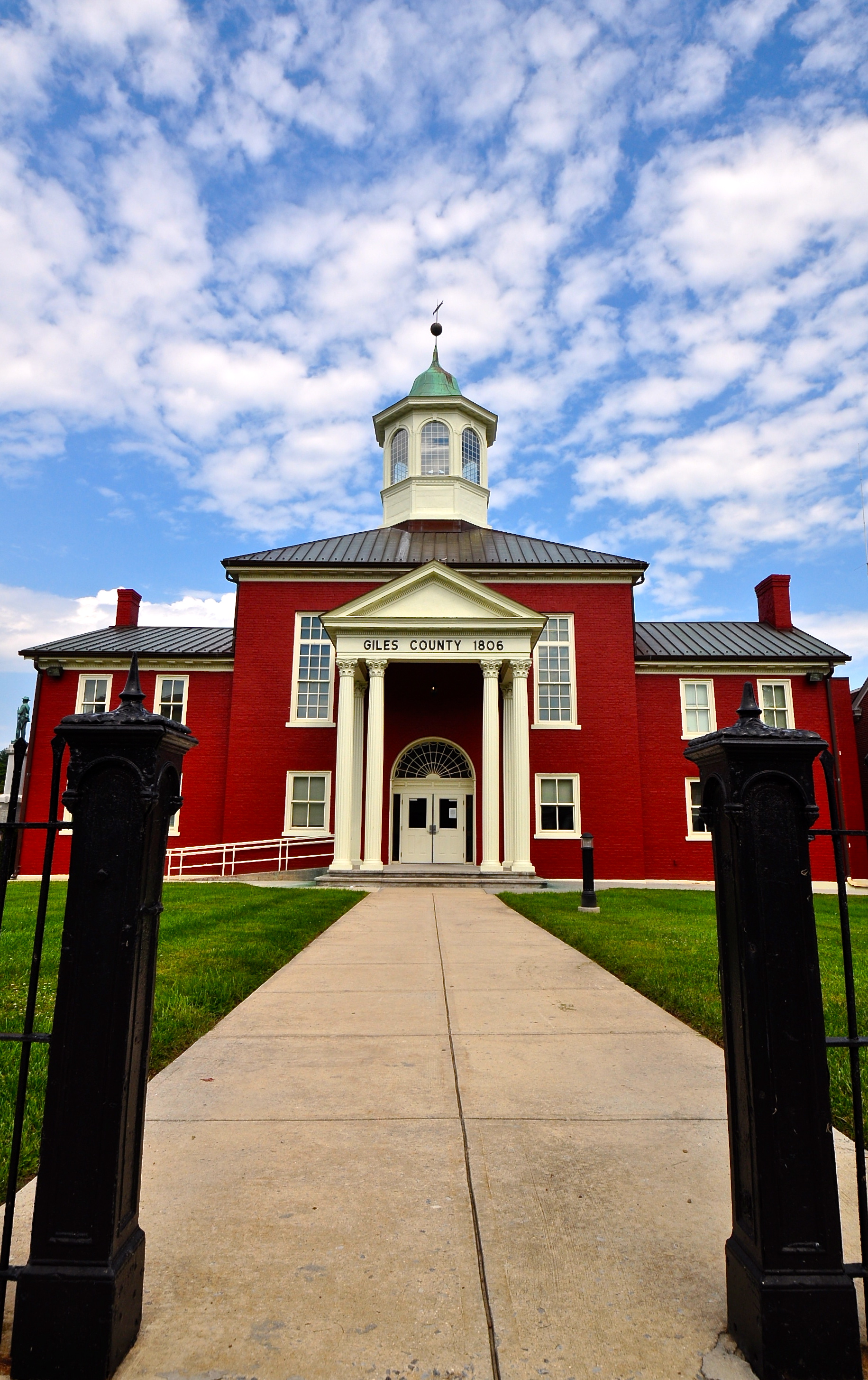
Giles County is a county located in the U.S. state of Virginia on the West Virginia state line. As of the 2020 census, the population was 16,787. Its county seat is Pearisburg. Giles County is included in the Blacksburg- Christiansburg, VA Metropolitan Statistical Area. Giles County is the location of Mountain Lake, one of only two natural fresh water lakes in Virginia. The lake drains into Little Stony Creek, which passes over a waterfall known as The Cascades before reaching the New River. History Giles County was established in 1806 from Montgomery, Monroe, Wythe, and Tazewell counties. The county is named for William Branch Giles who was born in Amelia County in 1762. Giles became a lawyer and from there was elected to the United States House of Representatives where he served from 1790 to 1815. He also served in the Virginia General Assembly from 1816 to 1822. In 1827, he was elected Governor. In all, he served his nation and state around a total of forty years. ... [...More Info...] [...Related Items...] OR: [Wikipedia] [Google] [Baidu] |
Shale
Shale is a fine-grained, clastic sedimentary rock formed from mud that is a mix of flakes of clay minerals (hydrous aluminium phyllosilicates, e.g. kaolin, Al2 Si2 O5( OH)4) and tiny fragments (silt-sized particles) of other minerals, especially quartz and calcite.Blatt, Harvey and Robert J. Tracy (1996) ''Petrology: Igneous, Sedimentary and Metamorphic'', 2nd ed., Freeman, pp. 281–292 Shale is characterized by its tendency to split into thin layers ( laminae) less than one centimeter in thickness. This property is called '' fissility''. Shale is the most common sedimentary rock. The term ''shale'' is sometimes applied more broadly, as essentially a synonym for mudrock, rather than in the more narrow sense of clay-rich fissile mudrock. Texture Shale typically exhibits varying degrees of fissility. Because of the parallel orientation of clay mineral flakes in shale, it breaks into thin layers, often splintery and usually parallel to the otherwise indistinguishable beddin ... [...More Info...] [...Related Items...] OR: [Wikipedia] [Google] [Baidu] |
Garden Mountain Cluster
The Garden Mountain Cluster is a region in the Jefferson National Forest recognized by The Wilderness Society for its diversity of habitats extending along the east, south and west of Burke's Garden. The cluster, part of the Appalachian Mountains in southwest Virginia, connects wildlands in the high country of Garden Mountain and adjacent streams and ridges in one of the most remote areas of Virginia. Description The Garden Mountain Cluster contains seven wildlands with different degrees of protection: wilderness areas, a study area and two areas recognized by the Wilderness Society as "Mountain Treasures", areas that are worthy of protection from logging and road construction. The areas in the cluster are: *Wilderness Areas ** Hunting Camp Creek Wilderness ** Garden Mountain Wilderness ** Beartown Wilderness *Study Areas ** Lynn Camp Creek Wilderness Study Area *Wild areas recognized by the Wilderness Society as "Mountain Treasures" ** Beartown Wilderness Addition A ** Beartown ... [...More Info...] [...Related Items...] OR: [Wikipedia] [Google] [Baidu] |
Kimberling Creek Cluster
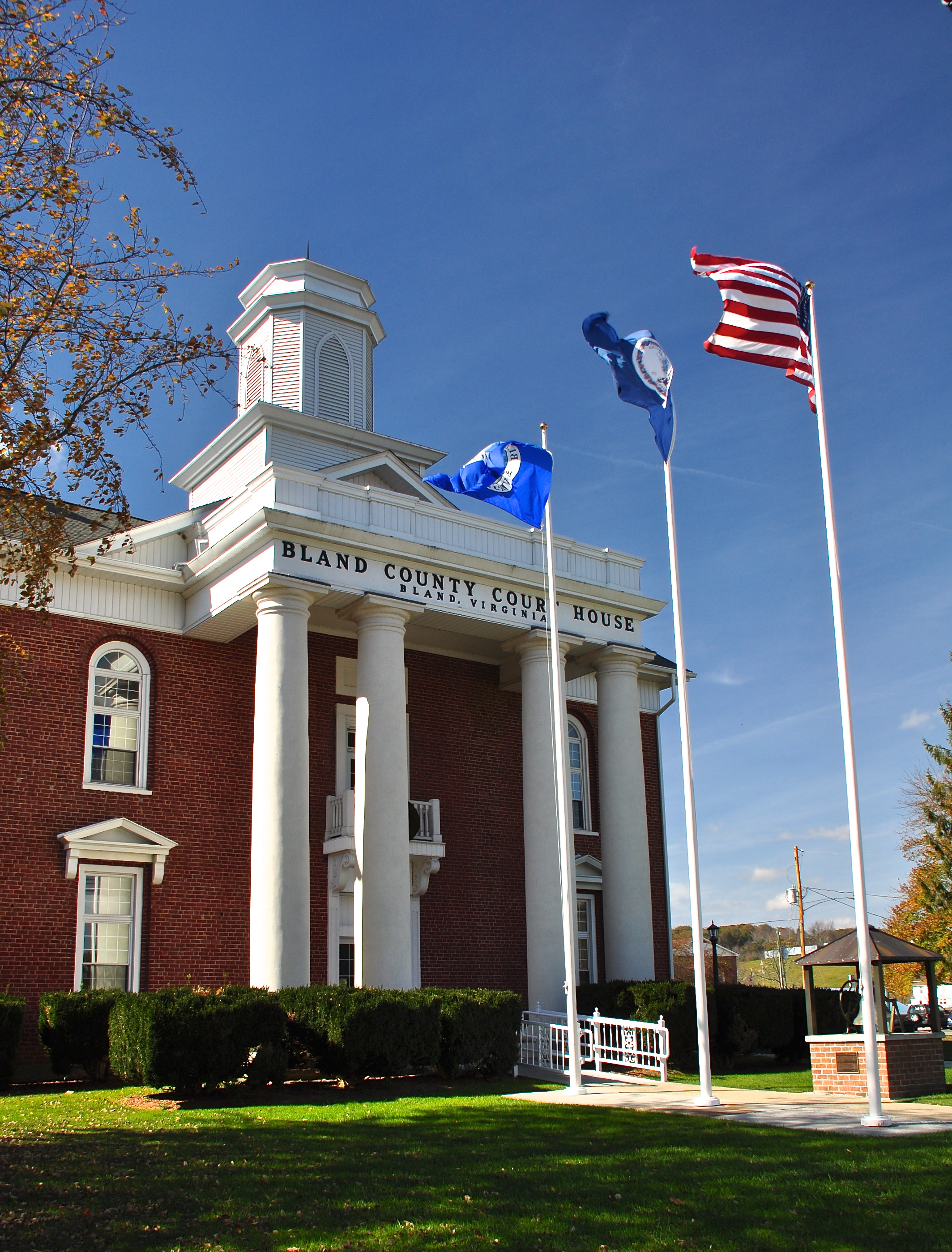
The Kimberling Creek Cluster is a region in the George Washington and Jefferson National Forests, Jefferson National Forest recognized by The Wilderness Society (United States), The Wilderness Society for its diversity of habitats extending along parts of Brushy and Hogback Mountains. Kimberling Creek, with headwaters in the cluster, flows into Big Walker Creek, a tributary of the New River. Description The Kimberling Creek Cluster contains wild areas that are worthy of protection from logging and road construction. These include areas with different levels of protection. One is recognized as a “Mountain Treasure” by the Wilderness Society and the other is a wilderness protected by law. The areas in the cluster are: *Brushy Mountain (conservation area) *Kimberling Creek Wilderness Nearby wild areas: *Walker Mountain Cluster *Garden Mountain Cluster *Angels Rest Cluster Location and access The cluster is east of Interstate I-77, about five miles north of Bland, Virginia ... [...More Info...] [...Related Items...] OR: [Wikipedia] [Google] [Baidu] |
Walker Mountain Cluster
The Walker Mountain Cluster is a region in the Jefferson National Forest recognized by The Wilderness Society for its diversity of habitats extending along Walker Mountain. The mountain, part of the Appalachian Mountains in southwest Virginia, borders the western side of the Great Valley of Virginia. Interstate 81 traverses the Great Valley as it takes travelers between Tennessee and West Virginia. Description The Walker Mountain Cluster contains four wildlands recognized by the Wilderness Society as “Mountain Treasures”, areas that are worthy of protection from logging and road construction. The areas in the cluster are: * Big Walker Mountain * Little Walker Mountain (conservation area) * Long Spur (conservation area) * Seven Sisters (conservation area) * Crawfish Valley (Bear Creek) Nearby wild areas: * Big Survey Wildlife Management Area Location and access The cluster extends along Walker Mountain from its southern end near Rural Retreat, Virginia to its northern e ... [...More Info...] [...Related Items...] OR: [Wikipedia] [Google] [Baidu] |
Mountain Lake Wilderness Cluster
The Mountain Lake Wilderness Cluster is a region recognized by The Wilderness Society for its unique waterfalls, vistas, trout stream and wildlife habitat. The heart of the region is the Mountain Lake Wilderness, the largest wilderness in the George Washington and Jefferson National Forests. These public lands are enhanced by the presence of private lands which are preserved to maintain their natural integrity.Virginia's Mountain Treasures, report issued by The Wilderness Society, May, 1999 The region includes the Mountain Lake Biological Station that studies distinctive wildlife and ecology of the area. Description The Mountain Lake Wilderness Cluster contains wildlands under different levels of management. There are wilderness areas protected by Congressional action, inventoried wilderness, areas recognized by Wilderness Society as worthy of protection from timbering and roads, and other forest service land that act as a buffer for the protected areas. These areas are in ... [...More Info...] [...Related Items...] OR: [Wikipedia] [Google] [Baidu] |
Sinking Creek Valley Cluster
The Sinking Creek Valley Cluster is a region in the Jefferson National Forest recognized by The Wilderness Society for its unique recreational and scenic values as well as the importance of its watershed protection for Johns Creek and Craig Creek. Sinking Creek Valley is one of the most scenic valleys in Virginia. Description The Sinking Creek Valley Cluster contains wildlands recognized by the Wilderness Society as “Mountain Treasures”, areas that are worthy of protection from logging and road construction. The areas in the cluster are: *Sinking Creek Mountain * Johns Creek Mountain Location and access The cluster is about six miles north of Newport Virginia. Roads and trails in the cluster are shown on National Geographic Map 788 (Covington, Alleghany Highlands. A great variety of information, including topographic maps, aerial views, satellite data and weather information, is obtained by selecting the link with the wild land’s coordinates in the upper right o ... [...More Info...] [...Related Items...] OR: [Wikipedia] [Google] [Baidu] |
Barbours Creek-Shawvers Run Cluster
The Barbours Creek-Shawvers Run Cluster is a region in the Jefferson National Forest recognized by The Wilderness Society for its unique high elevation mountains, vistas, trout streams and wildlife habitat. With over 25,000 acres in a remote corner of the national forest, the cluster provides protection for black bear, clean water, backcountry hiking, and scenic beauty. Description The Barbours Creek/Shawvers Run Wilderness Cluster contains wilderness areas, and wildlands recognized by the Wilderness Society as "Mountain Treasures", areas that are worthy of protection from logging and road construction. The areas in the cluster are: *Wilderness Areas ** Barbours Creek Wilderness ** Shawvers Run Wilderness *wild areas in the Jefferson National Forest recognized by the Wilderness Society as "Mountain Treasures" ** Hoop hole **Barbours Creek Wilderness Addition ** Potts Arm * Toms Knob, a wild area in the George Washington National Forest recognized by the Wilderness Society as a "M ... [...More Info...] [...Related Items...] OR: [Wikipedia] [Google] [Baidu] |
Craig Creek Cluster
The Craig Creek Cluster is a region recognized by The Wilderness Society for its unique high elevation mountains, vistas, trout streams and wildlife habitat. The cluster contains wildlands and wilderness areas along Craig Creek, a 65-mile long creek with headwaters at the Brush Mountain Wilderness near Blacksburg. Popular for hiking, canoeing, mountain biking, hunting, horseback riding, and fishing, the area offers an opportunity for secluded recreation. During the summer months the area is an escape from other public lands that are busy with visitors. Description The Craig Creek Wilderness Cluster contains wilderness areas and wildlands recognized by the Wilderness Society as “Mountain Treasures”, areas that are worthy of protection from logging and road construction. The areas in the cluster are: *Wilderness Areas **Brush Mountain Wilderness ** Brush Mountain East Wilderness *Wildareas recognized by the Wilderness Society as “Mountain Treasures” ** Patterson Mountai ... [...More Info...] [...Related Items...] OR: [Wikipedia] [Google] [Baidu] |
Glenwood Cluster
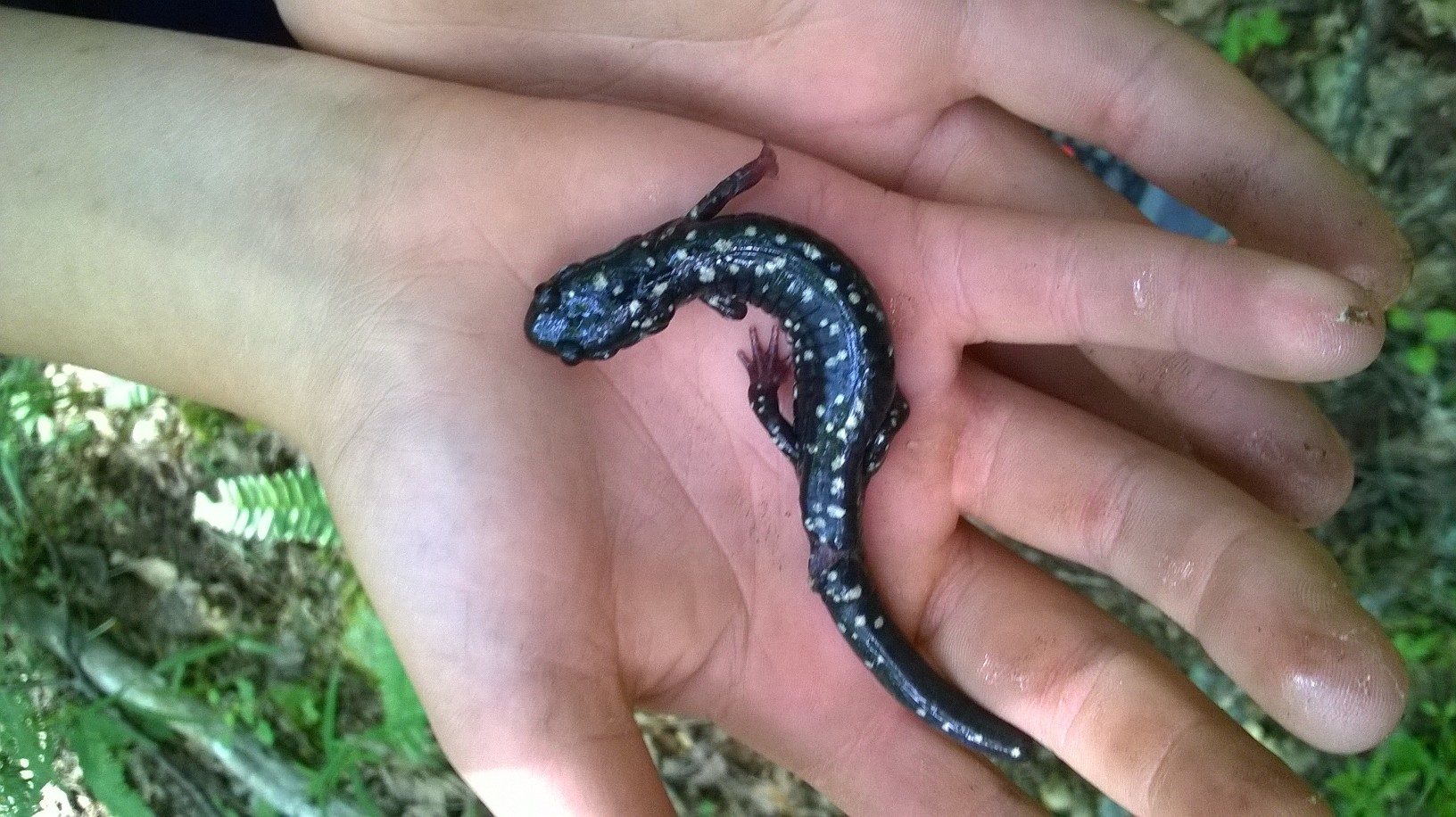
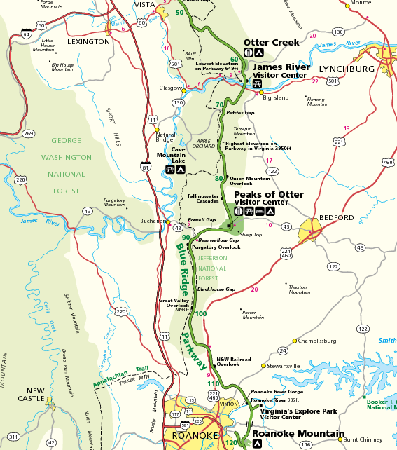
The Glenwood Cluster is a region in the George Washington and Jefferson National Forests recognized by The Wilderness Society for its rich biodiversity, scenery, wildflower displays, cold-water trout streams and horse trails. It offers a unique habitat for rare plants, salamanders and other rare species. The Blue Ridge Parkway and the Appalachian Trail traverse the area, giving ready access with views to the east of the Piedmont region and to the west of the Valley of Virginia.Virginia's Mountain Treasures, report issued by The Wilderness Society, May, 1999 Description The region includes wilderness areas protected by Congressional action, inventoried wilderness, and uninventoried areas recognized by the Wilderness Society as worthy of protection from timbering and roads. A corridor along the Blue Ridge Parkway, managed by the National Park Service, and forest service land in the Glenwood Ranger District act as a buffer for the protected areas. The following areas are in the ... [...More Info...] [...Related Items...] OR: [Wikipedia] [Google] [Baidu] |
Pearisburg Historic District
Pearisburg Historic District is a national historic district located at Pearisburg, Giles County, Virginia. It encompasses 18 contributing buildings and 1 contributing site in the town of Pearisburg, county seat of Giles County. The district is centered on the Public Square and includes a mix of commercial, institutional, and governmental buildings. Notable buildings include the First National Bank of Pearisburg (1906), Western Hotel (Thomas Building, c. 1827), Pearis Theater (1940), Giles County Sheriff's Office and Jail (1937–38), St. Elizabeth Hospital Building (1920), Giles County Motor Company Building (1923–1924), and Christ Episcopal Church (1910). The Giles County Courthouse is listed separately. an''Accompanying photo''an''Accompanying map''/ref> It was listed on the National Register of Historic Places The National Register of Historic Places (NRHP) is the United States federal government's official list of districts, sites, buildings, structures and objects ... [...More Info...] [...Related Items...] OR: [Wikipedia] [Google] [Baidu] |
Narrows Commercial Historic District
The Narrows Commercial Historic District encompasses the historic commercial heart of Narrows, Virginia. It is centered at the intersection of Main and Monroe Streets and MacArthur Lane, near the confluence of Wolf Creek and the New River. The area's major development did not begin until after the arrival in 1882 of the railroad, with most of it taking place in the two decades before World War II. Major buildings include the 1927 Norfolk and Western Railroad depot and the 1940 General Macarthur Hotel. The district was listed on the National Register of Historic Places The National Register of Historic Places (NRHP) is the United States federal government's official list of districts, sites, buildings, structures and objects deemed worthy of preservation for their historical significance or "great artistic v ... in 2014. See also * National Register of Historic Places listings in Giles County, Virginia References Historic districts on the National Register of Hist ... [...More Info...] [...Related Items...] OR: [Wikipedia] [Google] [Baidu] |
