|
Angelets
The Angelets, or “the Angelets of the Land” (in Catalan, ''“els Angelets de la Terra”''), were peasants who rose up in peasant revolts from 1667 to 1675 against the French authorities of the Roussillon province; the group of conflicts of the period is called the Revolt of the Angelets. The cause was the instituting of the gabelle (salt tax) in 1661 — a measure contrary to traditional constitutions of the earldom (the earldom of Roussillon and Cerdanya, the lands of the crown of Majorca from 1276 to 1344). The revolt first concerned the county of Vallespir, then it won those of Conflent and Roussillon. The name The reason why the revolts are referred to as “angelets” is unknown. One of the explanations advanced is the popular belief according to which the angels know the mountains well; another is the faculty that they have of appearing and disappearing. As for the word ''“miquelets,”'' it refers primarily to Catalan mercenaries but sometimes to armed p ... [...More Info...] [...Related Items...] OR: [Wikipedia] [Google] [Baidu] |
Prats-de-Mollo-la-Preste
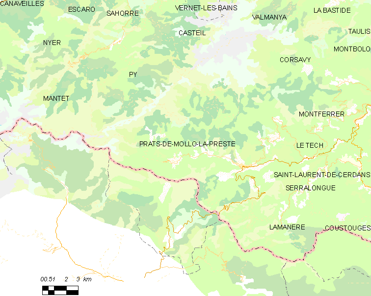
Prats-de-Mollo-la-Preste (; ) is a commune in the Pyrénées-Orientales department in southern France, near the border with Spain and the Autonomous Community of Catalonia. The name ''Prats-de-Mollo'' comes from Catalan "meadows of Molló". Molló is a town just across the border and the Col d'Ares. La Preste is a spa resort town that was a separate village but is now included as part of the municipality. Prats-de-Mollo-la-Preste was the capital of the eponymous former canton. It forms part of the historical comarca of Vallespir and is part of Northern Catalonia. Geography Prats-de-Mollo-la-Preste is located in the Pyrenees, from the Spanish border and the Autonomous Community of Catalonia, on the banks of the river Tech, and on the south face of the Canigou at an elevation of 735 meters. Prats-de-Mollo-la-Preste is located in the canton of Le Canigou and in the arrondissement of Céret. History The town, along with other Vallespir municipalities of Roussillon was sep ... [...More Info...] [...Related Items...] OR: [Wikipedia] [Google] [Baidu] |
Roussillon - Carte De Nicolas De Fer (1706)
Roussillon ( , , ; ca, Rosselló ; oc, Rosselhon ) is a historical province of France that largely corresponded to the County of Roussillon and part of the County of Cerdagne of the former Principality of Catalonia. It is part of the region of ''Northern Catalonia'' or ''French Catalonia'' (the former used by Catalan-speakers and the latter used by French-speakers), corresponding roughly to the present-day southern French ''département'' of Pyrénées-Orientales (with Roussillon, Conflent, and Fenouillèdes) in the former region of Languedoc-Roussillon (today Occitanie). History The name ''Roussillon'' is derived from Ruscino (Rosceliona, Castel Rossello), a small fortified place near modern-day Perpignan where Gaulish chieftains met to consider Hannibal's request for a conference. The region formed part of the Roman province of Gallia Narbonensis from 121 BC to AD 462, when it was ceded with the rest of Septimania to the Visigoth Theodoric II. His successor, Amal ... [...More Info...] [...Related Items...] OR: [Wikipedia] [Google] [Baidu] |
French Cerdagne
French Cerdagne ( ca, Alta Cerdanya, ) is the northern half of Cerdanya, which came under French control as a result of the Treaty of the Pyrenees in 1659, while the southern half remained in Spain (as part of Catalonia). Catalans often refer to French Cerdagne as Upper Cerdanya ( ca, Alta Cerdanya). It is the only French territory on the Iberian Peninsula, as it is located on the south side of the Pyrenees Range between France and Spain. For example, the Segre river, which goes west and then south to meet the Ebro, has its source in the French Cerdagne. An inadvertent result of the Treaty of the Pyrenees is the Spanish exclave of Llívia (the small uncolored area in the map) which is sovereign Spanish territory surrounded by French Cerdagne. French Cerdagne has no special status inside France, simply forming an area within the '' department'' of Pyrénées-Orientales, unlike the Spanish part of Cerdanya, which is officially a Catalan ''comarca'' called simply Cerdanya. In Fr ... [...More Info...] [...Related Items...] OR: [Wikipedia] [Google] [Baidu] |
Baillestavy
Baillestavy (; ca, Vallestàvia) is a commune in the Pyrénées-Orientales department in southern France. Geography Localisation Baillestavy is located in the canton of Le Canigou and in the arrondissement of Prades. Hydrography Baillestavy is crossed by the Lentillà river, a tributary of the Tech. Government and politics Mayors Population See also *Communes of the Pyrénées-Orientales department The Pyrénées-Orientales department is composed of 226 communes. Most of the territory (except for the district of Fenolheda) formed part of the Principality of Catalonia until 1659, and Catalan is still spoken (in addition to French) by a si ... References External links *Official site Communes of Pyrénées-Orientales {{PyrénéesOrientales-geo-stub ... [...More Info...] [...Related Items...] OR: [Wikipedia] [Google] [Baidu] |
1674 - Plan Bataille Maureillas
Events January–March * January 2 – The French West India Company is dissolved after less than 10 years. * January 7 – In the Chinese Empire, General Wu Sangui leads troops into the Giuzhou province, and soon takes control of the entire territory without a loss. * January 15 – The Earl of Arlington, a member of the English House of Commons, is impeached on charges of popery, but the Commons rejects the motion to remove him from office, 127 votes for and 166 against. * January 19 – The tragic opera '' Alceste'', by Jean-Baptiste Lully, is performed for the first time, presented by the Paris Opera company at the Theatre du Palais-Royal in Paris. * February 19 – England and the Netherlands sign the Treaty of Westminster, ending the Third Anglo-Dutch War. Its provisions come into effect gradually (''see'' November 10). * March 14 – Third Anglo-Dutch War: Battle of Ronas Voe – The English Royal Navy captures the Dutc ... [...More Info...] [...Related Items...] OR: [Wikipedia] [Google] [Baidu] |
Céret
Céret (; ) is a commune in the Pyrénées-Orientales department in southern France. It is the capital of the historic Catalan comarca of Vallespir. Geography The town lies in the foothills of the Pyrénées mountains, in southern France. It has an altitude of 175–1400 meters. It is located from the Autoroute A9, from Montpellier, from Toulouse and from Barcelona. It lies on the river Tech. The GR 10 footpath runs close by. Céret is located in the canton of Vallespir-Albères and in the arrondissement of Céret. Toponymy The name of the town in Catalan is ''Ceret''. Former known names of Céret are, in order of appearance, ''vicus Sirisidum'' in 814, ''vico Cereto'' in 866, ''villa Cerseto'' in 915, ''vigo Ceresido'' in 930, also ''Cered'' and ''Ceriteto'' in the 10th century, ''Ceret'', ''Cericeto'' in the 11th and 12th centuries, ''Cirset'' around 1070, ''Cersed'' (one of the most common forms) in 1130 and ''Cerset'' in 1138, and from the 13th to 15th cent ... [...More Info...] [...Related Items...] OR: [Wikipedia] [Google] [Baidu] |
Arles
Arles (, , ; oc, label= Provençal, Arle ; Classical la, Arelate) is a coastal city and commune in the South of France, a subprefecture in the Bouches-du-Rhône department of the Provence-Alpes-Côte d'Azur region, in the former province of Provence. A large part of the Camargue, the largest wetlands in France, is located on the territory of the commune, making it the largest commune in Metropolitan France in terms of geographic territory. (Maripasoula, French Guiana, is much larger than Arles). The city has a long history, and was of considerable importance in the Roman province of Gallia Narbonensis. The Roman and Romanesque Monuments of Arles were listed as UNESCO World Heritage Sites in 1981 for their testimony to the history of the region. Many artists have lived and worked in this area because of the southern light, including Pablo Picasso, Paul Gauguin, Jacques Réattu, and Peter Brown. The Dutch post-Impressionist painter Vincent van Gogh lived in Arles from 1888 ... [...More Info...] [...Related Items...] OR: [Wikipedia] [Google] [Baidu] |
Saint-Laurent-de-Cerdans
Saint-Laurent-de-Cerdans (; ca, Sant Llorenç de Cerdans) is a commune in the Pyrénées-Orientales department in southern France. Geography Saint-Laurent-de-Cerdans is located in the canton of Le Canigou and in the arrondissement of Céret. Government and politics Mayors Population See also *Communes of the Pyrénées-Orientales department The Pyrénées-Orientales department is composed of 226 communes. Most of the territory (except for the district of Fenolheda) formed part of the Principality of Catalonia until 1659, and Catalan is still spoken (in addition to French) by a si ... References Communes of Pyrénées-Orientales {{PyrénéesOrientales-geo-stub ... [...More Info...] [...Related Items...] OR: [Wikipedia] [Google] [Baidu] |
Amélie-les-Bains-Palalda
Amélie-les-Bains-Palalda (; ca, Els Banys i Palaldà) is a commune in the Pyrénées-Orientales department in southern France. Prior to 1942, it was known as Amélie-les-Bains. It is situated in the Tech valley, and combines the old and the new with a mix of narrow cobbled streets and modern accommodation. It has become a 'station verte' meaning that it must strive at all times to ensure that tourists benefit from a calm and natural environment. Geography Location Amélie-les-Bains-Palalda is located in the canton of Le Canigou and in the arrondissement of Céret. It sits at the confluence of the Mondony with the Tech, SSW of Perpignan by road. The town is situated at a height of and has both a winter and summer season. Climate In the winter season the average temperature is about 10 degrees Celsius, and in the summer it is roughly 29 degrees Celsius. Thunderstorms are not infrequent in the area, and the telltale signs are small showers throughout the day. Springs ... [...More Info...] [...Related Items...] OR: [Wikipedia] [Google] [Baidu] |
Montferrer
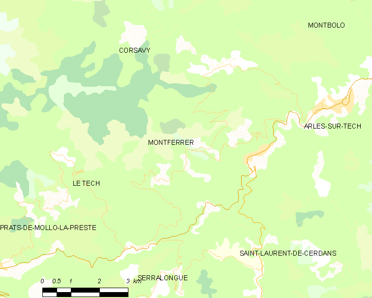
Montferrer () is a commune in the Pyrénées-Orientales department in southern France. Geography Montferrer is located in the canton of Le Canigou and in the arrondissement of Céret. Population See also *Communes of the Pyrénées-Orientales department The Pyrénées-Orientales department is composed of 226 communes. Most of the territory (except for the district of Fenolheda) formed part of the Principality of Catalonia until 1659, and Catalan is still spoken (in addition to French) by a ... References Communes of Pyrénées-Orientales {{PyrénéesOrientales-geo-stub ... [...More Info...] [...Related Items...] OR: [Wikipedia] [Google] [Baidu] |
Serralongue
Serralongue (; ca, Serrallonga) is a commune in the Pyrénées-Orientales department in southern France. Geography Serralongue is located in the canton of Le Canigou and in the arrondissement of Céret. Population See also *Communes of the Pyrénées-Orientales department The Pyrénées-Orientales department is composed of 226 communes. Most of the territory (except for the district of Fenolheda) formed part of the Principality of Catalonia until 1659, and Catalan is still spoken (in addition to French) by a si ... References Communes of Pyrénées-Orientales {{PyrénéesOrientales-geo-stub ... [...More Info...] [...Related Items...] OR: [Wikipedia] [Google] [Baidu] |
James II Of Majorca
James II ( ca, Jaume) (31 May 1243 – 29 May 1311) was King of Majorca and Lord of Montpellier from 1276 until his death. He was the second son of James I of Aragon and his wife, Violant, daughter of Andrew II of Hungary. In 1279, by the Treaty of Perpignan, he became a vassal of the Crown of Aragon. Biography James inherited from his father a realm including three of the Balearic Islands (Majorca, Ibiza, and Formentera), the counties of Roussillon and Cerdanya, the dominion of Montpellier, the barony of Aumelàs, and the viscounty of Carladès. He also gained tribute from the fourth Balearic island, Menorca, which remained under Muslim control throughout his life. He ruled as a vassal of his brother Peter III of Aragon, a subordinate status which he sought to escape. In 1276, his former seneschal, Ramon Llull persuaded James to fund a language school for Franciscan missionaries at Miramar. France and Aragon contested for control of Sicily. James held rights over borderla ... [...More Info...] [...Related Items...] OR: [Wikipedia] [Google] [Baidu] |
.jpg)


