|
Anagpur Dam
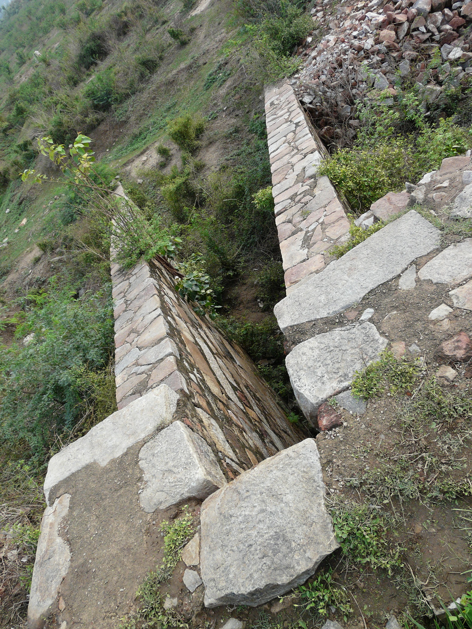
The Anangpur Dam is an Indian hydraulic engineering structure built during the reign of the King Anangpal I of the Tomara dynasty in the 8th century. It is located near the Anangpur village in Faridabad district, Haryana, India. History The king Anangpal Tomar I declared himself an independent ruler and established the Tomar Dynasty of Delhi in the early 8th century. He built his capital at the Anangpur village in Haryana and expanded his kingdom from there. He is said to have built numerous palaces and temples during his reign, majority of which are now completely diminished. Anangpal I is often misunderstood to be Anangpal II. Structure File:Stepped "downstream" side of dam.jpg, Downstream view of the dam File:Steps going into the dam1.jpg, Gallery entry into the dam File:Steps going into the dam.jpg, Steps into the gallery inside the dam File:Sluice_(Anagpur_Dam).jpg, Sluice inlet in the dam The ancient and solid gravity dam structure, a pre-Islamic structure that fo ... [...More Info...] [...Related Items...] OR: [Wikipedia] [Google] [Baidu] |
Anangpur
Anangpur is a historical village located near Faridabad in Haryana, India. Anangpur forms a geographical triangle along with Mehrauli and Tugluqabad. It was the earliest settlement of the Tomara dynasty. Anangpur was the capital of the Tomar king, Anangpal Tomar I. History Tomara dynasty (8th - 11th century CE) Anangpal I, first king of Tomara dynasty (c.736- 1052 CE), declared himself an independent ruler and established the Tomar Dynasty of Delhi in the early 8th century. He built his capital in this village and expanded his kingdom from there. He is said to have built numerous palaces and temples during his reign, the majority of which are diminished now. Last king of this dynasty was Anangpal Tomar (Anangpal II), who had built Delhi's Lal Kot, which was later renovated by Chauhan ruler and also came to be known as the Qila Rai Pithora. Tomara dynasty were overthrown by Chahamanas of Shakambhari, last Chahamana or Chauhan king was Prithviraj Chauhan, Qila Rai Pithora ... [...More Info...] [...Related Items...] OR: [Wikipedia] [Google] [Baidu] |
Nullah
A nullah or nala ( Hindustani or "nallah" in Punjabi) is an 'arm of the sea', stream, or watercourse, a steep narrow valley. Like the wadi of the Arabs, the nullah is characteristic of mountainous or hilly country where there is little rainfall. In the drier parts of India and Pakistan, and in many parts of Australia, there are small steep-sided valleys penetrating the hills, clothed with rough brushwood or small trees growing in the stony soil. During occasional heavy rains, torrents rush down the nullahs and quickly disappear. There is little local action upon the sides, while the bed is lowered, and consequently these valleys are narrow and steep. In cities on the Delhi plain in India, nullahs are concrete or brick-lined ditches about deep and wide, used to divert monsoon rain away from the cities. Encroachment into nullahs is a significant problem in many South Asian cities, since it hampers the drainage of stormwater and can exacerbate floods. Canal In East Asia, a n ... [...More Info...] [...Related Items...] OR: [Wikipedia] [Google] [Baidu] |
Aravalli Range
The Aravalli Range (also spelled ''Aravali'') is a mountain range in Northern-Western India, running approximately in a south-west direction, starting near Delhi, passing through southern Haryana, Rajasthan, and ending in Ahmedabad Gujarat. The highest peak is Guru Shikhar on Mount Abu at . The Aravalli Range is arguably the oldest geological feature on Earth, having its origin in the Proterozoic era. The Aravalli Range is rich in natural resources and serves as check to the growth of the western desert. Etymology Aravalli, a composite Sanskrit word from the roots ''"ara"'' and ''"vali"'', literally means the ''"line of peaks"''. Natural history Geology The Aravalli Range, an eroded stub of ancient mountains, is believed to be the oldest range of fold mountains in India.Roy, A. B. (1990). Evolution of the Precambrian crust of the Aravalli Range. Developments in Precambrian Geology, 8, 327–347. The natural history of the Aravalli Range dates back to times when ... [...More Info...] [...Related Items...] OR: [Wikipedia] [Google] [Baidu] |
Sarai Metro Station
Sarai is an elevated station on the Violet Line of the Delhi Metro. It is located between Badarpur and NHPC Chowk station on the line 6 in Faridabad district of Haryana. The station Station layout Facilities Entry/Exit Connections Buses Department of State Transport Haryana runs buses between Ballabgarh Bus Stand – Panipat Ballabgarh Bus Stand – Sonipat Cyber City – Sector 37 Faridabad Medanta Medicity – Sector 37 Faridabad and bus route number CS-1A, CS-1B, CS-1C, CS-13A, CS-13B, CS-14A, CS-14B from outside metro station stop. See also *Delhi *Faridabad *Haryana *List of Delhi Metro stations *Transport in Delhi *Delhi Metro Rail Corporation *Delhi Suburban Railway *Delhi Monorail *Delhi Transport Corporation *Faridabad district *New Delhi *National Capital Region (India) *National Capital Region Transport Corporation The National Capital Region Transport Corporation (NCRTC) is a joint venture company of the Government of India and the state ... [...More Info...] [...Related Items...] OR: [Wikipedia] [Google] [Baidu] |
Qutub Minar
The Qutb Minar, also spelled Qutub Minar and Qutab Minar, is a minaret and "victory tower" that forms part of the Qutb complex, which lies at the site of Delhi’s oldest fortified city, Lal Kot, founded by the Tomar Rajputs. It is a UNESCO World Heritage Site in the Mehrauli area of South Delhi, India. It is one of the most visited tourist spots in the city, mostly built between 1199 and 1220. It can be compared to the 62-metre all-brick Minaret of Jam in Afghanistan, of , which was constructed a decade or so before the probable start of the Delhi tower. The surfaces of both are elaborately decorated with inscriptions and geometric patterns. The Qutb Minar has a shaft that is fluted with "superb stalactite bracketing under the balconies" at the top of each stage. In general, minarets were slow to be used in India and are often detached from the main mosque where they exist. A Synthesis of South Asian and Islamic Architecture This victory tower is a symbol of the synthesis of ... [...More Info...] [...Related Items...] OR: [Wikipedia] [Google] [Baidu] |
Mathura
Mathura () is a city and the administrative headquarters of Mathura district in the Indian state of Uttar Pradesh. It is located approximately north of Agra, and south-east of Delhi; about from the town of Vrindavan, and from Govardhan. In ancient times, Mathura was an economic hub, located at the junction of important caravan routes. The 2011 Census of India estimated the population of Mathura at 441,894. In Hinduism, Mathura is birthplace of Krishna, which is located at the Krishna Janmasthan Temple Complex. It is one of the Sapta Puri, the seven cities considered holy by Hindus, also called Mokshyadayni Tirth. The Kesava Deo Temple was built in ancient times on the site of Krishna's birthplace (an underground prison). Mathura was the capital of the kingdom of Surasena, ruled by Kansa, the maternal uncle of Krishna. Mathura is part of the Lord Krishna circuit (Mathura,Vrindavan, Barsana, Govardhan, Kurukshetra, Dwarka and Bhalka). Janmashtami is grandly celebrate ... [...More Info...] [...Related Items...] OR: [Wikipedia] [Google] [Baidu] |
Asola Bhatti Wildlife Sanctuary
Asola-Bhati Wildlife Sanctuary covering 32.71 km2 area on the Southern Delhi Ridge of Aravalli hill range on Delhi-Haryana border lies in Southern Delhi as well as northern parts of Faridabad and Gurugram districts of Haryana state.Haryana Government moots buffer zone to save Asola sanctuary Times of India, 30 Jan 2019. significance of Ridge lies in its merger with s, a ... [...More Info...] [...Related Items...] OR: [Wikipedia] [Google] [Baidu] |
Mangar Bani
Mangar Bani, a paleolithic archaeological site and sacred grove hill forest next to the Mangar village on Delhi-Haryana border, is in the South Delhi Ridge of Aravalli mountain range in Faridabad tehsil of Faridabad district in the Indian state of Haryana.Mangar Census of India 2011. It lies, immediate south of India's national capital , within NCR. It is 's largest neolithic |
Pali Village
Pali is an Indian village in the NIT area of Faridabad city of Faridabad district under Faridabad Lok Sabha constituency of Haryana state, well known for being biggest crusher zone of Asia, that also has a seasonal waterfall. It is the part of the Northern Aravalli leopard wildlife corridor, an important wildlife corridor which starts from the Sariska National Park in Rajasthan, passes through Nuh, Faridabad and Gurugram districts of Haryana and ends at Delhi Ridge.Haryana Government moots buffer zone to save Asola sanctuary Times of India, 30 Jan 2019. The village is now a southwestern suburb of |
Chhatarpur Temple
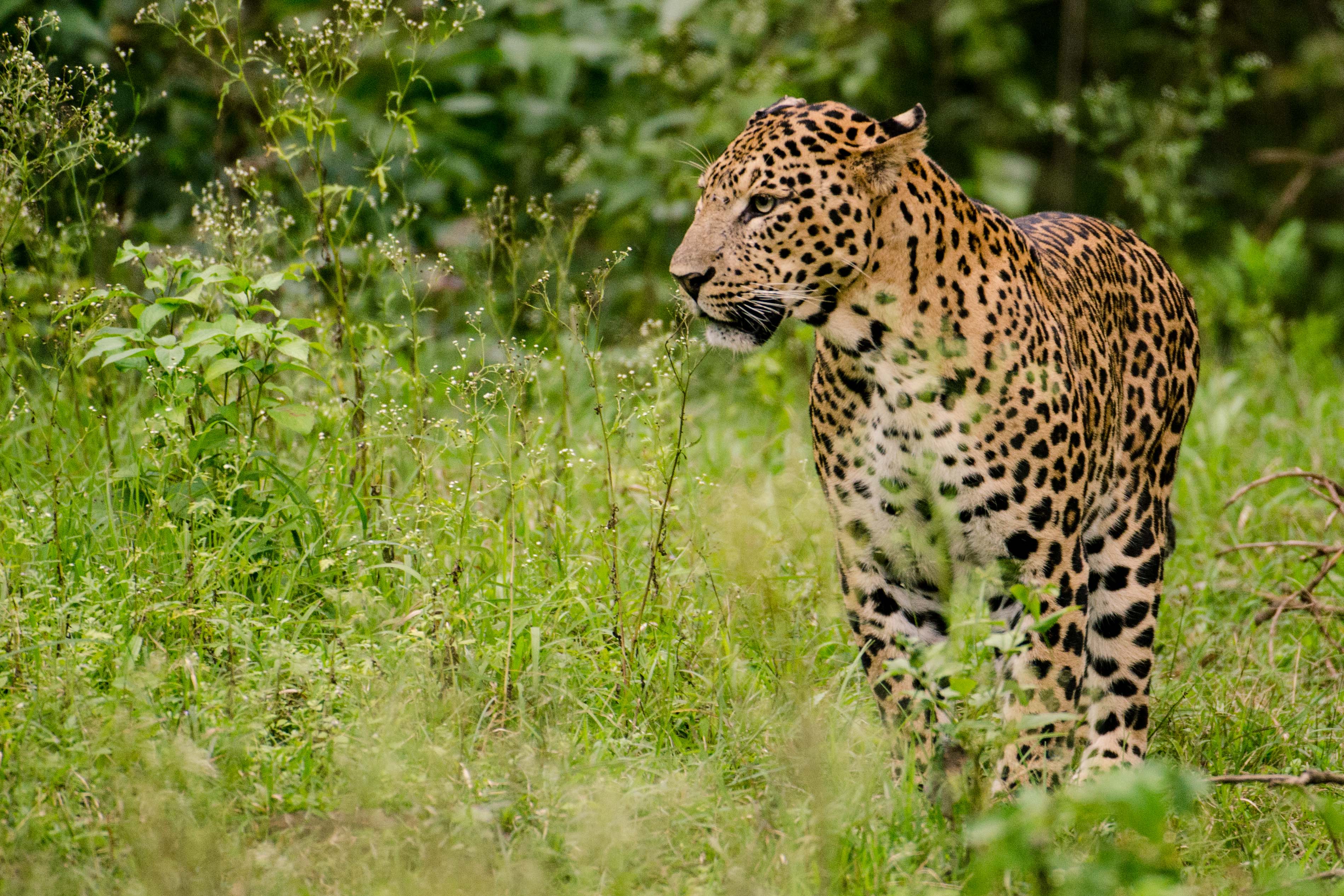
Chhatarpur Temple (Officially: Shri Aadya Katyayani Shakti Peetham) is located in a down town area in Chhatarpur, Delhi, India. This temple is dedicated to Goddess, Katyayani. The entire complex of the temple is spread over a wide area of 70 acres. It is located at Chhatarpur, on the southwestern outskirts of the New Delhi and is just from Qutub Minar, off Mehrauli-Gurgaon road. The temple was established in 1974, by Baba Sant Nagpal ji, who died in 1998. His samadhi shrine lies in the premises of the Shiv-Gauri Nageshwar Mandir within the temple complex. This temple was considered as the biggest temple in India and second largest in the world, before the Akshardham Temple was created in 2005 in Delhi. This temple is totally constructed from marble and on all the facets there is ''jaali'' (perforated stone or latticed screen) work. It can be classified a vesara style of architecture. Surroundings are an important biodiversity area within the Northern Aravalli leopard wildli ... [...More Info...] [...Related Items...] OR: [Wikipedia] [Google] [Baidu] |
Jahanpanah
Jahanpanah was the fourth medieval city of Delhi established in 1326–1327 by Muhammad bin Tughlaq (1325–51), of the Delhi Sultanate. To address the constant threat of the Mongols, Tughlaq built the fortified city of Jahanpanah (meaning in Persian: "Refuge of the World") subsuming the Adilabad fort that had been built in the 14th century and also all the establishments lying between Qila Rai Pithora and Siri Fort. Neither the city nor the fort has survived. Many reasons have been offered for such a situation. One of which is stated as the idiosyncratic rule of Mohammed bin Tughlaq when inexplicably he shifted the capital to Daulatabad in the Deccan and came back to Delhi soon after. The ruins of the city's walls are even now discerned in the road between Siri to Qutub Minar and also in isolated patches behind the Indian Institute of Technology (IIT), in Begumpur, Khirki Masjid near Khirki village, Satpula and many other nearby locations; at some sections, as seen at S ... [...More Info...] [...Related Items...] OR: [Wikipedia] [Google] [Baidu] |
Tughlaqabad Fort
Tughluqabad Fort is a ruined fort in Delhi, built by Ghiyasuddin Tughluq, the founder of the Tughlaq dynasty, of the Delhi Sultanate of India in 1321, as he established the third historic city of Delhi, which was later abandoned in 1327. It lends its name to the nearby Tughluqabad residential-commercial area as well as the Tughluqabad Institutional Area. Ghiyasuddin Tughluq also built the Qutub- Badarpur Road, which connected the new city to the Grand Trunk Road. The road is now known as Mehrauli-Badarpur Road. The entry fee for the Fort is Rs. 20 for Indians. Also, nearby is Dr. Karni Singh Shooting Range and Okhla Industrial Area. Surroundings are an important biodiversity area within the Northern Aravalli leopard wildlife corridor stretching from Sariska Tiger Reserve to Delhi. Historical places around the sanctuary are Badkhal Lake, northeast, the tenth century ancient Surajkund reservoir and Anangpur Dam, Damdama Lake, Tughlaqabad Fort and Adilabad ruins (both in Delh ... [...More Info...] [...Related Items...] OR: [Wikipedia] [Google] [Baidu] |


