|
Allied Airways
Allied Airways was a UK airline based at Aberdeen, Scotland. Formed in 1934 as Aberdeen Airways it was taken over by British European Airways in 1947. History Dyce Aerodrome In 1929 Eric Gandar Dower bought a Blackburn Bluebird IV two-seat biplane in which he toured the country and entered air races. In 1931 he landed in a field outside the village of Dyce, about from Aberdeen, and next to Dyce railway station. National Flying Services had already suggested the site as a municipal airport to the local council in 1930, but they declined. Gandar Dower had the idea of opening a flying school there and in 1933 he had started work levelling the land, installing an electricity supply and building a hangar. He established four companies: Aberdeen Flying School, which would also run the airfield, Aberdeen Flying Club, Aberdeen Aerodrome Fuel Supplies for ground support operations, and an airline, Aberdeen Airways. He was in quite a hurry to get going because Highland Airways had ... [...More Info...] [...Related Items...] OR: [Wikipedia] [Google] [Baidu] |
Aberdeen Airport
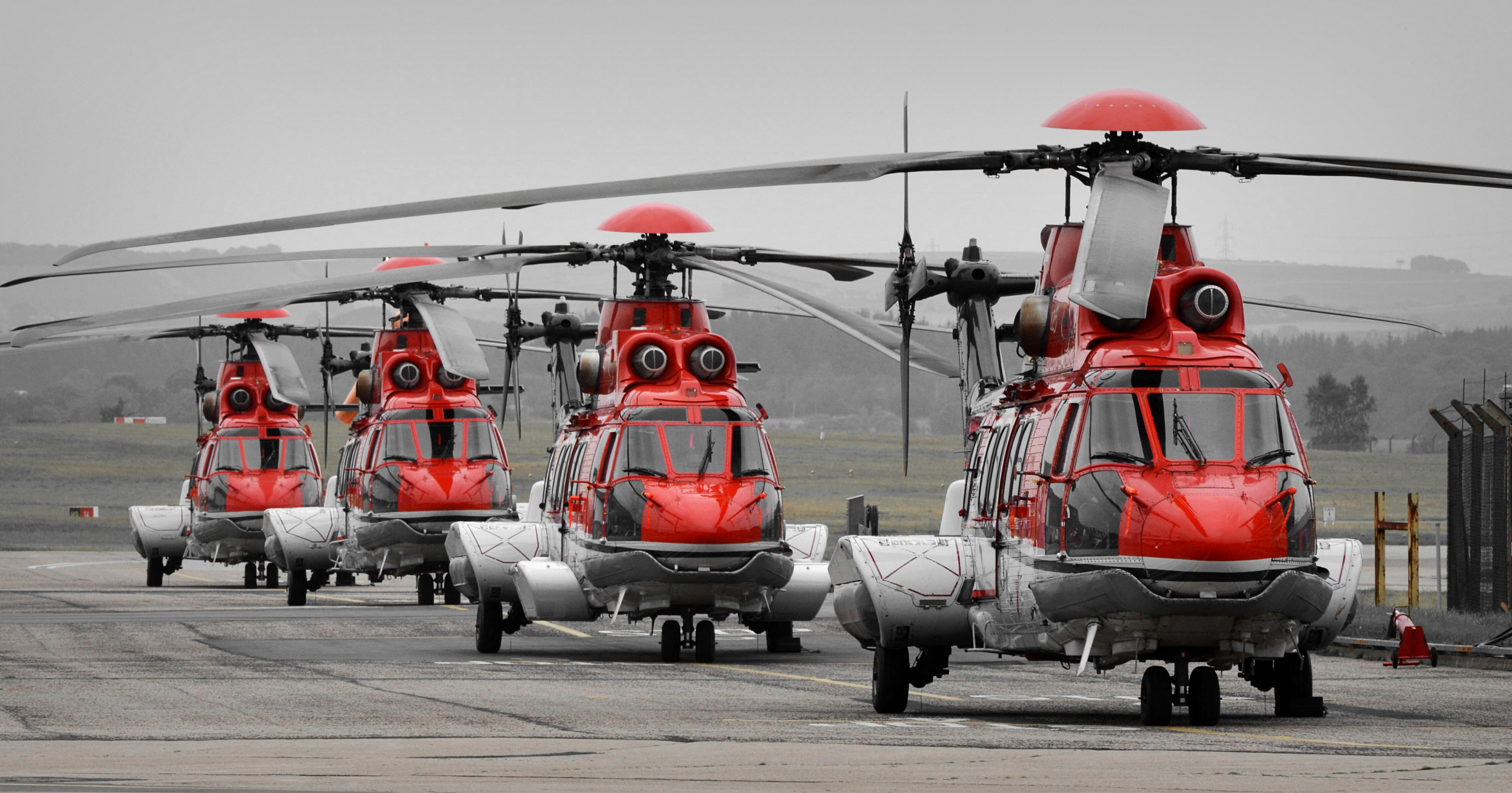
Aberdeen International Airport ( gd, Port-adhair Eadar-nàiseanta Obar Dheathain) is an international airport, located in the Dyce suburb of Aberdeen, Scotland, approximately northwest of Aberdeen city centre. A total of just under 3.1 million passengers used the airport in 2017, an increase of 4.6% compared with 2016. The airport is owned and operated by AGS Airports which also owns and operates Glasgow and Southampton airports. It was previously owned and operated by Heathrow Airport Holdings (formerly known as BAA). Aberdeen Airport is a base for Eastern Airways and Loganair. The airport also serves as the main heliport for offshore North Sea oil and gas industry. With the utilisation of newer aircraft, helicopters can reach northernmost platforms on both the east and west of Shetland. The airport has one main passenger terminal, serving all scheduled and charter holiday flights. In addition, there are four terminals dedicated to North Sea helicopter operations, us ... [...More Info...] [...Related Items...] OR: [Wikipedia] [Google] [Baidu] |
Eric Gandar Dower
Eric Leslie Gandar Dower (1894 – 4 October 1987) was a Scottish Unionist Party politician and businessman. Life He was educated at Brighton College, like his elder brother Leonard, and at Jesus College, Cambridge, and trained for the stage at the Royal Academy of Dramatic Art, touring with a number of theatre companies. Gandar Dower established Aberdeen Airport and Aberdeen Airways serving routes between Aberdeen and Edinburgh, Glasgow, Wick, Thurso, Kirkwall, and Stromness. The airline changed its name to '' Allied Airways (Gandar Dower) Ltd.'' when it started the first British/Norwegian airline route, between Newcastle and Stavanger in 1937. He served as a Flight Lieutenant in the Royal Air Force Volunteer Reserve from 1940 to 1943. Following World War II, Gandar Dower was elected as Conservative Member of Parliament for Caithness and Sutherland at the 1945 general election with a majority of just 6 in the tightest ever three-way marginal: just 61 votes separated him fr ... [...More Info...] [...Related Items...] OR: [Wikipedia] [Google] [Baidu] |
Orkney
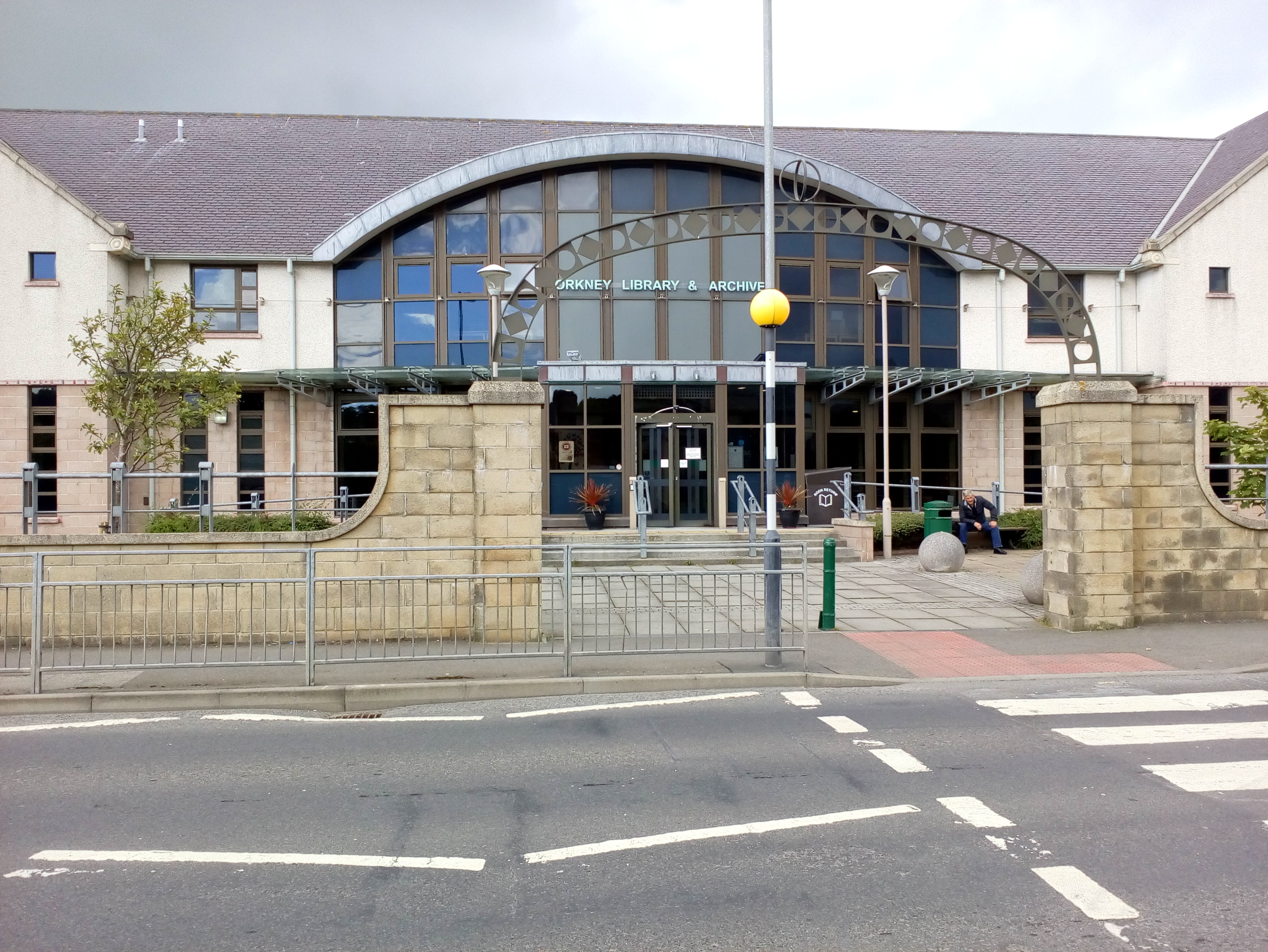
Orkney (; sco, Orkney; on, Orkneyjar; nrn, Orknøjar), also known as the Orkney Islands, is an archipelago in the Northern Isles of Scotland, situated off the north coast of the island of Great Britain. Orkney is 10 miles (16 km) north of the coast of Caithness and has about 70 islands, of which 20 are inhabited. The largest island, the Mainland, Orkney, Mainland, has an area of , making it the List of islands of Scotland, sixth-largest Scottish island and the List of islands of the British Isles, tenth-largest island in the British Isles. Orkney’s largest settlement, and also its administrative centre, is Kirkwall. Orkney is one of the 32 Subdivisions of Scotland, council areas of Scotland, as well as a Orkney (Scottish Parliament constituency), constituency of the Scottish Parliament, a Lieutenancy areas of Scotland, lieutenancy area, and an counties of Scotland, historic county. The local council is Orkney Islands Council, one of only three councils in Scotland with ... [...More Info...] [...Related Items...] OR: [Wikipedia] [Google] [Baidu] |
Sumburgh
Sumburgh is a small settlement in the Shetland Islands, Scotland. Sumburgh is located at the south end of the Mainland on Sumburgh Head. Sumburgh Airport is just outside the village to the north. Sumburgh has a population of approximately 100. Jarlshof is situated to the west of Sumburgh, adjacent to Sumburgh Hotel. Sumburgh is within the parish of Dunrossness Dunrossness, (Old Norse: ''Dynrastarnes'' meaning "headland of the loud tide-race", referring to the noise of Sumburgh Roost) is the southernmost parish of Shetland, Scotland. Historically the name Dunrossness has usually referred to the area o .... References External links Undiscovered Scotland - Sumburgh Villages in Mainland, Shetland {{Shetland-geo-stub ... [...More Info...] [...Related Items...] OR: [Wikipedia] [Google] [Baidu] |
Longhope
Longhope is a village in west Gloucestershire, situated within the Forest of Dean, England, United Kingdom. Arthur Bullock, who was born in Longhope in 1899, described its location as follows: * The parish occupies the most easterly valley in the group of hills which lie between the Severn and the Wye. The name means long valley. It is about four miles long, running roughly north to south, and it is separated from the Severn valley by a range of hills consisting of May Hill (937 ft), Huntley Hill, Blaisdon Hill and Notwood Hill.'Bullock, 2009, p. 11 The village falls in the 'Blaisdon and Longhope' Wards and electoral divisions of the United Kingdom, electoral ward. This ward has ''Longhope'' in the north and Blaisdon as its smaller southerly neighbour. The total ward population taken at the United Kingdom Census 2011, 2011 census was 1,754. May Hill is a prominent landmark and the ownership of the summit is vested with Longhope Parish Council. Little London is part of the ... [...More Info...] [...Related Items...] OR: [Wikipedia] [Google] [Baidu] |
South Ronaldsay
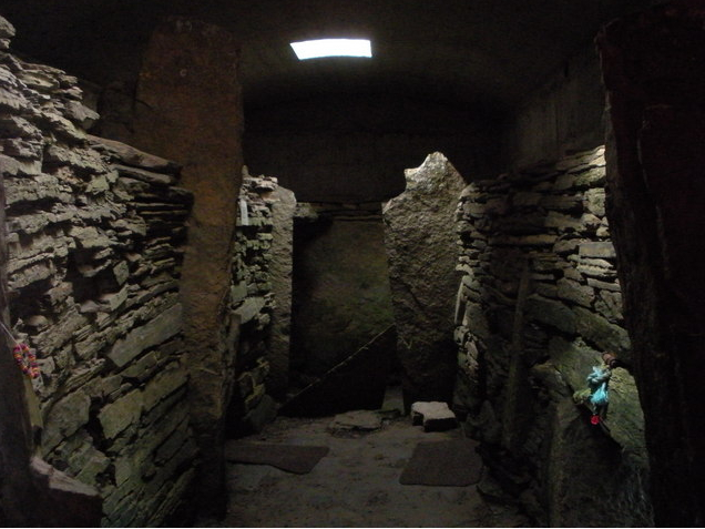
South Ronaldsay (, also , sco, Sooth Ronalshee) is one of the Orkney Islands off the north coast of Scotland. It is linked to the Orkney Mainland by the Churchill Barriers, running via Burray, Glimps Holm and Lamb Holm. Name Along with North Ronaldsay, the island is named after St Ronald. The original name from which the English name derives, ''Rǫgnvaldsey'', comes from Old Norse; ''Rǫgnvalds'' ("Ronald's") + ''ey'' ("island"). Geography and geology With an area of , it is the fourth largest of the Orkney islands after The Mainland, Hoy and Sanday. Ferries sail from Burwick on the island to John o' Groats on the Scottish mainland and from St Margaret's Hope to Gills Bay.Wenham, Sheena "The South Isles" in Omand (2003) p. 212. South Ronaldsay's main village is St Margaret's Hope, Orkney's third largest settlement. It is named either after Margaret, Maid of Norway, the heir to the Scottish throne who died in Orkney age sevenWenham, Sheena "The South Isles" in Omand (200 ... [...More Info...] [...Related Items...] OR: [Wikipedia] [Google] [Baidu] |
St Margaret's Hope
St Margaret's Hope is a village in the Orkney Islands, off the north coast of Scotland. It is known locally as "The Hope" or "The Hup". With a population of about 550, it is Orkney's third largest settlement after Kirkwall and Stromness. St Margaret's Hope is the main settlement of the island of South Ronaldsay. Situated off Water Sound at the head of a calm bay on the island's northern coast, it is connected to the Orkney Mainland by the A961 road running across the Churchill Barriers. St Margaret's Hope is believed to have been named after either Saint Margaret of Scotland (c.1045-1093), the wife of Malcolm III, or Margaret, Maid of Norway, who died in Orkney and possibly in this location in 1290. The village has a primary school, a small blacksmith's museum, a few shops and a cafe, a pub and a wine bar. Pentland Ferries run a reliable service from the pier in the bay to Gills Bay on the Scottish mainland. It is also known for its annual Boys' Ploughing Match A pl ... [...More Info...] [...Related Items...] OR: [Wikipedia] [Google] [Baidu] |
Berridale
Berridale is a small town in New South Wales. At the it had a population of 1,300. It was the administrative centre of the Snowy River Shire until in 2016 that shire merged with two others to form the Snowy Monaro Regional Council, one of Australia's major inland tourist destinations. Berridale lies at 860 metres above sea level between the towns of Cooma and Jindabyne and 435 kilometres south of Sydney. Climate and geography Berridale features an oceanic climate (''Cfb''); climate data sourced from nearby Cooma Airport—at similar elevation and position to Berridale itself. Snow falls occasionally, but is generally light and often melts swiftly due to the westerly foehn winds. Berridale's climate is relatively dry as the town is located in a rainshadow on the Monaro; between the Snowy Mountains and the coastal plain. The land surrounding the town is a combination of cleared farmland and lightly wooded bush. There are granite boulders located south through west of the town on ... [...More Info...] [...Related Items...] OR: [Wikipedia] [Google] [Baidu] |
Thurso
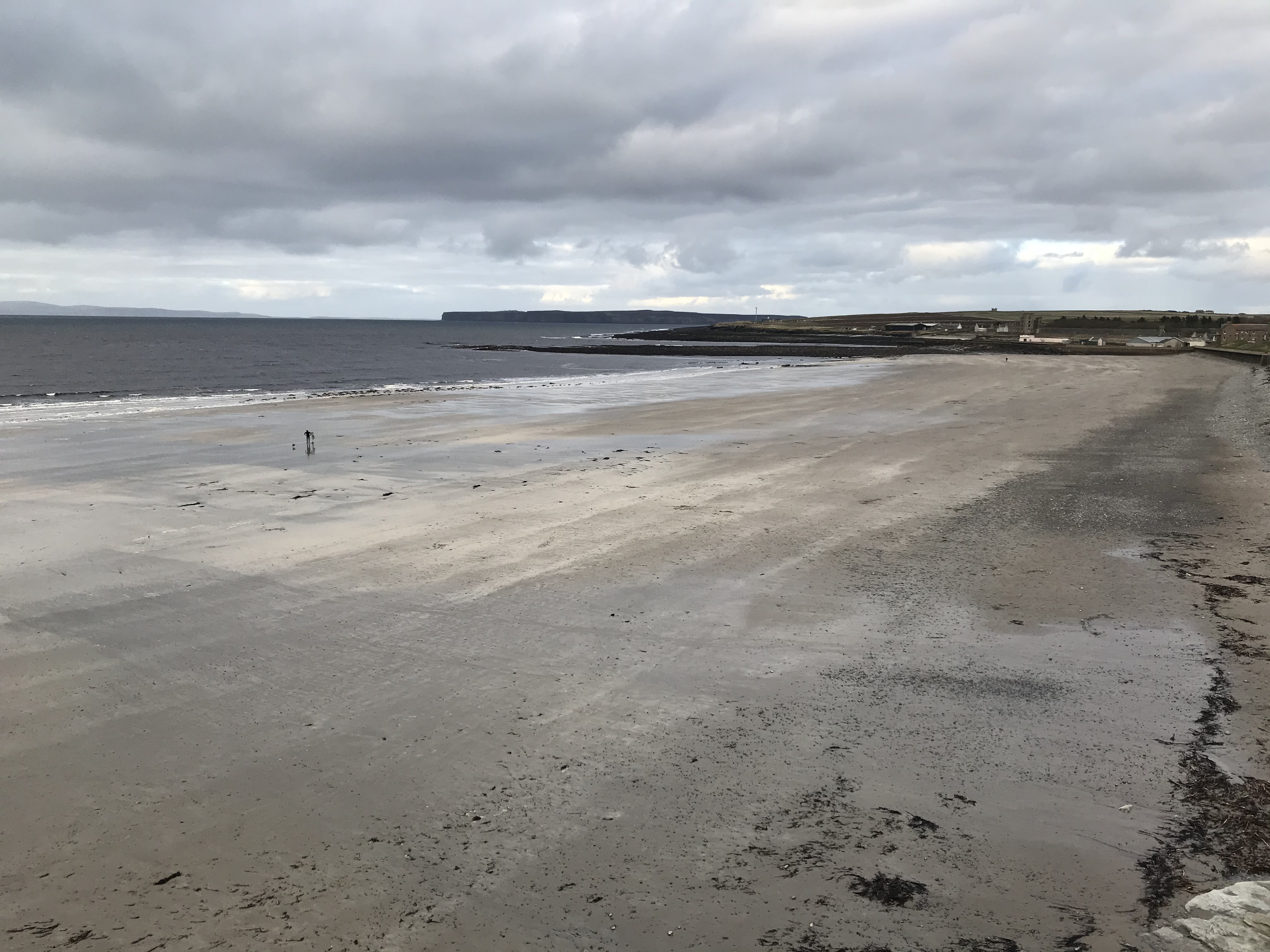
Thurso (pronounced ; sco, Thursa, gd, Inbhir Theòrsa ) is a town and former burgh on the north coast of the Highland council area of Scotland. Situated in the historical County of Caithness, it is the northernmost town on the island of Great Britain. From a latitudal standpoint, Thurso is located further north than the southernmost point of Norway and in addition lies more than north of London. It lies at the junction of the north–south A9 road and the west–east A836 road, connected to Bridge of Forss in the west and Castletown in the east. The River Thurso flows through the town and into Thurso Bay and the Pentland Firth. The river estuary serves as a small harbour. At the 2011 Census, Thurso had a population of 7,933. The larger Thurso civil parish including the town and the surrounding countryside had a population of 9,112. Thurso functioned as an important Norse port, and later traded with ports throughout northern Europe until the 19th century. A thriving fish ... [...More Info...] [...Related Items...] OR: [Wikipedia] [Google] [Baidu] |
Kirkwall
Kirkwall ( sco, Kirkwaa, gd, Bàgh na h-Eaglaise, nrn, Kirkavå) is the largest town in Orkney, an archipelago to the north of mainland Scotland. The name Kirkwall comes from the Norse name (''Church Bay''), which later changed to ''Kirkvoe'', ''Kirkwaa'' and ''Kirkwall''. Kirkwall was formerly the site of an ancient Norse town founded approximately 1000 years ago. Today, it is a transport hub with ferries to many locations. History The town was first mentioned in in the year 1046, when it was recorded as the residence of , the Earl of Orkney, who was killed by his uncle Thorfinn the Mighty. In 1486, King James III of Scotland elevated Kirkwall to the status of a royal burgh. On the western edge of the town, surrounded by Hatston Industrial Estate, there is a prehistoric monument, known as the "Grain Earth House" (see Historic Scotland). It is a short, low, stone-walled passage, deep underground, leading to a small pillared chamber. This kind of earth house (or "souterrai ... [...More Info...] [...Related Items...] OR: [Wikipedia] [Google] [Baidu] |
Seaton Park
Seaton Park is a public park in the Old Aberdeen area of Aberdeen, Scotland. One of the city's biggest parks, it was bought by the city for use as a public park in 1947 from Major J M Hay. It was formerly the grounds of Seaton House, which had been the Hay family home for centuries, but was gradually wound down as a family house due to inheritance tax, the contents were sold off in 1959 and the already dilapidated house burnt down in 1963. The River Don passes through the edge of the park, and there are paths running along both sides of the river. There are well-maintained flower beds on the lawns that run down the centre of one of the park's main pathways, with flowers that are tended daily and planted annually. There is also a secluded set of walled gardens next to a small private housing mews called Seaton Stables. The park is low-lying and has a tendency to flood. In 2016, part of the park was turned into a wetland area to help manage the flooding while creating new wildl ... [...More Info...] [...Related Items...] OR: [Wikipedia] [Google] [Baidu] |
_AN0230937.jpg)


