|
All Saints Church, Crondall
All Saints Church is an Anglican parish church in the village of Crondall, Hampshire, England. It is a Grade I listed building and stands at the highest point in the village. Much of the church dates from the Norman period, although the original central tower was replaced by a brick one at the north-east corner in 1659 and some alterations, particularly to the fenestration, the nave arcades and transepts, and the north porch, were made in two stages during the 19th century. According to Nikolaus Pevsner it is "a puzzle church and an extremely powerful one", while it has also been called "one of the finest parish churches in the country" and the "cathedral of North Hampshire" (Rev. Charles Stooks). Of the 19th-century restoration of the building, Simon Jenkins states that "for once the Victorian does not emerge the winner, especially in the chancel", which latter John Betjeman terms "splendid". History Anglo-Saxon An Anglo-Saxon church from the 9th century was built on the si ... [...More Info...] [...Related Items...] OR: [Wikipedia] [Google] [Baidu] |
Crondall, Hampshire
Crondall () is a village and large civil parish in the north east of Hampshire in England, in the Crondall Hundred surveyed in the Domesday Book of 1086. The village is on the gentle slopes of the low western end of the North Downs range, and has the remains of a Roman villa. Despite the English Reformation, Winchester Cathedral (or its Dean and Chapter) held the chief manors representing much of its land from 975 until 1861. A large collection of Anglo-Saxon and Merovingian coins found in the parish has become known as the Crondall Hoard. Toponymy Various earlier spellings have the intuitive, post-Norman spelling of "u" instead of "o" and the village is still pronounced as it has been for centuries by rooted residents or by those who correctly abstract the sound from 'front': in the 10th century 'Crundelas' was recorded; throughout the 14th century it was 'Crundale'. An Old English crundel was a chalk-pit or lime quarry, and the word has survived in the name of Crondall. The re ... [...More Info...] [...Related Items...] OR: [Wikipedia] [Google] [Baidu] |
Nikolaus Pevsner
Sir Nikolaus Bernhard Leon Pevsner (30 January 1902 – 18 August 1983) was a German-British art historian and architectural historian best known for his monumental 46-volume series of county-by-county guides, ''The Buildings of England'' (1951–74). Life Nikolaus Pevsner was born in Leipzig, Saxony, the son of Anna and her husband Hugo Pevsner, a Russian-Jewish fur merchant. He attended St. Thomas School, Leipzig, and went on to study at several universities, Munich, Berlin, and Frankfurt am Main, before being awarded a doctorate by Leipzig in 1924 for a thesis on the Baroque architecture of Leipzig. In 1923, he married Carola ("Lola") Kurlbaum, the daughter of distinguished Leipzig lawyer Alfred Kurlbaum. He worked as an assistant keeper at the Dresden Gallery between 1924 and 1928. He converted from Judaism to Lutheranism early in his life. During this period he became interested in establishing the supremacy of German modernist architecture after becoming aware of Le ... [...More Info...] [...Related Items...] OR: [Wikipedia] [Google] [Baidu] |
Stephen, King Of England
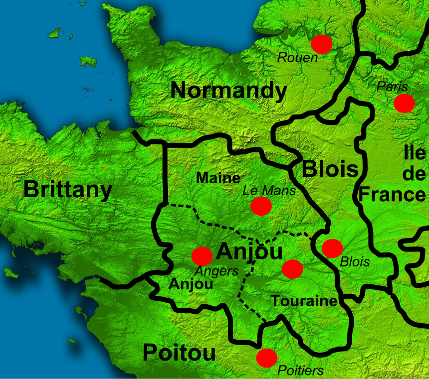
Stephen (1092 or 1096 – 25 October 1154), often referred to as Stephen of Blois, was King of England from 22 December 1135 to his death in 1154. He was Count of Boulogne ''jure uxoris'' from 1125 until 1147 and Duke of Normandy from 1135 until 1144. His reign was marked by the Anarchy, a civil war with his cousin and rival, the Empress Matilda, whose son, Henry II, succeeded Stephen as the first of the Angevin kings of England. Stephen was born in the County of Blois in central France as the fourth son of Stephen-Henry, Count of Blois, and Adela, daughter of William the Conqueror. His father died while Stephen was still young, and he was brought up by his mother. Placed into the court of his uncle Henry I of England, Stephen rose in prominence and was granted extensive lands. He married Matilda of Boulogne, inheriting additional estates in Kent and Boulogne that made the couple one of the wealthiest in England. Stephen narrowly escaped drowning with Henry I's son, William Ade ... [...More Info...] [...Related Items...] OR: [Wikipedia] [Google] [Baidu] |
Henry Of Blois
Henry of Blois ( c. 1096 8 August 1171), often known as Henry of Winchester, was Abbot of Glastonbury Abbey from 1126, and Bishop of Winchester from 1129 to his death. He was a younger son of Stephen Henry, Count of Blois by Adela of Normandy, daughter of William the Conqueror and Matilda of Flanders. Thus, he was a younger brother of Stephen, King of England, and a grandchild of William the Conqueror. Henry was also a major patron of the arts. Early life and education Henry was one of five sons of Stephen II, Count of Blois, by Adela of Normandy (daughter of William the Conqueror) and the younger brother of King Stephen.British History Online: Bishops of Winchester ; accessed on 2 November 2007 His birth date is uncertain, along with his siblings but he was the 4th or youngest son and he was mos ... [...More Info...] [...Related Items...] OR: [Wikipedia] [Google] [Baidu] |
Domesday Book
Domesday Book () – the Middle English spelling of "Doomsday Book" – is a manuscript record of the "Great Survey" of much of England and parts of Wales completed in 1086 by order of King William I, known as William the Conqueror. The manuscript was originally known by the Latin name ''Liber de Wintonia'', meaning "Book of Winchester", where it was originally kept in the royal treasury. The '' Anglo-Saxon Chronicle'' states that in 1085 the king sent his agents to survey every shire in England, to list his holdings and dues owed to him. Written in Medieval Latin, it was highly abbreviated and included some vernacular native terms without Latin equivalents. The survey's main purpose was to record the annual value of every piece of landed property to its lord, and the resources in land, manpower, and livestock from which the value derived. The name "Domesday Book" came into use in the 12th century. Richard FitzNeal wrote in the ''Dialogus de Scaccario'' ( 1179) that the book ... [...More Info...] [...Related Items...] OR: [Wikipedia] [Google] [Baidu] |
Walkelin
Walkelin (died 1098) was the first Norman bishop of Winchester. Life Walkelin was of noble birth and related to William the Conqueror, whom he served as a royal chaplain.British History Online Bishops of Winchester accessed on 2 November 2007 Before the he had probably been a at .Spear "The Norman Empire and the Secular Clergy" ''Journal of British Studies'' p. 5 He t ... [...More Info...] [...Related Items...] OR: [Wikipedia] [Google] [Baidu] |
Norman Conquest
The Norman Conquest (or the Conquest) was the 11th-century invasion and occupation of England by an army made up of thousands of Norman, Breton, Flemish, and French troops, all led by the Duke of Normandy, later styled William the Conqueror. William's claim to the English throne derived from his familial relationship with the childless Anglo-Saxon king Edward the Confessor, who may have encouraged William's hopes for the throne. Edward died in January 1066 and was succeeded by his brother-in-law Harold Godwinson. The Norwegian king Harald Hardrada invaded northern England in September 1066 and was victorious at the Battle of Fulford on 20 September, but Godwinson's army defeated and killed Hardrada at the Battle of Stamford Bridge on 25 September. Three days later on 28 September, William's invasion force of thousands of men and hundreds of ships landed at Pevensey in Sussex in southern England. Harold marched south to oppose him, leaving a significant portion of his ... [...More Info...] [...Related Items...] OR: [Wikipedia] [Google] [Baidu] |
Harrow Way
The Harrow Way (also spelled as "Harroway") is another name for the "Old Way", an ancient trackway in the south of England, dated by archaeological finds to 600–450 BC, but probably in existence since the Stone Age. The Old Way ran from Seaton in Devon to Dover, Kent. Later the eastern part of the Harrow Way become known as the Pilgrims' Way in the 19th century: the latter was a route invented by Albert Way of the Ordnance Survey, who imagined it (without evidence) to have been a pilgrimage route ran from Winchester, Hampshire, via Farnham, Surrey, to Canterbury Kent. The western section of the Harrow Way ends in Farnham, the eastern in Dover. The name may derive from '' herewag'', a military road, or ''har'', ancient (as in hoary) way, or ''heargway'', the road to the shrine (perhaps Stonehenge). It is sometimes described as the 'oldest road in Britain' and is possibly associated with ancient tin trading. The Old Way The Eastern part of the Harrow Way The east ... [...More Info...] [...Related Items...] OR: [Wikipedia] [Google] [Baidu] |
Yateley
Yateley () is a town and civil parish in the English county of Hampshire. It lies in the north-eastern corner of Hart District Council area. It includes the settlements of Frogmore and Darby Green to the east. It had a population of 21,011 at the 2001 census. The four wards that comprise Yateley and their 2001 populations are Yateley East (5,168), Yateley North (5,078), Yateley West (5,149), and Frogmore & Darby Green (5,616). The 2009 projection was 20,214, according to the Hart District Council website. Yateley Town Council is one of the few local councils to have been recognised under the national 'Quality Council' award scheme. In 2011 Hart district was named the UK's most desirable place to live, and Yateley was mentioned on a BBC News article as one of the towns within the district. History The name ''Yateley'' derives from the Middle English 'Yate' meaning 'Gate' (into Windsor Forest) and 'Lea' which was a 'forest clearing'. Although in historic records, variations of t ... [...More Info...] [...Related Items...] OR: [Wikipedia] [Google] [Baidu] |
Aldershot
Aldershot () is a town in Hampshire, England. It lies on heathland in the extreme northeast corner of the county, southwest of London. The area is administered by Rushmoor Borough Council. The town has a population of 37,131, while the Aldershot Urban Area, a loose conurbation (which also includes other towns such as Camberley, Farnborough, and Farnham) has a population of 243,344, making it the thirtieth-largest urban area in the UK. Aldershot is known as the "Home of the British Army", a connection which led to its rapid growth from a small village to a Victorian town. History Early history The name may have derived from alder trees found in the area (from the Old English 'alder-holt' meaning copse of alder trees). Any settlement, though not mentioned by name, would have been included as part of the Hundred of Crondall referred to in the Domesday Book of 1086. The Church of St Michael the Archangel is the parish church for the town and dates to the 12th century with la ... [...More Info...] [...Related Items...] OR: [Wikipedia] [Google] [Baidu] |
Long Sutton, Hampshire
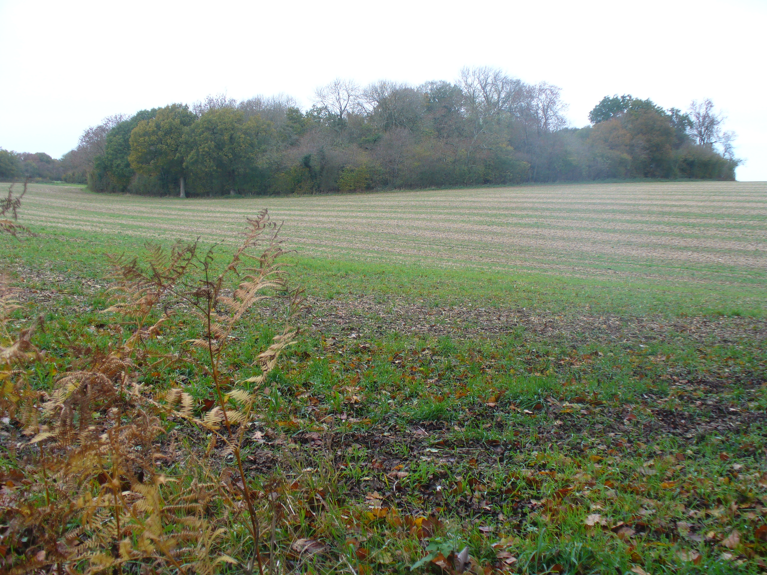
Long Sutton is a small village and civil parish in the Hart district of Hampshire, England. The village lies about south of the town of Odiham. Neighbouring villages include Well, South Warnborough and Upton Grey. The village includes picturesque brick and half-timbered cottages and a farmhouse dating from Tudor times. All Saints Church is the local church. Hydegate House was built in about 1561 by the Terry Family. In of farmland stands Lord Wandsworth College Lord Wandsworth College (LWC) is a co-educational independent school in Long Sutton, Hampshire, England, for day and boarding pupils between the ages of 11–18, which occupies a 1,200 acre campus and is known for its charitable foundation. It ..., a Neo-Georgian structure built in 1915, founded as a boarding school for boys who have lost a parent. The line of the "Harrow Way," one of the oldest roads in England, runs through the village. References External links Long Sutton & Well Parish Council Village ... [...More Info...] [...Related Items...] OR: [Wikipedia] [Google] [Baidu] |
Alfred The Great
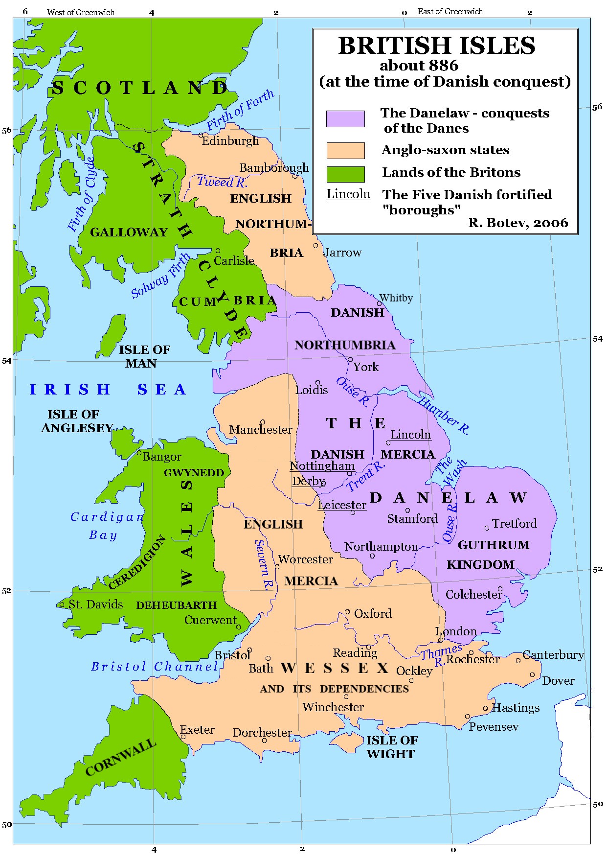
Alfred the Great (alt. Ælfred 848/849 – 26 October 899) was King of the West Saxons from 871 to 886, and King of the Anglo-Saxons from 886 until his death in 899. He was the youngest son of King Æthelwulf and his first wife Osburh, who both died when Alfred was young. Three of Alfred's brothers, Æthelbald, Æthelberht and Æthelred, reigned in turn before him. Under Alfred's rule, considerable administrative and military reforms were introduced, prompting lasting change in England. After ascending the throne, Alfred spent several years fighting Viking invasions. He won a decisive victory in the Battle of Edington in 878 and made an agreement with the Vikings, dividing England between Anglo-Saxon territory and the Viking-ruled Danelaw, composed of northern England, the north-east Midlands and East Anglia. Alfred also oversaw the conversion of Viking leader Guthrum to Christianity. He defended his kingdom against the Viking attempt at conquest, becoming the dominant ruler ... [...More Info...] [...Related Items...] OR: [Wikipedia] [Google] [Baidu] |


