|
Alentejo
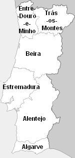
Alentejo ( , ) is a geographical, historical, and cultural region of south–central and southern Portugal. In Portuguese, its name means "beyond () the Tagus river" (''Tejo''). Alentejo includes the regions of Alto Alentejo and Baixo Alentejo. It corresponds to the districts of Beja, Évora, Portalegre, and Alentejo Litoral. Its main cities are Évora, Beja, Sines, Serpa, Estremoz, Elvas, and Portalegre. It has borders with Beira Baixa in the north, with Spain (Andalucia and Extremadura) in the east, Algarve in the south, and the Atlantic Ocean, Ribatejo, and Estremadura in the west. Alentejo is a region known for its traditional polyphonic singing groups, similar to those found in Tuscany, Corsica, and elsewhere. History The comarca of the Alentejo became the Alentejo Province, divided into upper (Alto Alentejo Province) and lower (Baixo Alentejo Province) designations. The modern NUTS statistical region, Alentejo Region, was expropriated from the medieval provi ... [...More Info...] [...Related Items...] OR: [Wikipedia] [Google] [Baidu] |
Baixo Alentejo Province
Baixo Alentejo was a Portuguese province. It was abolished with the Constitution of 1976. Districts * Beja District * Setúbal District (southern half) Subregions The area is equal to the area covered by Baixo Alentejo Subregion and Alentejo Litoral Subregion The Comunidade Intermunicipal do Alentejo Litoral () is an administrative division in Portugal. It was created in May 2009. It is also a NUTS3 subregion of the Alentejo Region. [...More Info...] [...Related Items...] OR: [Wikipedia] [Google] [Baidu] |
Alentejo Region
Alentejo Region () is one of the seven NUTS 2 regions of Portugal. It covers all of the historical Alentejo Province and part of the historical Ribatejo and Estremadura provinces. The greater region is defined within Portugal by the land bordering the left bank of the river Tagus to the North and extending to the South where it borders the Algarve region. The origin of its name, "além" + "Tejo" combined as Alentejo, literally translates to "Beyond-the-Tagus". However, a large part of the subregion Lezíria do Tejo is located on the right bank of the Tagus. The Alentejo is completely located beyond the left margin of the Tagus River. Its main cities are Évora, Elvas, Portalegre, Beja, Moura, Serpa, Sines and Santarém. Subdivisions The region is subdivided into five intermunicipal communities ( NUTS 3 regions): * Alentejo Litoral * Alentejo Central * Alto Alentejo * Baixo Alentejo * Lezíria do Tejo Demographics The resident population of the Alentej ... [...More Info...] [...Related Items...] OR: [Wikipedia] [Google] [Baidu] |
Algarve
The Algarve (, , ; from ) is the southernmost NUTS II region of continental Portugal. It has an area of with 467,495 permanent inhabitants and incorporates 16 municipalities ( ''concelhos'' or ''municípios'' in Portuguese). The region has its administrative centre in the city of Faro, where both the region's international airport (IATA: FAO) and public university, the University of Algarve, are located. The region coincides with Faro District and is subdivided into two zones, one to the West ( Barlavento) and another to the East ( Sotavento). Tourism and related activities are extensive and make up the bulk of the Algarve's summer economy. Production of food, which includes fish and other seafood, as well as different types of fruit and vegetables, such as oranges, figs, plums, carob pods, almonds, avocados, tomatoes, cauliflowers, strawberries, and raspberries, are also economically important in the region. Although Lisbon surpasses the Algarve in terms of tourism reve ... [...More Info...] [...Related Items...] OR: [Wikipedia] [Google] [Baidu] |
Portugal
Portugal, officially the Portuguese Republic ( pt, República Portuguesa, links=yes ), is a country whose mainland is located on the Iberian Peninsula of Southwestern Europe, and whose territory also includes the Atlantic archipelagos of the Azores and Madeira. It features the westernmost point in continental Europe, and its Iberian portion is bordered to the west and south by the Atlantic Ocean and to the north and east by Spain, the sole country to have a land border with Portugal. Its two archipelagos form two autonomous regions with their own regional governments. Lisbon is the capital and largest city by population. Portugal is the oldest continuously existing nation state on the Iberian Peninsula and one of the oldest in Europe, its territory having been continuously settled, invaded and fought over since prehistoric times. It was inhabited by pre-Celtic and Celtic peoples who had contact with Phoenicians and Ancient Greek traders, it was ruled by the Ro ... [...More Info...] [...Related Items...] OR: [Wikipedia] [Google] [Baidu] |
Sines
Sines () is a city and a municipality in Portugal. The municipality, divided into two parishes, has around 14,214 inhabitants (2021) in an area of . Sines holds an important oil refinery and several petrochemical industries. It is also a popular beach spot and the main fishing harbor of Alentejo region. The municipality is bordered to the north and east by the municipality of Santiago do Cacém, south by Odemira and west by the Atlantic Ocean. The coastline of the city, south of São Torpes, is part of the Southwest Alentejo and Vicentine Coast Natural Park. History Vestiges of a few settlements have today been discovered in archaeological sites, such as Palmeirinha and Quitéria, that attest to the age of human settlements in Sines. Arnaldo Soledade (1981) noted that these Visigoths, identified as ''Cinetos'', may have been the original civilization that gave rise to the community, suggesting the local toponymy may have derived from this; ''Cinetos'', to Cines and, finally ... [...More Info...] [...Related Items...] OR: [Wikipedia] [Google] [Baidu] |
Évora
Évora ( , ) is a city and a municipality in Portugal. It has 53,591 inhabitants (2021), in an area of 1307.08 km2. It is the historic capital of the Alentejo and serves as the seat of the Évora District. Due to its well-preserved old town centre, still partially enclosed by medieval walls, and many monuments dating from various historical periods, including a Roman Temple, Évora is a UNESCO World Heritage Site. Due to its inland position, Évora is one of Portugal's hottest cities in the summer, frequently subject to heat waves. Évora is ranked number two in the Portuguese most livable cities survey of living conditions published yearly by ''Expresso''. It was ranked first in a study concerning competitiveness of the 18 Portuguese district capitals, according to a 2006 study made by Minho University economics researchers. Along with Liepāja, Latvia, Évora was chosen to be European Capital of Culture in 2027. History Early history Évora has a history dating ... [...More Info...] [...Related Items...] OR: [Wikipedia] [Google] [Baidu] |
Elvas
Elvas () is a Portuguese municipality, former episcopal city and frontier fortress of easternmost central Portugal, located in the district of Portalegre in Alentejo. It is situated about east of Lisbon, and about west of the Spanish fortress of Badajoz, by the Madrid-Badajoz-Lisbon railway. The municipality population was 23,078, in an area of . The city itself had a population of 16,640 . Elvas is among the finest examples of intensive usage of the ''trace italienne'' ( star fort) in military architecture, and has been a World Heritage Site since 30June 2012. The inscribed site name is Garrison Border Town of Elvas and its Fortifications. History Elvas lies on a hill northwest of the Guadiana river. The Amoreira Aqueduct long supplies the city with pure water; it was begun early in the 15th century and completed in 1622. For some distance it includes four tiers of superimposed arches, with a total height of . It was wrested from the Moors by Afonso I of Portugal in 11 ... [...More Info...] [...Related Items...] OR: [Wikipedia] [Google] [Baidu] |
Alto Alentejo Province
Alto Alentejo was a Portuguese province. It was abolished with the Constitution of 1976. The area is now covered by Alto Alentejo Subregion and Alentejo Central Subregion. Municipalities * Alandroal Municipality * Alter do Chão Municipality *Arraiolos Municipality * Arronches Municipality * Avis * Borba * Campo Maior Municipality * Castelo de Vide Municipality * Crato *Elvas *Estremoz Municipality *Évora Municipality *Fronteira Municipality * Gavião Municipality * Marvão Municipality *Monforte Municipality *Montemor-o-Novo Municipality * Mora * Mourão Municipality * Nisa Municipality * Ponte de Sôr Municipality * Portalegre Municipality * Portel Municipality *Redondo Municipality *Reguengos de Monsaraz Municipality *Sousel Municipality * Viana do Alentejo Municipality *Vila Viçosa Municipality Vila may refer to: People *Vila (surname) Places Andorra * Vila, Andorra, a town in the parish of Encamp Brazil * Vila Bela da Santíssima Trindade, a municipality in the St ... [...More Info...] [...Related Items...] OR: [Wikipedia] [Google] [Baidu] |
Alentejo Litoral
The Comunidade Intermunicipal do Alentejo Litoral () is an administrative division in Portugal. It was created in May 2009. It is also a NUTS3 subregion of the Alentejo Region. Instituto Nacional de Estatística, 18 March 2015 The seat of the intermunicipal community is [...More Info...] [...Related Items...] OR: [Wikipedia] [Google] [Baidu] |
Alentejo Province
Alentejo Province () is one of the six historical provinces of Portugal. The province took its name from the Portuguese ''além Tejo'', meaning "Beyond the (River) Tagus". It covers the historical and cultural region Alentejo. It was created in 1832, and was divided into Alto Alentejo Province and Baixo Alentejo Province Baixo Alentejo was a Portuguese province. It was abolished with the Constitution of 1976. Districts * Beja District * Setúbal District (southern half) Subregions The area is equal to the area covered by Baixo Alentejo Subregion The ... in 1933. Alentejo Former provinces of Portugal {{Portugal-geo-stub ... [...More Info...] [...Related Items...] OR: [Wikipedia] [Google] [Baidu] |
Beja, Portugal
Beja () is a city and a municipality in the Alentejo region, Portugal. The population in 2011 was 35,854, in an area of . The city proper had a population of 21,658 in 2001. The municipality is the capital of the Beja District. The present Mayor is Paulo Arsénio, elected by the Socialist Party with an absolute majority in the 2017 Portuguese Local Elections. The municipal holiday is Ascension Day. The Portuguese Air Force has an airbase in the area – the Air Base No. 11. History Situated on a hill, commanding a strategic position over the vast plains of the Baixo Alentejo, Beja was already an important place in antiquity. Already inhabited in Celtic times, the town was later named ''Pax Julia'' by Julius Caesar in 48 BCE, when he made peace with the Lusitanians. He raised the town to be the capital of the southernmost province of Lusitania (Santarém and Braga were the other capitals of the ''conventi''). During the reign of emperor Augustus the thriving town became Pa ... [...More Info...] [...Related Items...] OR: [Wikipedia] [Google] [Baidu] |
NUTS Statistical Regions Of Portugal
The Nomenclature of Territorial Units for Statistics (NUTS) is developed by Eurostat, and employed in both Portugal and the entire European Union for statistical purposes. The NUTS branch extends from NUTS1, NUTS2 and NUTS3 regions, with the complementary LAU (''Local Administrative Units'') sub-categorization being used to differentiate the local areas, of trans-national importance. Developed by Eurostat and implemented in 1998, the Nomenclature of Territorial Units for Statistics (NUTS) regions, which comprises three levels of the Portuguese territory, are instrumental in European Union's Structural Fund delivery mechanisms. The standard was developed by the European Union and extensively used by national governments, Eurostat and other EU bodies for statistical and policy matters. Until 4 November 2002, the ''Sistema Estatístico Nacional'' (SEN) used a NUTS codification system that was distinct from the Eurostat system. With the enactment of Decree Law 244/2002 (5 November 20 ... [...More Info...] [...Related Items...] OR: [Wikipedia] [Google] [Baidu] |


