|
Albion Fire Station
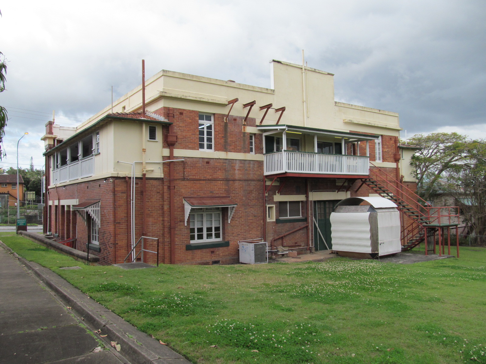
Albion Fire Station is a heritage-listed former fire station at 42 Bridge Street, Wooloowin, City of Brisbane, Queensland, Australia. It was designed by Department of Public Works and built from 1925 to 1927. It was added to the Queensland Heritage Register on 28 February 2003. History The former Albion Fire Station is a substantial two-storey red brick building standing prominently on Bridge Street (now in Wooloowin but formerly in Albion). It was officially opened on Monday 17 January 1927 when the Home Secretary James Stopford pulled a rope which automatically swung the doors open, rang the alarm and roused the firemen to action, and the two fire engines raced out of the station. The guests were very impressed at the demonstration of the speed with which the station could respond to an emergency. Designed by the Department of Public Works, the building was the major and coordinating fire station for the Brisbane northside area. Its sister station at South Brisbane (corner ... [...More Info...] [...Related Items...] OR: [Wikipedia] [Google] [Baidu] |
Wooloowin, Queensland
Wooloowin is a suburb in the City of Brisbane, Queensland, Australia. In the , Wooloowin had a population of 3,938 people. Geography Wooloowin is an inner-north suburb of Brisbane, Australia located approximately 5–6 km north of the city's central business district. History The origin of the suburb's name has been attributed to either the local Indigenous Australian term for a pigeon or the term for a species of fish. It was the home of Brisbane's first Resident Judge, Alfred Lutwyche, who lived in Kedron Lodge. Holy Cross Primary School opened in 1889. A stump-capping ceremony for Wooloowin Methodist Church was held on Saturday 30 November 1901. The site was on Old Sandgate Road at the junction with Bayview Terrace (now 170 Bonney Avenue). While the church was being built, it was destroyed by a cyclone in January 1901. The church was re-built and opened on Sunday 13 April 1902 by Reverend Robert Stewart, President of the Queensland Methodist Conference. In 1975 ... [...More Info...] [...Related Items...] OR: [Wikipedia] [Google] [Baidu] |
Henry Wallace Atkinson
Henry Wallace Atkinson (22 April 1866 – 26 April 1938) was an architect in Brisbane, Queensland, Australia. Many of his works are now heritage-listed. Early life Henry Wallace Atkinson was born on 22 April 1866 in Brisbane, the son of Paul Cole Atkinson from Cork, Ireland and his wife Jane (née Creech). Having finished school, he was one of the first intake of students into the Brisbane Technical College in 1883. He was a keen athlete and was Queensland champion cyclist in 1887. He married Martha Jane Hipwood, daughter of James Hipwood (Mayor of Brisbane) on 30 April 1891 at St Philips Church of England at Thompson Estate (now Annerley). Career He was articled to architect Christian Waagepetersen and then worked as a draughtsman in the office of the Queensland Colonial Architect from 1882 to 1890. In 1889, he submitted an entry into a competition for a new Head Fire Station on the corner of Ann and Edward Streets in Brisbane. Having won the competition, he left the Queensl ... [...More Info...] [...Related Items...] OR: [Wikipedia] [Google] [Baidu] |
Queensland Family History Society
The Queensland Family History Society (QFHS) is an incorporated association formed in Brisbane, Queensland, Australia. History The society was established in 1979 as a non-profit, non-sectarian, non-political organisation. They aim to promote the study of family history local history, genealogy, and heraldry, and encourage the collection and preservation of records relating to the history of Queensland families. At the end of 2022, the society relocated from 58 Bellevue Avenue, Gaythorne Gaythorne is a suburb in the City of Brisbane, Queensland, Australia. In the , Gaythorne had a population of 3,023 people. Geography Gaythorne is located seven kilometres north-west of the Brisbane central business district. It is bounded to ... () to its new QFHS Family History Research Centre at 46 Delaware Street, Chermside (). References External links * Non-profit organisations based in Queensland Historical societies of Australia Libraries in Brisbane Family hist ... [...More Info...] [...Related Items...] OR: [Wikipedia] [Google] [Baidu] |
Billiard Room
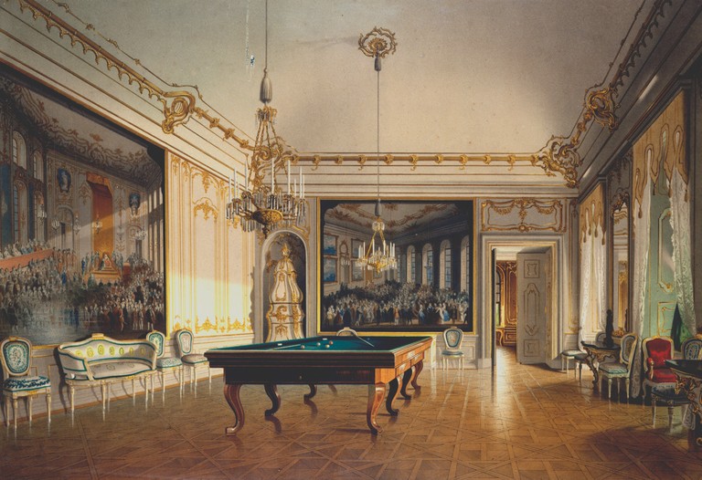
A billiard room (also billiards room, or more specifically pool room, snooker room) is a recreation room, such as in a house or recreation center, with a billiards, pool or snooker table. (The term "billiard room" or "pool room" may also be used for a business providing public billiards tables; see billiard hall.) The billiard room may be in the public center of the house or the private areas of the house. Billiard rooms require proper lighting and clearances for game playing. Although there are adjustable cue sticks on the market, 5 feet of clearance around the pool table is ideal. Interior designer Charlotte Moss believed that "a billiard room is synonymous with group dynamics. It's where you mix drinks and embark on a little friendly competition..." History Billiards probably developed from one of the late-14th century or early-15th century lawn games in which players hit balls with sticks. The earliest mention of pool as an indoor table game is in a 1470 inventory list ... [...More Info...] [...Related Items...] OR: [Wikipedia] [Google] [Baidu] |
Commonwealth Bank
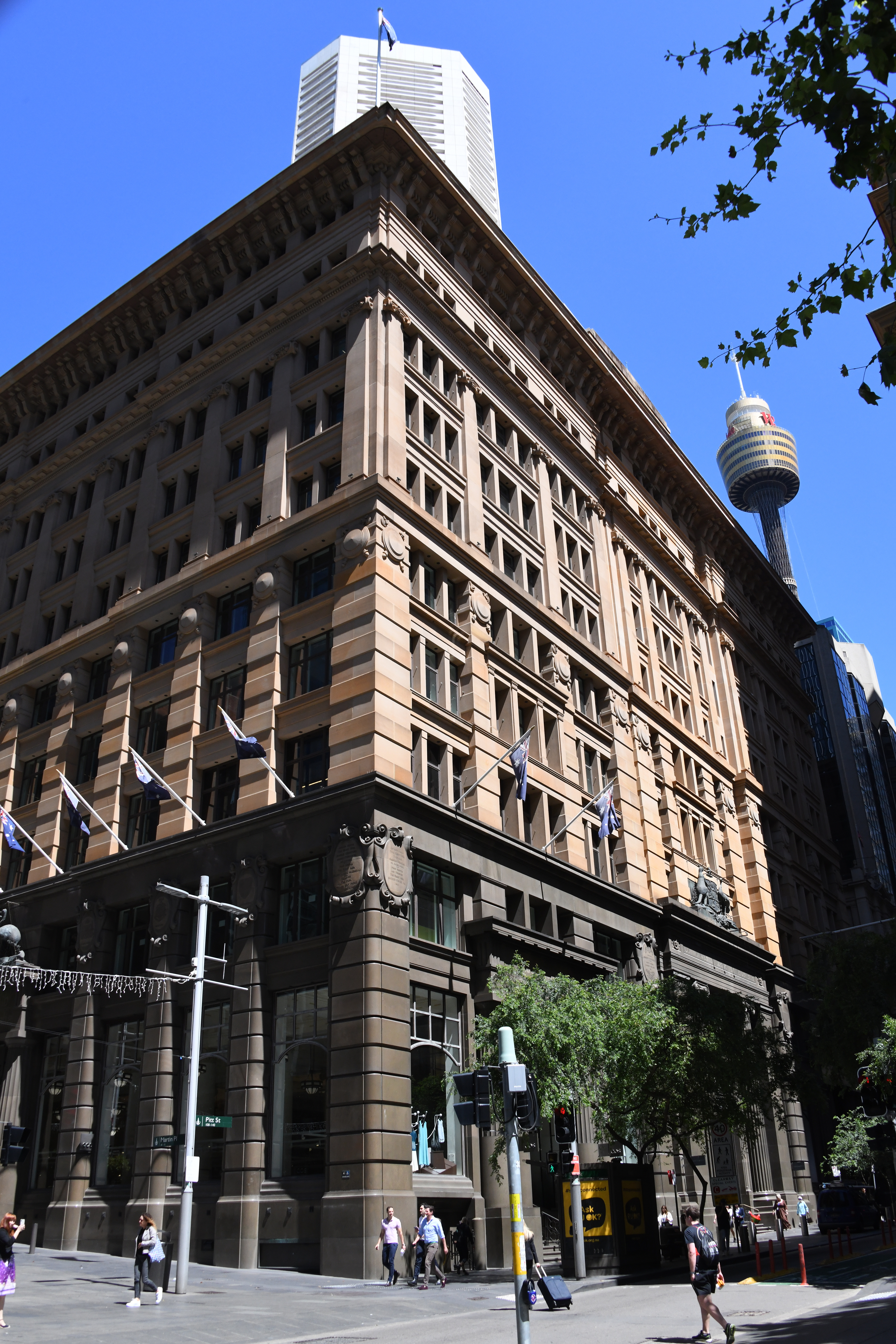
The Commonwealth Bank of Australia (CBA), or CommBank, is an Australian multinational bank with businesses across New Zealand, Asia, the United States and the United Kingdom. It provides a variety of financial services including retail, business and institutional banking, funds management, superannuation, insurance, investment and broking services. The Commonwealth Bank is the largest Australian listed company on the Australian Securities Exchange as of August 2015 with brands including Bankwest, Colonial First State Investments, ASB Bank (New Zealand), Commonwealth Securities (CommSec) and Commonwealth Insurance (CommInsure). Its former constituent parts were the Commonwealth Trading Bank of Australia, the Commonwealth Savings Bank of Australia, and the Commonwealth Development Bank. Founded in 1911 by the Australian Government and fully privatised in 1996, the Commonwealth Bank is one of the " big four" Australian banks, with the National Australia Bank (NAB), ANZ and Wes ... [...More Info...] [...Related Items...] OR: [Wikipedia] [Google] [Baidu] |
Queensland Treasury
The Treasurer of Queensland is the title held by the Cabinet minister who is responsible for the Queensland Treasury, and by extension, all financial matters of the Queensland Government. List of Queensland treasurers See also *Politics of Queensland References {{Australian Treasurers Queensland ) , nickname = Sunshine State , image_map = Queensland in Australia.svg , map_caption = Location of Queensland in Australia , subdivision_type = Country , subdivision_name = Australia , established_title = Before federation , establishe ... Queensland-related lists ... [...More Info...] [...Related Items...] OR: [Wikipedia] [Google] [Baidu] |
Sandgate, Queensland
Sandgate is a northern coastal suburb in the City of Brisbane, Queensland, Australia. In the , Sandgate had a population of 4,909 people. The town became a popular destination for the people of Brisbane in the early 20th century and remains popular due to its coastline, including Lovers Walk along the bay between Sandgate and neighbouring Shorncliffe as well as Moora Park and Beach. Geography Sandgate is situated on the coastline, along Bramble Bay part of Moreton Bay. The western border of the suburb is marked by the Gateway Motorway. The Shorncliffe railway line (part of the Queensland Rail City network) enters the suburb from the south-west ( Deagon) and exits to the south ( Shorncliffe) with Sandgate railway station in Chubb Street off Rainbow Street () serving the suburb. The Deagon Wetlands are in the west of the suburb (); they are part of the North East Wetlands of Brisbane. Dowse Lagoon is in the centre of the suburb (). It was officially named on 15 November 1975 ... [...More Info...] [...Related Items...] OR: [Wikipedia] [Google] [Baidu] |
Wynnum, Queensland
Wynnum is a coastal suburb in the City of Brisbane, Queensland, Australia. In the , Wynnum had a population of 12,915 people. The suburb is a popular destination in Brisbane due to its coastline, jetty and tidal wading pool. Geography Wynnum is on the shores of Moreton Bay in Brisbane, Australia, about by road east of the Brisbane GPO. Toponymy Wynnum likely derives from a Durubalic word meaning pandanus palm or mud crab. History Aboriginal history of Quandamooka (Moreton Bay) stretches back over 25,000 years and Aboriginal connection to the Wynnum area has remained strong throughout European colonisation. Thomas Petrie, a visitor in the 1840s, described Wynnum as a large Aboriginal camp (centred on what is now Elanora Park , referred to as Black's Camp as late as the 1980s) for launching expeditions to hunt turtle, dugong and flying fox on the neighbouring islands. European settlement first appeared at North Wynnum (around the mouth of Wynnum Creek) at the fringe of Bla ... [...More Info...] [...Related Items...] OR: [Wikipedia] [Google] [Baidu] |
Taringa, Queensland
Taringa is a suburb in the City of Brisbane, Queensland, Australia. In the , Taringa had a population of 8,376 people. Geography Taringa is by road south-west of the Brisbane GPO. The suburb of Taringa borders Brisbane's Mt Coot-Tha, Indooroopilly and St Lucia, and is dominated by a ridge that runs the length of Swann Road, with steep slopes on either side of the ridge. Taringa is mostly residential, except for a small number of commercial buildings mostly clustered along Moggill Road. It is a popular neighbourhood among the students of the University of Queensland and the Queensland University of Technology because of its proximity to the universities and to Brisbane CBD. History The name ''Taringa'' is a combination of two Aboriginal words: ''tarau'' (stones) and ''nga'' (made up of). Together, they mean "place of stones". The Main Line railway from Roma Street railway station to Indooroopilly railway station opened on 14 June 1875 with the area being served by West Mil ... [...More Info...] [...Related Items...] OR: [Wikipedia] [Google] [Baidu] |
Toowong
Toowong is a riverside suburb in the City of Brisbane, Queensland, Australia. In the , Toowong had a population of 10,830 people. Geography Toowong is situated between Mount Coot-tha and the Brisbane River and is made up of rolling hills with little flat land. Since European settlement most of the land has been cleared for residential and commercial use with the exception of some park land and bushland near the Western Freeway. At the centre of Toowong is a commercial precinct including Toowong Village, and several other commercial and office buildings. The western side of the suburb is predominantly residential with a mix of medium density dwellings and detached Queenslander houses, extending to the foothills of Mount Coot-tha. Toowong borders the Brisbane River. Along the riverside are a number of transport links: Coronation Drive, the Regatta ferry wharf, and the Bicentennial Bike Path (a bike and walkway) to the Brisbane CBD. This section of the river is the Toowong ... [...More Info...] [...Related Items...] OR: [Wikipedia] [Google] [Baidu] |
Ithaca, Queensland
Ithaca is a former suburb of Brisbane, Australia. Since 1975, Ithaca has been designated a neighbourhood within the suburb of Red Hill in Brisbane. Origin of the name The name of the suburb is believed to have been bestowed by Sir George Ferguson Bowen, Governor of Queensland (1859-1867), after the Ionian Island of Ithaca, the subject of a book he had authored. Geography Traditionally, Ithaca was bound by Jubilee Terrace to the west, Ithaca Creek to the north, the suburb of Red Hill to the east and the suburb of Paddington to the south. Therefore, despite the official designation as being part of Red Hill, the former suburb of Ithaca appears to span the present suburbs of Red Hill, Paddington and Bardon. History Ithaca was once the centre of the former local government areas of Shire of Ithaca, later Town of Ithaca. The Ithaca Town Council Chambers were built in 1910 at 99 Enoggera Terrace (then in Ithaca, now in Red Hill). With the amalgamation of the Town of Ithaca into ... [...More Info...] [...Related Items...] OR: [Wikipedia] [Google] [Baidu] |
Windsor, Queensland
Windsor is an inner northern suburb in the City of Brisbane, Queensland, Australia. In the , Windsor had a population of 7,013 people. Geography Windsor is located about from the Brisbane central business district. It is largely residential, featuring many old Queenslanders, although there is also considerable retail commercial activity, primarily concentrated along Lutwyche and Newmarket Roads. History Land was first sold in this remote part of then New South Wales in 1854 and development was slow until the opening of the Bowen Bridge in 1860, named after the newly arrived first Governor of Queensland, Sir George Bowen, allowing easier access to the district. At that time the district was known as Breakfast Creek or Upper Breakfast Creek. Distinctive homes including ''Rosemount'', ''Oakwal'', ''The Bower'', ''Wilston House'' and ''Eildon'' were built on large portions of land. In 1864, pioneer settlers approached the Queensland Government for aid to establish a local sc ... [...More Info...] [...Related Items...] OR: [Wikipedia] [Google] [Baidu] |


