|
Albanian Riviera
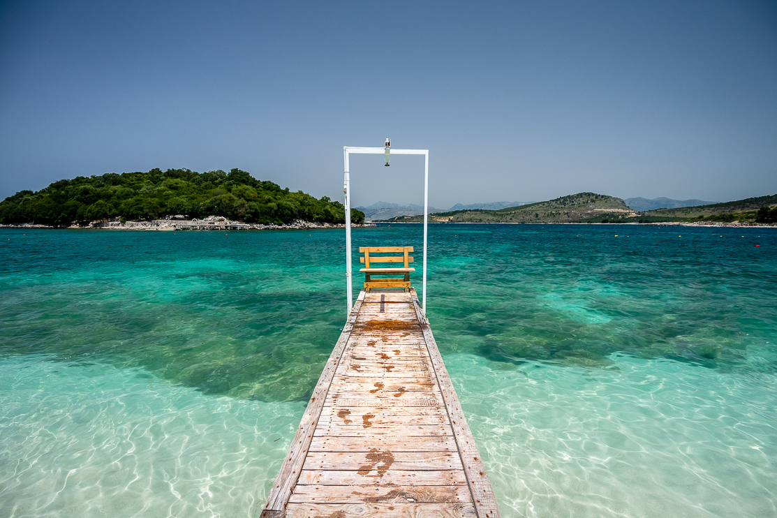
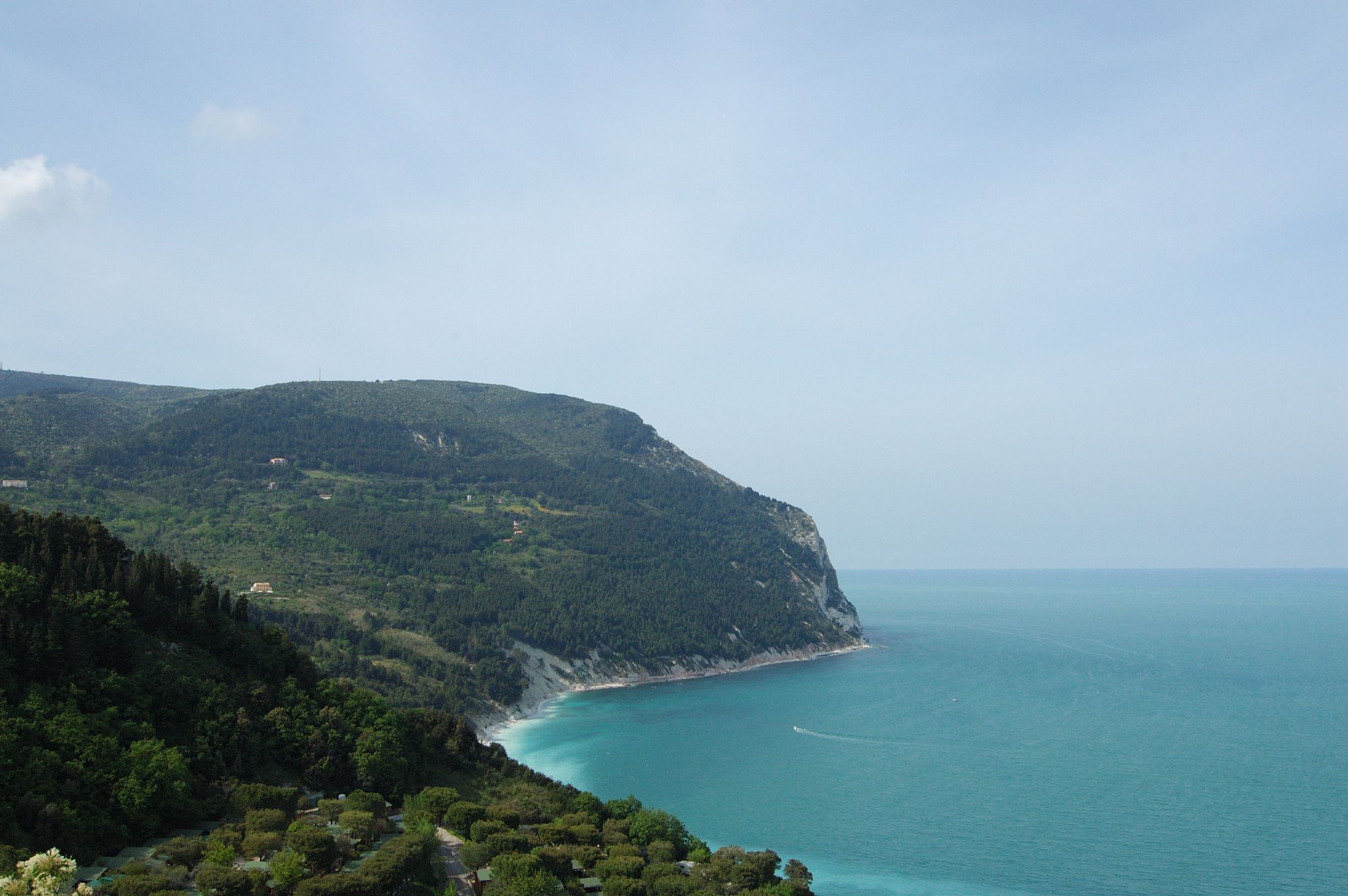
The Albanian Riviera ( sq, Riviera shqiptare, ), also popularly known as Bregu, is a coastline along the Northeastern Ionian Sea in the Mediterranean Sea encompassing the districts of Sarandë and Vlorë in Southwestern Albania. It forms an important section of the Albanian Ionian Sea Coast dotted with the villages of Palasë, Dhërmi, Vuno, Himara, Qeparo, Borsh, Piqeras, Lukovë and the city of Sarandë. The riviera should not be confused with the entire coastline of the country, which includes the Ionian Sea Coast, and the mostly flat Adriatic Sea Coast in the north. The Ceraunian Mountains separate the coast from the hinterland. The area is a major nightlife, ecotourist, and elite retreat destination in Albania. It features traditional Mediterranean villages, ancient castles, churches, monasteries, secluded turquoise beaches, bays, mountain passes, seaside canyons, coves, rivers, underwater fauna, caves, and orange, lemon, and olive groves. During the classical times, 4 ... [...More Info...] [...Related Items...] OR: [Wikipedia] [Google] [Baidu] |
Ceraunian Mountains
The Ceraunian Mountains ( sq, Malet e Vetëtimës, "Thunderbolt mountains"; el, Κεραύνια Όρη, ''Keravnia ori''; la, Cerauni Montes), also commonly Akroceraunian Mountains ( grc, Ἀκροκεραύνια, sq, Malet Akrokeraune "malet Akrokeraune, sot Malet e Vetëtimës"), are a coastal mountain range in southwestern Albania, within the county of Vlorë. The range rises on the northeastern bank of the Ionian Sea. It extends for approximately in a southeast-northwest direction near Sarandë along the Albanian Riviera nearby to Orikum. Geologically, the Karaburun Peninsula belongs to the mountain range, forming the eastern Akroceraunian Mountains. The mountains are about long and about wide. The highest peak is Maja e Çikës with an elevation of . The Llogara Pass () divides the mountains into a western and the Akroceraunian Mountains within the Karaburun Peninsula. Name The name ''Ceraunia'' is derived from Ancient Greek Κεραύνια ὄρη, meaning "thun ... [...More Info...] [...Related Items...] OR: [Wikipedia] [Google] [Baidu] |
National Road 8 (Albania)
The SH8 highway ( sq, Rruga Shtetërore 8) is a national highway in Albania spanning across the counties of Fier and Vlorë. It connects the cities of Fier and Vlorë to the city of Sarandë on the Albanian Ionian Sea Coast. The highest point of the SH8 is the Llogara Pass, above sea level. The road was built in 1920. Route The National Road SH8 branches off from the National Road SH4 in Fier and leads the city of Vlorë. From Vlorë, the road crosses the Llogara Pass, to the Albanian Riviera near Dhërmi and through Himarë to Sarandë. It ends at the city center of Sarandë. Gallery File:3Road_To_Kakome_Near_Saranda_2017.jpg, SH8 near Kakomë File:Albanian_Riviera_bunkers.jpg, Roads seen from Dhërmi File:Llogara_pass_2.jpg, Llogara Pass The Llogara Pass ( sq, Qafa e Llogarasë); is a high mountain pass within the Ceraunian Mountains along the Albanian Riviera. It connects the Dukat Valley in the north with Himarë in the south. Orikum is the nearest city on the ... [...More Info...] [...Related Items...] OR: [Wikipedia] [Google] [Baidu] |
Albanian Ionian Sea Coast
The Albanian Ionian Sea Coast ( — ) is a coastline of the Northeastern Ionian Sea, that encompasses the southwestern border of the Republic of Albania, stretching from the southern half of Karaburun Peninsula, across the historical region of Labëria, the city of Sarandë, the mountains of the Ceraunians and the Albanian Riviera, to the Lake of Butrint, where the Strait of Corfu separates the country from Greece. Albania is located in Southern and Southeastern Europe in the western section of the Balkan Peninsula. It borders on Montenegro to the northwest, Kosovo to the northeast, North Macedonia to the east, Greece to the south and the Mediterranean Sea to the west. The coastline occupies a total length of and explicitly marked by a mountainous landscape supplied with deep bays, numerous islands, high cliffs, rocky and sandy coasts and a unique marine life. The Ionian Sea is an arm of the Mediterranean Sea positioned south of the Adriatic Sea, which extend from Si ... [...More Info...] [...Related Items...] OR: [Wikipedia] [Google] [Baidu] |
Albanian Adriatic Sea Coast
The Albanian Adriatic Sea Coast ( — ) stretches in the Southeastern Adriatic Sea beginning at the Gulf of Drin in the north, across the port cities of Shëngjin, Durrës and Vlorë, to the Bay of Vlorë in the south, where the Albanian Riviera as well as the Albanian Ionian Sea Coast begins. Albania is geographically located in South and Southeast Europe within the Balkan Peninsula. It borders on Montenegro to the northwest, Kosovo to the northeast, North Macedonia to the east, Greece to the south and the Mediterranean Sea to the west. The total length of the coastline is approximately , of which are taken up by white sandy beaches and the remaining by different landforms. The Adriatic Sea is the northernmost arm of the Mediterranean Sea extending all the way from the Strait of Otranto in the south up to the Po Valley in the north. The sea is apportioned into two major basins, wherein Albania is entirely located within the deepest and southernmost one. The coastline i ... [...More Info...] [...Related Items...] OR: [Wikipedia] [Google] [Baidu] |
Llogara Pass
The Llogara Pass ( sq, Qafa e Llogarasë); is a high mountain pass within the Ceraunian Mountains along the Albanian Riviera. It connects the Dukat Valley in the north with Himarë in the south. Orikum is the nearest city on the northern side of the pass and the village of Dhërmi in the south. The Llogara Pass is also part of the Llogara National Park, which spans an area of . In November 1912, during the Himara revolt a Greek unit was positioned on the Llogara in order to defend the region of Himara from Ottoman-Albanian attacks from the direction of Vlorë. See also * Llogara National Park * Geography of Albania * Mountain passes of Albania References {{Navboxes , title = Topics related to the Llogara Pass , titlestyle = color:black; background-color:white; , list1= {{Albania topics Mountain passes of Albania Llogara National Park ... [...More Info...] [...Related Items...] OR: [Wikipedia] [Google] [Baidu] |
Julius Caesar
Gaius Julius Caesar (; ; 12 July 100 BC – 15 March 44 BC), was a Roman general and statesman. A member of the First Triumvirate, Caesar led the Roman armies in the Gallic Wars before defeating his political rival Pompey in a civil war, and subsequently became dictator from 49 BC until his assassination in 44 BC. He played a critical role in the events that led to the demise of the Roman Republic and the rise of the Roman Empire. In 60 BC, Caesar, Crassus and Pompey formed the First Triumvirate, an informal political alliance that dominated Roman politics for several years. Their attempts to amass power as were opposed by the within the Roman Senate, among them Cato the Younger with the frequent support of Cicero. Caesar rose to become one of the most powerful politicians in the Roman Republic through a string of military victories in the Gallic Wars, completed by 51 BC, which greatly extended Roman territory. During this time he both invaded Britain and built a b ... [...More Info...] [...Related Items...] OR: [Wikipedia] [Google] [Baidu] |
Pompey
Gnaeus Pompeius Magnus (; 29 September 106 BC – 28 September 48 BC), known in English as Pompey or Pompey the Great, was a leading Roman general and statesman. He played a significant role in the transformation of Rome from republic to empire. He was (for a time) a student of Roman general Sulla as well as the political ally, and later enemy, of Julius Caesar. A member of the senatorial nobility, Pompey entered into a military career while still young. He rose to prominence serving the dictator Sulla as a commander in the civil war of 83–82 BC. Pompey's success as a general while young enabled him to advance directly to his first Roman consulship without following the traditional '' cursus honorum'' (the required steps to advance in a political career). He was elected as Roman consul on three occasions. He celebrated three Roman triumphs, served as a commander in the Sertorian War, the Third Servile War, the Third Mithridatic War, and in va ... [...More Info...] [...Related Items...] OR: [Wikipedia] [Google] [Baidu] |
Classical Antiquity
Classical antiquity (also the classical era, classical period or classical age) is the period of cultural history between the 8th century BC and the 5th century AD centred on the Mediterranean Sea, comprising the interlocking civilizations of ancient Greece and ancient Rome known as the Greco-Roman world. It is the period in which both Greek and Roman societies flourished and wielded huge influence throughout much of Europe, North Africa, and Western Asia. Conventionally, it is taken to begin with the earliest-recorded Epic Greek poetry of Homer (8th–7th-century BC), and continues through the emergence of Christianity (1st century AD) and the fall of the Western Roman Empire (5th-century AD). It ends with the decline of classical culture during late antiquity (250–750), a period overlapping with the Early Middle Ages (600–1000). Such a wide span of history and territory covers many disparate cultures and periods. ''Classical antiquity'' may also refer to an idealized v ... [...More Info...] [...Related Items...] OR: [Wikipedia] [Google] [Baidu] |
Cave
A cave or cavern is a natural void in the ground, specifically a space large enough for a human to enter. Caves often form by the weathering of rock and often extend deep underground. The word ''cave'' can refer to smaller openings such as sea caves, rock shelters, and grottos, that extend a relatively short distance into the rock and they are called ''exogene'' caves. Caves which extend further underground than the opening is wide are called ''endogene'' caves. Speleology is the science of exploration and study of all aspects of caves and the cave environment. Visiting or exploring caves for recreation may be called ''caving'', ''potholing'', or ''spelunking''. Formation types The formation and development of caves is known as ''speleogenesis''; it can occur over the course of millions of years. Caves can range widely in size, and are formed by various geological processes. These may involve a combination of chemical processes, erosion by water, tectonic forces, microorgani ... [...More Info...] [...Related Items...] OR: [Wikipedia] [Google] [Baidu] |
Fauna
Fauna is all of the animal life present in a particular region or time. The corresponding term for plants is ''flora'', and for fungi, it is '' funga''. Flora, fauna, funga and other forms of life are collectively referred to as '' biota''. Zoologists and paleontologists use ''fauna'' to refer to a typical collection of animals found in a specific time or place, e.g. the "Sonoran Desert fauna" or the "Burgess Shale fauna". Paleontologists sometimes refer to a sequence of faunal stages, which is a series of rocks all containing similar fossils. The study of animals of a particular region is called faunistics. Etymology ''Fauna'' comes from the name Fauna, a Roman goddess of earth and fertility, the Roman god Faunus, and the related forest spirits called Fauns. All three words are cognates of the name of the Greek god Pan, and ''panis'' is the Greek equivalent of fauna. ''Fauna'' is also the word for a book that catalogues the animals in such a manner. The term was first used b ... [...More Info...] [...Related Items...] OR: [Wikipedia] [Google] [Baidu] |
River
A river is a natural flowing watercourse, usually freshwater, flowing towards an ocean, sea, lake or another river. In some cases, a river flows into the ground and becomes dry at the end of its course without reaching another body of water. Small rivers can be referred to using names such as Stream#Creek, creek, Stream#Brook, brook, rivulet, and rill. There are no official definitions for the generic term river as applied to Geographical feature, geographic features, although in some countries or communities a stream is defined by its size. Many names for small rivers are specific to geographic location; examples are "run" in some parts of the United States, "Burn (landform), burn" in Scotland and northeast England, and "beck" in northern England. Sometimes a river is defined as being larger than a creek, but not always: the language is vague. Rivers are part of the water cycle. Water generally collects in a river from Precipitation (meteorology), precipitation through a ... [...More Info...] [...Related Items...] OR: [Wikipedia] [Google] [Baidu] |


