|
Alamparai Fort
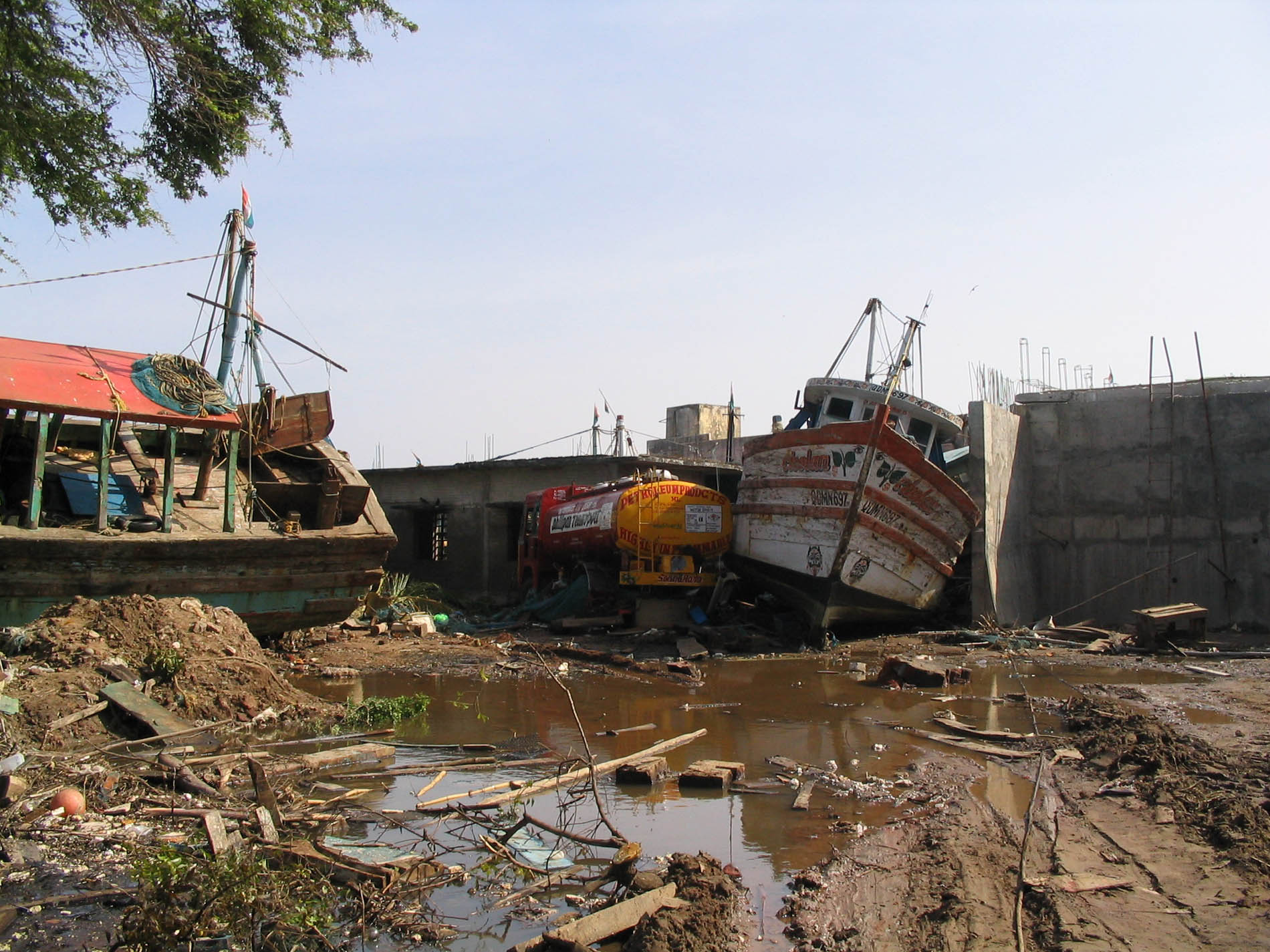
The ruins of Alamparai Fort (also called Alampara) lie near Kadappakkam in India, a village 50 km from Mamallapuram on the land overlooking the sea. Constructed in the late 17th century during the Mughal era, the Alamparai Fort once had a 100-metre long dockyard stretching into the sea, from which zari cloth, salt, and ghee were exported. During 1735 AD it was ruled by Nawab Doste Ali Khan. In 1750, for the services rendered by the famous French commander Dupleix to Subedar Muzaphar Jung, the fort was given to the French. When French were defeated by the British, the fort was captured and demolished in 1760 AD. More recently the structure was damaged in the 2004 Indian Ocean earthquake. History Alamparai was a seaport in historical times. The place had other names like Idaikazhinadu, Alamparva and Alampuravi. The fort was built during the Mughal era between 1736 and 1740 AD. The fort was initially under the control of the Nawab of Arcot, Doste Ali Khan, and was later gi ... [...More Info...] [...Related Items...] OR: [Wikipedia] [Google] [Baidu] |
History Of Tamil Nadu
The region of Tamil Nadu in the southeast of modern India, shows evidence of having had continuous human habitation from 15,000 BCE to 10,000 BCE. Throughout its history, spanning the early Upper Paleolithic age to modern times, this region has coexisted with various external cultures. The three ancient Tamil dynasties namely Chera, Chola, and Pandya were of ancient origins. Together they ruled over this land with a unique culture and language, contributing to the growth of some of the oldest extant literature in the world. These three dynasties were in constant struggle with each other vying for hegemony over the land. Invasion by the Kalabhras during the 3rd century disturbed the traditional order of the land, displacing the three ruling kingdoms. These occupiers were overthrown by the resurgence of the Pandyas and the Pallavas, who restored the traditional kingdoms. The Cholas who re-emerged from obscurity in the 9th century by defeating the Pallavas and the Pandyas ... [...More Info...] [...Related Items...] OR: [Wikipedia] [Google] [Baidu] |
Nawab Of Arcot
The Carnatic Sultanate was a kingdom in South India between about 1690 and 1855, and was under the legal purview of the Nizam of Hyderabad, until their demise. They initially had their capital at Arcot in the present-day Indian state of Tamil Nadu. Their rule is an important period in the history of the Carnatic and Coromandel Coast regions, in which the Mughal Empire gave way to the rising influence of the Maratha Empire, and later the emergence of the British Raj. Borders The old province known as the Carnatic, in which Madras (Chennai) was situated, extended from the Krishna river to the Kaveri river, and was bounded on the West by Mysore kingdom and Dindigul, (which formed part of the Sultanate of Mysore). The Northern portion was known as the ' Mughal Carnatic', the Southern the 'Maratha Carnatic' with the Maratha fortresses of Gingee and Ranjankudi. Carnatic thus was the name commonly given to the region of Southern India that stretches from the East Godavari of An ... [...More Info...] [...Related Items...] OR: [Wikipedia] [Google] [Baidu] |
Vedal
Vedal, pronounced as Vaedaal is a village in the Cheyyur taluk of the Chengalpattu district of Tamil Nadu, India. It is located away from Chennai and away from Pondicherry (city), Pondicherry on the Tamil Nadu East Coast Road East Coast Road, ECR. Vedal is situated about far from the Bay of Bengal coast. It is well known for the temple of Shiva Vadavayil Andavar (meaning - Chola's Northern gateway GOD) located here, once upon a time it was the northern entrance for Chola Dynasty. It was the last among the temples built by the king Raja Raja Chola I. Other names The village is also known as Chozha Kerala Charurvedi mangalam or Neelasathurvedimangalam or Veera Chozha Sathurvedimangalam) Sathurvedi means - A Land where all 4 VEDAS are keenly practiced. History It is believed that after the death of Veerapandiya Kattabomman in 1799 CE, the Palaiyakkarar fled the region in the fear of the British army and settled in Kadapakkam, and after some time they shifted to Neelasathurv ... [...More Info...] [...Related Items...] OR: [Wikipedia] [Google] [Baidu] |
Chennai
Chennai (, ), formerly known as Madras ( the official name until 1996), is the capital city of Tamil Nadu, the southernmost Indian state. The largest city of the state in area and population, Chennai is located on the Coromandel Coast of the Bay of Bengal. According to the 2011 Indian census, Chennai is the sixth-most populous city in the country and forms the fourth-most populous urban agglomeration. The Greater Chennai Corporation is the civic body responsible for the city; it is the oldest city corporation of India, established in 1688—the second oldest in the world after London. The city of Chennai is coterminous with Chennai district, which together with the adjoining suburbs constitutes the Chennai Metropolitan Area, the 36th-largest urban area in the world by population and one of the largest metropolitan economies of India. The traditional and de facto gateway of South India, Chennai is among the most-visited Indian cities by foreign tourists. It was ranked the ... [...More Info...] [...Related Items...] OR: [Wikipedia] [Google] [Baidu] |
East Coast Road
East Coast Road (ECR), combination of SH-49, NH-332A, NH-32, officially known as Mutthamizh Arignar Kalaignar Road, is a two-lane highway (now being partially upgraded to four-lane way from Chennai to Mamallapuram) in Tamil Nadu, India, built along the coast of the Bay of Bengal connecting Tamil Nadu's state capital city Chennai with Kanyakumari via Puducherry, Cuddalore, Chidambaram, Sirkali, Thirukkadaiyur, Tharangambadi, Karaikal, Nagore, Nagapattinam, Thiruthuraipoondi, Muthupet, Adirampattinam, Manora, Manamelkudi, Mimisal, Ramanathapuram, Thoothukudi, Tiruchendur, Uvari, Kudankulam. The total length of the road is about 777 km between Chennai and Kanyakumari. ECR once existed from Chennai to Puducherry, later it has been extended to Cuddalore and then to Nagapattinam and then Tuticorin via Ramanathapuram and finally up to Kanyakumari. The highway is a state highway maintained by the Government of Tamil Nadu under the Department of Highways and Minor Ports and ... [...More Info...] [...Related Items...] OR: [Wikipedia] [Google] [Baidu] |
Indian Ocean Tsunami
An earthquake and a tsunami, known as the Boxing Day Tsunami and, by the scientific community, the Sumatra–Andaman earthquake, occurred at 07:58:53 local time (UTC+7) on 26 December 2004, with an epicentre off the west coast of northern Sumatra, Indonesia. It was an undersea megathrust earthquake that registered a magnitude of 9.1–9.3 , reaching a Mercalli intensity up to IX in certain areas. The earthquake was caused by a rupture along the fault between the Burma Plate and the Indian Plate. A series of massive tsunami waves grew up to high once heading inland, after being created by the underwater seismic activity offshore. Communities along the surrounding coasts of the Indian Ocean were devastated, and the tsunamis killed an estimated 227,898 people in 14 countries, making it one of the deadliest natural disasters in recorded history. The direct results caused major disruptions to living conditions and commerce in coastal provinces of surrounded countries, including Ac ... [...More Info...] [...Related Items...] OR: [Wikipedia] [Google] [Baidu] |
Nagapattinam
Nagapattinam (''nākappaṭṭinam'', previously spelt Nagapatnam or Negapatam) is a town in the Indian state of Tamil Nadu and the administrative headquarters of Nagapattinam District. The town came to prominence during the period of Medieval Cholas (9th–12th century CE) and served as their important port for commerce and east-bound naval expeditions. The Chudamani Vihara in Nagapattinam constructed by the Srivijayan king Sri Mara Vijayattungavarman of the Sailendra dynasty with the help of Rajaraja Chola I was an important Buddhist structure in those times. Nagapattinam was settled by the Portuguese and, later, the Dutch under whom it served as the capital of Dutch Coromandel from 1660 to 1781. In November 1781, the town was conquered by the British East India Company. It served as the capital of Tanjore district from 1799 to 1845 under Madras Presidency of the British. It continued to be a part of Thanjavur district in Independent India. In 1991, it was made the headquar ... [...More Info...] [...Related Items...] OR: [Wikipedia] [Google] [Baidu] |
Karaikal
Karaikal ( /kʌdɛkʌl/, french: Karikal /kaʁikal/) is a town of the Indian Union Territory of Puducherry. Karaikal was sold to the French by the Rajah of Thanjavur and became a French Colony in 1739. The French held control, with occasional interruptions from the British, until 1954, when it was de facto incorporated into the Republic of India (de jure in 1962), along with Mahé, Yanaon, and Pondichéry. Etymology The origin of the word Karaikal is uncertain. The Imperial Gazetteer of British India gives its meaning as 'fish pass'. Both the words 'Karai' and 'Kal' have several meanings, of which the more acceptable ones are 'lime mix' and 'canal' respectively. Hence it has been suggested that the name may mean a canal built of lime mix, however, no trace of such a canal is evident. History Kingdom of Tanjore Before 1739, Karaikal was under the regime and control of Raja Pratap Singh of Tanjore. In 1738, Pierre Benoît Dumas was anxious to extend the French terr ... [...More Info...] [...Related Items...] OR: [Wikipedia] [Google] [Baidu] |
Tharangambadi
Tharangambadi (), formerly Tranquebar ( da, Trankebar, ), is a town in the Mayiladuthurai district of the Indian state of Tamil Nadu on the Coromandel Coast. It lies north of Karaikal, near the mouth of a distributary named Uppanar of the Kaveri River. Tranquebar was established on 19 November 1620 as the first Danish trading post in India. King Christian IV had sent his envoy Ove Gjedde who established contact with Raghunatha Nayak of Tanjore. An annual tribute was paid by the Danes to the Rajah of Tanjore until the colony of Tranquebar was sold to the British East India Company in 1845. Tharangambadi is the headquarters of Tharangambadi taluk. Its name means "place of the singing waves"; the old designation ''Trankebar'' remains current in modern Danish. Tharangambadi is located at the distance of 285 km from Chennai. The nearest airport is at Tiruchirapalli international airport at 172 km and the nearest port is at Karaikal at 26 km. History The place date ... [...More Info...] [...Related Items...] OR: [Wikipedia] [Google] [Baidu] |
Porto Nova
Porto or Oporto () is the second-largest city in Portugal, the capital of the Porto District, and one of the Iberian Peninsula's major urban areas. Porto city proper, which is the entire municipality of Porto, is small compared to its metropolitan area, with an estimated population of just 231,800 people in a municipality with only 41.42 km2. Porto's metropolitan area has around 1.7 million people (2021) in an area of ,Demographia: World Urban Areas March 2010 making it the second-largest urban area in Portugal. It is recognized as a global city with a Gamma + rating from the |
Cuddalore
Cuddalore, also spelt as Kadalur (), is the city and headquarters of the Cuddalore District in the Indian state of Tamil Nadu. Situated south of Chennai, Cuddalore was an important port during the British Raj. While the early history of Cuddalore remains unclear, the city first rose to prominence during Pallavas and Medieval Cholas' reign. After the fall of Cholas, the town was ruled by various dynasties like Pandyas, Vijayanagar Empire, Madurai Nayaks, Thanjavur Nayaks, Thanjavur Marathas, Tipu Sultan, French and the British Empire. Cuddalore was the scene of the Seven Years' War and the Battle of Cuddalore in 1758 between the French and British. It has been a part of independent India since 1947. During the 2004 Indian Ocean earthquake, and the subsequent tsunamis generated, Cuddalore was one of the affected towns, with 572 casualties. Apart from fishing and port-related industries, Cuddalore houses chemical, pharmacological and energy industries in SIPCOT, an industria ... [...More Info...] [...Related Items...] OR: [Wikipedia] [Google] [Baidu] |
Sadras
Sadras is a fortress town located on India's Coromandel Coast in Chengalpattu district, 70 km south of Chennai in Tamil Nadu state. ''Sadras'' is the anglicised form of the ancient town of ''Saduranga pattinam''. History and Etymology An inscription found in Sadras dated to 1359 mention this place as Rajanarayanan Pattinam after a Sambuvaraya chieftain. There is a temple to Vishnu here, and because of it later the city was known as Sadiravasagan Pattinam. This later changed into Sadurangapattinam, shortly known as Sadirai. Later the Dutch called it Sadras. Dutch Fort Modern Sadras was established as part of Dutch Coromandel in the seventeenth century, which was even before center for weaving superfine muslin cloth for export besides Pearl and edible oil. The magnificent Sadras Fort, built for commercial purposes by the Dutch, is a vast compound enclosing a huge granary, stables, and structures used to mount elephants. Unfortunately, only one of these structures survives. ... [...More Info...] [...Related Items...] OR: [Wikipedia] [Google] [Baidu] |


