|
Agua De La Piedra Formation
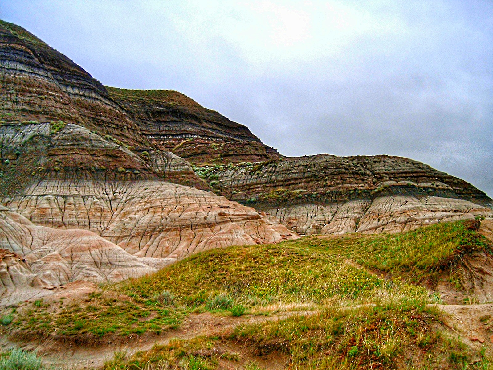
The Agua de la Piedra Formation (FAP, Spanish names include ''Estratos de Agua de la Piedra'' and ''Complejo Volcano-sedimentario del Terciario inferior'')Combina et al., 1994, p.418 is a Late Oligocene (Deseadan in the SALMA classification) geologic formation of the Malargüe Group that crops out in the southernmost Precordillera and northernmost Neuquén Basin in southern Mendoza Province, Argentina.Agua de la Piedra Formation in the The strictly terrestrial tuffs and paleosols of the formation, geologically belonging to |
Geological Formation
A geological formation, or simply formation, is a body of rock having a consistent set of physical characteristics ( lithology) that distinguishes it from adjacent bodies of rock, and which occupies a particular position in the layers of rock exposed in a geographical region (the stratigraphic column). It is the fundamental unit of lithostratigraphy, the study of strata or rock layers. A formation must be large enough that it can be mapped at the surface or traced in the subsurface. Formations are otherwise not defined by the thickness of their rock strata, which can vary widely. They are usually, but not universally, tabular in form. They may consist of a single lithology (rock type), or of alternating beds of two or more lithologies, or even a heterogeneous mixture of lithologies, so long as this distinguishes them from adjacent bodies of rock. The concept of a geologic formation goes back to the beginnings of modern scientific geology. The term was used by Abraham Gottlob ... [...More Info...] [...Related Items...] OR: [Wikipedia] [Google] [Baidu] |
Mendozahippus
''Mendozahippus'' is an extinct genus of notohippid notoungulate which existed in Mendoza, Argentina, during the late Oligocene. Fossils are known from the site of Quebrada Fiera of the Agua de la Piedra Formation and includes a complete skull and two associated metatarsals, two maxilla The maxilla (plural: ''maxillae'' ) in vertebrates is the upper fixed (not fixed in Neopterygii) bone of the jaw formed from the fusion of two maxillary bones. In humans, the upper jaw includes the hard palate in the front of the mouth. T ...ry fragments and five isolated upper teeth. It was first named by Esperanza Cerdeño and Bárbara Vera in 2010 and the type species is ''Mendozahippus fierensis''. References Toxodonts Oligocene mammals of South America Deseadan Paleogene Argentina Fossils of Argentina Fossil taxa described in 2010 Prehistoric placental genera {{paleo-mammal-stub ... [...More Info...] [...Related Items...] OR: [Wikipedia] [Google] [Baidu] |
Cretaceous–Paleogene Boundary
The Cretaceous–Paleogene (K–Pg) boundary, formerly known as the Cretaceous–Tertiary (K–T) boundary, is a geological signature, usually a thin band of rock containing much more iridium than other bands. The K–Pg boundary marks the end of the Cretaceous Period, the last period of the Mesozoic Era, and marks the beginning of the Paleogene Period, the first period of the Cenozoic Era. Its age is usually estimated at around 66 million years, with radiometric dating yielding a more precise age of 66.043 ± 0.011 Ma. The K–Pg boundary is associated with the Cretaceous–Paleogene extinction event, a mass extinction which destroyed a majority of the world's Mesozoic species, including all dinosaurs except for birds. Strong evidence exists that the extinction coincided with a large meteorite impact at the Chicxulub crater and the generally accepted scientific theory is that this impact triggered the extinction event. The word "Cretaceous" is derived from the Latin "creta" ... [...More Info...] [...Related Items...] OR: [Wikipedia] [Google] [Baidu] |
Jagüel Formation
The Jagüel Formation is a geological formation, located in Patagonia, Argentina. It underlies the Roca Formation and overlies the Allen Formation. All of these formations belong to the Malargüe Group. Its name was coined by Windhausen in 1914. This unit, defined in the eastern area of the Neuquén Embayment, registers an event of marine flooding that happened during the ages Maastrichtian and Danian.Rodríguez, María Fernanda (2011). «El Grupo Malargüe (Cretácico Tardío-Paleógeno Temprano) en la Cuenca Neuquina». ''Relatorio del XVIII Congreso Geológico Argentino'' (Neuquén): 245-264. It consists of mudrocks formed between the upper section or "Gypsum" of the Allen Formation, and the base of the first organogenic limestone of the Roca Formation. The Jagüel Formation is particularly important since a vast area of the formation contains the Cretaceous–Paleogene boundary that marks the end of the Mesozoic Era. It also shows evidence of the Cretaceous–Paleogene (K� ... [...More Info...] [...Related Items...] OR: [Wikipedia] [Google] [Baidu] |
Group (geology)
In geology, a group is a lithostratigraphic unit consisting of a series of related formations that have been classified together to form a group. Formations are the fundamental unit of stratigraphy. Groups may sometimes be combined into supergroups. Groups are useful for showing relationships between formations, and they are also useful for small-scale mapping or for studying the stratigraphy of large regions. Geologists exploring a new area have sometimes defined groups when they believe the strata within the groups can be divided into formations during subsequent investigations of the area. It is possible for only some of the strata making up a group to be divided into formations. An example of a group is the Glen Canyon Group, which includes (in ascending order) the Wingate Sandstone, the Moenave Formation, the Kayenta Formation, and the Navajo Sandstone. Each of the formations can be distinguished from its neighbor by its lithology, but all were deposited in the same va ... [...More Info...] [...Related Items...] OR: [Wikipedia] [Google] [Baidu] |
Allen Formation
The Allen Formation is a geological formation in Argentina whose strata date back to the Late Cretaceous (middle Campanian to early Maastrichtian.Salgado et al., 2007 Dinosaur remains are among the fossils that have been recovered from the formation.Weishampel, David B; et al. (2004). "Dinosaur distribution (Late Cretaceous, South America)." In: Weishampel, David B.; Dodson, Peter; and Osmólska, Halszka (eds.): The Dinosauria, 2nd, Berkeley: University of California Press. Pp. 600-604. . Description The stratotype of the formation was defined by Uliana and Dellapé in 1981 in the eastern area of the Bajo de Añelo, where the relation between base and top is clearly exposed. The deposits are mostly clastic, interbedded with banks of limestone and layers of anhydrite, which were defined continental and shallow marine facies associated with semiarid conditions.Armas & Sánchez, 2015, p.101 The interpreted sedimentary paleoenvironments range from purely continental such as ephemer ... [...More Info...] [...Related Items...] OR: [Wikipedia] [Google] [Baidu] |
Hinterland
Hinterland is a German word meaning "the land behind" (a city, a port, or similar). Its use in English was first documented by the geographer George Chisholm in his ''Handbook of Commercial Geography'' (1888). Originally the term was associated with the area of a port in which materials for export and import are stored and shipped. Subsequently, the use of the word expanded to include any area under the influence of a particular human settlement. Geographic region * An area behind a coast or the shoreline of a river. Specifically, by the ''doctrine of the hinterland,'' the hinterland is the inland region lying behind a port and is claimed by the state that owns the coast. * In shipping usage, a port's hinterland is the area that it serves, both for imports and for exports. * The term is also used to refer to the area around a city or town. * More generally, ''hinterland'' can refer to the rural area economically tied to an urban catchment area. The size of a hinterland can d ... [...More Info...] [...Related Items...] OR: [Wikipedia] [Google] [Baidu] |
Andes
The Andes, Andes Mountains or Andean Mountains (; ) are the longest continental mountain range in the world, forming a continuous highland along the western edge of South America. The range is long, wide (widest between 18°S – 20°S latitude), and has an average height of about . The Andes extend from north to south through seven South American countries: Venezuela, Colombia, Ecuador, Peru, Bolivia, Chile, and Argentina. Along their length, the Andes are split into several ranges, separated by intermediate depressions. The Andes are the location of several high plateaus—some of which host major cities such as Quito, Bogotá, Cali, Arequipa, Medellín, Bucaramanga, Sucre, Mérida, El Alto and La Paz. The Altiplano plateau is the world's second-highest after the Tibetan plateau. These ranges are in turn grouped into three major divisions based on climate: the Tropical Andes, the Dry Andes, and the Wet Andes. The Andes Mountains are the highest m ... [...More Info...] [...Related Items...] OR: [Wikipedia] [Google] [Baidu] |
Andean Orogeny
The Andean orogeny ( es, Orogenia andina) is an ongoing process of orogeny that began in the Early Jurassic and is responsible for the rise of the Andes mountains. The orogeny is driven by a reactivation of a long-lived subduction system along the western margin of South America. On a continental scale the Cretaceous (90 Ma) and Oligocene (30 Ma) were periods of re-arrangements in the orogeny. Locally the details of the nature of the orogeny varies depending on the segment and the geological period considered. Overview Subduction orogeny has been occurring in what is now western South America since the break-up of the supercontinent Rodinia in the Neoproterozoic. The Paleozoic Pampean, Famatinian and Gondwanan orogenies are the immediate precursors to the later Andean orogeny.Charrier ''et al''. 2006, pp. 113–114. The first phases of Andean orogeny in the Jurassic and Early Cretaceous were characterized by extensional tectonics, rifting, the development of back-arc b ... [...More Info...] [...Related Items...] OR: [Wikipedia] [Google] [Baidu] |
Phorusrhacidae
Phorusrhacids, colloquially known as terror birds, are an extinct clade of large carnivorous flightless birds that were one of the largest species of apex predators in South America during the Cenozoic era; their conventionally accepted temporal range covers from 62 to 0.1 million years ( Ma) ago. They ranged in height from . Their closest modern-day relatives are believed to be the seriemas. '' Titanis walleri'', one of the larger species, is known from Texas and Florida in North America. This makes the phorusrhacids the only known large South American predator to migrate north in the Great American Interchange that followed the formation of the Isthmus of Panama land bridge (the main pulse of the interchange began about 2.6 Ma ago; ''Titanis'' at 5 Ma was an early northward migrant). It was once believed that ''T. walleri'' became extinct in North America around the time of the arrival of humans, but subsequent datings of ''Titanis'' fossils provided no evidence for their surv ... [...More Info...] [...Related Items...] OR: [Wikipedia] [Google] [Baidu] |
Andrewsornis
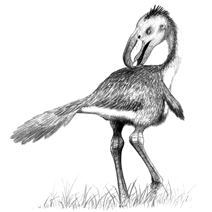
''Andrewsornis'' is an extinct genus of giant flightless predatory birds of the family Phorusrhacidae or "terror birds" that lived in Oligocene Argentina. Fossils have been found in the Sarmiento Formation, and possibly the Agua de la Piedra Formation.''Andrewsornis'' at Fossilworks.org Discovery and naming The of ''Andrewsornis'' ( FM-P13417) was discovered on September 18, 1923 by John Bernard Abbott in |
Terror Bird
Phorusrhacids, colloquially known as terror birds, are an extinct clade of large carnivorous flightless birds that were one of the largest species of apex predators in South America during the Cenozoic era; their conventionally accepted temporal range covers from 62 to 0.1 million years ( Ma) ago. They ranged in height from . Their closest modern-day relatives are believed to be the seriemas. '' Titanis walleri'', one of the larger species, is known from Texas and Florida in North America. This makes the phorusrhacids the only known large South American predator to migrate north in the Great American Interchange that followed the formation of the Isthmus of Panama land bridge (the main pulse of the interchange began about 2.6 Ma ago; ''Titanis'' at 5 Ma was an early northward migrant). It was once believed that ''T. walleri'' became extinct in North America around the time of the arrival of humans, but subsequent datings of ''Titanis'' fossils provided no evidence for their sur ... [...More Info...] [...Related Items...] OR: [Wikipedia] [Google] [Baidu] |


.jpg)


