|
Afghan Border Force
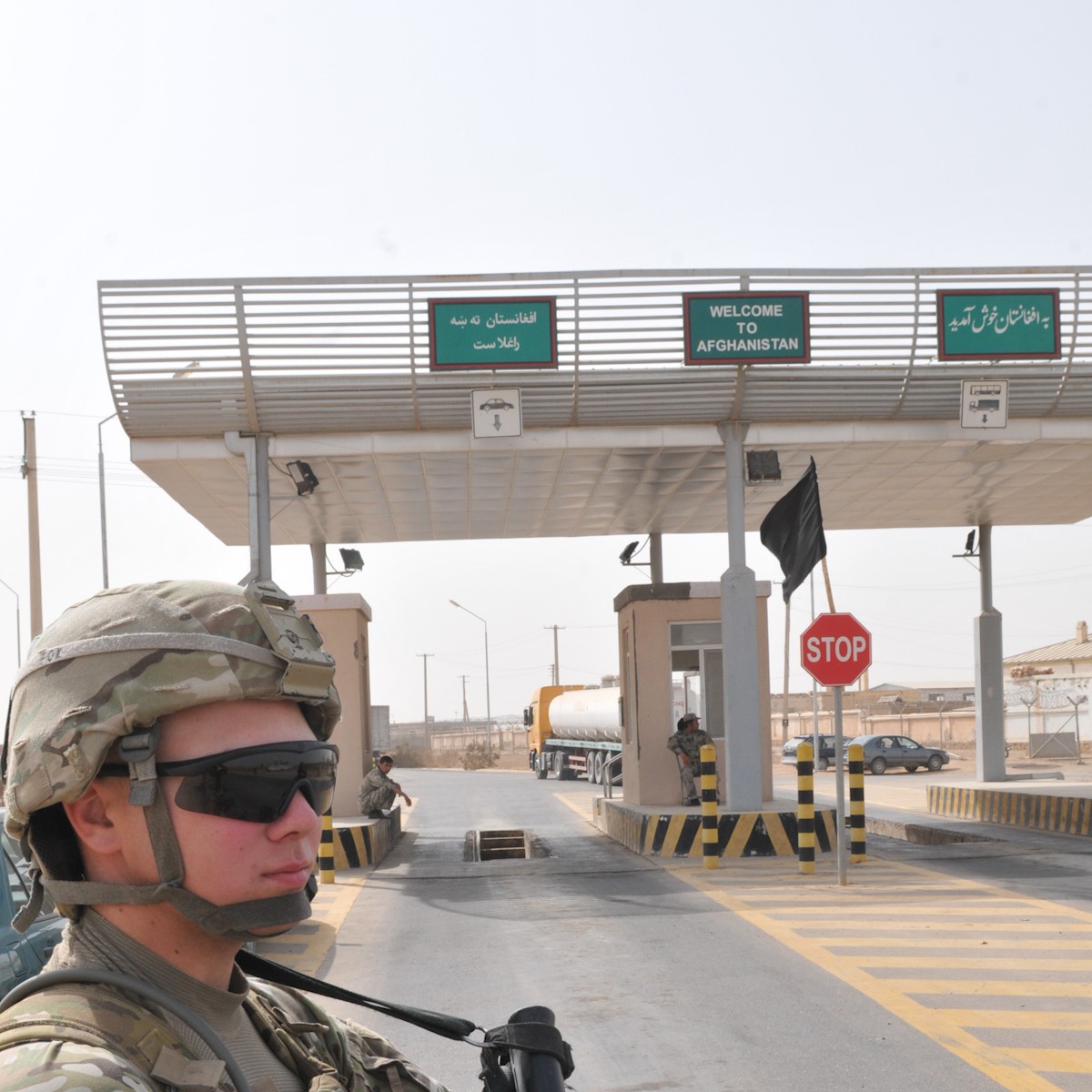
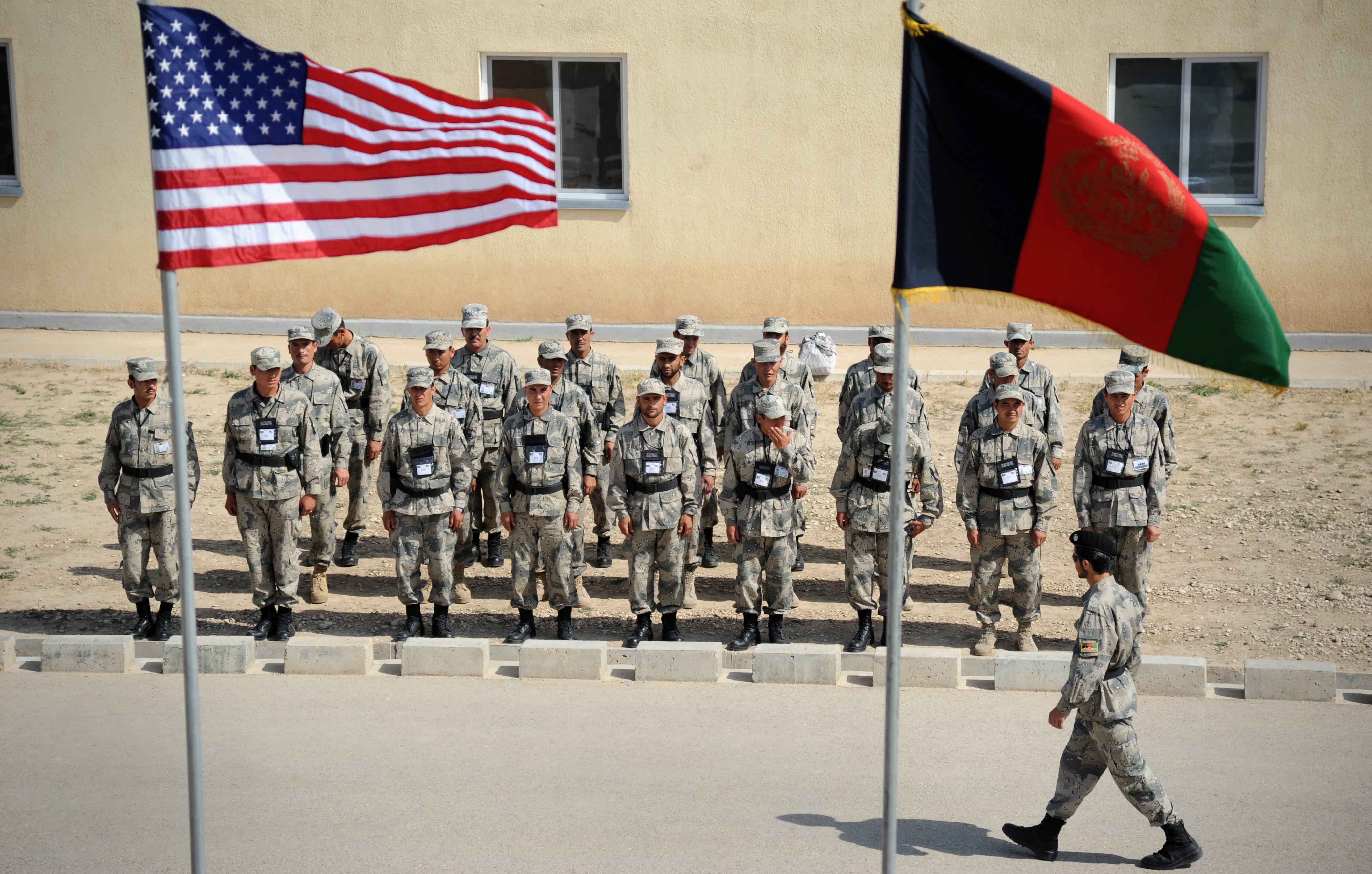
The Afghan Border Force (ABF) was responsible for security of Afghanistan's border area with neighboring countries extending up to into the interior and formed part of the Afghan National Army. In December 2017, most of the Afghan Border Police (ABP) personnel of the Afghan National Police were transferred to the Afghan National Army to form the Afghan Border Force. The ABP retained 4,000 personnel for customs operations at border crossings and international airports such as checking documents of foreigners entering the country or deporting them. The ABF's, and its predecessor the ABP, anti-narcotic efforts were a prominent concern to the international community during the War in Afghanistan. The ABF, and the ABP in its former role, patrolled a 50 km-wide corridor along the entirety of Afghanistan's border, particularly the long and porous Durand Line border in the southeast with neighboring Pakistan. Organization The ABP fell under the command of the Afghan National Po ... [...More Info...] [...Related Items...] OR: [Wikipedia] [Google] [Baidu] |
Afghan Border Police In Herat-2011
Afghan may refer to: *Something of or related to Afghanistan, a country in Southern-Central Asia *Afghans, people or citizens of Afghanistan, typically of any ethnicity **Afghan (ethnonym), the historic term applied strictly to people of the Pashtun ethnicity **Ethnic groups in Afghanistan, people of various ethnicities that are nationally Afghan *Afghan Hound, a dog breed originating in the mountainous regions of Afghanistan and the surrounding regions of Central Asia *Afghan (blanket) *Afghan coat *Afghan cuisine People * Sediq Afghan (born 1958), Afghan philosopher * Asghar Afghan (born 1987), former Afghan cricketer * Afgansyah Reza (born 1989), Indonesian musician also known as "Afgan" * Afghan Muhammad (died 1648), Afghan khan in modern day Russia * Azad Khan Afghan (died 1781), Afghan Commander and Ruler Places * Afghan, Iran, a village in Sistan and Baluchestan Province, Iran Other uses * Afghan (Australia), camel drivers from Afghanistan and Pakistan who came to the Au ... [...More Info...] [...Related Items...] OR: [Wikipedia] [Google] [Baidu] |
Almar District
Almar is a district in the southwestern part of Faryab Province, Afghanistan. Its northern border is the national border with Turkmenistan. The population was estimated at 150,000 in 2013. Ethnic diversity includes 35% Turkmen and 65% Uzbek. The district centre is the ancient bazaar town of Almar, (also known as Alaqadari-i-Almar or Almar Bazar). Located in a dry desert at an altitude of 847m, 35 km from Maimana Maymana (Persian/ Uzbek/Pashto: میمنه) is the capital city of Faryab Province in northwestern Afghanistan, near the Turkmenistan border. It is approximately northwest of the country's capital Kabul, and is located on the Maymana River, whi ..., this town is a major supply centre for all the villages on the banks of the Band-i-Turkestan river. From 24 April and 7 May 2014, flash flooding from heavy rainfall resulted in the destruction of public facilities, roads, and agricultural land. Assessment findings reported 84 families were affected, 700 livestoc ... [...More Info...] [...Related Items...] OR: [Wikipedia] [Google] [Baidu] |
Kunduz Province
Qunduz (Dari: ) is one of the 34 provinces of Afghanistan, located in the northern part of the country next to Tajikistan. The population of the province is around 1,136,677, which is mostly a tribal society; it is one of Afghanistan's most ethnically diverse provinces with many different ethnicities in large numbers living there.Archived aGhostarchiveand thWayback Machine https://repository.upenn.edu/cgi/viewcontent.cgi?article=1012&context=senior_seminar The city of Kunduz serves as the capital of the province. It borders the provinces of Takhar, Baghlan, Samangan and Balkh, as well as the Khatlon Region of Tajikistan. The Kunduz Airport is located next to the provincial capital. The Kunduz River valley dominates the Kunduz Province. The river flows irregularly from south to north into the Amu Darya river which forms the border between Afghanistan and Tajikistan. A newly constructed bridge crosses the Amu Darya at Sherkhan Bandar and the international trade is a large source ... [...More Info...] [...Related Items...] OR: [Wikipedia] [Google] [Baidu] |
Kaldar District
Kaldar ( prs, کلدار) is a small district (population around 19,400) in the northern part of Balkh Province, Afghanistan. The northern and the eastern border of the district is the large Amu Darya river. North of the river is Uzbekistan and east is Tajikistan. The main village, also called Kaldar, is in the northeastern part of the district, close to the river. According to the inhabitants of this village, its original name is Kakoldar. Demographics According to the 2012-13 census, there are 19,400 people living in the village. 9,900 or 51.0% of borough residents were males and 9,500 or 49.0% were females. With a multi-ethnic and mostly Persian-speaking society. The major ethnic group is the Tajiks followed by significant amount of population being ethnic Pashtoons and later Uzbek, Hazaras, Turkman, Arab and Baluch. Kaldar also has a small but noticeable population of Kuchis Kochis or Kuchis (Pashto: کوچۍ Kuchis) are pastoral nomads belonging primarily to the Ghi ... [...More Info...] [...Related Items...] OR: [Wikipedia] [Google] [Baidu] |
Shortepa District
Shortepa also Shor Tappeh ( prs, شور تیپه) (population 38,500) is one of the 15 districts of Balkh province. Shortepa, a small district in Balkh Province, Afghanistan. It is situated along the Amu Darya river, across the border with Termez, Uzbekistan, and to the east Kaldar. The main village is Shor Tappeh, A () at 274 m altitude. Economy The vast majority of villagers work in agriculture on farms along the coast. In the village of Joi Wakil there is a clinic which serves the spars district. Demographics According to the 2012-13 census, there are 38,500 people residing in the seven villages. 19,800 or 51.5% of villagers were males and 18,700 or 48.5% were females. With a multi-ethnic and mostly Persian-speaking society. The major ethnic group is the Tajiks with the vast population belonging to them followed by Pashtoons, Uzbek, Hazaras, Turkman, Arab and Baluch. Shortepa also has a small but noticeable population of Kuchis Kochis or Kuchis (Pashto: کوچۍ ... [...More Info...] [...Related Items...] OR: [Wikipedia] [Google] [Baidu] |
Balkh Province
Balkh (Dari: , ''Balx'') is one of the 34 provinces of Afghanistan, located in the north of the country. It is divided into 15 districts and has a population of about 1,509,183, which is multi-ethnic and mostly a Persian-speaking society. The city of Mazar-i-Sharif serves as the capital of the province. The Mazar-e Sharif International Airport and Camp Marmal sit on the eastern edge of Mazar-i-Sharif. Balkh, also called VazīrābādThename of the province is derived from the ancient city of Balkh, near the modern town. The city of Mazar-e-Sharif has been an important stop on the trade routes from the Far East to the Middle East, the Mediterranean and Europe. Home to the famous blue mosque, it was once destroyed by Genghis Khan but later rebuilt by Timur. The city of Balkh and the area of Balkh Province were considered a part of various historical regions in history including Ariana and Greater Khorasan. The province serves today as Afghanistan's second but main gateway to Ce ... [...More Info...] [...Related Items...] OR: [Wikipedia] [Google] [Baidu] |
Qarqin District
Qarqin District is a small boundary district in the northern part of Jowzjan Province, Afghanistan. It borders Turkmenistan to the north along the Amu Darya River, Khamyab District to the west, Mingajik and Mardyan districts to the south, and Balkh Province to the east. The population is 47,000 (2021). The district center is the town of Qarqin, which is situated on the bank of the Amu Darya River. See also * Qarqin * Jowzjan Province Jowzjan, sometimes spelled Jawzjan or Jozjan (Dari: ), is one of the thirty-four provinces of Afghanistan, located in the north of the country bordering neighboring Turkmenistan. The province is divided into 11 districts and contains hundreds of v ... District Map AIMS District Map Districts of Jowzjan Province {{Jowzjan-geo-stub ... [...More Info...] [...Related Items...] OR: [Wikipedia] [Google] [Baidu] |
Khamyab District
Khamyab District is a frontier district in the province of Jowzjan in Afghanistan. It shares borders with Turkmenistan to the north and west, Khwaja Du Koh district to the south and the Mingajik and Qarqin districts to the east. As of 2006, the population is 12,400. The district center is the village of Khamyab (Kham-e Ab). The Amu Darya river flows in the northern end of the district and forms part of the international border. Within the district is the westernmost point of the river on Afghan territory, and the area here is also the lowest point in the country (about 255 m above sea level). The riverbank in Khamyab and further downstream in Qarqin has suffered from erosion Erosion is the action of surface processes (such as water flow or wind) that removes soil, rock, or dissolved material from one location on the Earth's crust, and then transports it to another location where it is deposited. Erosion is distin ... on the Afghan side for decades, with the emergence of isl ... [...More Info...] [...Related Items...] OR: [Wikipedia] [Google] [Baidu] |
Jowzjan Province
Jowzjan, sometimes spelled Jawzjan or Jozjan (Dari: ), is one of the thirty-four provinces of Afghanistan, located in the north of the country bordering neighboring Turkmenistan. The province is divided into 11 districts and contains hundreds of villages. It has a population of about 613,481, which is multi-ethnic and mostly agriculturalists. Sheberghan is the capital of Jozjan province. History The province is named after the early medieval region and principality of Juzjan. Between the early 16th century and mid-18th century, the area was ruled by the Khanate of Bukhara. It was conquered by Ahmad Shah Durrani and became part of the Durrani Empire in or about 1750, which formed to the modern state of Afghanistan. The area was untouched by the British during the three Anglo-Afghan wars that were fought in the 19th and 20th centuries. Recent history Following a series of changing allegiances and falling out with Uzbek warlord Abdul Malik Pahlawan in 1997, the Taliban withdrew from ... [...More Info...] [...Related Items...] OR: [Wikipedia] [Google] [Baidu] |
Khani Chahar Bagh District
Khani Chahar Bagh is the most northerly district in Faryab Province. The main village, Chahar Bagh , is in the southern part of the district. In the north the district's border is with Turkmenistan. The population in 2013 was estimated at 70,000. Ethnic composition includes 35% Turkmen Turkmen, Türkmen, Turkoman, or Turkman may refer to: Peoples Historical ethnonym * Turkoman (ethnonym), ethnonym used for the Oghuz Turks during the Middle Ages Ethnic groups * Turkmen in Anatolia and the Levant (Seljuk and Ottoman-Turkish desc ... and 65% Uzbek. References External links District ProfileUNHCR, July 2002 Map of SettlementsIMMAP, 2011 Districts of Faryab Province {{Faryab-geo-stub ... [...More Info...] [...Related Items...] OR: [Wikipedia] [Google] [Baidu] |
Andkhoy District
Andkhoy District is a district in Faryab Province, Afghanistan. The district center is Andkhoy, and there are a total of 81 villages in the district. Most people farm or raise livestock in the district. The district is considered to be government-influenced, as opposed to the Taliban. Geography AH76 connects this district to the provincial capital of Maymana and the capital of Jowzjan province, Sheberghan, among other places. However, the road from Maymana to Andkhoy is currently contested by an armed group, affecting the people. The road is considered one of the worst in Afghanistan. The Shirin Tagab River flows through the district. Location The district is surrounded by five other districts: Khani Chahar Bagh, Khwaja Du Koh, Dawlatabad, Qaramqol, and Qurghan. Khwaja Du Koh is located in Jowzjan Province. The district used to border Turkmenistan. Economy Most people are engaged in agriculture and livestock activities. The main crops are wheat, barley, maize and potatoes. ... [...More Info...] [...Related Items...] OR: [Wikipedia] [Google] [Baidu] |


