|
Andkhoy District
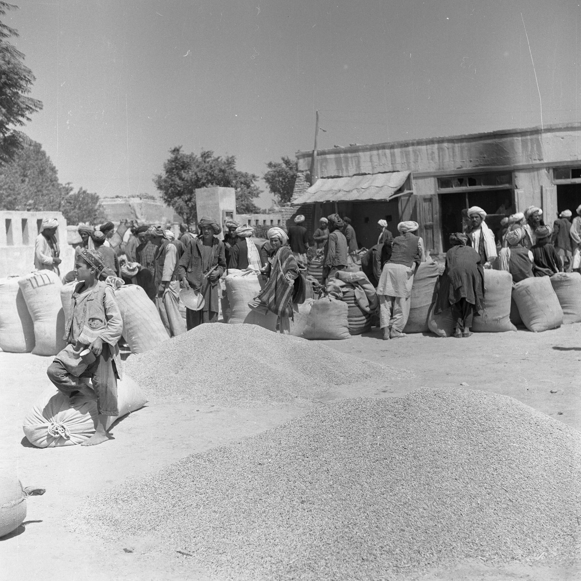
Andkhoy District is a district in Faryab Province, Afghanistan. The district center is Andkhoy, and there are a total of 81 villages in the district. Most people farm or raise livestock in the district. The district is considered to be government-influenced, as opposed to the Taliban. Geography AH76 connects this district to the provincial capital of Maymana and the capital of Jowzjan province, Sheberghan, among other places. However, the road from Maymana to Andkhoy is currently contested by an armed group, affecting the people. The road is considered one of the worst in Afghanistan. The Shirin Tagab River flows through the district. Location The district is surrounded by five other districts: Khani Chahar Bagh, Khwaja Du Koh, Dawlatabad, Qaramqol, and Qurghan. Khwaja Du Koh is located in Jowzjan Province. The district used to border Turkmenistan. Economy Most people are engaged in agriculture and livestock activities. The main crops are wheat, barley, maize and potatoes. ... [...More Info...] [...Related Items...] OR: [Wikipedia] [Google] [Baidu] |
Districts Of Afghanistan
The districts of Afghanistan, known as ''wuleswali'' ( ps, ولسوالۍ, ''wuləswāləi''; fa, شهرستان, ''shahrestān'') are secondary-level administrative units, one level below provinces. The Afghan government issued its first district map in 1973.''Afghanistan; Districts and Codes by Province'', Edition 2.0, AID / Rep. DC&A Mapping Unit, October 1991, Peshawar, Pakista/ref> It recognized 325 districts, counting ''wuleswalis'' (districts), ''alaqadaries'' (sub-districts), and ''markaz-e-wulaiyat'' (provincial center districts). In the ensuing years, additional districts have been added through splits, and some eliminated through merges. In June 2005, the Afghan government issued a map of 398 districts. It was widely adopted by many information management systems, though usually with the addition of ''Sharak-e-Hayratan'' for 399 districts in total. It remains the ''de facto'' standard as of late 2018, despite a string of government announcements of the creation of ... [...More Info...] [...Related Items...] OR: [Wikipedia] [Google] [Baidu] |
Shirin Tagab River
The Shirin Tagab River is a river in Afghanistan, and travels before ending in an inland delta around Andkhoi. The river's watershed has 504 settlements with a population of 605972, and covers the majority of Faryab Province. Downstream, the river is brackish/saltwater. In addition, the river is a source of water-borne diseases. Course The river begins flowing west in the eastern part of Bilchiragh District, and is joined by the river Chashma-i Khwab near the district center, after the Chashma has flowed through scenic rapids. The Tagab then turns north, flowing through the northeast corner of Pashtun Kot District and western Khwaja Sabz Posh District. As it enters Shirin Tagab District, the river is joined by the Astana river. At Araba, an irrigation canal takes the majority of the river's water. Then, near Pata Baba in Dawlat Abad District, it is joined by the Shor Darya River, which carries the water from the Almar, Qaysar, and Maimana rivers. The Shirin Tagab then dissipate ... [...More Info...] [...Related Items...] OR: [Wikipedia] [Google] [Baidu] |
Turkmenistan
Turkmenistan ( or ; tk, Türkmenistan / Түркменистан, ) is a country located in Central Asia, bordered by Kazakhstan to the northwest, Uzbekistan to the north, east and northeast, Afghanistan to the southeast, Iran to the south and southwest and the Caspian Sea to the west. Ashgabat is the capital and largest city. The population is about 6 million, the lowest of the Central Asian republics, and Turkmenistan is one of the most sparsely populated nations in Asia. Turkmenistan has long served as a thoroughfare for other nations and cultures. Merv is one of the oldest oasis-cities in Central Asia, and was once the biggest city in the world. It was also one of the great cities of the Islamic world and an important stop on the Silk Road. Annexed by the Russian Empire in 1881, Turkmenistan figured prominently in the anti-Bolshevik movement in Central Asia. In 1925, Turkmenistan became a constituent republic of the Soviet Union, the Turkmen Soviet Socialist Repu ... [...More Info...] [...Related Items...] OR: [Wikipedia] [Google] [Baidu] |
Jowzjan Province
Jowzjan, sometimes spelled Jawzjan or Jozjan (Dari: ), is one of the thirty-four provinces of Afghanistan, located in the north of the country bordering neighboring Turkmenistan. The province is divided into 11 districts and contains hundreds of villages. It has a population of about 613,481, which is multi-ethnic and mostly agriculturalists. Sheberghan is the capital of Jozjan province. History The province is named after the early medieval region and principality of Juzjan. Between the early 16th century and mid-18th century, the area was ruled by the Khanate of Bukhara. It was conquered by Ahmad Shah Durrani and became part of the Durrani Empire in or about 1750, which formed to the modern state of Afghanistan. The area was untouched by the British during the three Anglo-Afghan wars that were fought in the 19th and 20th centuries. Recent history Following a series of changing allegiances and falling out with Uzbek warlord Abdul Malik Pahlawan in 1997, the Taliban withdrew from ... [...More Info...] [...Related Items...] OR: [Wikipedia] [Google] [Baidu] |
Qurghan District
Qurghan ( fa, قرغان) is a district in Faryab province, Afghanistan. It was created in 2005 from the western part of Andkhoy District Andkhoy District is a district in Faryab Province, Afghanistan. The district center is Andkhoy, and there are a total of 81 villages in the district. Most people farm or raise livestock in the district. The district is considered to be government .... The district center Qurghan is very close to Andkhoy at 317 m altitude. The district covers and has 13 villages. As of 2003, the population is 27,116. Notes References * External links Map of SettlementsIMMAP, 2011 Districts of Faryab Province {{Faryab-geo-stub ... [...More Info...] [...Related Items...] OR: [Wikipedia] [Google] [Baidu] |
Qaramqol District
Qaramqol (Qaramqũl) district is located south of Andkhoy District in the northern part of Faryab Province Faryab (Dari: ) is one of the thirty-four provinces of Afghanistan, which is located in the north of the country bordering neighboring Turkmenistan. It has a population of about 1,109,223, which is multi-ethnic and mostly a tribal society. The pr .... with an ethnic composition of 5% Pashtun, 35% Uzbek and 60% Turkman. The district center Qaram Qũl is close to the town of Andkhoy. References External links Map of SettlementsIMMAP, 2011 Districts of Faryab Province {{Faryab-geo-stub ... [...More Info...] [...Related Items...] OR: [Wikipedia] [Google] [Baidu] |
Dawlatabad District
Dawlatabad District (Pashto and fa, ) is a landlocked district, located in the northwestern part of Balkh province, in northern Afghanistan. The population is 101,900 people. The capital is the village of Dowlatabad (Pop: 12,400) at 298 m height above sea level. Major ethnic groups in this district are Uzbek, Turkmen, Tajik, Hazara, Pashtun, and Arab. History In the 12th century, the region was missed by Genghis Khan and the invading Mongols. Archaeology has taken place in the district, including works by the French Archaeological Delegation in Afghanistan (DAFA). On 14 March 2020, the Ministry of Public Health announced that the district had its first positive case of coronavirus disease in Balkh province, during the 2019-COVID-19 pandemic and outbreak in Afghanistan. The 23-year-old patient had fled Bo Ali Sina Hospital after testing positive. Landmarks The Zadian Minaret, a sun-baked clay minaret built by the Seljuks The Seljuk dynasty, or Seljuki ... [...More Info...] [...Related Items...] OR: [Wikipedia] [Google] [Baidu] |
Khani Chahar Bagh District
Khani Chahar Bagh is the most northerly district in Faryab Province. The main village, Chahar Bagh , is in the southern part of the district. In the north the district's border is with Turkmenistan. The population in 2013 was estimated at 70,000. Ethnic composition includes 35% Turkmen Turkmen, Türkmen, Turkoman, or Turkman may refer to: Peoples Historical ethnonym * Turkoman (ethnonym), ethnonym used for the Oghuz Turks during the Middle Ages Ethnic groups * Turkmen in Anatolia and the Levant (Seljuk and Ottoman-Turkish desc ... and 65% Uzbek. References External links District ProfileUNHCR, July 2002 Map of SettlementsIMMAP, 2011 Districts of Faryab Province {{Faryab-geo-stub ... [...More Info...] [...Related Items...] OR: [Wikipedia] [Google] [Baidu] |
Sheberghan
Sheberghān or Shaburghān ( Uzbek, Pashto, fa, شبرغان), also spelled ''Shebirghan'' and ''Shibarghan'', is the capital city of the Jowzjan Province in northern Afghanistan. The city of Sheberghan has a population of 175,599. It has four districts and a total land area of 7,335 hectares. The total number of dwellings in Sheberghān is 19,511. In 2021, the Taliban gained control of the city during the 2021 Taliban offensive. Location Sheberghān is located along the Sari Pul River banks, about west of Mazar-i-Sharif on the national primary ring road that connects Kabul, Puli Khumri, Mazar-i-Sharif, Sheberghān, Maymana, Herat, Kandahar, Ghazni, and Maidan Shar. Sheberghān airport is situated between Sheberghān and Aqcha. Etymology The city's name is a corruption of its classical Persian name, Shaporgân, meaning "ingShapur's town". Shapur was the name of two Sasanian kings, both of whom built a great number of cities. However, Shapur I was the governor of the east ... [...More Info...] [...Related Items...] OR: [Wikipedia] [Google] [Baidu] |
Provinces Of Afghanistan
Afghanistan is divided into 34 provinces (, '' wilåyat''). The provinces of Afghanistan are the primary administrative divisions. Each province encompasses a number of districts or usually over 1,000 villages. Provincial governors played a critical role in the reconstruction of the Afghan state following the creation of the new government under Hamid Karzai. According to international security scholar Dipali Mukhopadhyay, many of the provincial governors of the western-backed government were former warlords who were incorporated into the political system. Provinces of Afghanistan Regions of Afghanistan UN Regions Former provinces of Afghanistan During Afghanistan's history it had a number of provinces in it. It started out as just Kabul, Herat, Qandahar, and Balkh but the number of provinces increased and by 1880 the provinces consisted of Balkh, Herat, Qandahar, Ghazni, Jalalabad, and Kabul. * Southern Province – dissolved in 1964 to create Paktia Provinc ... [...More Info...] [...Related Items...] OR: [Wikipedia] [Google] [Baidu] |
Jowzjan Province
Jowzjan, sometimes spelled Jawzjan or Jozjan (Dari: ), is one of the thirty-four provinces of Afghanistan, located in the north of the country bordering neighboring Turkmenistan. The province is divided into 11 districts and contains hundreds of villages. It has a population of about 613,481, which is multi-ethnic and mostly agriculturalists. Sheberghan is the capital of Jozjan province. History The province is named after the early medieval region and principality of Juzjan. Between the early 16th century and mid-18th century, the area was ruled by the Khanate of Bukhara. It was conquered by Ahmad Shah Durrani and became part of the Durrani Empire in or about 1750, which formed to the modern state of Afghanistan. The area was untouched by the British during the three Anglo-Afghan wars that were fought in the 19th and 20th centuries. Recent history Following a series of changing allegiances and falling out with Uzbek warlord Abdul Malik Pahlawan in 1997, the Taliban withdrew from ... [...More Info...] [...Related Items...] OR: [Wikipedia] [Google] [Baidu] |


