|
Adonara
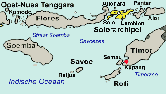
Adonara is an island in the Lesser Sunda Islands of Indonesia, located east of the larger island of Flores in the Solor Archipelago. To the east lies Lembata, formerly known as Lomblen. Adonara is the highest of the islands of the archipelago, reaching an altitude of 1,659 metres, and it has an area of 529.75 km2. It is situated in the East Flores Regency of East Nusa Tenggara province. Administration The island is divided into eight districts (''kecamatan''), tabulated below with their areas (in km2) and their populations at the 2010 Census and 2020 census, together with the official estimates as at mid 2021.Badan Pusat Statistik, Jakarta, 2022. Note: (a) Adonara District covers only the northern part of Adonara Island ("Adonara Utara"). History Local history on Adonara is documented from the sixteenth century, when Portuguese traders and missionaries established a post on the nearby island of Solor. By that time Adonara and the surrounding islands were ritually divi ... [...More Info...] [...Related Items...] OR: [Wikipedia] [Google] [Baidu] |
Adonara 1911
Adonara is an island in the Lesser Sunda Islands of Indonesia, located east of the larger island of Flores in the Solor Archipelago. To the east lies Lembata, formerly known as Lomblen. Adonara is the highest of the islands of the archipelago, reaching an altitude of 1,659 metres, and it has an area of 529.75 km2. It is situated in the East Flores Regency of East Nusa Tenggara province. Administration The island is divided into eight districts (''kecamatan''), tabulated below with their areas (in km2) and their populations at the 2010 Census and 2020 census, together with the official estimates as at mid 2021.Badan Pusat Statistik, Jakarta, 2022. Note: (a) Adonara District covers only the northern part of Adonara Island ("Adonara Utara"). History Local history on Adonara is documented from the sixteenth century, when Portuguese traders and missionaries established a post on the nearby island of Solor. By that time Adonara and the surrounding islands were ritually divide ... [...More Info...] [...Related Items...] OR: [Wikipedia] [Google] [Baidu] |
East Flores Regency
East Flores Regency ( id, Kabupaten Flores Timur) is a regency in East Nusa Tenggara province of Indonesia. Established in 1958, the regency has its seat (capital) in Larantuka on Flores Island. It covers a land area of 1,812.85 km2, and it had a population of 232,605 as of the 2010 censusBiro Pusat Statistik, Jakarta, 2011. and 276,896 at the 2020 Census; the official estimate as at mid 2021 was 283,626. The regency encompasses the eastern tip of the island of Flores, together with all of the smaller islands of Adonara and Solor, both part of the Solor Archipelago, and some much smaller offshore islands. In 1999 the island of Lembata (formerly called Lomblen) at the eastern end of the Archipelago was separated out to create its own Regency. Administration The regency is divided into nineteen districts A district is a type of administrative division that, in some countries, is managed by the local government. Across the world, areas known as "districts" vary greatly in ... [...More Info...] [...Related Items...] OR: [Wikipedia] [Google] [Baidu] |
Solor Archipelago
The Solor Archipelago () is a group of islands in the Lesser Sunda Islands, Indonesia, lying to the east of Flores and to the west of the Alor Strait and the Alor Archipelago. To the north is the west part of the Banda Sea, while to the south across the Savu Sea lies the island of Timor. The largest islands are, from west to east, Solor, Adonara, and Lembata (formerly known as Lomblen), although there are many small islands as well. Administratively, the islands of Solor and Adonara are included within the East Flores Regency, while Lembata (with smaller offshore islands) forms its own regency (''kabupaten''), the Lembata Regency. Both regencies lie within the province of East Nusa Tenggara. The islands are listed below with their areas and their populations at the 2010 Census and the 2020 Census, and according to the official estimates for mid 2021, together with the number of administrative districts (''kecamatan'') on each island. In addition to the national language of ... [...More Info...] [...Related Items...] OR: [Wikipedia] [Google] [Baidu] |
Lamaholot People
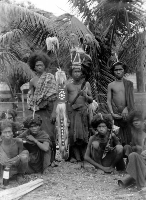
The Lamahalot or Solorese people are an indigenous tribe located on Flores Island, Indonesia, and some smaller islands around it (Solor, Adonara, and Lomblen). Lamaholot people speak the Lamaholot language with different dialects, the number of speakers counts between 150,000 and 200,000. Lamaholot people's famous traditional dance is a war dance known as ''Hedung''. History Since the 16th century the territory of the Lamaholot was the object of the claims of the Sultanate of Makassar, Portugal and the Netherlands. Until the middle of the 19th century Lamaholot were under the Portuguese colonial administration, then under the Netherlands in 1859–1942, and until the middle of the 20th century they were formally submitted to the Rajas of Larantuka and Adonara. Language The Lamaholot language belongs to the Malayo-Polynesian languages of the Austronesian languages family. The language is divided into many dialects, or possibly distinct languages as Adonara language, the most ... [...More Info...] [...Related Items...] OR: [Wikipedia] [Google] [Baidu] |
Larantuka
Larantuka () is a ''kecamatan'' (district) and the seat capital of East Flores Regency, on the eastern end of Flores Island, East Nusa Tenggara, Indonesia. Like much of the region, Larantuka has a strong a colonial Portuguese influence. The town had 37,348 inhabitants at the 2010 census and 40,828 at the 2020 census. This overwhelmingly (95.4%) Roman Catholic area enjoys some international renown for its Holy Week celebrations. Indonesia Tourism: Larantuka (also known as Ende Malay), a local over 80% |
East Nusa Tenggara
East Nusa Tenggara ( id, Nusa Tenggara Timur – NTT; pt, Sonda Oriental) is the southernmost province of Indonesia. It comprises the eastern portion of the Lesser Sunda Islands, facing the Indian Ocean in the south and the Flores Sea in the north. It consists of more than 500 islands, with the largest ones being Sumba, Flores, and the western part of Timor; the latter shares a land border with the separate nation of East Timor. The province is subdivided into twenty-one regencies and the regency-level city of Kupang, which is the capital and largest city. A Christian-majority region, East Nusa Tenggara is the only Indonesian province where Roman Catholicism is the predominant religion. The province has a total area of 47,931.54 km2 and a population of 5,325,566 at the 2020 Census; the official estimate as at mid 2021 was 5,387,738. Economically, East Nusa Tenggara still remains one of the least developed provinces in Indonesia. It currently focuses on expanding the touris ... [...More Info...] [...Related Items...] OR: [Wikipedia] [Google] [Baidu] |
Solor
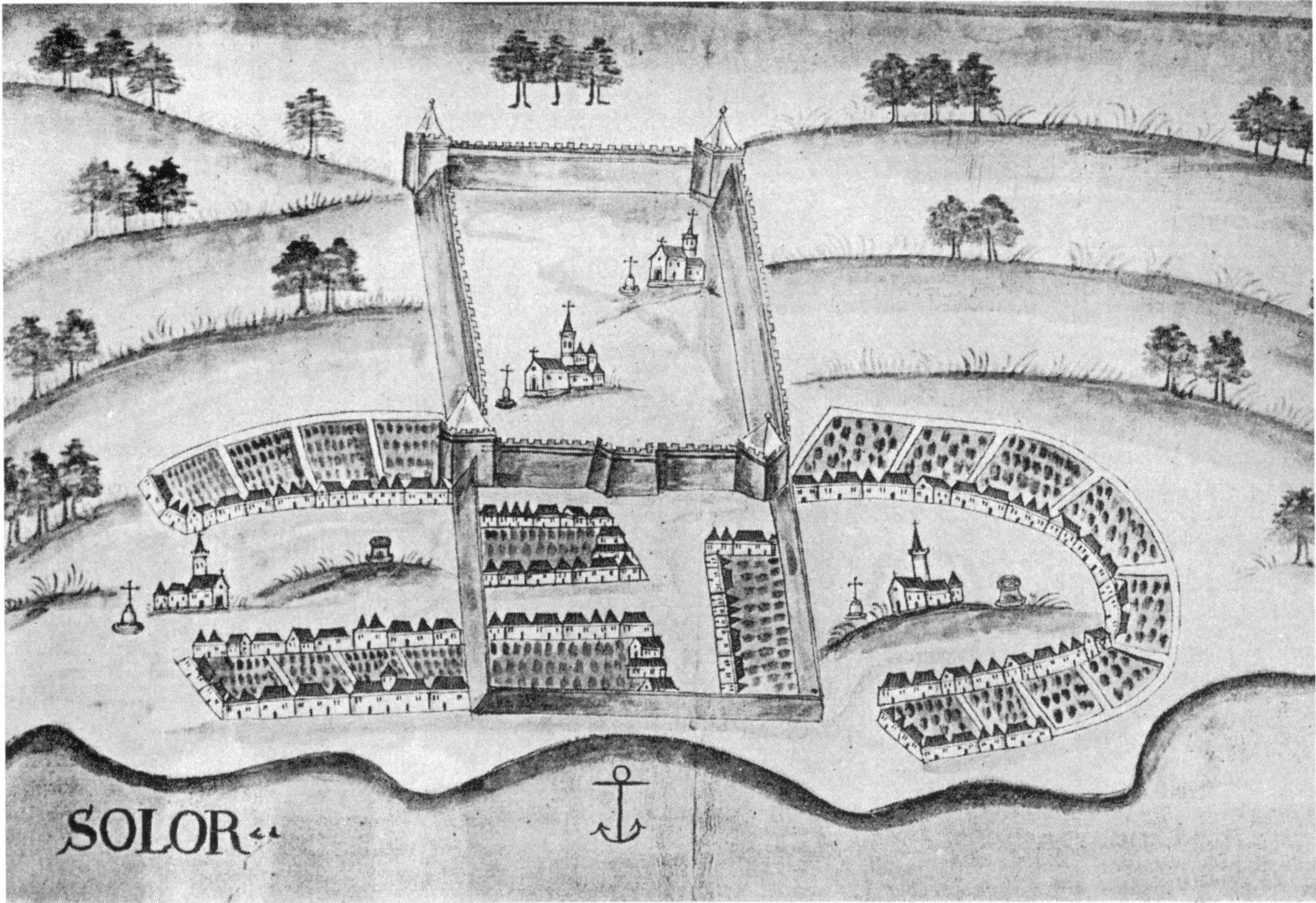
Solor is a volcanic island located off the eastern tip of Flores island in the Lesser Sunda Islands of Indonesia, in the Solor Archipelago. The island supports a small population that has been whaling for hundreds of years. They speak the languages of Adonara and Lamaholot. There are at least five volcanoes on this island which measures only by . The island's area is , and it had a population of 34,029 at the 2020 Census. The official estimate as at mid 2021 was 35,045. Administrative Districts The island is divided into three districts (''kecamatan''), tabulated below with their areas (in km2) and their populations at the 2010 Census and 2020 Census, together with the official estimates as at mid 2021. The entire island is administered by the East Flores Regency. History of European contact In 1520, the Portuguese established a trading post in the village of Lamakera on the eastern side of the island as a transit harbor between Maluku and Portuguese Malacca. In 1562 ... [...More Info...] [...Related Items...] OR: [Wikipedia] [Google] [Baidu] |
Flores
Flores is one of the Lesser Sunda Islands, a group of islands in the eastern half of Indonesia. Including the Komodo Islands off its west coast (but excluding the Solor Archipelago to the east of Flores), the land area is 15,530.58 km2, and the population was 1,878,875 in the 2020 Census (including various offshore islands); the official estimate as at mid 2021 was 1,897,550. The largest towns are Maumere and Ende. The name ''Flores'' is the Portuguese and Spanish word for "Flowers". Flores is located east of Sumbawa and the Komodo islands, and west of the Solor Islands and the Alor Archipelago. To the southeast is Timor. To the south, across the Sumba Strait, is Sumba island and to the north, beyond the Flores Sea, is Sulawesi. Among all islands containing Indonesian territory, Flores is the 10th most populous after Java, Sumatra, Borneo ( Kalimantan), Sulawesi, New Guinea, Bali, Madura, Lombok, and Timor and also the 10th biggest island of Indonesia. Until the arr ... [...More Info...] [...Related Items...] OR: [Wikipedia] [Google] [Baidu] |
Lembata
Lembata is an island in the Lesser Sunda Islands, also known as Lomblen island; it is the largest island of the Solor Archipelago, in the Lesser Sunda Islands, Indonesia. It forms a separate regency of the province of Nusa Tenggara Timur. The length of the island is about 80 km from the southwest to the northeast and the width is about 30 km from the west to the east. It rises to a height of 1,533 metres. To the west lie the other islands in the archipelago, most notably Solor and Adonara, and then the larger island of Flores. To the east is the Alor Strait, which separates this archipelago from the Alor Archipelago. To the south across the Savu Sea lies the island of Timor, while to the north the western branch of the Banda Sea separates it from Buton and the other islands of Southeast Sulawesi. Administration The Lembata Regency includes the island of Lembata and three small offshore islands. It is sub-divided into nine districts. Geography The capital city Lew ... [...More Info...] [...Related Items...] OR: [Wikipedia] [Google] [Baidu] |
Lomblen
Lembata is an island in the Lesser Sunda Islands, also known as Lomblen island; it is the largest island of the Solor Archipelago, in the Lesser Sunda Islands, Indonesia. It forms a separate regency of the province of Nusa Tenggara Timur. The length of the island is about 80 km from the southwest to the northeast and the width is about 30 km from the west to the east. It rises to a height of 1,533 metres. To the west lie the other islands in the archipelago, most notably Solor and Adonara, and then the larger island of Flores. To the east is the Alor Strait, which separates this archipelago from the Alor Archipelago. To the south across the Savu Sea lies the island of Timor, while to the north the western branch of the Banda Sea separates it from Buton and the other islands of Southeast Sulawesi. Administration The Lembata Regency includes the island of Lembata and three small offshore islands. It is sub-divided into nine districts. Geography The capital city Lewo ... [...More Info...] [...Related Items...] OR: [Wikipedia] [Google] [Baidu] |
Space Shuttle
The Space Shuttle is a retired, partially reusable low Earth orbital spacecraft system operated from 1981 to 2011 by the U.S. National Aeronautics and Space Administration (NASA) as part of the Space Shuttle program. Its official program name was Space Transportation System (STS), taken from a 1969 plan for a system of reusable spacecraft where it was the only item funded for development. The first ( STS-1) of four orbital test flights occurred in 1981, leading to operational flights (STS-5) beginning in 1982. Five complete Space Shuttle orbiter vehicles were built and flown on a total of 135 missions from 1981 to 2011. They launched from the Kennedy Space Center (KSC) in Florida. Operational missions launched numerous satellites, interplanetary probes, and the Hubble Space Telescope (HST), conducted science experiments in orbit, participated in the Shuttle-''Mir'' program with Russia, and participated in construction and servicing of the International Space Station (ISS). ... [...More Info...] [...Related Items...] OR: [Wikipedia] [Google] [Baidu] |
Indonesian National Revolution
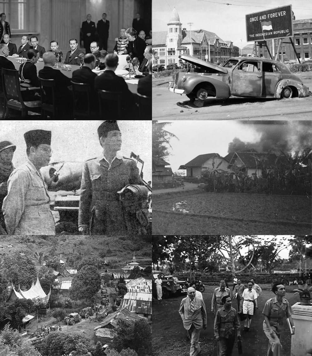
The Indonesian National Revolution, or the Indonesian War of Independence, was an armed conflict and diplomatic struggle between the Republic of Indonesia and the Dutch Empire and an internal social revolution during Aftermath of WWII, postwar and Dutch East Indies#World War II and independence, postcolonial Indonesia. It took place between Indonesian Declaration of Independence, Indonesia's declaration of independence in 1945 and the Netherlands' Dutch–Indonesian Round Table Conference, transfer of sovereignty over the Dutch East Indies to the Republic of the United States of Indonesia at the end of 1949. The four-year struggle involved sporadic but bloody armed conflict, internal Indonesian political and communal upheavals, and two major international diplomatic interventions. Dutch military forces (and, for a while, the forces of the World War II Allies, World War II allies) were able to control the major towns, cities and industrial assets in Republican heartlands on Ja ... [...More Info...] [...Related Items...] OR: [Wikipedia] [Google] [Baidu] |


