|
A345 Road (England)
The A345 is a secondary A road in Wiltshire, England running from Salisbury to Marlborough and the A4. The road is a main south–north link across Salisbury Plain, which is renowned for its rich archaeology, and passes many ancient points of interest along its way. Route The road begins in Salisbury at the Castle roundabout and travels north out of the city, passing close to Old Sarum castle, taking a predominantly straight line to Boscombe Down and then Amesbury before meeting the A303 at Countess roundabout where it shares Countess Services with the major road. At this point it passes within of the World Heritage Site at Stonehenge. Continuing north, the road passes near to Woodhenge and the Ministry of Defence Royal School of Artillery base at Larkhill. This part of the route can be hazardous as there are often tanks crossing and the road is susceptible to subsidence. The next significant places are Netheravon, and then Upavon where the road briefly separates i ... [...More Info...] [...Related Items...] OR: [Wikipedia] [Google] [Baidu] |
Upavon
Upavon is a rural village and civil parish in the county of Wiltshire, England. As its name suggests, it is on the upper portion of the River Avon which runs from north to south through the village. It is on the north edge of Salisbury Plain about south of Pewsey, southeast of the market town of Devizes, and north of the cathedral city of Salisbury. The A345 and A342 roads run through the village. History Occupation of the area dates back to the Iron Age and Romano-British settlement at Casterley Camp, approximately southwest of the current village, and to the southeast was the small Iron Age settlement of Chisenbury Camp. The first mention of Upavon is in the 1086 Domesday Book as ''Oppavrene''; although no population was recorded, it can be estimated that the village supported some 200 to 250 people. The village prospered during the 12th and 13th centuries and started to develop features that are recognisable today. A large Norman church replaced the previous Saxon o ... [...More Info...] [...Related Items...] OR: [Wikipedia] [Google] [Baidu] |
Tank
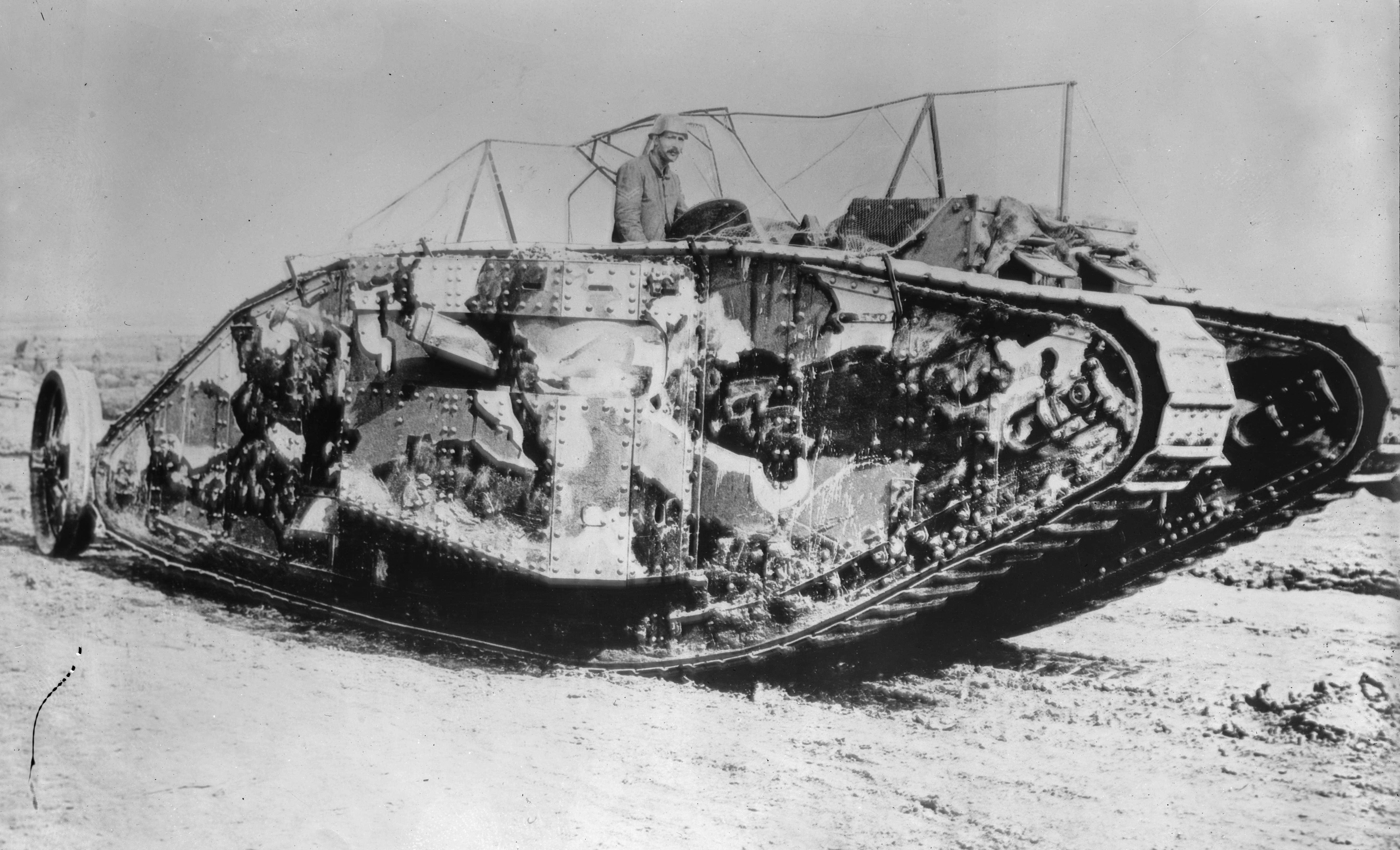
A tank is an armoured fighting vehicle intended as a primary offensive weapon in front-line ground combat. Tank designs are a balance of heavy firepower, strong armour, and good battlefield mobility provided by tracks and a powerful engine; usually their main armament is mounted in a turret. They are a mainstay of modern 20th and 21st century ground forces and a key part of combined arms combat. Modern tanks are versatile mobile land weapons platforms whose main armament is a large-caliber tank gun mounted in a rotating gun turret, supplemented by machine guns or other ranged weapons such as anti-tank guided missiles or rocket launchers. They have heavy vehicle armour which provides protection for the crew, the vehicle's munition storage, fuel tank and propulsion systems. The use of tracks rather than wheels provides improved operational mobility which allows the tank to overcome rugged terrain and adverse conditions such as mud and ice/snow better than wheeled vehicles, ... [...More Info...] [...Related Items...] OR: [Wikipedia] [Google] [Baidu] |
A4311 Road
List of A roads in zone 4 in Great Britain Great Britain is an island in the North Atlantic Ocean off the northwest coast of continental Europe. With an area of , it is the largest of the British Isles, the largest European island and the ninth-largest island in the world. It is ... starting north of the A4 and south/west of the A5 (roads beginning with 4). __TOC__ Single- and double-digit roads Triple-digit roads Only roads that have individual articles have been linked in the "Road" column below. Four-digit roads (40xx) Four-digit roads (41xx) Four-digit roads (42xx and higher) References {{UK road lists 4 4 ... [...More Info...] [...Related Items...] OR: [Wikipedia] [Google] [Baidu] |
A4259 Road
List of A roads in zone 4 in Great Britain Great Britain is an island in the North Atlantic Ocean off the northwest coast of continental Europe. With an area of , it is the largest of the British Isles, the largest European island and the ninth-largest island in the world. It i ... starting north of the A4 and south/west of the A5 (roads beginning with 4). __TOC__ Single- and double-digit roads Triple-digit roads Only roads that have individual articles have been linked in the "Road" column below. Four-digit roads (40xx) Four-digit roads (41xx) Four-digit roads (42xx and higher) References {{UK road lists 4 4 ... [...More Info...] [...Related Items...] OR: [Wikipedia] [Google] [Baidu] |
A346 Road
List of A roads in zone 3 in Great Britain Great Britain is an island in the North Atlantic Ocean off the northwest coast of continental Europe. With an area of , it is the largest of the British Isles, the largest European island and the ninth-largest island in the world. It i ... starting west of the A3 and south of the A4 (roads beginning with 3). Single- and double-digit roads Triple-digit roads Four-digit roads (30xx) Four-digit roads (31xx and higher) Notes and references ;Notes ;References {{UK road lists 3 3 ... [...More Info...] [...Related Items...] OR: [Wikipedia] [Google] [Baidu] |
M4 Motorway
The M4, originally the London-South Wales Motorway, is a motorway in the United Kingdom running from west London to southwest Wales. The English section to the Severn Bridge was constructed between 1961 and 1971; the Welsh element was largely complete by 1980, though a non-motorway section around Briton Ferry bridge remained until 1993. On the opening of the Second Severn Crossing in 1996, the M4 was rerouted over it. The line of the motorway from London to Bristol runs closely in parallel with the A4 road (England), A4. After crossing the River Severn, toll-free since 17 December 2018, the motorway follows the A48 road (Great Britain), A48, to terminate at the Pont Abraham services in Carmarthenshire. The M4 is the only motorway in Wales apart from its two Spur route, spurs: the A48(M) motorway, A48(M) and the M48 motorway, M48. The major towns and cities along the routea distance of approximately include Slough, Reading, Berkshire, Reading, Swindon, Bristol, Newport, Wales, ... [...More Info...] [...Related Items...] OR: [Wikipedia] [Google] [Baidu] |
Blunsdon
Blunsdon is a civil parish in the Borough of Swindon, in Wiltshire, England, about north of the centre of Swindon, with the A419 forming its southern boundary. Its main settlement is the village of Broad Blunsdon, with Lower Blunsdon nearby; the hamlet of Broadbush is now contiguous with Broad Blunsdon. Blunsdon is the eastern half of the former Blunsdon St Andrew civil parish. In April 2017, that parish was divided and the western half became a new St Andrews parish. History Blunsdon dates from Roman times: it was discovered that a Roman travellers’ resting place existed on the site of the present-day Cold Harbour public house. The main A419 road follow the course of a Roman road known as Ermin Street that linked the historic Roman towns of Gloucester (Glevum) and Silchester (Calleva Atrebatum), via Cirencester (Corinium). The Domesday Book of 1086 recorded three estates at ''Bluntesdone'', with altogether ten households. Widhill Widhill, land lying north of Blunsdon St ... [...More Info...] [...Related Items...] OR: [Wikipedia] [Google] [Baidu] |
Swindon
Swindon () is a town and unitary authority with Borough status in the United Kingdom, borough status in Wiltshire, England. As of the 2021 Census, the population of Swindon was 201,669, making it the largest town in the county. The Swindon unitary authority area had a population of 233,410 as of 2021. Located in South West England, the town lies between Bristol, 35 miles (56 kilometres) to its west, and Reading, Berkshire, Reading, equidistant to its east. Recorded in the 1086 Domesday Book as ''Suindune'', it was a small market town until the mid-19th century, when it was selected as the principal site for the Great Western Railway's repair and maintenance Swindon Works, works, leading to a marked increase in its population. The new town constructed for the railway workers produced forward-looking amenities such as the UK’s first lending library and a ‘cradle-to-grave' health care centre that was later used as a blueprint for the National Health Service, NHS. After the W ... [...More Info...] [...Related Items...] OR: [Wikipedia] [Google] [Baidu] |
A419 Road
The A419 road is a primary route between Chiseldon near Swindon at junction 15 of the M4 with the A346 road, and Whitminster in Gloucestershire, England near the M5 motorway. The A419 is managed and maintained by a private company, Road Management Group, on behalf of the UK Department for Transport. Route From the M4 to Cirencester it is a dual carriageway road, which generally follows the course of the Roman road Ermin Way, but dualling work completed in the late 1990s, and the bypass of Cirencester, has taken it off-course in some places. East of Cirencester the A417 continues straight ahead as the major road and the A419 separates through Cirencester and Stroud, becoming mainly single carriageway. West of Cirencester the road loses its primary status; it crosses the M5 at junction 13 close to a former Little Chef restaurant, then finishes further west at a roundabout with the A38. A419 Road Bridge The A419 Road Bridge is a modern bridge carrying the Cricklade by-pass ... [...More Info...] [...Related Items...] OR: [Wikipedia] [Google] [Baidu] |
Pewsey White Horse
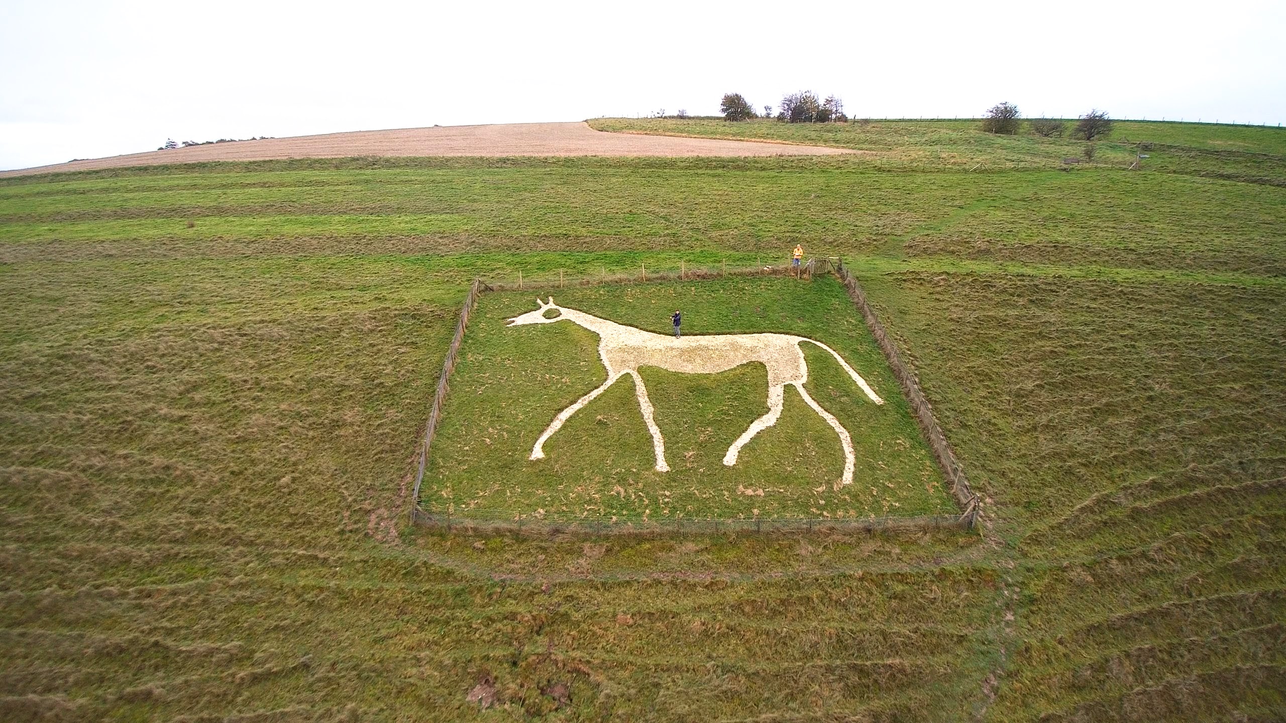
Pewsey White Horse is a hill figure of a white horse near the village of Pewsey, Wiltshire, England. Cut of chalk in 1937, it replaces an earlier horse that had disappeared under the grass and is one of eight remaining white horses in Wiltshire. It measures 66’ by 45’, making it the smallest of the eight canonical white horses in Wiltshire. When Pewsey White Horse was cut it was the seventh or eighth White Horse in Wiltshire (the confusion arising as Rockley White Horse was unknown until 1948) and the first of the 20th century. It was also one of the smallest. George Marples designed the white horse to commemorate the coronation of George VI, and was inspired by other white horses in Wiltshire. The horse is a prominent landmark in Pewsey, and today it is maintained and scoured by the Pewsey 6X Club, who work under the name Pewsey Horse Restoration Group. Wiltshirewhitehorses.org.uk consider it to be a "well-proportioned representation of the real animal." The white horse a ... [...More Info...] [...Related Items...] OR: [Wikipedia] [Google] [Baidu] |
Pewsey
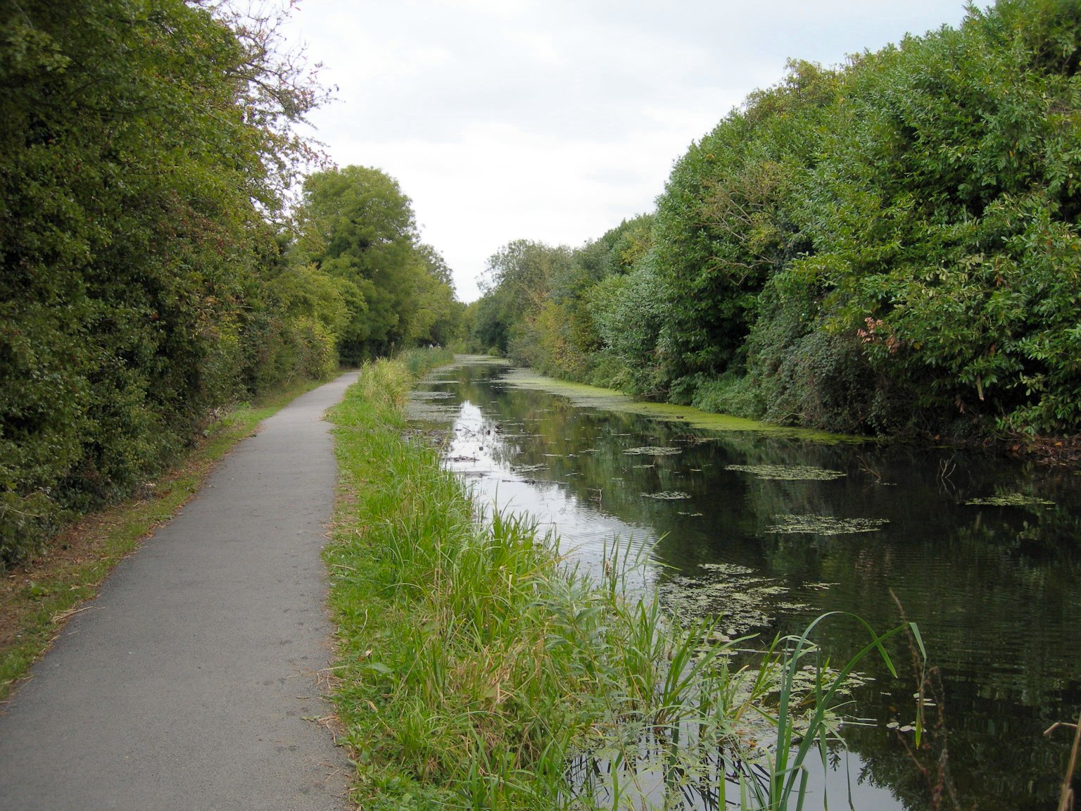
Pewsey is a large village and civil parish at the centre of the Vale of Pewsey in Wiltshire, about south of Marlborough and west of London. It is within reach of the M4 motorway and the A303 and is served by Pewsey railway station on the Reading to Taunton line. The parish includes these small settlements: * Kepnal – east of the village, south of the Burbage road * Pewsey Wharf – north, where the A345 crosses the Kennet and Avon canal * Sharcott – west, by the Avon; marked on some maps as East Sharcott as distinct from West Sharcott, a short distance downstream in Manningford parish * Southcott – close to the southeast of the village. History Archaeological excavations on Pewsey Hill show evidence of a settlement in the 6th century. In the Tudor era, the Manor of Pewsey belonged to the Duchess of Somerset. Several of the village's houses were built in this era: the timber framed cruck house at Ball Corner, Bridge Cottage on the Avon and the Court House by the Chur ... [...More Info...] [...Related Items...] OR: [Wikipedia] [Google] [Baidu] |
Devizes
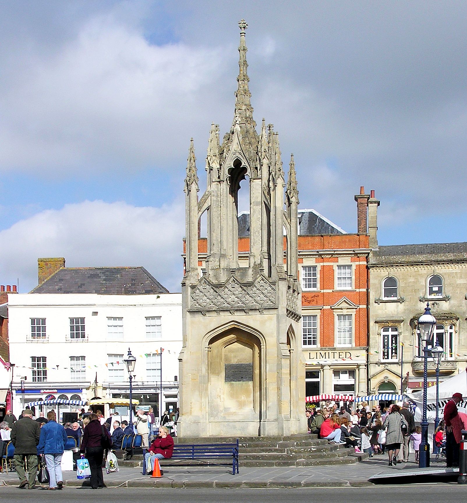
Devizes is a market town and civil parish in Wiltshire, England. It developed around Devizes Castle, an 11th-century Norman architecture, Norman castle, and received a charter in 1141. The castle was besieged during the Anarchy, a 12th-century civil war between Stephen of England and Empress Matilda, and again during the English Civil War when the Cavaliers lifted the siege at the Battle of Roundway Down. Devizes remained under Royalist control until 1645, when Oliver Cromwell attacked and forced the Royalists to surrender. The castle was Slighting, destroyed in 1648 on the orders of Parliament, and today little remains of it. From the 16th century Devizes became known for its textiles, and by the early 18th century it held the largest corn market in the West Country, constructing the Corn Exchange in 1857. In the 18th century, brewing, curing of tobacco, and Snuff (tobacco), snuff-making were established. The Wadworth Brewery was founded in the town in 1875. Standing at the w ... [...More Info...] [...Related Items...] OR: [Wikipedia] [Google] [Baidu] |


