|
A271 Road
The A271 road is a main road through East Sussex, England. It runs east–west from the A2100 in Battle to the A22 and A267 at Horsebridge near Hailsham. The road starts at a roundabout in Battle. It continues through the suburbs into some wooded countryside and later on the road comes to a junction with the A269. The bendy road continues through Boreham Street and Windmill Hill. It then enters Herstmonceux, coming out of the village down a hill it then comes up to Magham Down. The road then enters Hailsham meeting the A295 and the B2104 and then goes into Lower Horsebridge meeting the A22. The eastern end of this road was renumbered sometime after 1980 – originally the eastern end of the A271 was at Ninfield where it met the A269 which went to Battle via Catsfield Catsfield is a village and civil parish in the Rother district of East Sussex, England. It is located six miles (9.7 km) north of Bexhill, and three miles (5 km) southwest of Battle. The vi ... [...More Info...] [...Related Items...] OR: [Wikipedia] [Google] [Baidu] |
Battle, East Sussex
Battle is a small town and civil parish in the local government district of Rother in East Sussex, England. It lies south-east of London, east of Brighton and east of Lewes. Hastings is to the south-east and Bexhill-on-Sea to the south. Battle is in the designated High Weald Area of Outstanding Natural Beauty, and is a tourist destination and commuter town for white collar workers in the City of London. The parish population was 6,048 according to the 2001 census, increasing to 6,673 with the 2011 Census. Battle is the site of the Battle of Hastings, where William, Duke of Normandy, defeated King Harold II to become William I in 1066. History In 1066, the area was known for its salt production, with today's Netherfield ward within a large wealthy ancient hundred called Hailesaltede.Nether ... [...More Info...] [...Related Items...] OR: [Wikipedia] [Google] [Baidu] |
Hailsham, East Sussex
Hailsham is a town, a civil parish and the administrative centre of the Wealden district of East Sussex, England.OS Explorer map Eastbourne and Beachy Head Scale: 1:25 000. Publisher:Ordnance Survey – Southampton B2 edition. Publishing Date:2009. It is mentioned in the Domesday Book, where it is called ''Hamelesham''.The Domesday Book, Englands Heritage, Then and Now, Editor: Thomas Hinde. Work:Hailsham, Sussex, Page 276 In one part yet, mentioned in other part of the same book as ‘’’Tilux’’’, the land of Ricard de Tunbrige. The town of Hailsham has a history of industry and agriculture. Etymology The name "Hailsham" is thought to come from the Saxon "Haegels Ham", meaning the clearing or settlement of Haegel, Hella or a similar name, possibly even "Aella's Ham", the clearing of Aella the Saxon. The name of the town has been spelt in various ways through the ages from ‘Hamelsham’ (as it was referred to in the Domesday Book), "Aylesham" in the 13th centur ... [...More Info...] [...Related Items...] OR: [Wikipedia] [Google] [Baidu] |
Catsfield
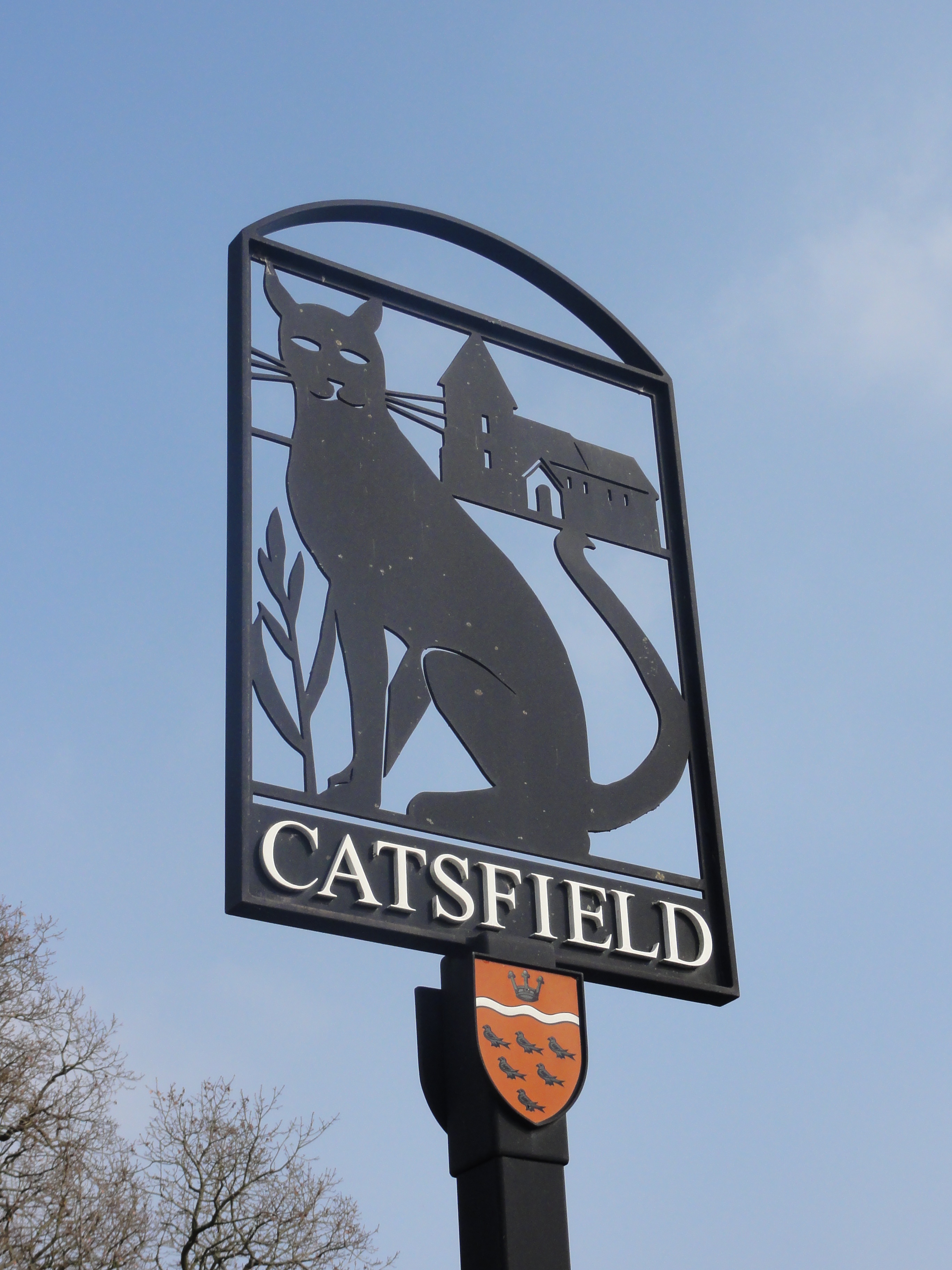
Catsfield is a village and civil parish in the Rother district of East Sussex, England. It is located six miles (9.7 km) north of Bexhill, and three miles (5 km) southwest of Battle. The village was first documented in the Domesday Book of 1086 where it was recorded "''there is a little church serving the hall''". It is one of the oldest settlements in the area, with Romano British period archaeological remains. The village once consisted of two manors: Catsfield and Catsfield Levett. Thomas Lyvet (Levett) held the lordship of the manor of Catsfield in 1445 but forfeited it, along with the lordship of Firle, for his debts. But the manor of Catsfield Levett remained in the Levett family for centuries, and in the seventeenth century a Levett heiress carried it into the Eversfield family. (Richard Lyvet of Firle was lord of the manor of Catsfield in 1431.) With a fortune built on ancestral landholdings and later on iron making, the Levetts held land across Sussex. The p ... [...More Info...] [...Related Items...] OR: [Wikipedia] [Google] [Baidu] |
Ninfield
Ninfield is a village and civil parish in the Wealden District of East Sussex, England. The village is quite linear and centred 4 miles (6.4 km) north of Bexhill-on-Sea where two roads cross: the A269 from Bexhill to Battle and the A271 to Hailsham. The parish covers 2,500 acres (1,010 ha); approximately the northern half of which is in the High Weald AONB. To the west of the village is Standard Hill, said to be the place that William the Conqueror placed his flag after the Battle of Hastings. As with many other Wealden villages, it was involved in the iron industry: that fact is commemorated by the presence in the village of a set of iron stocks. Smuggling was also rife in the eighteenth century. The village name is said to come from the fact that it was originally composed of nine and three quarter fields. A legal record, of 1452, mentioning a Sussex village as "Nempnefeld", may refer to Ninfield. Civil parish and civic events The parish council co ... [...More Info...] [...Related Items...] OR: [Wikipedia] [Google] [Baidu] |
A295 Road
List of A roads in zone 2 in Great Britain starting south of the River Thames The River Thames ( ), known alternatively in parts as the The Isis, River Isis, is a river that flows through southern England including London. At , it is the longest river entirely in England and the Longest rivers of the United Kingdom, se ... and east of the A3 (roads beginning with 2). __FORCETOC__ Single- and double-digit roads Triple-digit roads Four digit roads {{United Kingdom roads 2 2 ... [...More Info...] [...Related Items...] OR: [Wikipedia] [Google] [Baidu] |
Herstmonceux
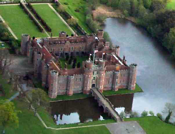
Herstmonceux ( , ; ) is a village and civil parish in the Wealden District of East Sussex, England, which includes Herstmonceux Castle. The Herstmonceux Medieval Festival is held annually in August. History The name comes from Anglo-Saxon ''hyrst'', "wooded hill", plus the name of the Monceux family who were lords of the manor in the 12th century. In 1086, the manor, simply called Herste, was in the ancient hundred of Foxearle. In 1677, Thomas Lennard, 1st Earl of Sussex, was paid £3 when he went to a cricket match played at "ye Dicker", a common near Herstmonceux, one of the earliest references to the sport. The Herstmonceux area is known for the making of trugs, baskets made from split willow boards set in an ash or chestnut frame. A number of local people continue this tradition. Governance The parish council consists of eleven elected members. An electoral ward of the same name exists. This ward had a population at the 2011 census of 2,852. Education is provided at ... [...More Info...] [...Related Items...] OR: [Wikipedia] [Google] [Baidu] |
Windmill Hill, East Sussex
Windmill Hill is a village in the civil parish of Herstmonceux, in the Wealden district of East Sussex East Sussex is a ceremonial and non-metropolitan county in South East England on the English Channel coast. It is bordered by Kent to the north and east, West Sussex to the west, and Surrey to the north-west. The largest settlement in East Su ..., England. In 2020 it had an estimated population of 585. References Villages in East Sussex Herstmonceux {{EastSussex-geo-stub ... [...More Info...] [...Related Items...] OR: [Wikipedia] [Google] [Baidu] |
Boreham Street
Boreham Street is a small village in the Wealden District, Wealden district of East Sussex, England. Its nearest towns are Hailsham, which lies approximately west of the village and Battle, which lies approximately to the east. A number of listed buildings line the village high street. Boreham Street sits atop a ridge with views south over the Pevensey Levels towards Normans Bay and the coast and to the north over open farmland. Boreham Street has the 'Bull's Head' public house and Scolfe's restaurant/tea rooms. The village hall, Reid Hall, holds local events. Villages in East Sussex Wealden District {{EastSussex-geo-stub ... [...More Info...] [...Related Items...] OR: [Wikipedia] [Google] [Baidu] |
A269 Road
List of A roads in zone 2 in Great Britain starting south of the River Thames The River Thames ( ), known alternatively in parts as the The Isis, River Isis, is a river that flows through southern England including London. At , it is the longest river entirely in England and the Longest rivers of the United Kingdom, se ... and east of the A3 (roads beginning with 2). __FORCETOC__ Single- and double-digit roads Triple-digit roads Four digit roads {{United Kingdom roads 2 2 ... [...More Info...] [...Related Items...] OR: [Wikipedia] [Google] [Baidu] |
A267 Road
A, or a, is the first letter and the first vowel of the Latin alphabet, used in the modern English alphabet, the alphabets of other western European languages and others worldwide. Its name in English is ''a'' (pronounced ), plural ''aes''. It is similar in shape to the Ancient Greek letter alpha, from which it derives. The uppercase version consists of the two slanting sides of a triangle, crossed in the middle by a horizontal bar. The lowercase version can be written in two forms: the double-storey a and single-storey ɑ. The latter is commonly used in handwriting and fonts based on it, especially fonts intended to be read by children, and is also found in italic type. In English grammar, " a", and its variant " an", are indefinite articles. History The earliest certain ancestor of "A" is aleph (also written 'aleph), the first letter of the Phoenician alphabet, which consisted entirely of consonants (for that reason, it is also called an abjad to distinguish it f ... [...More Info...] [...Related Items...] OR: [Wikipedia] [Google] [Baidu] |
Lower Horsebridge
{{Disambiguation ...
Lower may refer to: *Lower (surname) *Lower Township, New Jersey *Lower Receiver (firearms) *Lower Wick Gloucestershire, England See also *Nizhny Nizhny (russian: Ни́жний; masculine), Nizhnyaya (; feminine), or Nizhneye (russian: Ни́жнее; neuter), literally meaning "lower", is the name of several Russian localities. It may refer to: * Nizhny Novgorod, a Russian city colloquial ... [...More Info...] [...Related Items...] OR: [Wikipedia] [Google] [Baidu] |
A22 Road
A, or a, is the first letter and the first vowel of the Latin alphabet, used in the modern English alphabet, the alphabets of other western European languages and others worldwide. Its name in English is ''a'' (pronounced ), plural ''aes''. It is similar in shape to the Ancient Greek letter alpha, from which it derives. The uppercase version consists of the two slanting sides of a triangle, crossed in the middle by a horizontal bar. The lowercase version can be written in two forms: the double-storey a and single-storey ɑ. The latter is commonly used in handwriting and fonts based on it, especially fonts intended to be read by children, and is also found in italic type. In English grammar, " a", and its variant " an", are indefinite articles. History The earliest certain ancestor of "A" is aleph (also written 'aleph), the first letter of the Phoenician alphabet, which consisted entirely of consonants (for that reason, it is also called an abjad to distinguish it fr ... [...More Info...] [...Related Items...] OR: [Wikipedia] [Google] [Baidu] |


