|
A180 Highway (Russia)
Russian Route A180, also known as Narva Highway (russian: –§–Ķ–ī–Ķ—Ä–įŐĀ–Ľ—Ć–Ĺ–į—Ź –į–≤—ā–ĺ–ľ–ĺ–Ī–łŐĀ–Ľ—Ć–Ĺ–į—Ź –ī–ĺ—Ä–ĺŐĀ–≥–į –ź180 ¬ę–Ě–įŐĀ—Ä–≤–į¬Ľ, Federal highway A180 "Narva") is a Russian federal highway that runs from Saint Petersburg through Ivangorod up to the border with Estonia by the Narva River, with the Estonian city of Narva on the opposite bank, which explains the name of the highway. It is part of European route E20, making its easternmost stretch. Up until late 2010, it was designated as –ú11, which is now the number of the newly planned Moscow‚ÄďSaint Petersburg motorway. Since the 2000s the road has been being gradually reconstructed to have four lanes instead of two and to pass around the congested streets of Kransnoye Selo. The eastern stretch of the highway adjacent to Saint Petersburg, known there as Tallinskoye Highway (russian: –Ę–į–Ľ–Ľ–ł–Ĺ—Ā–ļ–ĺ–Ķ –®–ĺ—Ā—Ā–Ķ), is a part of World Heritage site Historic Centre of Saint Petersburg and Related Groups of Mon ... [...More Info...] [...Related Items...] OR: [Wikipedia] [Google] [Baidu] |
Saint Petersburg
Saint Petersburg ( rus, links=no, –°–į–Ĺ–ļ—ā-–ü–Ķ—ā–Ķ—Ä–Ī—É—Ä–≥, a=Ru-Sankt Peterburg Leningrad Petrograd Piter.ogg, r=Sankt-Peterburg, p=ňąsankt p ≤…™t ≤…™rňąburk), formerly known as Petrograd (1914‚Äď1924) and later Leningrad (1924‚Äď1991), is the second-largest city in Russia. It is situated on the Neva River, at the head of the Gulf of Finland on the Baltic Sea, with a population of roughly 5.4 million residents. Saint Petersburg is the fourth-most populous city in Europe after Istanbul, Moscow and London, the most populous city on the Baltic Sea, and the world's northernmost city of more than 1 million residents. As Russia's Imperial capital, and a historically strategic port, it is governed as a federal city. The city was founded by Tsar Peter the Great on 27 May 1703 on the site of a captured Swedish fortress, and was named after apostle Saint Peter. In Russia, Saint Petersburg is historically and culturally associated with t ... [...More Info...] [...Related Items...] OR: [Wikipedia] [Google] [Baidu] |
Russian Federal Highway
Russian federal highways ( rus, –į–≤—ā–ĺ–ľ–ĺ–Ī–ł–Ľ—Ć–Ĺ—č–Ķ –ī–ĺ—Ä–ĺ–≥–ł —Ą–Ķ–ī–Ķ—Ä–į–Ľ—Ć–Ĺ–ĺ–≥–ĺ –∑–Ĺ–į—á–Ķ–Ĺ–ł—Ź –†–ĺ—Ā—Ā–ł–Ļ—Ā–ļ–ĺ–Ļ –§–Ķ–ī–Ķ—Ä–į—Ü–ł–ł, r=avtomobil‚Äônyye dorogi federal‚Äônogo znacheniya Rossiyskoy Federatsii; lit. ''highways of federal importance of the Russian Federation'') are the most important highways in Russia that are federal property. The following motorways are designated as federal. A Russian decree of December 24 1991 about the list of federal highways (), with subsequent amendments by the |
Ivangorod
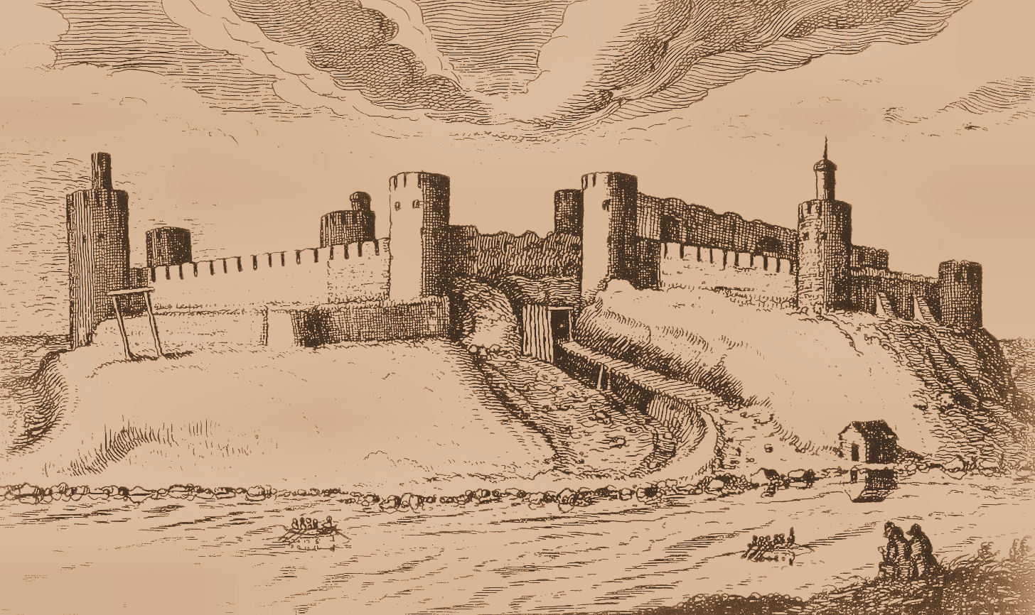
Ivangorod ( rus, –ė–≤–į–Ĺ–≥–ĺŐĀ—Ä–ĺ–ī, p=…™v…źnňą…°or…ôt; et, Jaanilinn; vot, Jaanilidna) is a town in Kingiseppsky District of Leningrad Oblast, Russia, located on the east bank of the Narva river which flows along the Estonia‚ÄďRussia international border, west of St. Petersburg. The town's population was recorded as Ivangorod is a major border crossing point and a railway station by the Tallinn‚Äď St. Petersburg line. It is located just opposite to the Estonian town of Narva. The town is the site of the Ivangorod Fortress, a prominent fortification monument of the 15th and the 16th centuries. History The fortress, established in 1492 during the reign of Ivan III of Moscow, took its name (literally: Ivan-town ‚ÄĒ ''gorod'' in Russian means "town" or "city") from that of the Tsar. Between 1581 and 1590 and from 1612 to 1704, Sweden controlled the area. Ivangorod was granted town privileges and administered as a Russian township under the Swedish Empire ... [...More Info...] [...Related Items...] OR: [Wikipedia] [Google] [Baidu] |
Estonia
Estonia, formally the Republic of Estonia, is a country by the Baltic Sea in Northern Europe. It is bordered to the north by the Gulf of Finland across from Finland, to the west by the sea across from Sweden, to the south by Latvia, and to the east by Lake Peipus and Russia. The territory of Estonia consists of the mainland, the larger islands of Saaremaa and Hiiumaa, and over 2,200 other islands and islets on the eastern coast of the Baltic Sea, covering a total area of . The capital city Tallinn and Tartu are the two largest urban areas of the country. The Estonian language is the autochthonous and the official language of Estonia; it is the first language of the majority of its population, as well as the world's second most spoken Finnic language. The land of what is now modern Estonia has been inhabited by '' Homo sapiens'' since at least 9,000 BC. The medieval indigenous population of Estonia was one of the last " pagan" civilisations in Europe to adopt Ch ... [...More Info...] [...Related Items...] OR: [Wikipedia] [Google] [Baidu] |
Narva River
The river Narva ( et, Narva j√Ķgi; russian: –Ě–į—Ä–≤–į), formerly also Narova flows north into the Baltic Sea and is the largest Estonian river by discharge. A similar length of land far to the south, together with it and a much longer intermediate lake, altogether forms the Estonia-Russia border. The long lake, mentioned, which the river drains is Lake Peipus. The lake notably drains the much longer Russian river, the Velikaya, and a large, splayed drainage basin in the two countries. The river gives its name to the Narva culture and the city of Narva, which faces the Russian town Ivangorod. At the coast it passes part of the resort of Narva-J√Ķesuu. Its mouth is specifically into the very open WNW-facing Narva Bay of the Gulf of Finland. It gives the second-greatest discharge into the Gulf of Finland. The greatest discharge is the Neva, ranking fourth as to European rivers. Etymology The etymology of the toponym ''Narva'' is not clear, but according to the most common ... [...More Info...] [...Related Items...] OR: [Wikipedia] [Google] [Baidu] |
Narva
Narva, russian: –Ě–į—Ä–≤–į is a municipality and city in Estonia. It is located in Ida-Viru County, Ida-Viru county, at the Extreme points of Estonia, eastern extreme point of Estonia, on the west bank of the Narva (river), Narva river which forms the Estonia‚ÄďRussia border, Estonia‚ÄďRussia international border. With 54,409 inhabitants (as of 2020) Narva is Estonia's third largest city after capital Tallinn and Tartu. In 1944, Narva was nearly completely destroyed during the battles of World War II. During the period of Soviet occupation of Estonia, Soviet occupation (1944‚Äď1991), the city‚Äôs original native inhabitants were not permitted to return after the war, and immigrant workers from Russia and other parts of the Soviet Union, former USSR were brought in to populate the city. The city whose population had been, as of 1934 census, 65% ethnic Estonian, became overwhelmingly non-Estonian in the second half of the 20th century. According to more recent data, 46.7% of th ... [...More Info...] [...Related Items...] OR: [Wikipedia] [Google] [Baidu] |
European Route E20
European route E20 is a part of the United Nations International E-road network. It runs roughly west‚Äďeast through Ireland, the United Kingdom, Denmark, Sweden, Estonia, and Russia. Its length is but it is not continuous; at three points, a sea crossing is required. Roll-on/roll-off ferries make the crossings from Dublin to Liverpool and from Stockholm to Tallinn. No publicly accessible ferries traverse the North Sea from Kingston-upon-Hull to Esbjerg (as of 2019), but a ferry for commercial drivers leaves Immingham for Esbjerg on most days. Route Ireland The initial section of the E20 from Shannon Airport to Dublin via Limerick is approximately 228 km long and is only partially signed, along the M7/N7. The section from Shannon Airport to east of Limerick is mainly dual carriageway, with a short section of motorway as part of the Limerick Southern Ring Road. The Shannon Tunnel, opened on 16 July 2010, completed the bypass of Limerick. The section from Limerick to ... [...More Info...] [...Related Items...] OR: [Wikipedia] [Google] [Baidu] |
Moscow‚ÄďSaint Petersburg Motorway
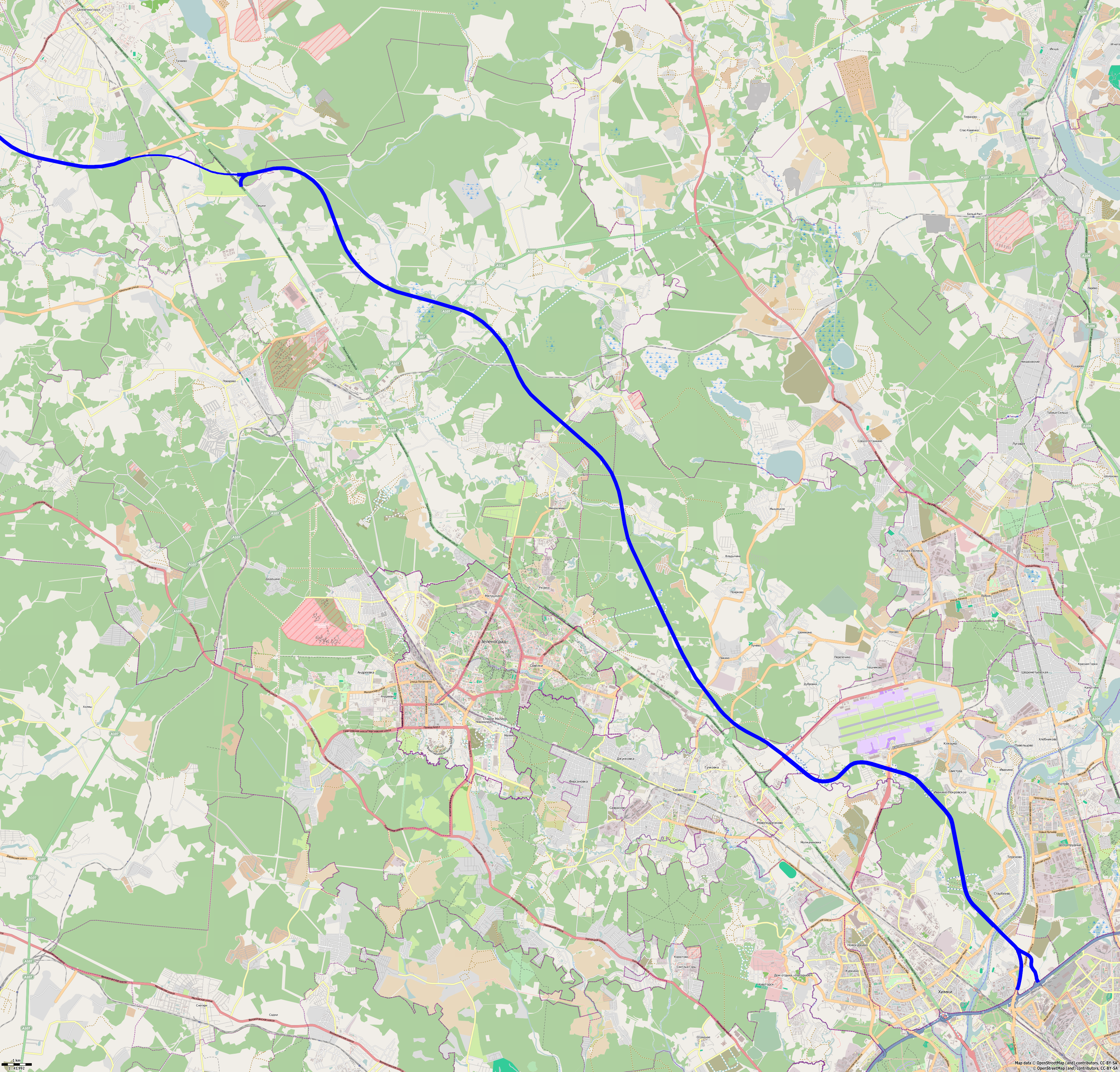
The Moscow‚ÄďSaint Petersburg motorway ( rus, –ź–≤—ā–ĺ–ľ–į–≥–ł—Ā—ā—Ä–į–Ľ—Ć –ú–ĺ—Ā–ļ–≤–į ‚ÄĒ –°–į–Ĺ–ļ—ā-–ü–Ķ—ā–Ķ—Ä–Ī—É—Ä–≥, Avtomagistral' Moskva-Sankt-Peterburg}), designated as the –ú11 Neva, is a Russian federal highway in the European part of Russia, running parallel to the M10 highway, serving from the federal cities of Moscow to St. Petersburg. The M11 goes through Moscow, Tver, Novgorod, and Leningrad Oblasts, running pass the cities of Khimki, Zelenograd, Solnechnogorsk, Klin, Tver, Vyshny Volochyok, Valday, Veliky Novgorod, Chudovo, and Tosno. The M11 is a category 1A highway, defined as a motorway, which has two to five lanes on each side and a calculated speed limit of around 150 km/h. The M11 is one of the most recent federal highways. Construction began in 2010. It was planned that the highway would be opened in 2018, before the start of Russia FIFA World Cup. The M11 was completed and opened in November 2019. With the M1, St. Petersburg is the second city in Rus ... [...More Info...] [...Related Items...] OR: [Wikipedia] [Google] [Baidu] |
Krasnoye Selo
Krasnoye Selo (russian: –ö—Ä–įŐĀ—Ā–Ĺ–ĺ–Ķ –°–Ķ–Ľ–ĺŐĀ, lit. ''Red village''). –ď. –ü. –°–ľ–ĺ–Ľ–ł—Ü–ļ–į—Ź. "–Ę–ĺ–Ņ–ĺ–Ĺ–ł–ľ–ł—á–Ķ—Ā–ļ–ł–Ļ —Ā–Ľ–ĺ–≤–į—Ä—Ć –¶–Ķ–Ĺ—ā—Ä–į–Ľ—Ć–Ĺ–ĺ–Ļ –†–ĺ—Ā—Ā–ł–ł". "–ź—Ä–ľ–į–ī–į-–ü—Ä–Ķ—Ā—Ā", 2002 is a municipal town in Krasnoselsky District of the federal city of St. Petersburg, Russia. It is located south-southeast of the city center. Population: It was founded in the early 18th century, as a suburban village south of St. Petersburg. In 1764, the village had a paper mill, located near the road leading to St. Petersburg. During the 19th century, Krasnoye Selo developed as a recreational suburb of the capital with numerous summer dachas and villas, including the summer residences of the royals. In 1884, the famous airplane designer Alexander Mozhaysky tested his early monoplane there, achieving a power-assisted take off or 'hop' of . In late tsarist times, Krasnoye Selo was the location of the annual military manoeuvres pre ... [...More Info...] [...Related Items...] OR: [Wikipedia] [Google] [Baidu] |
World Heritage Site
A World Heritage Site is a landmark or area with legal protection by an international convention administered by the United Nations Educational, Scientific and Cultural Organization (UNESCO). World Heritage Sites are designated by UNESCO for having cultural, historical, scientific or other form of significance. The sites are judged to contain " cultural and natural heritage around the world considered to be of outstanding value to humanity". To be selected, a World Heritage Site must be a somehow unique landmark which is geographically and historically identifiable and has special cultural or physical significance. For example, World Heritage Sites might be ancient ruins or historical structures, buildings, cities, deserts, forests, islands, lakes, monuments, mountains, or wilderness areas. A World Heritage Site may signify a remarkable accomplishment of humanity, and serve as evidence of our intellectual history on the planet, or it might be a place of great natural beauty. A ... [...More Info...] [...Related Items...] OR: [Wikipedia] [Google] [Baidu] |
Historic Centre Of Saint Petersburg And Related Groups Of Monuments
Historic Centre of Saint Petersburg and Related Groups of Monuments is the name used by UNESCO when it collectively designated the historic core of the Russian city of St. Petersburg, as well as buildings and ensembles located in the immediate vicinity as a World Heritage Site in 1991. The site was recognised for its architectural heritage, fusing Baroque, Neoclassical, and traditional Russian-Byzantine influences. Sites The site contains 126 locations including the following objects, # Historic Centre of St. Petersburg # Historical Part of the Town of Kronstadt # Fortress of Kronstadt #* Forts of the Island Kotlin #** Redoubts Dena (Fort Den) #** Fort Shanz #** Fort Catherine #** Fort Rift #** Fort Constantin #** Tolbukhin Signal Tower on Tolbukhin Island #* Forts of the Gulf of Finland #** Obrutchev Fort #** Totleben Fort #** North Forts Nos. 1-7 #** Paul Fort (Riesbank) #** Kronshlot Fort #** Alexander Fort ("Tchumny") #** Peter Fort #** South Forts Nos. ... [...More Info...] [...Related Items...] OR: [Wikipedia] [Google] [Baidu] |
Roads In Russia
Russian federal highways ( rus, –į–≤—ā–ĺ–ľ–ĺ–Ī–ł–Ľ—Ć–Ĺ—č–Ķ –ī–ĺ—Ä–ĺ–≥–ł —Ą–Ķ–ī–Ķ—Ä–į–Ľ—Ć–Ĺ–ĺ–≥–ĺ –∑–Ĺ–į—á–Ķ–Ĺ–ł—Ź –†–ĺ—Ā—Ā–ł–Ļ—Ā–ļ–ĺ–Ļ –§–Ķ–ī–Ķ—Ä–į—Ü–ł–ł, r=avtomobil‚Äônyye dorogi federal‚Äônogo znacheniya Rossiyskoy Federatsii; lit. ''highways of federal importance of the Russian Federation'') are the most important highways in Russia that are federal property. The following motorways are designated as federal. A Russian decree of December 24 1991 about the list of federal highways (), with subsequent amendments by the |


