|
A148 Road
The A148 is an English A road entirely in the county of Norfolk. It runs from King's Lynn to Cromer via Fakenham, which it bypasses to the north. Route King’s Lynn starting point Starting at the western end, A148 starts as an exit from a roundabout on the A47. It runs in a northerly direction, as Saddlebow Road, through the King’s Lynn suburb of South Lynn. In just over Saddlebow Road becomes Wisbech Road and crosses the River Nar. The road now joins a roundabout at the bottom end of King's Lynn. At this roundabout the A149, Hardwick Road, runs of to the right whilst the B1144 is straight across the island and runs around the eastern skirt of the town. The A148 turns right and northward and is now called London Road. The road soon passes under the South Gate of what were once the town's defences. This gateway was built during the Reign of Edward III. It is brick built with stone surrounds to the arches. The gate only straddles the northbound carriage way and was resto ... [...More Info...] [...Related Items...] OR: [Wikipedia] [Google] [Baidu] |
King's Lynn
King's Lynn, known until 1537 as Bishop's Lynn and colloquially as Lynn, is a port and market town in the borough of King's Lynn and West Norfolk in the county of Norfolk, England. It is located north of London, north-east of Peterborough, north-north-east of Cambridge and west of Norwich. History Toponymy The etymology of King's Lynn is uncertain. The name ''Lynn'' may signify a body of water near the town – the Welsh word means a lake; but the name is plausibly of Anglo-Saxon origin, from ''lean'' meaning a tenure in fee or farm. As the 1085 Domesday Book mentions saltings at Lena (Lynn), an area of partitioned pools may have existed there at the time. Other places with Lynn in the name include Dublin, Ireland. An Dubh Linn....the Black Pool. The presence of salt, which was relatively rare and expensive in the early medieval period, may have added to the interest of Herbert de Losinga and other prominent Normans in the modest parish. The town was named ''Len '' (Bis ... [...More Info...] [...Related Items...] OR: [Wikipedia] [Google] [Baidu] |
Gaywood River
Gaywood River (sometimes known as the River Gay or River Gaywood or, in King's Lynn, as the Fisher Fleet) is a tributary of the River Great Ouse in the west of the county of Norfolk.Ordnance Survey (2002). ''OS Explorer Map 250 - Norfolk Coast West''. . Its source is 11 metres above sea level, northwest of the village of Gayton in Derby Fen, Map Reference TF 705 209. It runs for to its outflow into the River Great Ouse in the town of King's Lynn. Derby Fen is the remnant of a valley fen system once found in these parts. The remnant supports a range of habitats from dry calcareous to damp acidic grasslands and heath which all rely on the river. From Derby Fen the stream runs under Leziate Drove and along the southern side of Sugar Fen after which the river passes into the open countryside. In recent years, attempts have been made to restore the river to its original meandering course in the section of the river. With these improvements there have been recordings of water vole, ... [...More Info...] [...Related Items...] OR: [Wikipedia] [Google] [Baidu] |
Peddars Way
The Peddars Way is a long distance footpath that passes through Suffolk and Norfolk, England. Route The Peddars Way is 46 miles (74 km) long and follows the route of a Roman road. It has been suggested by more than one writer that it was not created by the Romans but was an ancient trackway, a branch or extension of the Icknield Way, used and remodelled by the Romans. The name-type, which recurs in medieval records from other parts of East Anglia, derives from Middle English ''pedder'', meaning an itinerant trader. It is first mentioned on a map of 1587 AD. It starts at Knettishall Heath in Suffolk (near the Norfolk-Suffolk border, about east of Thetford), and it links with the Norfolk Coast Path at Holme-next-the-Sea. Combined with the Norfolk Coast Path, it forms the Peddars Way & Norfolk Coast Path National Trail, one of 15 National Trails in England and Wales, and the two paths together run for . It is one of four long distance footpaths which, when combined, run fr ... [...More Info...] [...Related Items...] OR: [Wikipedia] [Google] [Baidu] |
Harpley, Norfolk
Harpley is a village and civil parish in the English county of Norfolk. It covers an area of and had a population of 353 in 157 households at the 2001 census, the population reducing to 338 at the 2011 Census. For the purposes of local government, it falls within the district of King's Lynn and West Norfolk. The villages name means 'Harp wood/clearing', perhaps in the sense of a sieve used in salt working. The village is north-east of King's Lynn. The village is on the south side of the A148 King's Lynn to Cromer road. There is an Anglican church, and a primary school (which celebrated its centenary in 2008). It has a Pub 'The Rose and Crown', The two shops, and a Post Office which used to operate in the village have closed. A Methodist chapel in Nethergate Street has been converted into a private dwelling. Nearby points of interest include Houghton Hall located north of the parish and the Peddars Way, accessible from the A148 just west of town. Transport Harpley can b ... [...More Info...] [...Related Items...] OR: [Wikipedia] [Google] [Baidu] |
King's Lynn And West Norfolk
King's Lynn and West Norfolk is a local government district with borough status in Norfolk, England. Its council is based in the town of King's Lynn. The population of the Local Authority at the 2011 Census was 147,451. History The district was formed in 1974 by the merger of the Municipal Borough of King's Lynn, Hunstanton and Downham Market urban districts along with Docking Rural District, Downham Rural District, Freebridge Lynn Rural District and Marshland Rural District. The district was originally known as just West Norfolk, and adopted its present name in 1981. Politics Elections to the borough council are held every four years, with all of the 55 councillors, representing 42 wards, on the council being elected at each election. After being under no overall control from the 1999 election, the Conservative party gained a majority at the 2003 election and has held one ever since, although losing a large number of seats due to the resurgence of the Independent Group ... [...More Info...] [...Related Items...] OR: [Wikipedia] [Google] [Baidu] |
Flitcham
Flitcham is a village and civil parish in the English county of Norfolk. The village is located north-east of King's Lynn and north-west of Norwich, along the River Babingley. Together with the villages of West Newton, Shernborne and Anmer, Flitcham forms part of the Royal Sandringham Estate. History Flitcham's name is of Anglo-Saxon origin and derives from the Old English for a village or settlement where 'flitches' of Bacon were produced. In 1948, the site of a Roman villa was excavated close to Denbeck Wood, within the parish. After excavation, the villa was found to have glazed windows, a tessellated floor and a small courtyard flanker by other buildings from the same period. Further artefacts, including coins, pottery and metalwork dating from the Third and Forth Centuries, have been discovered close to the site and across the parish. Another possible Roman building has been identified close to the course of the River Babingley. In addition, the Denbeck Wood excavations ... [...More Info...] [...Related Items...] OR: [Wikipedia] [Google] [Baidu] |
Grimston, Norfolk
Grimston is a village and civil parish in the English county of Norfolk, approximately 6 miles north-east of King's Lynn. It covers an area of and had a population of 1,952 in 823 households at the 2001 census, increasing to a population of 1,980 at the 2011 Census. For the purposes of local government, it falls within the district of King's Lynn and West Norfolk. The village is a few miles away from the Royal family residence at Sandringham House. The village was built on a spring line and a Roman villa was found near Watery Lane in the late 19th century. Subsequently, Roman villas were found in the neighbouring villages of Gayton Thorpe and Well Hall to the south and Congham and Appleton to the north. Some red bricks from the villas were re-used in the church, on buttresses and on the South Wall. Grimston, and particularly the nearby hamlet of Pott Row were quite significant centres of pottery production from the 11th to 16th centuries, and important suppliers of this to ... [...More Info...] [...Related Items...] OR: [Wikipedia] [Google] [Baidu] |
Charles II Of England
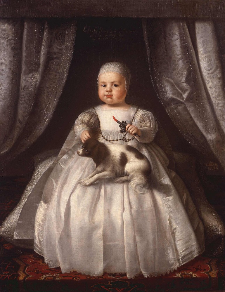
Charles II (29 May 1630 – 6 February 1685) was King of Scotland from 1649 until 1651, and King of England, Scotland and Ireland from the 1660 Restoration of the monarchy until his death in 1685. Charles II was the eldest surviving child of Charles I of England, Scotland and Ireland and Henrietta Maria of France. After Charles I's execution at Whitehall on 30 January 1649, at the climax of the English Civil War, the Parliament of Scotland proclaimed Charles II king on 5 February 1649. But England entered the period known as the English Interregnum or the English Commonwealth, and the country was a de facto republic led by Oliver Cromwell. Cromwell defeated Charles II at the Battle of Worcester on 3 September 1651, and Charles fled to mainland Europe. Cromwell became virtual dictator of England, Scotland and Ireland. Charles spent the next nine years in exile in France, the Dutch Republic and the Spanish Netherlands. The political crisis that followed Cromwell's death in 1 ... [...More Info...] [...Related Items...] OR: [Wikipedia] [Google] [Baidu] |
Catherine Of Braganza
Catherine of Braganza ( pt, Catarina de Bragança; 25 November 1638 – 31 December 1705) was List of English royal consorts, Queen of England, List of Scottish royal consorts, Scotland and Ireland during her marriage to Charles II of England, King Charles II, which lasted from 21 May 1662 until his death on 6 February 1685. She was the daughter of King John IV of Portugal, who became the first king from the House of Braganza in 1640 after overthrowing the 60–year rule of the Habsburg Spain, Spanish Habsburgs over Portugal and restoring the Portuguese throne which had first been created in 1143. Catherine served as regent of Portugal during the absence of her brother Peter II of Portugal, Peter II in 1701 and during 1704–1705, after her return to her homeland as a widow. Owing to her devotion to the Catholic Church, Roman Catholic faith in which she had been raised, Catherine was unpopular in England. She was a special object of attack by the inventors of the Popish Plot. I ... [...More Info...] [...Related Items...] OR: [Wikipedia] [Google] [Baidu] |
Coaching Inn
The coaching inn (also coaching house or staging inn) was a vital part of Europe's inland transport infrastructure until the development of the railway, providing a resting point ( layover) for people and horses. The inn served the needs of travellers, for food, drink, and rest. The attached stables, staffed by hostlers, cared for the horses, including changing a tired team for a fresh one. Coaching inns were used by private travellers in their coaches, the public riding stagecoaches between one town and another, and (in England at least) the mail coach. Just as with roadhouses in other countries, although many survive, and some still offer overnight accommodation, in general coaching inns have lost their original function and now operate as ordinary pubs. Coaching inns stabled teams of horses for stagecoaches and mail coaches and replaced tired teams with fresh teams. In America, stage stations performed these functions. Traditionally English coaching inns were seven miles a ... [...More Info...] [...Related Items...] OR: [Wikipedia] [Google] [Baidu] |
Hillington, Norfolk
Hillington is a village and civil parish in the English county of Norfolk. It covers an area of and had a population of 287 in 123 households as of the United Kingdom Census 2001, 2001 census, increasing to 400 at the 2011 Census. For the purposes of local government, it falls within the Non-metropolitan district, district of King's Lynn and West Norfolk. The village straddles the A148 road, A148 King's Lynn to Cromer road. It formerly had a Hillington railway station, railway station, but this closed in 1959. History The settlement was recorded in the Domesday Book as ''Helingetuna'', which is believed to mean ‘the farmstead of the family or followers of a man named Hythla or Hydl'. Archaeological test pits were dug between 2015–2017 and a report was published in 2019. Notable people Hillington is the traditional home of the ffolkes baronets. Francis ffolkes, 5th Baronet was Rector of Hillington from 1912 until his death. His nephew, the intelligence officer and conserva ... [...More Info...] [...Related Items...] OR: [Wikipedia] [Google] [Baidu] |
Sandringham House
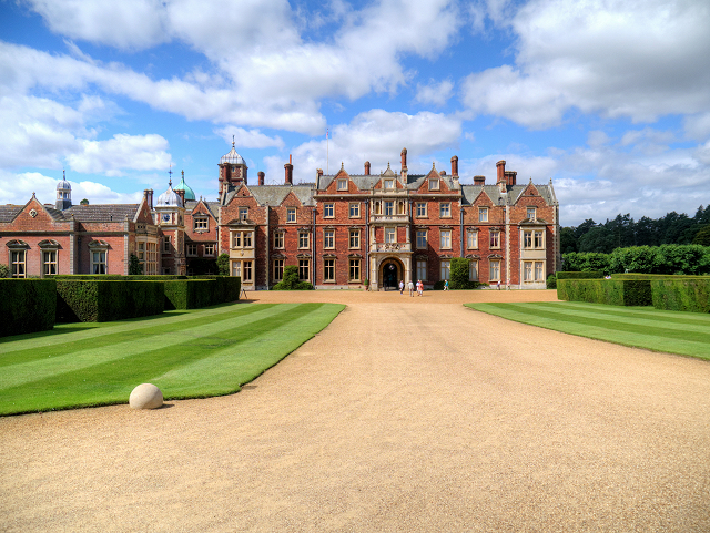
Sandringham House is a country house in the parish of Sandringham, Norfolk, England. It is one of the royal residences of Charles III, whose grandfather, George VI, and great-grandfather, George V, both died there. The house stands in a estate in the Norfolk Coast Area of Outstanding Natural Beauty. The house is listed as Grade II* and the landscaped gardens, park and woodlands are on the National Register of Historic Parks and Gardens. The site has been occupied since Elizabethan era, Elizabethan times, when a large manor house was constructed. This was replaced in 1771 by a Georgian architecture, Georgian mansion for the owners, the Hoste Henleys. In 1836 Sandringham was bought by John Motteux, a London merchant, who already owned property in Norfolk and Surrey. Motteux had no direct heir, and on his death in 1843, his entire estate was left to Charles Spencer Cowper, the son of Motteux's close friend Emily Temple, Viscountess Palmerston. Cowper sold the Norfolk and the Surr ... [...More Info...] [...Related Items...] OR: [Wikipedia] [Google] [Baidu] |


