|
Azhagiapandiapuram
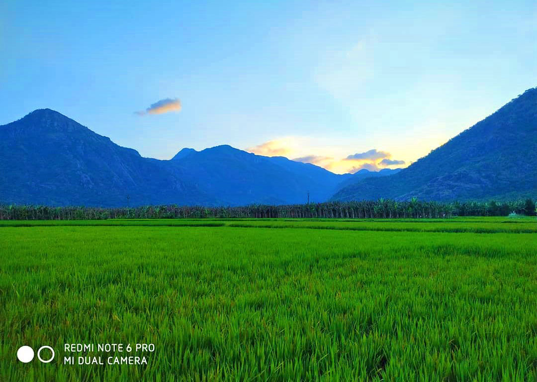
Azhagiapandiapuram is a second grade town panchayat in Kanniyakumari district in the state of Tamil Nadu, India. It is located at the centre of Pazhayar valley. It is one of the four town panchayat's in Thovalai taluk. Location and Significance The town spans an area of around 10.24 km2 with Ettamadai, Kesavanputhoor, Melkarai, Perunthalaikadu, Kurathiyarai, Thomaiyarpuram and Palkulam as its sub-villages. The places situated in the vicinity of the town include Asambu Reserve Forest to the North, Derisanamcope and Thittuvilai to the south, and Kadukkarai and Kattuputhoor to the East, Chiramadam to Southwest, Gnalam to west and Arumanallur to Northwest. Azhagiapandiapuram is located 70 km Southeast of the Trivandrum Metropolitan Region and 15 km to the North of Nagercoil the nearest city. Azhagiapandiapuram is 32 km away from the commercial towns of Marthandam and it is 35 km to the Northwest of Tourism hub Kanyakumari. Demographics India cen ... [...More Info...] [...Related Items...] OR: [Wikipedia] [Google] [Baidu] |
Kanniyakumari District
Kanniyakumari district is one of the 38 districts in Tamil Nadu state and the southernmost district in mainland India. It stands second in terms of population density among the districts of Tamil Nadu. It is also the richest district in Tamil Nadu in terms of per capita income, and also tops the state in Human Development Index (HDI), literacy, and education. The district's headquarters is Nagercoil. Kanniyakumari district has a varied topography with the sea on three sides and the mountains of the Western Ghats bordering the northern side. Except for a small stretch of land to the east of Kanniyakumari town, almost the entire district is sandwiched between the Western Ghats and the Arabian Sea – the only district in Tamilnadu state facing the Arabian Sea. Geologically, the landmass of the district is much younger when compared to the rest of the state – faulted as late as 2.5 million years during the Miocene, after which numerous transgression, as well as regression of s ... [...More Info...] [...Related Items...] OR: [Wikipedia] [Google] [Baidu] |
Country
A country is a distinct part of the world, such as a state, nation, or other political entity. It may be a sovereign state or make up one part of a larger state. For example, the country of Japan is an independent, sovereign state, while the country of Wales is a component of a multi-part sovereign state, the United Kingdom. A country may be a historically sovereign area (such as Korea), a currently sovereign territory with a unified government (such as Senegal), or a non-sovereign geographic region associated with certain distinct political, ethnic, or cultural characteristics (such as the Basque Country). The definition and usage of the word "country" is flexible and has changed over time. ''The Economist'' wrote in 2010 that "any attempt to find a clear definition of a country soon runs into a thicket of exceptions and anomalies." Most sovereign states, but not all countries, are members of the United Nations. The largest country by area is Russia, while the smallest is ... [...More Info...] [...Related Items...] OR: [Wikipedia] [Google] [Baidu] |
India
India, officially the Republic of India (Hindi: ), is a country in South Asia. It is the seventh-largest country by area, the second-most populous country, and the most populous democracy in the world. Bounded by the Indian Ocean on the south, the Arabian Sea on the southwest, and the Bay of Bengal on the southeast, it shares land borders with Pakistan to the west; China, Nepal, and Bhutan to the north; and Bangladesh and Myanmar to the east. In the Indian Ocean, India is in the vicinity of Sri Lanka and the Maldives; its Andaman and Nicobar Islands share a maritime border with Thailand, Myanmar, and Indonesia. Modern humans arrived on the Indian subcontinent from Africa no later than 55,000 years ago., "Y-Chromosome and Mt-DNA data support the colonization of South Asia by modern humans originating in Africa. ... Coalescence dates for most non-European populations average to between 73–55 ka.", "Modern human beings—''Homo sapiens''—originated in Africa. Then, int ... [...More Info...] [...Related Items...] OR: [Wikipedia] [Google] [Baidu] |
Scheduled Castes And Scheduled Tribes
The Scheduled Castes (SCs) and Scheduled Tribes (STs) are officially designated groups of people and among the most disadvantaged socio-economic groups in India. The terms are recognized in the Constitution of India and the groups are designated in one or other of the categories. For much of the period of British rule in the Indian subcontinent, they were known as the Depressed Classes. In modern literature, the ''Scheduled Castes'' are sometimes referred to as Dalit, meaning "broken" or "dispersed", having been popularised by B. R. Ambedkar (1891–1956), a Dalit himself, an economist, reformer, chairman of the Constituent Assembly of India, and Dalit leader during the independence struggle. Ambedkar preferred the term Dalit to Gandhi's term, Harijan, meaning "person of Hari/Vishnu" (or Man of God). In September 2018, the government "issued an advisory to all private satellite channels asking them to 'refrain' from using the nomenclature 'Dalit'", though "rights groups and i ... [...More Info...] [...Related Items...] OR: [Wikipedia] [Google] [Baidu] |
Literacy In India
Literacy in India is a key for social-economic progress. The 2011 census, indicated a 2001–2011 literacy growth of 97.2%, which is slower than the growth seen during the previous decade. An old analytical 1990 study estimated that it would take until 2060 for India to achieve universal literacy at then-current rate of progress. Census of India pegged average literacy rate to be 73% in 2011 while National Statistical Commission surveyed literacy to be 77.7% in 2017–18. Literacy rate in urban areas was higher 87.7% than rural areas with 73.5%. There is a widgender disparity in the literacy rate in Indiaand effective literacy rates (age 7 and above) was 84.7% for men and 70.3% for women. The low female literacy rate has a dramatically negative impact on family planning and population stabillisation efforts in India. Studies have indicated that female literacy is a strong predictor of the use of contraception among married Indian couples, even when women do not otherwise have ec ... [...More Info...] [...Related Items...] OR: [Wikipedia] [Google] [Baidu] |
Census
A census is the procedure of systematically acquiring, recording and calculating information about the members of a given population. This term is used mostly in connection with national population and housing censuses; other common censuses include censuses of agriculture, traditional culture, business, supplies, and traffic censuses. The United Nations (UN) defines the essential features of population and housing censuses as "individual enumeration, universality within a defined territory, simultaneity and defined periodicity", and recommends that population censuses be taken at least every ten years. UN recommendations also cover census topics to be collected, official definitions, classifications and other useful information to co-ordinate international practices. The UN's Food and Agriculture Organization (FAO), in turn, defines the census of agriculture as "a statistical operation for collecting, processing and disseminating data on the structure of agriculture, covering th ... [...More Info...] [...Related Items...] OR: [Wikipedia] [Google] [Baidu] |
Kanyakumari
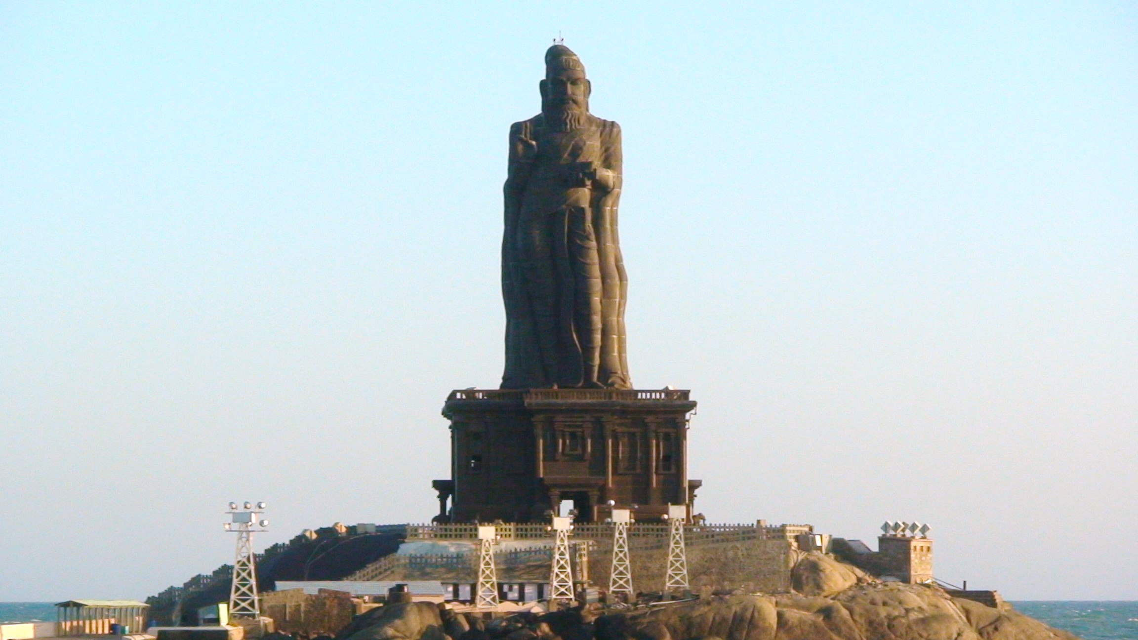
Kanniyakumari (; , referring to Devi Kanya Kumari), also known as Cape Comorin, is a city in Kanniyakumari district in the state of Tamil Nadu, India. It is the southern tip of the Indian subcontinent and the southernmost city in mainland India, thus referred to as 'The Land's End'. The city is situated south of Thiruvananthapuram city, and about south of Nagercoil, the headquarters of Kanniyakumari district. Kanniyakumari is a popular tourist destination and pilgrimage centre in India. Notable tourist spots include its unique sunrise and sunset points, the Thiruvalluvar Statue and Vivekananda Rock Memorial off the coast. Lying at the tip of peninsular India, the town is bordered on the west, south and east by the Laccadive Sea. It has a coastal line of stretched on the three sides. On the shores of the city is a temple dedicated to Goddess Kanniyakumari (the virgin Goddess), after which the town is named.https://thehinduimages.com/details-page.php?id=157918128 ... [...More Info...] [...Related Items...] OR: [Wikipedia] [Google] [Baidu] |
Marthandam
Marthandam is a major trade centre in Kuzhithurai municipality across National Highway (NH 47) in the Kanyakumari district of Tamil Nadu, India. Formerly known as Thoduvetty (another name for the Marthandam market region), it was a portion of Kanyakumari district which was added to the state of Tamil Nadu on 1 November 1956. Marthandam is the largest town in the district. It derived its name from the founder and ruler of Travancore, Anizham Thirunal Marthanda Varma. Marthandam is famous for honey, cashew nut processing, rubber and hand-embroidered motifs. The area is among the most fertile lands of Tamil Nadu with substantial vegetation, and a river adjoining. It is also a major trade center due to its location bordering Kerala. History The Chitharal Jain Monuments are the ruins of a Jain training centre from the 9th century CE, on a small hill. It is famous for the hillock which has a cave containing rock-cut sculptures of Thirthankaras and attendant deities carved insid ... [...More Info...] [...Related Items...] OR: [Wikipedia] [Google] [Baidu] |
Thiruvananthapuram
Thiruvananthapuram (; ), also known by its former name Trivandrum (), is the capital of the Indian state of Kerala. It is the most populous city in Kerala with a population of 957,730 as of 2011. The encompassing urban agglomeration population is around 1.68 million. Located on the west coast of India near the extreme south of the mainland, Thiruvananthapuram is a major information technology hub in Kerala and contributes 55% of the state's software exports as of 2016. Referred to by Mahatma Gandhi as the "Evergreen city of India", the city is characterised by its undulating terrain of low coastal hills. The present regions that constitute Thiruvananthapuram were ruled by the Ays who were feudatories of the Chera dynasty. In the 12th century, it was conquered by the Kingdom of Venad. In the 18th century, the king Marthanda Varma expanded the territory, founded the princely state of Travancore, and made Thiruvananthapuram its capital. Travancore became the most dominan ... [...More Info...] [...Related Items...] OR: [Wikipedia] [Google] [Baidu] |
Arumanallur
Anumanallur is a village in the Papanasam taluk of Thanjavur district, Tamil Nadu, India India, officially the Republic of India (Hindi: ), is a country in South Asia. It is the seventh-largest country by area, the second-most populous country, and the most populous democracy in the world. Bounded by the Indian Ocean on the so .... Demographics As per the 2001 census, Arumanallur had a total population of 540 with 259 males and 281 females. The sex ratio was 1085. The literacy rate was 64.72. References * Villages in Thanjavur district {{Thanjavur-geo-stub ... [...More Info...] [...Related Items...] OR: [Wikipedia] [Google] [Baidu] |


