|
Axj
is an airport northwest of Amakusa, Kumamoto, Japan, on the Amakusa, Amakusa Islands in Japan. Locals often refer to it as Amakusa Airport. It is on the northern side of the Amakusa Islands, northwest of Amakusa city. It is used by only one airline, Amakusa Airlines, which is based there. History On September 6, 1982, the governor of Kumamoto Prefecture announced plans for a small airport during a regular press conference. On December 26, 1990, the Ministry of Land, Infrastructure, Transport and Tourism (Japan), Ministry of Land, Infrastructure and Transport approved the construction of the airfield. Construction began in 1992. The first plane that landed at this airport was a DHC-8 of Amakusa Airlines on November 19, 1999. The airfield was opened for public use on March 23, 2000. In the spring of 2000, it had round trips between Amakusa Islands and Kumamoto twice a day. Starting from December 1, 2005, the operating time was extended from (8:00 am ~ 7:00 pm) to (7:40 am ~ ... [...More Info...] [...Related Items...] OR: [Wikipedia] [Google] [Baidu] |
Amakusa, Kumamoto
is a city located in Kumamoto Prefecture, Japan. , the city had an estimated population of 72,243 in 36029 households, and a population density of 110 persons per km2. The total area of the city is . Geography Amakusa covers the majority of two main islands, Kamishima (上島, "Upper Island") and Shimoshima (下島, "Lower Island") (天草諸島), and six smaller inhabited islands and numerous uninhabited islets located the central-west Kumamoto Prefecture, in between the Yatsushiro Sea and the East China Sea. Large parts of the city are within the borders of the Unzen-Amakusa National Park. Neighboring municipalities Kumamoto Prefecture * Kamiamakusa * Reihoku Climate Amakusa has a humid subtropical climate (Köppen climate classification ''Cfa'') with hot summers and cool winters. Precipitation is significant throughout the year, and is heaviest from May to August. The average annual temperature in Amakusa is . The average annual rainfall is with June as the wettest mo ... [...More Info...] [...Related Items...] OR: [Wikipedia] [Google] [Baidu] |
Kobe Airport
is a primarily domestic airport on an artificial island just off the coast of Kobe, south of Sannomiya StationAIS Japan . Opened on February 16, 2006, it primarily handles domestic flights. International flights to destinations within , and , started in April 2025. The airport can also accommodate international charter flights. In the first year of operation (2006), the airport handled ... [...More Info...] [...Related Items...] OR: [Wikipedia] [Google] [Baidu] |
Airports In Kyushu
An airport is an aerodrome with extended facilities, mostly for commercial air transport. They usually consist of a landing area, which comprises an aerially accessible open space including at least one operationally active surface such as a runway for a plane to take off and to land or a helipad, and often includes adjacent utility buildings such as control towers, hangars and terminals, to maintain and monitor aircraft. Larger airports may have airport aprons, taxiway bridges, air traffic control centres, passenger facilities such as restaurants and lounges, and emergency services. In some countries, the US in particular, airports also typically have one or more fixed-base operators, serving general aviation. Airport operations are extremely complex, with a complicated system of aircraft support services, passenger services, and aircraft control services contained within the operation. Thus airports can be major employers, as well as important hubs for tourism and ot ... [...More Info...] [...Related Items...] OR: [Wikipedia] [Google] [Baidu] |
List Of Bus Operating Companies In Japan (west)
List of bus operating companies in Japan lists Japanese bus operators. The list includes companies operating now. Operators are listed from north to south by Prefectures of Japan, prefecture of its headquarters. The list includes transit buses, highway buses, or sightseeing buses. Operators of lines not open to passers-by, such as charter only companies, or schools operating school buses are not listed. The list also excludes lines. It refers to feeder bus transits with usually smaller vehicles, operated by municipalities. See :ja:日本のコミュニティバス一覧 for the list. "Normal" municipal bus transits (''kōei basu'' , such as Toei Bus of Tokyo, Tōkyō) are listed here. Trolleybuses and guided buses are listed in the List of railway companies in Japan, as they are classified as railway in the country. For the operators in Kantō region, Kantō and Kansai region, Kansai, accepted fare collection cards are indicated as below. Other operators may accept different car ... [...More Info...] [...Related Items...] OR: [Wikipedia] [Google] [Baidu] |
Precision Approach Path Indicator
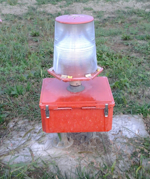
A precision approach path indicator (PAPI) is a system of Electric light, lights on the side of an airport runway threshold that provides visual descent (aircraft), descent guidance information during final approach. It is generally located on the left-hand side of the runway approximately beyond the landing threshold of the runway. Design and installation A typical engineering design specification for a PAPI light unit is shown below: Optical construction: * Two lamps for redundancy; * Anodized aluminium reflectors; * Red color filter; * One or two lenses; * Lamps and reflectors replaceable without recalibration. Each light unit consists of one or more light sources, red filters and lenses. A color filter may not be necessary with colored LED lights. Each light unit emits a high-intensity beam. The lower segment of the beam is red, and the upper part is white. The transition between the two colours must take place over an angle not greater than three minutes of arc. This cha ... [...More Info...] [...Related Items...] OR: [Wikipedia] [Google] [Baidu] |
Runway End Identification Lights
Runway end identifier lights (REIL) (ICAO identifies these as Runway Threshold Identification Lights) are installed at many airports to provide rapid and positive identification of the approach end of a particular runway. The system consists of a pair of synchronized flashing lights located laterally on each side of the runway threshold. REILs may be either omnidirectional or unidirectional facing the approach area.FAA Aeronautical Information Manual, Chapter 2 (Aeronautical Lighting and Other Airport Visual Aids), Section 1 (Airport Lighting Aids) They are effective for: * Identification of a runway surrounded by a preponderance of other ... [...More Info...] [...Related Items...] OR: [Wikipedia] [Google] [Baidu] |
High Intensity Runway Lights
Runway edge lighting is used to outline the edges of runways during periods of darkness or restricted visibility conditions. These light systems are classified according to the intensity they are capable of producing: * High intensity runway lights (HIRL) * Medium intensity runway lights (MIRL) * Low intensity runway lights (LIRL) Many HIRL and MIRL systems have variable intensity controls, whereas the LIRLs normally have one intensity setting. At airports where there is a control tower, the tower will manage the lights to account for visibility and pilot preference, but some airports do not have control towers. These airports will have Pilot Controlled Lighting, or PCL, where pilots can adjust the lighting themselves by keying a microphone button a certain number of times. The majority of runway edge lights are clear or white, but there are some exceptions to provide additional information to pilots in certain circumstances. When an instrument runway lighting is designed, th ... [...More Info...] [...Related Items...] OR: [Wikipedia] [Google] [Baidu] |
Asphalt Concrete
Asphalt concrete (commonly called asphalt, blacktop, or pavement in North America, and Tarmacadam, tarmac or bitumen macadam in the United Kingdom and the Republic of Ireland) is a composite material commonly used to surface road surface, roads, parking lots, airports, and the core of embankment dams. Asphalt mixtures have been used in pavement construction since the nineteenth century. It consists of Construction aggregate, mineral aggregate Binder (material), bound together with bitumen (a substance also independently known as asphalt, Pitch (resin), pitch, or tar), laid in layers, and compacted. The American English terms ''asphalt'' (or ''asphaltic'') ''concrete'', ''bituminous asphalt concrete'', and ''bituminous mixture'' are typically used only in engineering and construction documents, which define concrete as any composite material composed of mineral aggregate adhered with a binder. The abbreviation, ''AC'', is sometimes used for ''asphalt concrete'' but can also denot ... [...More Info...] [...Related Items...] OR: [Wikipedia] [Google] [Baidu] |
Distance Measuring Equipment
In aviation, distance measuring equipment (DME) is a radio navigation technology that measures the slant range (distance) between an aircraft and a ground station by timing the propagation delay of radio signals in the frequency band between 960 and 1215 megahertz (MHz). Line-of-visibility between the aircraft and ground station is required. An interrogator (airborne) initiates an exchange by transmitting a pulse pair, on an assigned 'channel', to the transponder ground station. The channel assignment specifies the carrier frequency and the spacing between the pulses. After a known delay, the transponder replies by transmitting a pulse pair on a frequency that is offset from the interrogation frequency by 63 MHz and having specified separation.''Annex 10 to the Convention on International Civil Aviation, Volume I – Radio Navigation Aids''; International Civil Aviation Organization; International Standards and Recommended Practices. DME systems are used worldwide, usi ... [...More Info...] [...Related Items...] OR: [Wikipedia] [Google] [Baidu] |
VHF Omnidirectional Range
Very High Frequency Omnidirectional Range Station (VOR) is a type of short-range VHF radio navigation system for aircraft, enabling aircraft with a VOR receiver to determine the azimuth (also radial), referenced to magnetic north, between the aircraft to/from fixed VOR ground transmitter, radio beacons. VOR and the first DME(1950) system (referenced to 1950 since different from today's DME/N) to provide the slant range distance, were developed in the United States as part of a U.S. civil/military program for Aeronautical Navigation Aids in 1945. Deployment of VOR and DME(1950) began in 1949 by the U.S. CAA (Civil Aeronautics Administration). ICAO standardized VOR and DME(1950) in 1950 in ICAO Annex ed.1. Frequencies for the use of VOR are standardized in the very high frequency (VHF) band between 108.00 and 117.95 MHz Chapter 3, Table A. To improve azimuth accuracy of VOR even under difficult siting conditions, Doppler VOR (DVOR) was developed in the 1960s. VOR is accordi ... [...More Info...] [...Related Items...] OR: [Wikipedia] [Google] [Baidu] |
ATR 72
The ATR 72 is a twin-engine turboprop, short-haul regional airliner developed and produced in France and Italy by aircraft manufacturer ATR. The number "72" in its name is derived from the aircraft's typical standard seating capacity of 72 passengers. The ATR 72 has also been used as a corporate transport, cargo aircraft, and maritime patrol aircraft. To date, all of the ATR series have been completed at the company's final assembly line in Toulouse, France; ATR benefits from sharing resources and technology with Airbus SE, which has continued to hold a 50% interest in the company. Successive models of the ATR 72 have been developed. Typical updates have included new avionics, such as a glass cockpit, and the adoption of newer engine versions to deliver enhanced performance, such as increased efficiency and reliability and reductions in operating costs. The aircraft shares a high degree of commonality with the smaller ATR 42, which remains in production as of 2025. History ... [...More Info...] [...Related Items...] OR: [Wikipedia] [Google] [Baidu] |


