|
Avon Hill Historic District
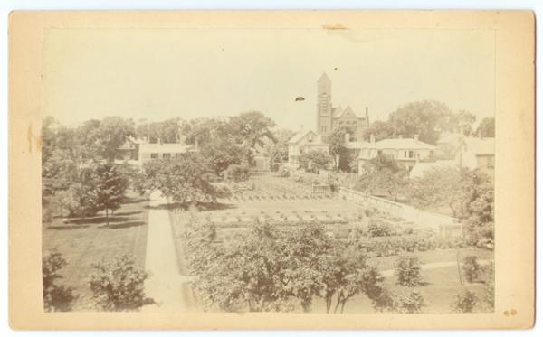
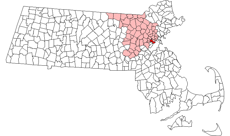
The Avon Hill Historic District is a residential historic district near Porter Square in Cambridge, Massachusetts. Set atop Avon Hill southwest of Porter Square, this subdivision, laid out about 1870, contains a concentration of the finest Victorian and Second Empire residential buildings in the city. The district was listed on the National Register of Historic Places in 1983. Description and history Avon Hill was originally known as Jones Hill, and was used agriculturally from the mid-17th to mid-19th centuries. The five acres at the top of the hill were sold for development in 1869 to Henry Melendez and Gilbert Dexter, two prominent local businessmen. Each built a fine Second Empire house on Washington Street; that of Melendez survives, while Dexter's burned down in 1939. The area was built out by 1890 with architecturally distinguished houses on large landscaped lots, mainly for the owners of local businesses. Four of the houses were designed by the prominent firm of Ha ... [...More Info...] [...Related Items...] OR: [Wikipedia] [Google] [Baidu] |
Cambridge, Massachusetts
Cambridge ( ) is a city in Middlesex County, Massachusetts, United States. As part of the Boston metropolitan area, the cities population of the 2020 U.S. census was 118,403, making it the fourth most populous city in the state, behind Boston, Worcester, and Springfield. It is one of two de jure county seats of Middlesex County, although the county's executive government was abolished in 1997. Situated directly north of Boston, across the Charles River, it was named in honor of the University of Cambridge in England, once also an important center of the Puritan theology embraced by the town's founders. Harvard University, the Massachusetts Institute of Technology (MIT), Lesley University, and Hult International Business School are in Cambridge, as was Radcliffe College before it merged with Harvard. Kendall Square in Cambridge has been called "the most innovative square mile on the planet" owing to the high concentration of successful startups that have emerged in the vicinity ... [...More Info...] [...Related Items...] OR: [Wikipedia] [Google] [Baidu] |
Historic District (United States)
Historic districts in the United States are designated historic districts recognizing a group of buildings, Property, properties, or sites by one of several entities on different levels as historically or architecturally significant. Buildings, structures, objects and sites within a historic district are normally divided into two categories, Contributing property, contributing and non-contributing. Districts vary greatly in size: some have hundreds of structures, while others have just a few. The U.S. federal government designates historic districts through the United States Department of the Interior, United States Department of Interior under the auspices of the National Park Service. Federally designated historic districts are listed on the National Register of Historic Places, but listing usually imposes no restrictions on what property owners may do with a designated property. U.S. state, State-level historic districts may follow similar criteria (no restrictions) or may req ... [...More Info...] [...Related Items...] OR: [Wikipedia] [Google] [Baidu] |
Porter Square
Porter Square is a neighborhood in Cambridge and Somerville, Massachusetts, located around the intersection of Massachusetts Avenue and Somerville Avenue, between Harvard and Davis Squares. The Porter Square station serves both the MBTA Red Line and the Commuter Rail Fitchburg Line. A major part of the Lesley University campus is located within the Porter Square area. In 2004–06 the principal intersection, including the area adjacent to the shopping center, underwent extensive construction both to improve access for vehicles, pedestrians, bicyclists, and mass transit users, and to improve drainage and storm water conditions. The artist Toshihiro Katayama of Harvard University, in conjunction with the landscape architect Cynthia Smith, designed a new visual look for the new circulation design, including contrasting light and dark concrete paving, stone walls and boulders. History Previously called Union Square, Porter Square was renamed in 1899 for the now-vanished Porter's ... [...More Info...] [...Related Items...] OR: [Wikipedia] [Google] [Baidu] |
National Register Of Historic Places
The National Register of Historic Places (NRHP) is the United States federal government's official list of districts, sites, buildings, structures and objects deemed worthy of preservation for their historical significance or "great artistic value". A property listed in the National Register, or located within a National Register Historic District, may qualify for tax incentives derived from the total value of expenses incurred in preserving the property. The passage of the National Historic Preservation Act (NHPA) in 1966 established the National Register and the process for adding properties to it. Of the more than one and a half million properties on the National Register, 95,000 are listed individually. The remainder are contributing resources within historic districts. For most of its history, the National Register has been administered by the National Park Service (NPS), an agency within the U.S. Department of the Interior. Its goals are to help property owners and inte ... [...More Info...] [...Related Items...] OR: [Wikipedia] [Google] [Baidu] |
Hartwell & Richardson
Hartwell and Richardson was a Boston, Massachusetts architectural firm established in 1881, by Henry Walker Hartwell (1833–1919) and William Cummings Richardson (1854–1935). The firm contributed significantly to the current building stock and architecture of the greater Boston area. Many of its buildings are listed on the National Register of Historic Places. History Hartwell was the son of Boston painter Alonzo Hartwell. He did not attend college, and apprenticed with the architects Joseph E. and Hammatt Billings – (Billings & Billings). He opened his own office in 1856, and was one of the founding members of the Boston Society of Architects. He served in Company A of the 44th Regiment Massachusetts Volunteer Infantry during the American Civil War. In the late 1860s, he began a partnership with Albert E. Swasey, Jr. – Hartwell & Swasey – that lasted until 1877. He briefly paired with George Thomas Tilden, before beginning the partnership with Richardson. ... [...More Info...] [...Related Items...] OR: [Wikipedia] [Google] [Baidu] |
Massachusetts Avenue (Boston)
Massachusetts Avenue (colloquially referred to as Mass Ave) is a major thoroughfare in Boston, Massachusetts, and several cities and towns northwest of Boston. According to ''Boston'' magazine, "Its 16 miles of blacktop run from gritty industrial zones to verdant suburbia, passing gentrified brownstones, college campuses and bustling commercial strips." Route The street begins in the Boston neighborhood of Dorchester and runs southeast-northwest through Boston, paralleling Interstate 93 for a short distance. Massachusetts Avenue passes below part of the Boston Medical Center complex near Harrison Street, before passing above routes 9, 2, and the Massachusetts Turnpike (Interstate 90). It crosses the Charles River from the Back Bay neighborhood of Boston into the city of Cambridge via the Harvard Bridge, where passes both U.S. Route 3 and MA-Route 3, it then bisects the campus of the Massachusetts Institute of Technology, passes through Central Square, and curves around two s ... [...More Info...] [...Related Items...] OR: [Wikipedia] [Google] [Baidu] |
National Register Of Historic Places Listings In Cambridge, Massachusetts
This is a list of sites listed on the National Register of Historic Places in Cambridge, Massachusetts. This is intended to be a complete list of the properties and districts on the National Register of Historic Places in Cambridge, Massachusetts, United States. Latitude and longitude coordinates are provided for many National Register properties and districts; these locations may be seen together in an online map. There are 206 properties and districts listed on the National Register in Cambridge, including 18 National Historic Landmarks. Current listings Former listing See also *Blue plaque *List of National Historic Landmarks in Massachusetts *National Register of Historic Places listings in Massachusetts *National Register of Historic Places listings in Middle ... [...More Info...] [...Related Items...] OR: [Wikipedia] [Google] [Baidu] |
Historic Districts In Middlesex County, Massachusetts
History (derived ) is the systematic study and the documentation of the human activity. The time period of event before the invention of writing systems is considered prehistory. "History" is an umbrella term comprising past events as well as the memory, discovery, collection, organization, presentation, and interpretation of these events. Historians seek knowledge of the past using historical sources such as written documents, oral accounts, art and material artifacts, and ecological markers. History is not complete and still has debatable mysteries. History is also an academic discipline which uses narrative to describe, examine, question, and analyze past events, and investigate their patterns of cause and effect. Historians often debate which narrative best explains an event, as well as the significance of different causes and effects. Historians also debate the nature of history as an end in itself, as well as its usefulness to give perspective on the problems of the p ... [...More Info...] [...Related Items...] OR: [Wikipedia] [Google] [Baidu] |
Neighborhoods In Cambridge, Massachusetts
A neighbourhood (British English, Irish English, Australian English and Canadian English) or neighborhood (American English; see spelling differences) is a geographically localised community within a larger city, town, suburb or rural area, sometimes consisting of a single street and the buildings lining it. Neighbourhoods are often social communities with considerable face-to-face interaction among members. Researchers have not agreed on an exact definition, but the following may serve as a starting point: "Neighbourhood is generally defined spatially as a specific geographic area and functionally as a set of social networks. Neighbourhoods, then, are the spatial units in which face-to-face social interactions occur—the personal settings and situations where residents seek to realise common values, socialise youth, and maintain effective social control." Preindustrial cities In the words of the urban scholar Lewis Mumford, "Neighbourhoods, in some annoying, inchoate fashi ... [...More Info...] [...Related Items...] OR: [Wikipedia] [Google] [Baidu] |
National Register Of Historic Places In Cambridge, Massachusetts
This is a list of sites listed on the National Register of Historic Places in Cambridge, Massachusetts. This is intended to be a complete list of the properties and districts on the National Register of Historic Places in Cambridge, Massachusetts, United States. Latitude and longitude coordinates are provided for many National Register properties and districts; these locations may be seen together in an online map. There are 206 properties and districts listed on the National Register in Cambridge, including 18 National Historic Landmarks. Current listings Former listing See also *Blue plaque *List of National Historic Landmarks in Massachusetts *National Register of Historic Places listings in Massachusetts *National Register of Historic Places listings in Middle ... [...More Info...] [...Related Items...] OR: [Wikipedia] [Google] [Baidu] |


.jpg)