|
Atlanta Mixed-income Communities
In 1996, The Atlanta Housing Authority (AHA) created the financial and legal model for mixed-income communities or MICs, that is, communities with both owners and renters of differing income levels, that include public-assisted housing as a component. This model is used by the U.S. Department of Housing and Urban Development's HOPE VI revitalization program. As of 2011, it has resulted in all housing projects having been demolished, with partial replacement by MICs. The first of these, Centennial Place, has been recognized by HUD and the Urban Land Institute. As of 2007, Centennial Place had a math, science and technology-focused elementary school, a YMCA, a branch bank, a child-care facility and retail shops. There were plans to include homeownership units. In 2011, the agency also tore down the Roosevelt House and Palmer House senior-citizen high-rises and relocated residents into other properties. However, the John O. Chiles and Cosby Spear senior citizen high rises remaine ... [...More Info...] [...Related Items...] OR: [Wikipedia] [Google] [Baidu] |
Atlanta Housing Authority
The Atlanta Housing Authority (AHA) is an agency that provides affordable housing for low-income families in Atlanta. Today, the AHA is the largest housing agency in Georgia and one of the largest in the United States, serving approximately 50,000 people. The AHA was founded in 1938, taking over from the Public Works Administration (PWA). Due to the lobbying of Charles Palmer, an Atlantan real estate developer, Atlanta had been the site of the first public housing project in the country in 1936, Techwood Homes. Early public housing projects such as Techwood and its sister project, University Homes, were built for working-class families on the sites of former slums. Charles Palmer became the AHA's first chairperson, and under him and his successors, the agency continued to clear slums and build public housing complexes. The first phase of construction lasted from 1938 to 1941, and was financed with funds from the Wagner-Steagall Act. The second phase was from 1951 to 1956, using ... [...More Info...] [...Related Items...] OR: [Wikipedia] [Google] [Baidu] |
Neighborhood Planning Unit
The neighborhood planning unit (NPU) is a community-scale governmental structure used in the City of Atlanta, Georgia. History The system was established in 1974 by Atlanta's first black mayor, Maynard Holbrook Jackson. His aim was to ensure that citizens, particularly those who had been historically disenfranchised, would be in a position to comment on the structure of their communities, and to ensure that the citizens would not have this ability stripped of them by politicians who found an involved and engaged public inconvenient. Mayor Jackson had the NPU system placed within the City Charter, which can only be changed by the Georgia Legislature. That same section of the Charter also contains the Office of the Mayor as well as the Atlanta City Council. Structure and operations There are 25 NPUs, lettered from A to Z, except U. Each NPU represents the citizens in a specified geographic area. Each NPU meets once a month to review applications for rezoning properties, varying exist ... [...More Info...] [...Related Items...] OR: [Wikipedia] [Google] [Baidu] |
Public Housing In Atlanta
In public relations and communication science, publics are groups of individual people, and the public (a.k.a. the general public) is the totality of such groupings. This is a different concept to the sociological concept of the ''Öffentlichkeit'' or public sphere. The concept of a public has also been defined in political science, psychology, marketing, and advertising. In public relations and communication science, it is one of the more ambiguous concepts in the field. Although it has definitions in the theory of the field that have been formulated from the early 20th century onwards, and suffered more recent years from being blurred, as a result of conflation of the idea of a public with the notions of audience, market segment, community, constituency, and stakeholder. Etymology and definitions The name "public" originates with the Latin '' publicus'' (also '' poplicus''), from '' populus'', to the English word 'populace', and in general denotes some mass population ("the ... [...More Info...] [...Related Items...] OR: [Wikipedia] [Google] [Baidu] |
Old Fourth Ward
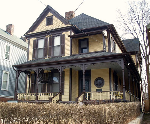
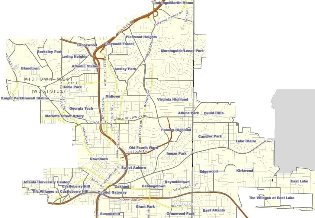
The Old Fourth Ward, often abbreviated O4W, is an intown neighborhood on the eastside of Atlanta, Georgia, United States. The neighborhood is best known as the location of the Martin Luther King Jr. historic site. Geography The Old Fourth Ward's borders: * West: Piedmont Avenue, across which is Downtown Atlanta * East: the BeltLine, across which are Poncey–Highland and Inman Park * North: Ponce de Leon Avenue, across which is Midtown Atlanta * South: MARTA Green Line and Oakland Cemetery, across which are Grant Park and Cabbagetown The exception is the area west of Boulevard and south of Freedom Parkway which, although historically part of Atlanta's Fourth Ward (see Atlanta annexations and wards), is considered a separate recognized neighborhood called Sweet Auburn. The neighborhood can be divided into three areas, with Freedom Parkway and Boulevard serving as dividing lines. Northeast The area north of Freedom Parkway and east of Boulevard is one of the city's mos ... [...More Info...] [...Related Items...] OR: [Wikipedia] [Google] [Baidu] |
Tom Cousins
Tom or TOM may refer to: * Tom (given name), a diminutive of Thomas or Tomás or an independent Aramaic given name (and a list of people with the name) Characters * Tom Anderson, a character in ''Beavis and Butt-Head'' * Tom Beck, a character in the 1998 American science-fiction disaster movie '' Deep Impact'' * Tom Buchanan, the main antagonist from the 1925 novel ''The Great Gatsby'' * Tom Cat, a character from the ''Tom and Jerry'' cartoons * Tom Lucitor, a character from the American animated series '' Star vs. the Forces of Evil'' * Tom Natsworthy, from the science fantasy novel '' Mortal Engines'' * Tom Nook, a character in ''Animal Crossing'' video game series * Tom Servo, a robot character from the ''Mystery Science Theater 3000'' television series * Tom Sloane, a non-adult character from the animated sitcom ''Daria'' * Talking Tom, the protagonist from the ''Talking Tom & Friends'' franchise * Tom, a character from the '' Deltora Quest'' books by Emily Rodda * Tom, a ... [...More Info...] [...Related Items...] OR: [Wikipedia] [Google] [Baidu] |
High Point (Atlanta)
High Point is a neighborhood of Atlanta on the south side of the city, bordered by the BeltLine and the neighborhood of Peoplestown, west of South Atlanta and the Villages at Carver In 1996, The Atlanta Housing Authority (AHA) created the financial and legal model for mixed-income communities or MICs, that is, communities with both owners and renters of differing income levels, that include public-assisted housing as a comp ..., north of Joyland, and east of Capitol View Manor. It is a small planned community containing newly constructed single-family homes, as well as an apartment community designed for senior citizens. External links Neighborhood Planning Unit Y {{Coord, 33.716491, -84.395937, display=title Neighborhoods in Atlanta ... [...More Info...] [...Related Items...] OR: [Wikipedia] [Google] [Baidu] |
Joyland (Atlanta)
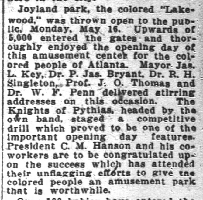
Joyland is a neighborhood of small, single family homes in southeast Atlanta, Georgia and site of a former 1921 amusement park built for African Americans. It is bordered by the Downtown Connector (I-75/I-85) freeway on the west, High Point on the north, Pryor Avenue and The Villages at Carver on the east, and Amal Heights on the south. History On May 16, 1921, Joyland Park, an amusement park for African Americans was opened in the area, according to its ads in the ''Atlanta Independent'' at the time, "the only shady park" where African Americans "could enjoy themselves". At the opening a number of prominent Atlantans spoke: *Mayor James Key * Big Bethel AME Church pastor Rev. Dr. Richard Henry Singleton *Wheat Street Baptist Church pastor Rev. Dr. P. James Bryant * Jessie O. Thomas, founder of the Atlanta University School of Social Work and first director of the Southern Field Division of the National Urban League *Prominent black physician and founding member of the Atlant ... [...More Info...] [...Related Items...] OR: [Wikipedia] [Google] [Baidu] |
South Atlanta
South Atlanta is an officially defined neighborhood of the city of Atlanta within the city's south side. It is bounded on the northeast by the railroad and the Chosewood Park neighborhood; on the northwest by the railroad and the BeltLine and the Peoplestown neighborhood, on the west by High Point and the Villages at Carver, and on the south mostly by Turman Street and the Lakewood Heights neighborhood. History South Atlanta was originally known as Brownsville. Author Ray Stannard Baker in ''The Atlanta Riot'' described it in 1907, in the tone illustrating the presuppositions with which white Americans wrote about African Americans at that time; but nonetheless illustrating the industriousness of Brownsville at the time: When I went out to Brownsville, knowing of its bloody part in the riot, I expected to find a typical negro slum. I looked for squalor, ignorance, vice. And I was surprised to find a large settlement of negroes practically every one of whom owned his own home, so ... [...More Info...] [...Related Items...] OR: [Wikipedia] [Google] [Baidu] |
Neighborhoods Of Atlanta
: The city of Atlanta, Georgia is made up of 243 neighborhoods officially defined by the city. These neighborhoods are a mix of traditional neighborhoods, subdivisions, or groups of subdivisions. The neighborhoods are grouped by the city planning department into 25 neighborhood planning units (NPUs). These NPUs are "citizen advisory councils that make recommendations to the Mayor and City Council on zoning, land use, and other planning issues". There are also a variety of other widely recognized named areas within the city; some are officially designated, while others are more informal. Other areas In addition to the officially designated neighborhoods, many other named areas exist. Several larger areas, consisting of multiple neighborhoods, are not formally defined but commonly used. Most notable are Buckhead, Midtown, and Downtown. However, other smaller examples exist, such as Little Five Points, which encompasses parts of three neighborhoods. Some of these regions may over ... [...More Info...] [...Related Items...] OR: [Wikipedia] [Google] [Baidu] |
Vine City
English Avenue and Vine City are two adjacent and closely linked neighborhoods of Atlanta, Georgia. Together the neighborhoods make up neighborhood planning unit L. The two neighborhoods are frequently cited together in reference to shared problems and to shared redevelopment schemes and revitalization plans."grants to the Vine City and English Avenue communities" i/ref>"The Vine City and English Avenue neighborhoods have voiced their support" iSunset Avenue Historic District English Avenue is bounded by the railroad line and the Marietta Street Artery neighborhood to the northeast, Northside Drive, the North Avenue railyards and downtown Atlanta to the east, Joseph E. Lowery Blvd. (formerly Ashby St.) and the Bankhead neighborhood to the west, and Joseph E. Boone Blvd. (called Simpson St. until 2008) and Vine City to the south. Its population was 3,309 in 2010.2010 U.S. census figures as tabulated bWalkScore/ref> Vine City is bounded by Joseph E. Boone Blvd. (Simpson) ... [...More Info...] [...Related Items...] OR: [Wikipedia] [Google] [Baidu] |
United States Department Of Housing And Urban Development
The United States Department of Housing and Urban Development (HUD) is one of the executive departments of the U.S. federal government. It administers federal housing and urban development laws. It is headed by the Secretary of Housing and Urban Development, who reports directly to the President of the United States and is a member of the president's Cabinet. Although its beginnings were in the House and Home Financing Agency, it was founded as a Cabinet department in 1965, as part of the "Great Society" program of President Lyndon B. Johnson, to develop and execute policies on housing and metropolises. History The idea of a department of Urban Affairs was proposed in a 1957 report to President Dwight D. Eisenhower, led by New York Governor Nelson A. Rockefeller. The idea of a department of Housing and Urban Affairs was taken up by President John F. Kennedy, with Pennsylvania Senator and Kennedy ally Joseph S. Clark Jr. listing it as one of the top seven legislative prioritie ... [...More Info...] [...Related Items...] OR: [Wikipedia] [Google] [Baidu] |
Mechanicsville (Atlanta)
Mechanicsville is a neighborhood of Atlanta, Georgia. It sits just south of downtown Atlanta. The neighborhood is bounded by: * I-20 on the north, across which is Castleberry Hill and Downtown Atlanta * the I-75/I-85 Downtown Connector on the east, across which are Summerhill and Peoplestown * the Southern Railway lines on the southwest, across which is Pittsburgh Mechanicsville is in NPU V. History Mechanicsville is one of the oldest neighborhoods in Atlanta. The neighborhood sprang up in the late 19th century, adjacent to several railroad lines just south of downtown. The name "Mechanicsville" comes from the "mechanics" that worked on the railway lines. It was once a vibrant multiethnic community with working class blacks and middle class whites, and home to several prominent merchant families, including the Rich family, of department store fame. Mechanicsville was established in 1870. The mural in the background displays this information from an artists work. Its decl ... [...More Info...] [...Related Items...] OR: [Wikipedia] [Google] [Baidu] |


