|
Athabasca Country
In fur trade days the term Athabasca Country was used for the fur-producing region around Lake Athabasca. The area was important for two reasons. The cold climate produced some of the densest and thickest beaver fur in North America. The number of furs produced was somewhat greater than its only rival, the Saskatchewan River fur trade. Secondly, the great distance from Montreal and Hudson Bay required the highly developed and efficient transportation system that characterized the Hudson's Bay Company in the nineteenth century.Catton, Ted. (2000) ''The environment and the fur trade experience in Voyageurs National Park, 1730-1870.'' National Park Service. Midwest Region, pp. 8-9. The natural centre of the trade was the Peace-Athabasca Delta at the west end of Lake Athabasca. The lake itself led eastward into relatively poor country. To the north, the Slave River and Mackenzie River led to the Arctic Ocean. To the west, the Peace River (Canada) led to the Rocky Mountains. To ... [...More Info...] [...Related Items...] OR: [Wikipedia] [Google] [Baidu] |
Lake Athabasca
Lake Athabasca (; French: ''lac Athabasca''; from Woods Cree: , "herethere are plants one after another") is located in the north-west corner of Saskatchewan and the north-east corner of Alberta between 58° and 60° N in Canada. The lake is 26% in Alberta and 74% in Saskatchewan. History The name in the Dene language originally referred only to the large delta formed by the confluence of the Athabasca River at the southwest corner of the lake. Prior to 1789, Sir Alexander Mackenzie explored the lake. In 1791, Philip Turnor, cartographer for the Hudson’s Bay Company, wrote in his journal, "low swampy ground on the South side with a few willows growing upon it, from which the Lake in general takes its name Athapison in the Southern Cree tongue which signifies open country such as lakes with willows and grass growing about them". Peter Fidler originally recorded the name for the river in 1790 as ''the Great Arabuska''. By 1801, the name had gained a closer spelling to the ... [...More Info...] [...Related Items...] OR: [Wikipedia] [Google] [Baidu] |
Methye Portage
The Methye Portage or Portage La Loche in northwestern Saskatchewan was one of the most important portages in the old fur trade route across Canada. The portage connected the Mackenzie River basin to rivers that ran east to the Atlantic. It was reached by Peter Pond in 1778 and abandoned in 1883 when steamboats began running on the Athabasca River with links to the railroad. It ranks with Grand Portage as one of the two most important and difficult portages used during the fur trade era. 'Methye' is Cree and 'La Loche' is French for a fish that is called 'burbot' in English. Although 'Methye Portage' is often used the official name since 1957 is Portage La Loche. Both names are used in historical documents, books and journals. Alexander Mackenzie in his book "Voyages from Montreal" used both Portage la Loche and Mithy-Ouinigam Portage (in 1789–1793). History The Methye Portage had been in use by indigenous peoples as a trade route for generations. They introduced it to Pet ... [...More Info...] [...Related Items...] OR: [Wikipedia] [Google] [Baidu] |
Fur Trade
The fur trade is a worldwide industry dealing in the acquisition and sale of animal fur. Since the establishment of a world fur market in the early modern period, furs of boreal, polar and cold temperate mammalian animals have been the most valued. Historically the trade stimulated the exploration and colonization of Siberia, northern North America, and the South Shetland and South Sandwich Islands. Today the importance of the fur trade has diminished; it is based on pelts produced at fur farms and regulated fur-bearer trapping, but has become controversial. Animal rights organizations oppose the fur trade, citing that animals are brutally killed and sometimes skinned alive. Fur has been replaced in some clothing by synthetic imitations, for example, as in ruffs on hoods of parkas. Continental fur trade Russian fur trade Before the European colonization of the Americas, Russia was a major supplier of fur pelts to Western Europe and parts of Asia. Its trade developed in ... [...More Info...] [...Related Items...] OR: [Wikipedia] [Google] [Baidu] |
Lake Winnipeg
Lake Winnipeg (french: Lac Winnipeg, oj, ᐑᓂᐸᑲᒥᐠᓴᑯ˙ᑯᐣ, italics=no, Weenipagamiksaguygun) is a very large, relatively shallow lake in North America, in the Provinces and territories of Canada, province of Manitoba, Canada. Its southern end is about north of the city of Winnipeg. Lake Winnipeg is Canada's sixth-largest freshwater lake and the third-largest freshwater lake contained entirely within Canada, but it is relatively shallow (mean depth of ) excluding a narrow deep channel between the northern and southern basins. It is the eleventh-largest freshwater lake on Earth. The lake's east side has pristine boreal forests and rivers that were in 2018 inscribed as Pimachiowin Aki, a UNESCO World Heritage Site. The lake is from north to south, with remote sandy beaches, large limestone cliffs, and many bat caves in some areas. Manitoba Hydro uses the lake as one of the largest reservoirs in the world. There are many islands, most of them undeveloped. The Sag ... [...More Info...] [...Related Items...] OR: [Wikipedia] [Google] [Baidu] |
Saskatchewan River
The Saskatchewan River (Cree: ''kisiskāciwani-sīpiy'', "swift flowing river") is a major river in Canada. It stretches about from where it is formed by the joining together of the North Saskatchewan and South Saskatchewan Rivers to Lake Winnipeg. It flows roughly eastward across Saskatchewan and Manitoba to empty into Lake Winnipeg. Through its tributaries the North Saskatchewan and South Saskatchewan, its watershed encompasses much of the prairie regions of Canada, stretching westward to the Rocky Mountains in Alberta and north-western Montana in the United States. Including its tributaries, it reaches to its farthest headwaters on the Bow River, a tributary of the South Saskatchewan in Alberta. Description It is formed in central Saskatchewan, approximately east of Prince Albert, by the confluence of its two major branches, the North Saskatchewan and the South Saskatchewan, at the Saskatchewan River Forks. Both source rivers originate from glaciers in the Alberta Ro ... [...More Info...] [...Related Items...] OR: [Wikipedia] [Google] [Baidu] |
Cumberland House, Saskatchewan
Cumberland House is a community in Census Division No. 18 in northeast Saskatchewan, Canada on the Saskatchewan River. It is the oldest settler community in Saskatchewan and has a population of about 2,000 people. Cumberland House Provincial Park, which provides tours of an 1890s powder house built by the Hudson's Bay Company, is located nearby. The community consists of the Northern Village of Cumberland House with a population of 772 and the adjoining Cumberland House Cree Nation with a population of 715. The community is served by the Cumberland House Airport and by Saskatchewan Highway 123. Cumberland House Cree Nation The population of Cumberland House consists of mostly First Nations people, including Cree and Métis. Cumberland House was and is a Cree "n" dialect community, known in Cree as "Waskahikanihk". In March 2013, Cumberland House Cree Nation had a registered population of 1387 with 814 members living on-reserve or crown land and 573 members living off-re ... [...More Info...] [...Related Items...] OR: [Wikipedia] [Google] [Baidu] |
Sturgeon-Weir River
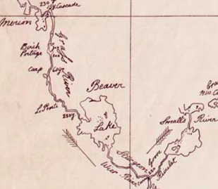
The Sturgeon-Weir River is a river in east-central Saskatchewan, Canada. It flows about south-southeast to join the Saskatchewan River at Cumberland House, Saskatchewan. It was on the main voyageur route from eastern Canada northeast to the Mackenzie River basin. The river is a popular wilderness canoe route in Canada. Description The river's source is Corneille Lake, near the community of Pelican Narrows. It travels southeast, crossing Saskatchewan Highway 106 before reaching Amisk Lake. It then continues southeasterly to Sturgeon Landing and Namew Lake. It runs through the Churchill River Uplands ecoregion which is located along the southern edge of the Precambrian Shield. The area contains continuous coniferous and boreal forest, consisting of closed stands of black spruce and jack pine and a ground cover of mosses and lichens. Local relief rarely exceeds 25 m, but there are ridged steeply sloping rocky uplands and lowlands with exposed bedrock throughout. Wildlife incl ... [...More Info...] [...Related Items...] OR: [Wikipedia] [Google] [Baidu] |
Frog Portage
Frog Portage or Portage du Traite was one of the most important portages on the voyageur route from eastern Canada to the Mackenzie River basin. It allowed boatmen to move from the Saskatchewan River basin to the Churchill River basin. The Churchill then led west to the Mackenzie River basin. The fur trade route ran from Cumberland House, Saskatchewan north up the Sturgeon-Weir River. At its source the 300-yard Frog Portage ran, with a 20-foot drop, to Trade Lake on the Churchill a few miles west of the mouth of Reindeer River. The route then ran at least 250 miles northwest up the Churchill to Methye Portage which led to the Mackenzie basin. For background, see Canadian canoe routes (early). The name is said to come from a dried frog skin that the Cree Nation put up in derision of the Chipewayan's incompetence in preparing beaver skin. The name Traite (trade) comes from Frobisher's coup (see below). Today there are still a plank road and push car. There is a cairn at the Churc ... [...More Info...] [...Related Items...] OR: [Wikipedia] [Google] [Baidu] |
Churchill River (Hudson Bay)
The Churchill River () is a major river in Alberta, Saskatchewan and Manitoba, Canada. From the head of the Churchill Lake it is long. It was named after John Churchill, 1st Duke of Marlborough and governor of the Hudson's Bay Company from 1685 to 1691. The Cree name for the river is ''Missinipi'', meaning "big waters". The Denesuline name for the river is ''des nëdhë́'', meaning "Great River". The river is located entirely within the Canadian Shield. The drainage basin includes a number of lakes in Central-East Alberta which flow into a series of lakes in Saskatchewan and Manitoba. The main tributary, the Beaver River, joins at Lac Île-à-la-Crosse. Nistowiak Falls—the tallest falls in Saskatchewan—are on the Rapid River, which flows north, out of Lac la Ronge into Nistowiak Lake on the Churchill just north of La Ronge. A large amount of flow of the Churchill River after Manitoba–Saskatchewan border comes from the Reindeer River, which flows from Wollaston ... [...More Info...] [...Related Items...] OR: [Wikipedia] [Google] [Baidu] |
Clearwater River (Saskatchewan)
The Clearwater River is located in the Canadian provinces of Saskatchewan and Alberta. It rises in the northern forest region of north-western Saskatchewan and joins the Athabasca River in north-eastern Alberta. It was part of an important trade route during the fur trade era and has been designated as a Canadian Heritage River. Course The Clearwater River has a total length of . It flows south-eastward from its headwaters at Broach Lake and turns to the south-west from Careen Lake to the Alberta / Saskatchewan border. From there it flows westward for a distance of to join the Athabasca River at Fort McMurray. The section of the river in Fort McMurray is affectionately referred to as ''the Chant''. From Broach Lake at an elevation of above sea level, the Clearwater drops about to the confluence at Fort McMurray. Its waters eventually reach the Arctic Ocean via the Athabasca and Mackenzie Rivers. Tributaries of the Clearwater River include Descharme River and McLean River ... [...More Info...] [...Related Items...] OR: [Wikipedia] [Google] [Baidu] |
Saskatchewan River Fur Trade
Saskatchewan River fur trade The Saskatchewan River was one of the two main axes of Canadian expansion west of Lake Winnipeg. The other and more important one was northwest to the Athabasca Country. For background see Canadian canoe routes (early). The main trade route followed the North Saskatchewan River and Saskatchewan River, which were just south of the forested beaver country. The South Saskatchewan River was a prairie river with few furs. Overview The Saskatchewan River was a natural highway for furs going east and trade goods going west. The forests to the north provided beaver pelts. The grassland to the south provided buffalo for food and pemmican to feed to voyageurs in the food-poor country to the north. Pemmican was often more important than beaver. Most was sent downriver to Cumberland House, Saskatchewan, before being sent northward, but from 1790 some was sent via a relatively short overland route to the Green Lake, Saskatchewan and on to the Athabasca Country. ... [...More Info...] [...Related Items...] OR: [Wikipedia] [Google] [Baidu] |
Fort Chipewyan
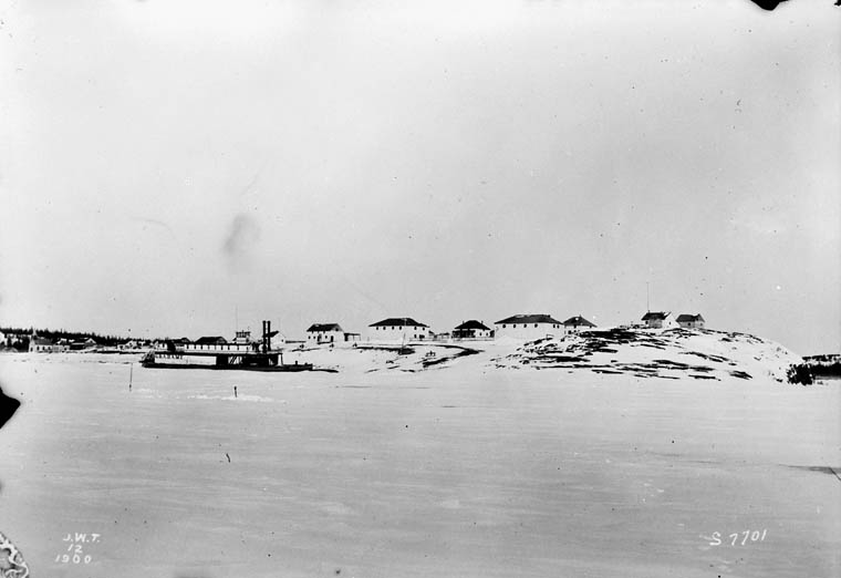
Fort Chipewyan , commonly referred to as Fort Chip, is a hamlet in northern Alberta, Canada, within the Regional Municipality (RM) of Wood Buffalo. It is located on the western tip of Lake Athabasca, adjacent to Wood Buffalo National Park, approximately north of Fort McMurray. History Fort Chipewyan is one of the oldest European settlements in the Province of Alberta. It was established as a trading post by Peter Pond of the North West Company in 1788. The fort was named after the Chipewyan people living in the area. One of the establishers of the fort, Roderick Mackenzie of Terrebonne, always had a taste for literature, as was seen years later when he opened correspondence with traders all over the north and west, asking for descriptions of scenery, adventure, folklore and history. He also had in view the founding of a library at the fort, which would not be only for the immediate residents of Fort Chipewyan, but for traders and clerks of the whole region tributary to Lake At ... [...More Info...] [...Related Items...] OR: [Wikipedia] [Google] [Baidu] |


.jpg)


