|
Ashokan Reservoir
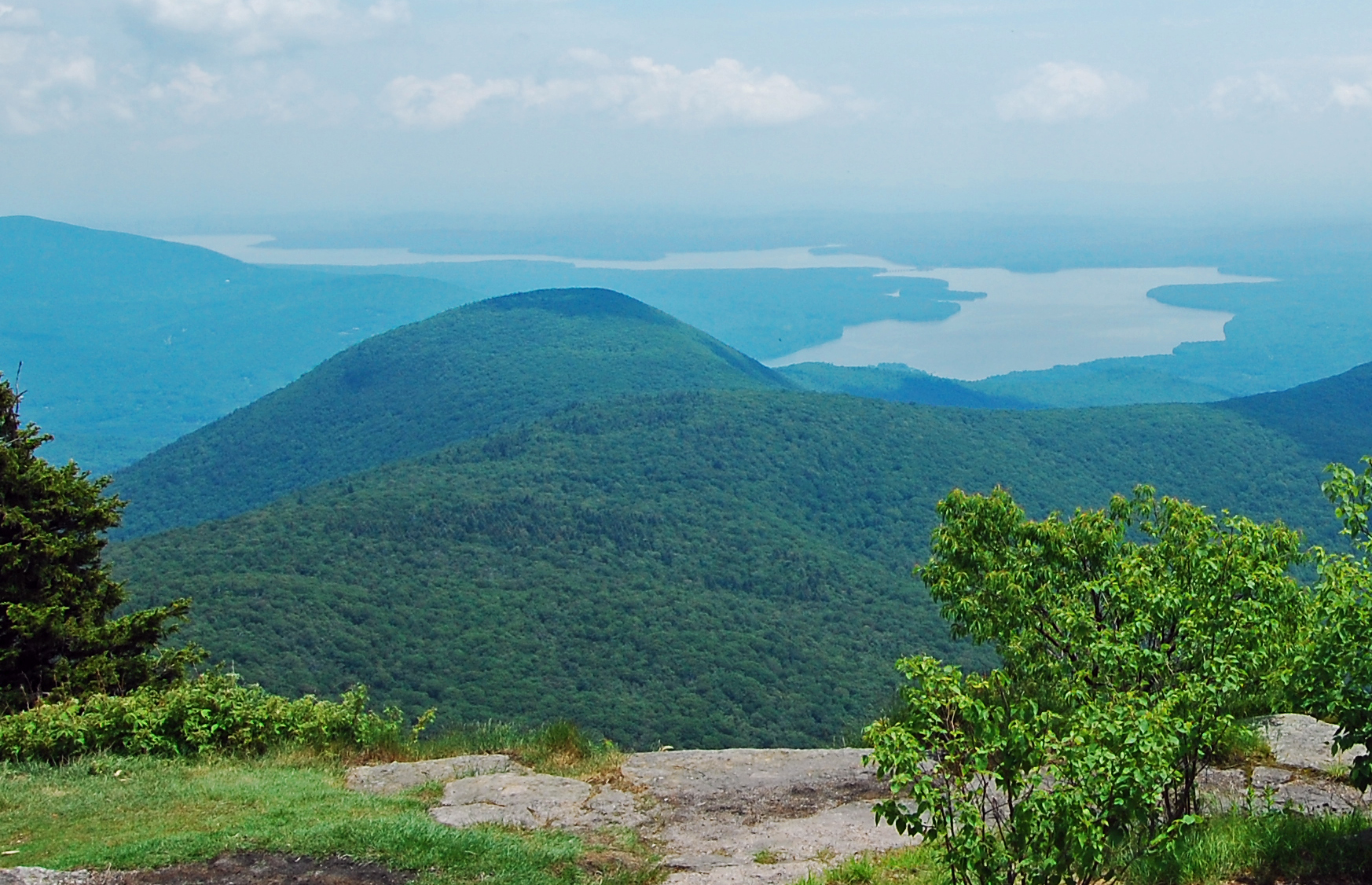
The Ashokan Reservoir (; Iroquoian languages, Iroquois for "place of fish") is a reservoir (water), reservoir in Ulster County, New York. It is at the eastern end of the Catskill Park, and is one of several in the region created to New York City water supply system, provide the City of New York with water. It is the city's deepest reservoir at near the dam at the former site of Bishop Falls. History New York City turned to the Catskills for water in the early 20th century after discovering that a group of speculators calling itself the Ramapo Water Company had bought up Riparian Right, riparian rights to many water sources further south in Rockland County, New York, Rockland, Orange County, New York, Orange and Ulster County, New York, Ulster counties. The Catskills were more desirable, as state-owned Forest Preserve (New York), Forest Preserve land in the region could not, under the state constitution, be sold to any other party. A recent amendment to that section of the state ... [...More Info...] [...Related Items...] OR: [Wikipedia] [Google] [Baidu] |
Ulster County, New York
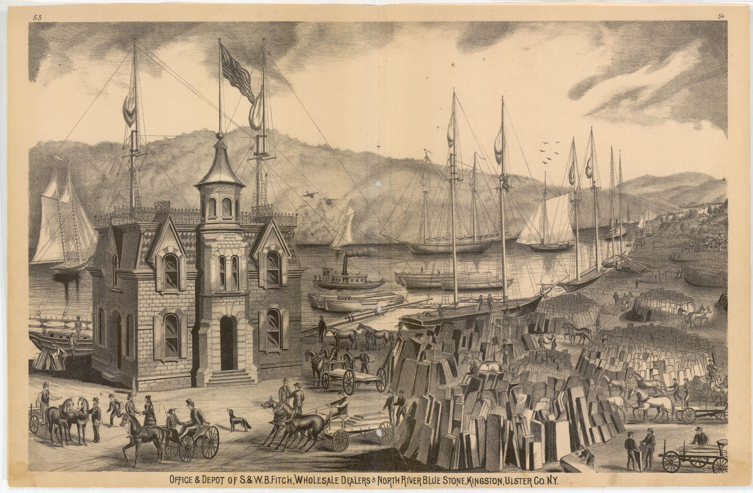
Ulster County is a county in the U.S. state of New York. It is situated along the Hudson River. As of the 2020 census, the population was 181,851. The county seat is Kingston. The county is named after the Irish province of Ulster. History Founding and formation When part of the New Netherland colony, Dutch traders first called the area of present-day Ulster County "Esopus", a name borrowed for convenience from a locality on the opposite side of the Hudson. The local Lenape indigenous people called themselves Waranawanka, but soon came to be known to the Dutch as the "Esopus Indians" because they were encountered around the settlement known as Esopus. In 1652, Thomas Chambers, a freeholder from the Manor of Rensselaerswyck, purchased land at Esopus. He and several others actually settled and began farming by June, 1653. The settlements grew into the village of Wiltwijck, which the English later named Kingston. In 1683, the Duke of York created 12 counties in his province, ... [...More Info...] [...Related Items...] OR: [Wikipedia] [Google] [Baidu] |
Eminent Domain
Eminent domain (United States, Philippines), land acquisition (India, Malaysia, Singapore), compulsory purchase/acquisition (Australia, New Zealand, Ireland, United Kingdom), resumption (Hong Kong, Uganda), resumption/compulsory acquisition (Australia, Barbados, New Zealand, Ireland, United Kingdom), or expropriation (Argentina, Belgium, Brazil, Canada, Chile, Denmark, Finland, France, Germany, Greece, Italy, Mexico, Netherlands, Norway, Panama, Poland, Portugal, Russia, South Africa, Spain, Sweden, Serbia) is the power of a state, provincial, or national government to take private property for public use. It does not include the power to take and transfer ownership of private property from one property owner to another private property owner without a valid public purpose. This power can be legislatively delegated by the state to municipalities, government subdivisions, or even to private persons or corporations, when they are authorized by the legislature to exercise the functi ... [...More Info...] [...Related Items...] OR: [Wikipedia] [Google] [Baidu] |
Kingston, New York
Kingston is a Administrative divisions of New York#City, city in and the county seat of Ulster County, New York, United States. It is north of New York City and south of Albany, New York, Albany. The city's metropolitan area is grouped with the New York metropolitan area around Manhattan by the United States Census Bureau. The population was 24,069 at the 2020 United States Census. Kingston became New York's first capital in 1777. During the American Revolutionary War, the city Burning of Kingston, was burned by the British on October 13, 1777, after the Battles of Saratoga. In the 19th century, it became an important transport hub after the discovery of Rosendale cement, natural cement in the region. It had connections to other markets through both the railroad and canal connections. Many of the older buildings are considered contributing as part of three historic districts, including the Kingston Stockade District, Stockade District uptown, the Midtown Neighborhood Broadway ... [...More Info...] [...Related Items...] OR: [Wikipedia] [Google] [Baidu] |
Ulster County
Ulster County is a county in the U.S. state of New York. It is situated along the Hudson River. As of the 2020 census, the population was 181,851. The county seat is Kingston. The county is named after the Irish province of Ulster. History Founding and formation When part of the New Netherland colony, Dutch traders first called the area of present-day Ulster County "Esopus", a name borrowed for convenience from a locality on the opposite side of the Hudson. The local Lenape indigenous people called themselves Waranawanka, but soon came to be known to the Dutch as the "Esopus Indians" because they were encountered around the settlement known as Esopus. In 1652, Thomas Chambers, a freeholder from the Manor of Rensselaerswyck, purchased land at Esopus. He and several others actually settled and began farming by June, 1653. The settlements grew into the village of Wiltwijck, which the English later named Kingston. In 1683, the Duke of York created 12 counties in his province, ... [...More Info...] [...Related Items...] OR: [Wikipedia] [Google] [Baidu] |
Catskill Mountains
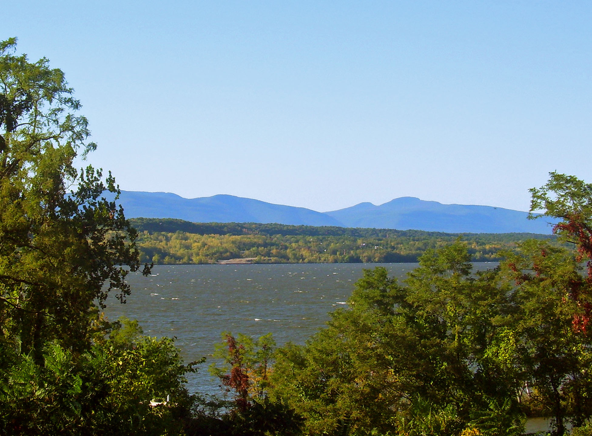
The Catskill Mountains, also known as the Catskills, are a physiographic province of the larger Appalachian Mountains, located in southeastern New York. As a cultural and geographic region, the Catskills are generally defined as those areas close to or within the borders of the Catskill Park, a forest preserve protected from many forms of development under New York state law. Geologically, the Catskills are a mature dissected plateau, a flat region subsequently uplifted and eroded into sharp relief by watercourses. The Catskills form the northeastern end of the Allegheny Plateau (also known as the Appalachian Plateau). The Catskills were named by early Dutch settlers. They are well known in American society as the setting for films and works of art, including many 19th-century Hudson River School paintings, as well as for being a favored destination for vacationers from New York City in the mid-20th century. The region's many large resorts gave many young stand-up comedian ... [...More Info...] [...Related Items...] OR: [Wikipedia] [Google] [Baidu] |
Ashokan Reservoir From Wittenberg 2011
Ashokan may refer to: Places * Ashokan Center, a Catskills outdoor education center and retreat facility * Ashokan Reservoir, part of the New York City watershed People * Ashokan (304–232 BCE), Indian emperor * Ashokan (actor), actor in Malayalam cinema * Ashokan (film director) (1961/62–2022), director in Malayalam cinema * Gayathri Ashokan (born 1957), poster designer for Malayalam films * Harisree Ashokan (born 1964), actor in Malayalam cinema * S. A. Ashokan (fl. 1958–1982), actor in Tamil cinema Other uses * Ashokan Edicts in Delhi * "Ashokan Farewell "Ashokan Farewell" is a piece of music composed by the American folk musician Jay Ungar in 1982. For many years it served as a goodnight or farewell waltz at the annual Ashokan Fiddle & Dance Camps run by Ungar and his wife Molly Mason, who ga ...", a song See also * Ashoka (other) {{disambiguation, hndis, surname ... [...More Info...] [...Related Items...] OR: [Wikipedia] [Google] [Baidu] |
New York State Route 28A
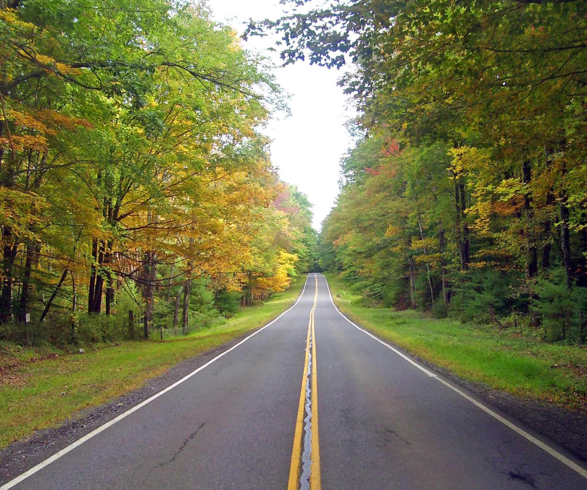
New York State Route 28A (NY 28A) is an east–west state highway in Ulster County, New York, in the United States. It extends for nearly along the south side of Ashokan Reservoir in Catskill Park, serving as a southerly alternate route of NY 28 through the area. Many of the communities along its length, such as West Shokan and Olivebridge, are relocated versions of those condemned for the reservoir's construction. Near Olivebridge, NY 28A intersects NY 213, the only other state route that NY 28A intersects aside from its parent, NY 28. NY 28A was built in the early 20th century during the Ashokan Reservoir's construction. The highway was built and subsequently maintained by New York City as the result of a 1909 court order, which mandated that the city maintain the reservoir perimeter roads in perpetuity. In the 1930 renumbering of state highways in New York, the portion of the southern loop road between Boiceville and Olivebridge beca ... [...More Info...] [...Related Items...] OR: [Wikipedia] [Google] [Baidu] |
New York State Route 28
New York State Route 28 (NY 28) is a state highway extending for in the shape of a "C" between the Hudson Valley city of Kingston and southern Warren County in the U.S. state of New York. Along the way, it intersects several major routes, including Interstate 88 (I-88), U.S. Route 20 (US 20), and the New York State Thruway twice. The southern terminus of NY 28 is at NY 32 in Kingston and the northern terminus is at US 9 in Warrensburg. In Kingston, NY 28 is co-designated as Interstate 587 from its southern terminus at NY 32 to the roundabout linking it to the Thruway (I-87). NY 28 was originally assigned in 1924, to an alignment extending from Colliersville in the south to Utica in the north via Ilion. From Colliersville to Cooperstown, the highway followed its current routing (excluding minor realignments); north of Cooperstown, NY 28 was routed along several state highways that now have other designati ... [...More Info...] [...Related Items...] OR: [Wikipedia] [Google] [Baidu] |
Brown's Station, New York
Brown's Station was a hamlet in the Esopus Valley of southeastern Ulster County, New York, United States. It was submerged by the waters of the Ashokan Reservoir, an artificial lake built between 1906 and 1915 to supply fresh water to New York City. The easternmost hamlet in the town of Olive, Brown's Station was named for Alfred Brown, a prominent local farmer. In the village and its environs, there were farms, boarding houses, shops, and a telegraph office. Two streams flowed through the village: the Esopus Creek and the Beaverkill Creek, which merged, at the downhill end of the village, retaining the name, Esopus Creek. Brown's Station was a popular spot, especially for vacationers from New York City, who would come to swim in the creeks, and to enjoy rafting (using rubber inner tubes), boating, and fishing. The village was served by the Ulster and Delaware Railroad; the railroad depot called Brown's Station, which lent the hamlet its name, was one of the busiest passenge ... [...More Info...] [...Related Items...] OR: [Wikipedia] [Google] [Baidu] |
Olivebridge, New York
Olivebridge is a hamlet in the town of Olive, Ulster County Ulster County is a county in the U.S. state of New York. It is situated along the Hudson River. As of the 2020 census, the population was 181,851. The county seat is Kingston. The county is named after the Irish province of Ulster. History ..., New York, United States, within Catskill Park and the Catskill Mountains. The community's name is sometimes written Olive Bridge, but the United States Board on Geographic Names gives the name as Olivebridge. The Ashokan-Turnwood Covered Bridge was listed on the National Register of Historic Places in 2000. The U.S. post office ZIP code for Olivebridge is 12461 and includes the hamlets of Krumville, New York, Krumville and Samsonville, New York, Samsonville, which no longer have their own post offices. References Hamlets in New York (state) Catskills Hamlets in Ulster County, New York {{UlsterCountyNY-geo-stub ... [...More Info...] [...Related Items...] OR: [Wikipedia] [Google] [Baidu] |
West Hurley, West Shokan, New York
West or Occident is one of the four cardinal directions or points of the compass. It is the opposite direction from east and is the direction in which the Sun sets on the Earth. Etymology The word "west" is a Germanic word passed into some Romance languages (''ouest'' in French, ''oest'' in Catalan, ''ovest'' in Italian, ''oeste'' in Spanish and Portuguese). As in other languages, the word formation stems from the fact that west is the direction of the setting sun in the evening: 'west' derives from the Indo-European root ''*wes'' reduced from ''*wes-pero'' 'evening, night', cognate with Ancient Greek ἕσπερος hesperos 'evening; evening star; western' and Latin vesper 'evening; west'. Examples of the same formation in other languages include Latin occidens 'west' from occidō 'to go down, to set' and Hebrew מַעֲרָב maarav 'west' from עֶרֶב erev 'evening'. Navigation To go west using a compass for navigation (in a place where magnetic north is the same dire ... [...More Info...] [...Related Items...] OR: [Wikipedia] [Google] [Baidu] |
Rosendale Cement
Rosendale cement is a natural hydraulic cement that was produced in and around Rosendale, New York, beginning in 1825. From 1818 to 1970 natural cements were produced in over 70 locations in the United States and Canada. More than half of the 35 million tons of natural cement produced in the United States originated with cement rock mined in Ulster County, New York, in and around the Town of Rosendale in the Hudson River Valley. The Rosendale region of southeastern New York State is widely recognized as the source of the highest quality natural cement in North America. The Rosendale region was also coveted by geologists, such as W. W. Mather, a geologist working for the State of New York, for its unusual exposed bedrock.` Because of its reputation, Rosendale cement was used as both a trade name and as a generic term referring to any natural hydraulic cement in the US. It was used in the construction of many of the United States' most important landmarks, including the Brooklyn Bridg ... [...More Info...] [...Related Items...] OR: [Wikipedia] [Google] [Baidu] |


