|
Arthurs Hill
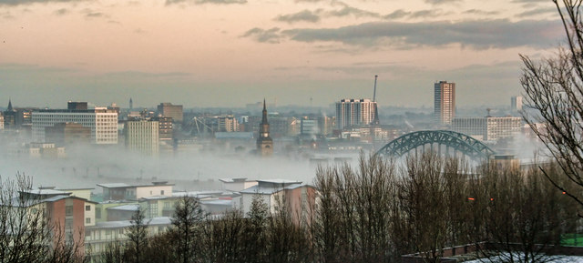
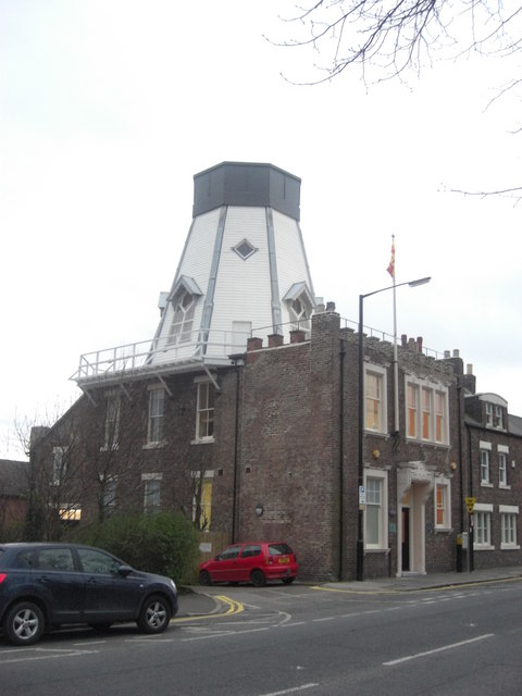
Arthur's Hill is a district of Newcastle upon Tyne. It lies approximately 1 mile west of Newcastle City Centre. It is bordered by Fenham to the west, Elswick to the south, and Spital Tongues to the north west. It gives name to a Newcastle City Council electoral ward with a population of 14,507. The area was part of the Westgate Westgate or West Gate may refer to: Companies * Westgate Resorts, a real estate company and timeshare company * Westgate Department Stores, the department store division of Anglia Regional Co-operative Society in the United Kingdom Events * Westg ... and Wingrove electoral wards up until 2018. As the name suggests, Arthur's Hill is atop a large hill overlooking the city. It was known as Westgate until the 1820s. Isaac Cookson developed an estate opposite Westgate Cemetery in 1826. This was named after his first son Arthur, the origin of the area's current name. Arthur's Hill is a multicultural area which many migrants from South Asia settled in with ... [...More Info...] [...Related Items...] OR: [Wikipedia] [Google] [Baidu] |
Newcastle Upon Tyne
Newcastle upon Tyne ( RP: , ), or simply Newcastle, is a city and metropolitan borough in Tyne and Wear, England. The city is located on the River Tyne's northern bank and forms the largest part of the Tyneside built-up area. Newcastle is also the most populous city of North East England. Newcastle developed around a Roman settlement called Pons Aelius and the settlement later took the name of a castle built in 1080 by William the Conqueror's eldest son, Robert Curthose. Historically, the city’s economy was dependent on its port and in particular, its status as one of the world's largest ship building and repair centres. Today, the city's economy is diverse with major economic output in science, finance, retail, education, tourism, and nightlife. Newcastle is one of the UK Core Cities, as well as part of the Eurocities network. Famous landmarks in Newcastle include the Tyne Bridge; the Swing Bridge; Newcastle Castle; St Thomas’ Church; Grainger Town including G ... [...More Info...] [...Related Items...] OR: [Wikipedia] [Google] [Baidu] |
Tyne And Wear
Tyne and Wear () is a metropolitan county in North East England, situated around the mouths of the rivers Tyne and Wear. It was created in 1974, by the Local Government Act 1972, along with five metropolitan boroughs of Gateshead, Newcastle upon Tyne, Sunderland, North Tyneside and South Tyneside. It is bordered by Northumberland to the north and Durham to the south; the county boundary was formerly split between these counties with the border as the River Tyne. The former county council was based at Sandyford House. There is no longer county level local governance following the county council disbanding in 1986, by the Local Government Act 1985, with the metropolitan boroughs functioning separately. The county still exists as a metropolitan county and ceremonial purposes, as a geographic frame of reference. There are two combined authorities covering parts of the county area, North of Tyne and North East. History In the late 600s and into the 700s Saint Bede lived ... [...More Info...] [...Related Items...] OR: [Wikipedia] [Google] [Baidu] |
Newcastle Upon Tyne Central (UK Parliament Constituency)
Newcastle upon Tyne Central is a constituency represented in the House of Commons of the UK Parliament since 2010 by Chi Onwurah of the Labour Party. As with all constituencies, the constituency elects one Member of Parliament (MP) by the first past the post system of election at least every five years. History Parliament created this seat under the Representation of the People Act 1918 for the general election later that year. It was one of four divisions of the parliamentary borough of Newcastle-upon-Tyne, which had previously been represented by one two-member seat. The constituency currently covers the central part of Newcastle upon Tyne, being one of three constituencies in the city. Between 1983 and 2010, the seat did not actually include the city's commercial centre, being instead part of the now-abolished Tyne Bridge constituency. From its creation, the constituency has been represented by only members of the Labour and Conservative parties. The seat has been repr ... [...More Info...] [...Related Items...] OR: [Wikipedia] [Google] [Baidu] |
0191
0191 is the UK telephone dialling code used by Newcastle, Durham, Sunderland and other nearby areas in the north east of England. Areas covered Numbering in the 0191 area is officially divided into three distinct areas, each with their own batches of local subscriber numbers: In practice, some of the distinction between these areas has been lost due to differing levels of demand in each area and the need to find sufficient blocks of numbers for the many competing telephone companies that now exist. In particular, the original distinction between north Tyneside (2xx xxxx) and south Tyneside (4xx xxxx) has been obscured as the former range reached full capacity and recent allocations north of the Tyne have made use of spare capacity in the 4xx xxxx range. Further anomalies include Durham prefixes such as (0191) 350 being used by Cable & Wireless in Newcastle city centre and (0191) 275 being used by BT in South Shields, an area traditionally (0191) 4XX. New connections with Tal ... [...More Info...] [...Related Items...] OR: [Wikipedia] [Google] [Baidu] |
Newcastle City Centre
Newcastle City Centre is the city centre district of Newcastle upon Tyne, England. It is the historical heart of the city and serves as the main cultural and commercial centre of the North East England region. The city centre forms the core of the Tyneside conurbation. The city centre district is sometimes subdivided into the areas of Haymarket, Quayside, Grainger Town, Monument, Gallowgate, and Chinatown. Areas Haymarket Haymarket is the northern edge of the city centre bordered by Spital Tongues and Jesmond to the north west and north east respectively. It is the location of Newcastle Civic Centre, Newcastle University, Northumbria University, Haymarket bus station and the City Pool, and is mainly a business area. The Church of St Thomas the Martyr is a prominent landmark in the area opposite the Metro station at the northern end of Northumberland Street, the city's main shopping street. Quayside The Quayside is a more modern part of Newcastle city centre known for its ba ... [...More Info...] [...Related Items...] OR: [Wikipedia] [Google] [Baidu] |
Fenham
Fenham is an area of the west-end of Newcastle upon Tyne, England. It lies to the west of the city centre, and is bounded on the north and east by a large area of open land known as the Town Moor. To the south lies Benwell, West Denton lies to the west, Blakelaw and Cowgate to the north, and Arthur's Hill and Spital Tongues to the east. As of 2018, the area covers two wards of Newcastle: Wingrove Ward, and West Fenham Ward. Fenham grew up as a separate township from Newcastle, lying on the western outskirts of the city. Much of the land originally belonged to religious charitable institutions, and there are covenant restrictions on the building of any licensed premises. History Fenham was part of the manor of Elswick in the Barony of Bolam until the lands were passed into the ownership of the Knights Templar in 1185. Following the suppression of the Templars in 1307 the manor of Fenham was transferred to the Knights Hospitaller in 1313. In the intervening years it is rec ... [...More Info...] [...Related Items...] OR: [Wikipedia] [Google] [Baidu] |
Elswick, Tyne And Wear
Elswick ( ) is a district and electoral ward of the city and metropolitan borough of Newcastle upon Tyne, England, 1.9 miles west of the city centre, bordering the River Tyne. Historically in Northumberland, Elswick became part of Newcastle upon Tyne in 1835. Elswick is home to the Newcastle Utilita Arena; and Newcastle College, with approximately 45,000 students. History In Roman times the Vallum, a defensive barrier behind Hadrian's Wall, reached its easternmost limit in Elswick. The Wall itself carried on as far as Wallsend. The township of Elswick had originally formed part of the Barony of Bolam and was owned by Tynemouth Priory from 1120-1539, with a fishery present on the site. One of the earliest references to the coal mining industry of the north east occurs in 1330, when it was recorded that the Prior of Tynemouth let a colliery, called Heygrove, at "Elstewyke" for a rent of £5 per year. Elswick Colliery had 3 pits working from 1860 onwards. Elswick was owned by t ... [...More Info...] [...Related Items...] OR: [Wikipedia] [Google] [Baidu] |
Spital Tongues
Spital Tongues is a district of Newcastle upon Tyne, located due north-west of the Newcastle City Centre. Its unusual name is believed to be derived from ''spital'' – a corruption of the word ''hospital'', commonly found in British place names (e.g. Spitalfields) - and ''tongues'', meaning outlying pieces of land. North of Spital Tongues is Leazes Park and the Town Moor. Buildings and structures of note Fenham Barracks Fenham Barracks was constructed in Spital Tongues in 1806. Several buildings are the site are listed grade II structures. The barracks has been repurposed as student accommodation. The barracks were home to the Northumberland Fusiliers during the second world war. The Queen's Own Yeomanry currently has a presence on the site. BBC Broadcasting Centre Occupying the prominent site on the corner of Hunters Road and Barrack Road, is the BBC Broadcasting Centre, affectionately known as the 'Pink Palace'. Opened in 1986, it brought together the BBC's TV and r ... [...More Info...] [...Related Items...] OR: [Wikipedia] [Google] [Baidu] |
Newcastle City Council
Newcastle City Council is the local government authority for the city and metropolitan borough of Newcastle upon Tyne. The council consists of 78 councillors, three for each of the 26 wards in the city. It is currently controlled by the Labour Party, led by Nick Kemp. Karen Robinson serves as the Lord Mayor and Veronica Dunn serves as Deputy Lord Mayor and Sheriff. The council is a member of the North of Tyne Combined Authority. Political control election, there are 52 Labour councillors, 20 Liberal Democrat councillors, three Newcastle Independent councillors and three Independent councillors. Wards Newcastle has 26 electoral wards. Each electoral ward has three councillors, representing and elected exclusively by the voting population of each ward. Following an electoral review in 2016, the current wards and boundaries were introduced in May 2018. See also * Newcastle Upon Tyne Youth Council *List of Lord Mayors of Newcastle-upon-Tyne This is a list of mayors a ... [...More Info...] [...Related Items...] OR: [Wikipedia] [Google] [Baidu] |
Westgate, Newcastle Upon Tyne
Westgate was an electoral ward of Newcastle upon Tyne in North East England from 2004 to 2018. The population of the ward taken at the 2011 Census was 10,059. It contained the majority of the city centre. Westgate Ward was succeeded by Arthur's Hill Ward and Monument A monument is a type of structure that was explicitly created to commemorate a person or event, or which has become relevant to a social group as a part of their remembrance of historic times or cultural heritage, due to its artistic, his ... Ward. References External links Newcastle Council Ward Info: Westgate Districts of Newcastle upon Tyne Wards of Newcastle upon Tyne {{England-poli-stub ... [...More Info...] [...Related Items...] OR: [Wikipedia] [Google] [Baidu] |
Wingrove, Newcastle Upon Tyne
Wingrove is an electoral ward of Newcastle upon Tyne in North East England, roughly 2 miles west of Newcastle City Centre Newcastle City Centre is the city centre district of Newcastle upon Tyne, England. It is the historical heart of the city and serves as the main cultural and commercial centre of the North East England region. The city centre forms the core o .... The population of the ward as of mid-2018 was 12,773. References External links Newcastle Council Ward Info: Wingrove Districts of Newcastle upon Tyne Wards of Newcastle upon Tyne {{UK-poli-stub ... [...More Info...] [...Related Items...] OR: [Wikipedia] [Google] [Baidu] |


