|
Arrondissements Of The Pas-de-Calais Department
The 7 arrondissements of the Pas-de-Calais department are: # Arrondissement of Arras, (prefecture of the Pas-de-Calais department: Arras) with 357 communes. The population of the arrondissement was 248,929 in 2016. # Arrondissement of Béthune, (subprefecture: Béthune) with 104 communes. The population of the arrondissement was 293,991 in 2016. # Arrondissement of Boulogne-sur-Mer, (subprefecture: Boulogne-sur-Mer) with 74 communes. The population of the arrondissement was 159,748 in 2016. # Arrondissement of Calais, (subprefecture: Calais) with 52 communes. The population of the arrondissement was 158,492 in 2016. # Arrondissement of Lens, (subprefecture: Lens) with 50 communes. The population of the arrondissement was 367,839 in 2016. # Arrondissement of Montreuil, (subprefecture: Montreuil) with 164 communes. The population of the arrondissement was 112,118 in 2016. # Arrondissement of Saint-Omer, (subprefecture: Saint-Omer) with 89 communes. The population of t ... [...More Info...] [...Related Items...] OR: [Wikipedia] [Google] [Baidu] |
Département Pas-de-Calais Arrondissement 2019
In the administrative divisions of France, the department (french: département, ) is one of the three levels of government under the national level ("territorial collectivity, territorial collectivities"), between the regions of France, administrative regions and the communes of France, communes. Ninety-six departments are in metropolitan France, and five are overseas department and region, overseas departments, which are also classified as overseas regions. Departments are further subdivided into 332 arrondissements of France, arrondissements, and these are divided into cantons of France, cantons. The last two levels of government have no autonomy; they are the basis of local organisation of police, fire departments and, sometimes, administration of elections. Each department is administered by an elected body called a departmental council (France), departmental council ( [sing.], [plur.]). From 1800 to April 2015, these were called general councils ( [sing.] [plur.]). Each ... [...More Info...] [...Related Items...] OR: [Wikipedia] [Google] [Baidu] |
Boulogne-sur-Mer
Boulogne-sur-Mer (; pcd, Boulonne-su-Mér; nl, Bonen; la, Gesoriacum or ''Bononia''), often called just Boulogne (, ), is a coastal city in Northern France. It is a sub-prefecture of the department of Pas-de-Calais. Boulogne lies on the Côte d'Opale, a touristic stretch of French coast on the English Channel between Calais and Normandy, and the most visited location in the region after the Lille conurbation. Boulogne is its department's second-largest city after Calais, and the 183rd-largest in France.Téléchargement du fichier d'ensemble des populations légales en 2017 [...More Info...] [...Related Items...] OR: [Wikipedia] [Google] [Baidu] |
Cantons Of The Pas-de-Calais Department
The following is a list of the 39 cantons of the Pas-de-Calais department, in France, following the French canton reorganisation which came into effect in March 2015: * Aire-sur-la-Lys * Arras-1 * Arras-2 * Arras-3 * Auchel * Auxi-le-Château * Avesnes-le-Comte * Avion * Bapaume * Berck * Béthune * Beuvry * Boulogne-sur-Mer-1 * Boulogne-sur-Mer-2 * Brebières * Bruay-la-Buissière * Bully-les-Mines * Calais-1 * Calais-2 * Calais-3 * Carvin * Desvres * Douvrin * Étaples * Fruges * Harnes * Hénin-Beaumont-1 * Hénin-Beaumont-2 * Lens * Liévin * Lillers * Longuenesse * Lumbres * Marck * Nœux-les-Mines * Outreau * Saint-Omer * Saint-Pol-sur-Ternoise * Wingles Wingles () is a commune of the Pas-de-Calais department in the Hauts-de-France region of France. Geography An ex-coalmining area, now a farming and light industrial town, Wingles lies north of Lens, at the junction of the N47, D39 and the D16 ... References {{Cantons of France ... [...More Info...] [...Related Items...] OR: [Wikipedia] [Google] [Baidu] |
Communes Of The Pas-de-Calais Department
The following is a list of the 890 communes of the Pas-de-Calais department of France. The communes cooperate in the following intercommunalities (as of 2020):BANATIC Périmètre des EPCI à fiscalité propre. Accessed 3 July 2020. * * * |
Saint-Omer
Saint-Omer (; vls, Sint-Omaars) is a commune and sub-prefecture of the Pas-de-Calais department in France. It is west-northwest of Lille on the railway to Calais, and is located in the Artois province. The town is named after Saint Audomar, who brought Christianity to the area. The canalised section of the river Aa begins at Saint-Omer, reaching the North Sea at Gravelines in northern France. Below its walls, the Aa connects with the Neufossé Canal, which ends at the river Lys. History Saint-Omer first appeared in the writings during the 7th century under the name of Sithiu (Sithieu or Sitdiu), around the Saint-Bertin abbey founded on the initiative of Audomar, (Odemaars or Omer). Omer, bishop of Thérouanne, in the 7th century established the Abbey of Saint Bertin, from which that of Notre-Dame was an offshoot. Rivalry and dissension, which lasted till the French Revolution, soon sprang up between the two monasteries, becoming especially virulent when in 1559 St Omer ... [...More Info...] [...Related Items...] OR: [Wikipedia] [Google] [Baidu] |
Arrondissement Of Saint-Omer
The arrondissement of Saint-Omer is an arrondissement of France in the Pas-de-Calais department in the Hauts-de-France region. It has 89 communes. Its population is 129,608 (2016), and its area is . Composition The communes of the arrondissement of Saint-Omer, and their INSEE codes, are: # Acquin-Westbécourt (62008) # Affringues (62010) # Aire-sur-la-Lys (62014) # Alquines (62024) # Arques (62040) # Audincthun (62053) # Audrehem (62055) # Avroult (62067) # Bayenghem-lès-Seninghem (62088) # Bayenghem-lès-Éperlecques (62087) # Beaumetz-lès-Aire (62095) # Bellinghem (62471) # Blendecques (62139) # Bléquin (62140) # Boisdinghem (62149) # Bomy (62153) # Bonningues-lès-Ardres (62155) # Bouvelinghem (62169) # Campagne-lès-Wardrecques (62205) # Clairmarais (62225) # Clerques (62228) # Cléty (62229) # Coulomby (62245) # Coyecques (62254) # Delettes (62265) # Dennebrœucq (62267) # Dohem (62271) # Ecques (62288) # Elnes (62292) # Enquin-lez-Guinegatte ( ... [...More Info...] [...Related Items...] OR: [Wikipedia] [Google] [Baidu] |
Montreuil, Pas-de-Calais
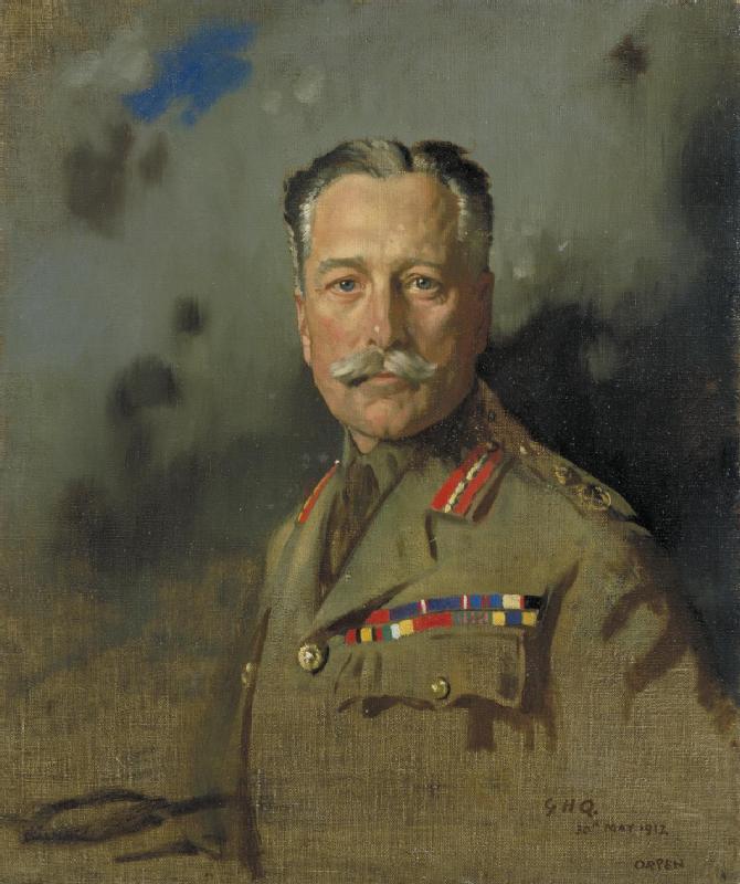
Montreuil (; also nl, Monsterole), also known as Montreuil-sur-Mer (; pcd, Montreu-su-Mér or , literally ''Montreuil on Sea''), is a sub-prefecture in the Pas-de-Calais department, northern France. It is located on the Canche river, not far from Étaples. The sea, however, is now some distance away. Montreuil-sur-Mer station has rail connections to Arras and Étaples. Sights Montreuil is surrounded by notable brickwork ramparts, constructed after the destruction of the town by troops of Habsburg emperor Charles V in June 1537. These fortifications pre-date the extensive fortification of towns in northern France by Sébastien Le Prestre de Vauban in the 17th century. History Montreuil was the headquarters of the British Army in France during the First World War from March 1916 until it closed in April 1919. The military academy there provided excellent facilities for GHQ. Montreuil was chosen as GHQ for a wide variety of reasons. It was on a main road from London to Paris— ... [...More Info...] [...Related Items...] OR: [Wikipedia] [Google] [Baidu] |
Arrondissement Of Montreuil
The arrondissement of Montreuil is an arrondissement of France in the Pas-de-Calais department in the Hauts-de-France region. It has 164 communes. Its population is 112,118 (2016), and its area is . Composition The communes of the arrondissement of Montreuil, and their INSEE codes, are: # Airon-Notre-Dame (62015) # Airon-Saint-Vaast (62016) # Aix-en-Ergny (62017) # Aix-en-Issart (62018) # Alette (62021) # Ambricourt (62026) # Attin (62044) # Aubin-Saint-Vaast (62046) # Auchy-lès-Hesdin(62050) # Avesnes (62062) # Avondance (62066) # Azincourt (62069) # Béalencourt(62090) # Beaumerie-Saint-Martin (62094) # Beaurainville (62100) # Bécourt (62102) # Berck (62108) # Bernieulles (62116) # Beussent (62123) # Beutin (62124) # Bezinghem (62127) # Bimont (62134) # Blangy-sur-Ternoise(62138) # Blingel(62142) # Boisjean (62150) # Boubers-lès-Hesmond (62157) # Bouin-Plumoison (62661) # Bourthes (62168) # Brévillers (62175) # Bréxent-Énocq (62176) # Brimeux (621 ... [...More Info...] [...Related Items...] OR: [Wikipedia] [Google] [Baidu] |
Lens, Pas-de-Calais
Lens (; pcd, Linse) is a city in the Pas-de-Calais department in northern France. It is one of the main towns of Hauts-de-France along with Lille, Valenciennes, Amiens, Roubaix, Tourcoing, Arras and Douai. The inhabitants are called ''Lensois'' (). Metropolitan area Lens belongs to the intercommunality of Lens-Liévin, which consists of 36 communes, with a total population of 242,000. Lens, along with Douai and 65 other communes, forms the agglomeration (''unité urbaine'') of Douai-Lens, whose population as of 2018 was 504,281.Comparateur de territoire INSEE, retrieved 20 June 2022. History Lens was initially a fortification from the Norman invasions. In 1180, it was owned by the |
Arrondissement Of Lens
The arrondissement of Lens is an arrondissement of northern France in the Pas-de-Calais department in the Hauts-de-France region. It has 50 communes. Its population is 367,839 (2016), and its area is . Composition The communes of the arrondissement of Lens, and their INSEE codes, are: # Ablain-Saint-Nazaire (62001) # Acheville (62003) # Aix-Noulette (62019) # Angres (62032) # Annay (62033) # Avion (62065) # Bénifontaine (62107) # Billy-Montigny (62133) # Bois-Bernard (62148) # Bouvigny-Boyeffles (62170) # Bully-les-Mines (62186) # Carency (62213) # Carvin (62215) # Courcelles-lès-Lens (62249) # Courrières (62250) # Dourges (62274) # Drocourt (62277) # Éleu-dit-Leauwette (62291) # Estevelles (62311) # Évin-Malmaison (62321) # Fouquières-lès-Lens (62351) # Givenchy-en-Gohelle (62371) # Gouy-Servins (62380) # Grenay (62386) # Harnes (62413) # Hénin-Beaumont (62427) # Hulluch (62464) # Leforest (62497) # Lens (62498) # Libercourt (62907) # Liévin (62510) # ... [...More Info...] [...Related Items...] OR: [Wikipedia] [Google] [Baidu] |
Calais
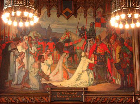
Calais ( , , traditionally , ) is a port city in the Pas-de-Calais department, of which it is a subprefecture. Although Calais is by far the largest city in Pas-de-Calais, the department's prefecture is its third-largest city of Arras. The population of the city proper is 72,929; that of the urban area is 149,673 (2018).Comparateur de territoire: Aire d'attraction des villes 2020 de Calais (073), Commune de Calais (62193) INSEE Calais overlooks the Strait of Dover, the narrowest point in the |
Arrondissement Of Calais
The Arrondissement of Calais is an arrondissement of France in the Pas-de-Calais department in the Hauts-de-France region. It has 52 communes. Its population is 158,492 (2016), and its area is . Composition The communes of the arrondissement of Calais, and their INSEE codes, are: # Alembon (62020) # Andres (62031) # Ardres (62038) # Les Attaques (62043) # Audruicq (62057) # Autingues (62059) # Bainghen (62076) # Balinghem (62078) # Bonningues-lès-Calais (62156) # Bouquehault (62161) # Boursin (62167) # Brêmes (62174) # Caffiers (62191) # Calais (62193) # Campagne-lès-Guines (62203) # Coquelles (62239) # Coulogne (62244) # Escalles (62307) # Fiennes (62334) # Fréthun (62360) # Guemps (62393) # Guînes (62397) # Hames-Boucres (62408) # Hardinghen (62412) # Herbinghen (62432) # Hermelinghen (62439) # Hocquinghen (62455) # Landrethun-lès-Ardres (62488) # Licques (62506) # Louches (62531) # Marck (62548) # Muncq-Nieurlet (62598) # Nielles-lès-Ardres (62 ... [...More Info...] [...Related Items...] OR: [Wikipedia] [Google] [Baidu] |


.jpg)
