|
Arkansas Highway 345 (1969–2020)
Highway 345 (AR 345, Ark. 345, and Hwy. 345) is a former state highway in Gassville, Arkansas. Added to the state highway system access to industrial facilities in 1969, the designation was decommissioned and the streets returned to local maintenance in 2020. It was maintained by the Arkansas Department of Transportation (ArDOT). Route description AR 345 began at US 62/US 412 and ran north as Lakeview Drive for about . The designation then turned east onto Vine Street and terminated at AR 126. History The route was designated along a city street to serve an industrial area on May 28, 1969, initially only running due north as Lakeview Drive. The route was extended east from the Mar-Bax shirt factory along Vine Street to Highway 126 on July 28, 1977. On March 13, 2019, the Arkansas State Highway Commission agreed to repave the street in cooperation with the City of Gassville, who assumed maintenance of the street following construction. Major intersections R ... [...More Info...] [...Related Items...] OR: [Wikipedia] [Google] [Baidu] |
Gassville, Arkansas
Gassville (formerly Mount Pleasant and Turkey's Neck) is a city in Baxter County, Arkansas, United States. According to the 2020 census, the city population was 2,171. Geography Gassville is located at (36.283160, -92.490124). According to the United States Census Bureau, the city has a total area of , all land. Major highways * US 62/US 412 * Arkansas Highway 126 * Arkansas Highway 345 Education Almost all of Gassville is within the Cotter School District, Text listbr> and students attend Cotter High School to graduate from public schooling. A small part is within the Mountain Home School District. Demographics 2020 census As of the 2020 United States census, there were 2,171 people, 942 households, and 627 families residing in the city. 2010 census As of the census of 2010, there were 2,158 people, 688 households, and 502 families residing in the city. The population density was . There were 712 housing units at an average density of . The racial makeup ... [...More Info...] [...Related Items...] OR: [Wikipedia] [Google] [Baidu] |
Baxter County, Arkansas
Baxter County is a County (United States), county in the Ozark Mountains of Arkansas. Created as Arkansas's 66th county on March 24, 1873, the county has eight incorporated municipalities, including Mountain Home, Arkansas, Mountain Home, its largest city and county seat. The county is named for Elisha Baxter, the tenth governor of Arkansas. It is coterminal with the Mountain Home Micropolitan Statistical Area. The county is located in a steep section of the Ozark Mountains sometimes known as the Twin Lakes Area because it is bordered by two of Arkansas's largest lakes, Bull Shoals Lake and Norfork Lake. On its southern border are the White River (Arkansas–Missouri), White River, Norfork Tailwater and the Buffalo National River. Occupying 587 square miles (170,000 ha), the county's population was 41,627 as of the 2020 United States census, 2020 Census, ranking Baxter the 66th largest and 16th most populous of the 75 counties in Arkansas. The county seat is Mountain Home, Arka ... [...More Info...] [...Related Items...] OR: [Wikipedia] [Google] [Baidu] |
List Of Arkansas State Highways
The following is a list of state highways in the U.S. state of Arkansas. The state does not use a numbering convention. Generally, the two-digit odd numbered highways run north–south with a few exceptions; and even-numbered two-digit state highways run east–west with a few exceptions. Arkansas has long had a stigma of poor roads, dating from the "Arkansas Roads Scandal" playing a prominent role in state politics through the 1920s and 1930s, periodic allegations of corruption, waste, and fraud, and a long-running struggle to adequately fund the operation, maintenance and expansion of a large highway system serving a rural state. The state has received the designation of "worst roads in America" from several publications throughout the 1990s and into the 2000s, with Interstate 30 in Arkansas, Interstate 30 and Interstate 40 in Arkansas, Interstate 40 often ranking particularly poorly among truckers. Rankings improved after a large construction project was completed on I-40. A ... [...More Info...] [...Related Items...] OR: [Wikipedia] [Google] [Baidu] |
Arkansas Department Of Transportation
The Arkansas Department of Transportation (ARDOT), formerly the Arkansas Highway and Transportation Department, is a government department in the U.S. state of Arkansas. Its mission is to provide a safe, efficient, aesthetically pleasing and environmentally sound intermodal transportation system for the user. The department is responsible for implementing policy made by the Arkansas State Highway Commission, a board of officials appointed by the Governor of Arkansas to direct transportation policy in the state. The department's director is appointed by the commission to hire staff and manage construction and maintenance on Arkansas's highways. The primary duty of ARDOT is the maintenance and management of the over Arkansas Highway System. The department also conducts planning, public transportation, the State Aid County Road Program, the Arkansas Highway Police, and Federal-Aid Highway Act, Federal-Aid project administration. Its headquarters are in Little Rock, Arkansas, Little ... [...More Info...] [...Related Items...] OR: [Wikipedia] [Google] [Baidu] |
Arkansas Highway 126
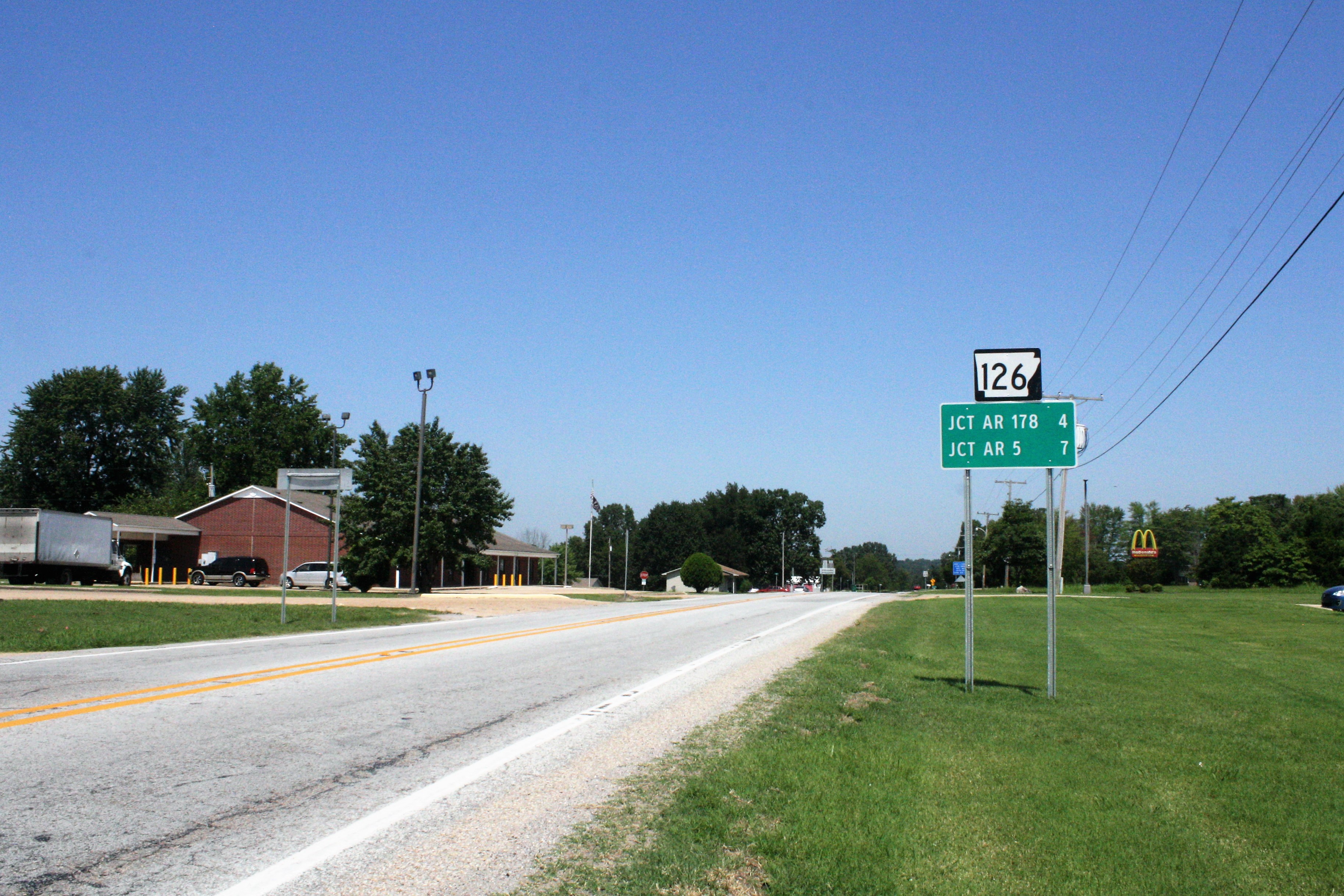
Highway 126 (AR 126, Ark. 126, and Hwy. 126) is a designation for two north–south state highways in Baxter County, Arkansas. A southern route of runs from Buffalo City north to US Route 62/ US Route 412 (US 62/US 412) near Mountain Home. A second route of begins at US 62/US 412 in Gassville and runs north to Highway 5/ Highway 178 at Midway. Route description Buffalo City to Mountain Home Highway 126 begins near the Marion County line at Buffalo City, situated at the confluence of the Buffalo River and White River. It heads north to Buford and before it meets US 62/ US 412, where it terminates near Mountain Home. The average daily traffic counts from the Arkansas State Highway and Transportation Department (AHTD) for 2010 show that a maximum of about 1500 vehicles per day (VPD) use the northern portion of Highway 126 nearest US 62/US 412, with the count dropping to around 660 VPD for ... [...More Info...] [...Related Items...] OR: [Wikipedia] [Google] [Baidu] |
Arkansas State Highway Commission
The Arkansas Department of Transportation (ARDOT), formerly the Arkansas Highway and Transportation Department, is a government department in the U.S. state of Arkansas. Its mission is to provide a safe, efficient, aesthetically pleasing and environmentally sound intermodal transportation system for the user. The department is responsible for implementing policy made by the Arkansas State Highway Commission, a board of officials appointed by the Governor of Arkansas to direct transportation policy in the state. The department's director is appointed by the commission to hire staff and manage construction and maintenance on Arkansas's highways. The primary duty of ARDOT is the maintenance and management of the over Arkansas Highway System. The department also conducts planning, public transportation, the State Aid County Road Program, the Arkansas Highway Police, and Federal-Aid project administration. Its headquarters are in Little Rock. History Central control of highwa ... [...More Info...] [...Related Items...] OR: [Wikipedia] [Google] [Baidu] |
Former State Highways In Arkansas
A former is an object, such as a template, gauge or cutting die, which is used to form something such as a boat's hull. Typically, a former gives shape to a structure that may have complex curvature. A former may become an integral part of the finished structure, as in an aircraft fuselage, or it may be removable, being used in the construction process and then discarded or re-used. Aircraft formers Formers are used in the construction of aircraft fuselage, of which a typical fuselage has a series from the nose cone to the empennage, typically perpendicular to the longitudinal axis of the aircraft. The primary purpose of formers is to establish the shape of the fuselage and reduce the column length of stringers to prevent instability. Formers are typically attached to longerons, which support the skin of the aircraft. The "former-and-longeron" technique (also called stations and stringers) was adopted from boat construction, and was typical of light aircraft built until th ... [...More Info...] [...Related Items...] OR: [Wikipedia] [Google] [Baidu] |
Transportation In Baxter County, Arkansas
Transport (in British English) or transportation (in American English) is the intentional movement of humans, animals, and goods from one location to another. Modes of transport include air, land (rail and road), water, cable, pipelines, and space. The field can be divided into infrastructure, vehicles, and operations. Transport enables human trade, which is essential for the development of civilizations. Transport infrastructure consists of both fixed installations, including roads, railways, airways, waterways, canals, and pipelines, and terminals such as airports, railway stations, bus stations, warehouses, trucking terminals, refueling depots (including fuel docks and fuel stations), and seaports. Terminals may be used both for the interchange of passengers and cargo and for maintenance. Means of transport are any of the different kinds of transport facilities used to carry people or cargo. They may include vehicles, riding animals, and pack animals. Vehicles may include ... [...More Info...] [...Related Items...] OR: [Wikipedia] [Google] [Baidu] |

