|
Arcadia University, Pennsylvania
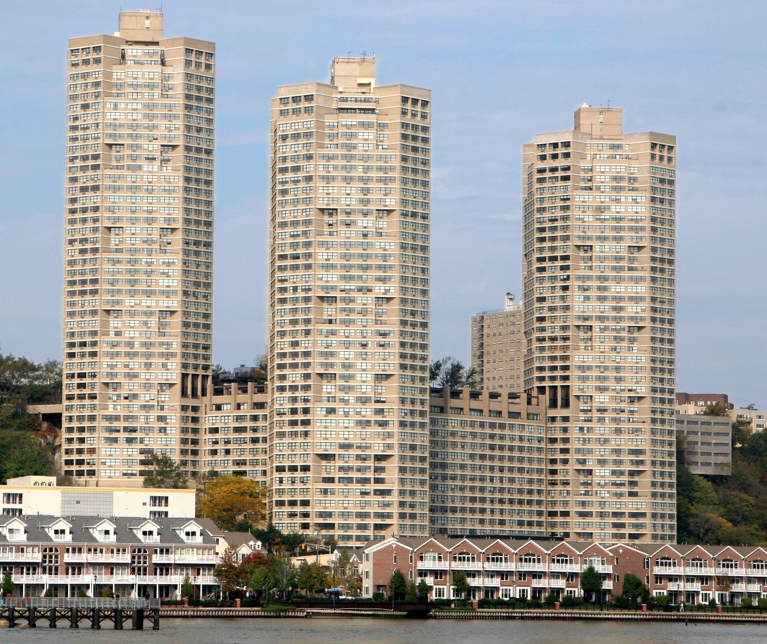
upright=1.1, Knight Hall at Arcardia University upright=1.1, Heinz Hall at Arcardia University Arcadia University is a census-designated place located in Cheltenham Township, Montgomery County, Pennsylvania. It is located just off campus at Arcadia University and off Pennsylvania Route 309. As of the 2010 census the population was 595 residents. With 10,438 people per square mile, Arcadia University is the most densely populated census-designated place in Montgomery County and 33rd most densely populated census-designated place in the U.S. It is one of only two places in Montgomery County that has over 10,000 people per square mile (the other is Conshohocken). This is attributed to the land area consisting mostly of college dormitories. Arcadia University is home to National Historic Landmark Grey Towers Castle Grey Towers Castle is a building on the campus of Arcadia University in Glenside, Pennsylvania which is in Cheltenham Township, a suburb of Philadelphia, Unite ... [...More Info...] [...Related Items...] OR: [Wikipedia] [Google] [Baidu] |
Census-designated Place
A census-designated place (CDP) is a concentration of population defined by the United States Census Bureau for statistical purposes only. CDPs have been used in each decennial census since 1980 as the counterparts of incorporated places, such as self-governing cities, towns, and villages, for the purposes of gathering and correlating statistical data. CDPs are populated areas that generally include one officially designated but currently unincorporated community, for which the CDP is named, plus surrounding inhabited countryside of varying dimensions and, occasionally, other, smaller unincorporated communities as well. CDPs include small rural communities, edge cities, colonias located along the Mexico–United States border, and unincorporated resort and retirement communities and their environs. The boundaries of any CDP may change from decade to decade, and the Census Bureau may de-establish a CDP after a period of study, then re-establish it some decades later. Most unin ... [...More Info...] [...Related Items...] OR: [Wikipedia] [Google] [Baidu] |
Grey Towers Castle
Grey Towers Castle is a building on the campus of Arcadia University in Glenside, Pennsylvania which is in Cheltenham Township, a suburb of Philadelphia, United States. The castle was designed by Horace Trumbauer and built starting in 1893 as the estate of William Welsh Harrison. The university (then known as Beaver College and located in nearby Jenkintown, Pennsylvania, Jenkintown) purchased the estate in 1929 for $712,500, equal to $ today. Classes were split between the two locations until 1962, when the school moved all of its operations to the Glenside area. The castle was designated a National Historic Landmark in 1985 for its architecture. History In 1881, William Welsh Harrison, co-owner of the Franklin Sugar Refinery, purchased Rosedale Hall from J. Thomas Audenreid. By 1891, Harrison had expanded his estate to and decided to expand the house and add a gate house and more adequate stables. He employed the skills of 23-year-old architect Horace Trumbauer, who complete ... [...More Info...] [...Related Items...] OR: [Wikipedia] [Google] [Baidu] |
Conshohocken, Pennsylvania
Conshohocken ( ; Lenape: ''Kanshihàkink'') is a borough on the Schuylkill River in Montgomery County, Pennsylvania in suburban Philadelphia. Historically a large mill town and industrial and manufacturing center, after the decline of industry in recent years Conshohocken has developed into a center of riverfront commercial and residential development.Fact Sheets-CONSHOHOCKEN BOROUGH In the regional slang, it is sometimes referred to by the nickname Conshy ( ). [...More Info...] [...Related Items...] OR: [Wikipedia] [Google] [Baidu] |
List Of United States Cities By Population Density
The following is a list of incorporated places in the United States with a population density of over 10,000 people per square mile. As defined by the United States Census Bureau, an incorporated place is a place that has a self-governing local government and as such has been " incorporated" by the state it is in. Each state has different laws defining how a place can be incorporated. An "incorporated place" as recognized by the U.S. Census Bureau can designate a variety of places, such as a city, town, village, borough, and township. The other type of place defined by the U.S. Census Bureau for statistical purposes are census-designated places. Census-designated places are distinct from incorporated places because they do not have a local government and thus depend on higher government bodies, such as a county, for governance. Census-designated places are defined as being in an unincorporated area. Census-designated places that have a population density of over 10,000 people pe ... [...More Info...] [...Related Items...] OR: [Wikipedia] [Google] [Baidu] |
2010 United States Census
The United States census of 2010 was the twenty-third United States national census. National Census Day, the reference day used for the census, was April 1, 2010. The census was taken via mail-in citizen self-reporting, with enumerators serving to spot-check randomly selected neighborhoods and communities. As part of a drive to increase the count's accuracy, 635,000 temporary enumerators were hired. The population of the United States was counted as 308,745,538, a 9.7% increase from the 2000 census. This was the first census in which all states recorded a population of over half a million people as well as the first in which all 100 largest cities recorded populations of over 200,000. Introduction As required by the United States Constitution, the U.S. census has been conducted every 10 years since 1790. The 2000 U.S. census was the previous census completed. Participation in the U.S. census is required by law of persons living in the United States in Title 13 of the United ... [...More Info...] [...Related Items...] OR: [Wikipedia] [Google] [Baidu] |
Pennsylvania Route 309
Pennsylvania Route 309 (PA 309) is a state highway that runs for 134 miles (216 km) through eastern Pennsylvania. The route runs from an interchange between Pennsylvania Route 611, PA 611 and Cheltenham Avenue on the border of Philadelphia and Cheltenham Township, Montgomery County, Pennsylvania, Cheltenham Township north to an intersection with Pennsylvania Route 29, PA 29 in Bowman Creek, Pennsylvania, Bowman Creek, a village in Monroe Township, Wyoming County, Pennsylvania, Monroe Township in Wyoming County, Pennsylvania, Wyoming County. The highway connects Philadelphia and its northern suburbs to Allentown, Pennsylvania, Allentown and the Lehigh Valley, and Hazleton, Pennsylvania, Hazleton and Wilkes-Barre, Pennsylvania, Wilkes-Barre in the Wyoming Valley. PA 309 heads north from Philadelphia and becomes a freeway called the Fort Washington Expressway through suburban areas in Montgomery County, Pennsylvania, Montgomery County, passing through Fort Washington, Pennsylvan ... [...More Info...] [...Related Items...] OR: [Wikipedia] [Google] [Baidu] |
Arcadia University
Arcadia University is a private university in Glenside, Pennsylvania. The university enrolls approximately 4,000 undergraduate, master's, and doctoral students. The campus features Grey Towers Castle, a National Historic Landmark. History Beaver Female Seminary The school was founded in Beaver, Pennsylvania, in 1853 as Beaver Female Seminary. Beaver College By 1872, it had attained collegiate status, under the auspices of the Methodist Episcopal Church, and was named Beaver College. The school admitted men from 1872 to 1907, then limited enrollment to women until 1972. In 1925, Beaver College moved east to Jenkintown, Pennsylvania, and changed its religious affiliation to Presbyterian Church (USA). In 1928, the school acquired the Harrison estate in Glenside, including Grey Towers Castle, the location of the current campus. The college operated both the Jenkintown and Glenside campuses until 1962, when it consolidated all activities to the Glenside campus. Some significa ... [...More Info...] [...Related Items...] OR: [Wikipedia] [Google] [Baidu] |
Cheltenham Township
Cheltenham Township is a home rule township in Montgomery County, Pennsylvania, United States. Cheltenham's population density ranges from over 10,000 per square mile (25,900 per square kilometer) in rowhouses and high-rise apartments along Cheltenham Avenue to historic neighborhoods in Wyncote and Elkins Park. It is the most densely populated township in Montgomery County. The population was 36,793 at the 2010 U.S. Census, making it the third most populous township in Montgomery County and the 27th most populous municipality in Pennsylvania. It was originally part of Philadelphia County, and it became part of Montgomery County upon that county's creation in 1784. Cheltenham is located five miles from Center City Philadelphia and is surrounded by the North and Northeast sections of Philadelphia, Abington, Jenkintown, and Springfield. The SEPTA Main Line passes through Cheltenham via 5 regional rail stations, some of which are the busiest in the SEPTA system. Cheltenham is serve ... [...More Info...] [...Related Items...] OR: [Wikipedia] [Google] [Baidu] |
Heinz Hall, Arcadia University 01
The H. J. Heinz Company is an American food processing company headquartered at One PPG Place in Pittsburgh, Pennsylvania. The company was founded by Henry J. Heinz in 1869. Heinz manufactures thousands of food products in plants on six continents, and markets these products in more than 200 countries and territories. The company claims to have 150 number-one or number-two brands worldwide. Heinz ranked first in ketchup in the US with a market share in excess of 50%; the Ore-Ida label held 46% of the frozen potato sector in 2003. Since 1896, the company has used its " 57 Varieties" slogan; it was inspired by a sign advertising 21 styles of shoes, and Henry Heinz chose the number 57 even though the company manufactured more than 60 products at the time, because "5" was his lucky number and "7" was his wife's. In February 2013, Heinz agreed to be purchased by Berkshire Hathaway and the Brazilian investment firm 3G Capital for $23billion. On March 25, 2015, Kraft announced its me ... [...More Info...] [...Related Items...] OR: [Wikipedia] [Google] [Baidu] |
Cheltenham Township, Pennsylvania
Cheltenham Township is a Home Rule Municipality (Pennsylvania), home rule township (Pennsylvania), township in Montgomery County, Pennsylvania, United States. Cheltenham's population density ranges from over 10,000 per square mile (25,900 per square kilometer) in rowhouses and high-rise apartments along Cheltenham Avenue to historic neighborhoods in Wyncote, Pennsylvania, Wyncote and Elkins Park, Pennsylvania, Elkins Park. It is the most densely populated township in Montgomery County. The population was 36,793 at the 2010 U.S. Census, making it the Montgomery County, Pennsylvania#Demographics, third most populous township in Montgomery County and the List of municipalities in Pennsylvania, 27th most populous municipality in Pennsylvania. It was originally part of Philadelphia County, Pennsylvania, Philadelphia County, and it became part of Montgomery County upon that county's creation in 1784. Cheltenham is located five miles from Center City, Philadelphia, Center City Philadelphi ... [...More Info...] [...Related Items...] OR: [Wikipedia] [Google] [Baidu] |


