|
Annesley
Annesley is a village and civil parish in the Ashfield district of Nottinghamshire, England, between Hucknall and Kirkby-in-Ashfield. At the 2011 census, it had a population of 1,162 (including Annesley Woodhouse to the west). Annesley Hall is a grade two listed building, once owned by the Chaworth-Musters family, which has connections to the Byron family of nearby Newstead Abbey. Annesley Old Church was mentioned by Lord Byron and D. H. Lawrence. There is also close by the earthworks of Annesley Castle. The Misk Hills lie to the south of the village. Annesley is part of Nottinghamshire's Hidden Valleys area. The parish is grouped with the neighbouring parish of Felley to elect a joint parish council. The old church of Annesley was dedicated to All Saints. It was allowed to become derelict in the 1940s. Features of interest included the east window of the south aisle, the 13th century sedilia and the 17th century royal arms in stucco.Pevsner, N. (1951) ''Nottinghamshire''. ... [...More Info...] [...Related Items...] OR: [Wikipedia] [Google] [Baidu] |
Annesley Hall, Nottinghamshire
Annesley Hall is a Grade II listed country house near Annesley in Nottinghamshire, England and the ancestral home of the Chaworth-Musters family. The 13th-century park, 17th-century terraces and 19th-century pleasure gardens and walled gardens of the hall are Grade II* listed on the Register of Historic Parks and Gardens. History The Hall dates from the mid-13th century and was the home of the Annesley family, passing to the Chaworth family when Alice, heiress to the Manor of Annesley, married George Chaworth, third son of Sir Thomas Chaworth of Wiverton, in the 15th century. The Chaworth family were to possess the estate for the next 350 years. It was significantly enlarged and improved by Patrick Chaworth, 3rd Viscount Chaworth, in the 17th century when damage to his family seat at Wiverton obliged him to move to Annesley. Mary Chaworth, who lived at the Hall, was the boyhood lover of the poet Lord Byron, who lived at nearby Newstead Abbey. Byron's poem " The Dream" concerns ... [...More Info...] [...Related Items...] OR: [Wikipedia] [Google] [Baidu] |
Annesley Old Church
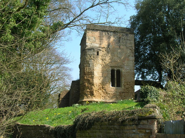
Annesley Old Church or the Church of All Saints, Annesley Park, is a disused church in a ruinous condition which stands on a mound near to Annesley Hall, Nottinghamshire. The building remains are Grade I listed and are surrounded by a graveyard. The site is scheduled as an ancient monument. The church is built in stone and measures approximately by . The standing remains include the roofless west tower, nave, chancel and a large 14th-century lady chapel to the south. The Lady Chapel, known as the "Felley Chantry” after the priory at Felley to whom the patronage once belonged, contained three fine sedilia and a piscina and a large east window with reticulated stone tracery. The surrounding graveyard contains a variety of mainly 17th- and 18th-century grave markers. History The present building, constructed by the Annesley family in 1356, replaced a previous Norman building on the same site. After the Annesley estate had passed by marriage to the Chaworths, Patrick Chaworth, 3r ... [...More Info...] [...Related Items...] OR: [Wikipedia] [Google] [Baidu] |
All Saints' Church, Annesley
All Saints' Church, Annesley is a parish church in the Church of England in Annesley, Nottinghamshire. The church is Grade II* listed by the Department for Digital, Culture, Media and Sport as it is a particularly significant building of more than local interest. History The church was erected in 1874 to a design by the architect Thomas Graham Jackson to replace the old church on the Annesley estate. Until 1942 services were held at both sites. The interior of the church was destroyed by fire in 1907 but was re-opened in 1909. The chief glories of the church are the Norman font and the East window. The church contains the achievement of arms of Patrick Chaworth, 3rd Viscount Chaworth which was moved here from the old church in 1874, as were many other monuments. Parish structure It is in a group of parishes with *All Saints' Church, Annesley * St. Mary the Virgin, Newstead * St. Mary's Church, Newstead Abbey Organ The National Pipe Organ Register The British Ins ... [...More Info...] [...Related Items...] OR: [Wikipedia] [Google] [Baidu] |
Annesley Railway Station
Annesley railway station was a station in Annesley, Nottinghamshire. It was opened in 1874, to serve the mining village of Annesley which had grown following the opening of Annesley colliery in 1865. It was closed in 1953 as part of the post-war cutback, and the line closed to passengers in 1964. The station did not reopen as part of the Robin Hood Line project in the 1990s. History Opened by the Midland Railway, it became part of the London, Midland and Scottish Railway during the Grouping of 1923. The station then passed on to the London Midland Region of British Railways on nationalisation in 1948, closing five years later under the control of the British Railways Board British may refer to: Peoples, culture, and language * British people, nationals or natives of the United Kingdom, British Overseas Territories, and Crown Dependencies. ** Britishness, the British identity and common culture * British English .... Stationmasters *R. Grice 1874 - 1878 *Henry Hard ... [...More Info...] [...Related Items...] OR: [Wikipedia] [Google] [Baidu] |
Annesley Woodhouse
Annesley Woodhouse is a village in Nottinghamshire, England, located approximately 10 miles north of the City of Nottingham and 6 miles south of Mansfield, close to Junction 27 of the M1. With a current population of around 3.500, from the 2011 census being included in the civil parish In England, a civil parish is a type of Parish (administrative division), administrative parish used for Local government in England, local government. It is a territorial designation which is the lowest tier of local government below district ... of Annesley. History Annesley Woodhouse originated as a farming community and expanded in the 19th and 20th centuries as the mining industry locally was established and grew. In the post-war years and beyond, the village has grown rapidly and conjoined with neighbouring villages Nuncargate & Kirkby Woodhouse. All have now become an extension of their 'parent' town, Kirkby-in-Ashfield. Modern Annesley Woodhouse With the demise of the mining in ... [...More Info...] [...Related Items...] OR: [Wikipedia] [Google] [Baidu] |
Hucknall
Hucknall, formerly Hucknall Torkard, is a market town in the Ashfield district of Nottinghamshire, England. It lies 7 miles north of Nottingham, 7 miles south-east of Kirkby-in-Ashfield, 9 miles from Mansfield and 10 miles south of Sutton-in-Ashfield. It is the second largest town in the Ashfield district after Sutton-in-Ashfield. Hucknall is north-west of Nottingham, on the west bank of the Leen Valley, on land which rises from the Trent Valley in the south and extends northwards to Kirkby-in-Ashfield. The Whyburn or Town Brook flows through the town centre. Farleys Brook marks its southern boundary. Due to the mass amount of housing and industrial estates along the southside of the town. Hucknall is contiguous with the wider City of Nottingham with the suburbs of Bulwell and Bestwood Village both to the south and southeast. The town's highest point is Long Hill, at above sea level, with views over the city and Trent Valley, which descends to 22–24 metres (72– ... [...More Info...] [...Related Items...] OR: [Wikipedia] [Google] [Baidu] |
Ashfield, Nottinghamshire
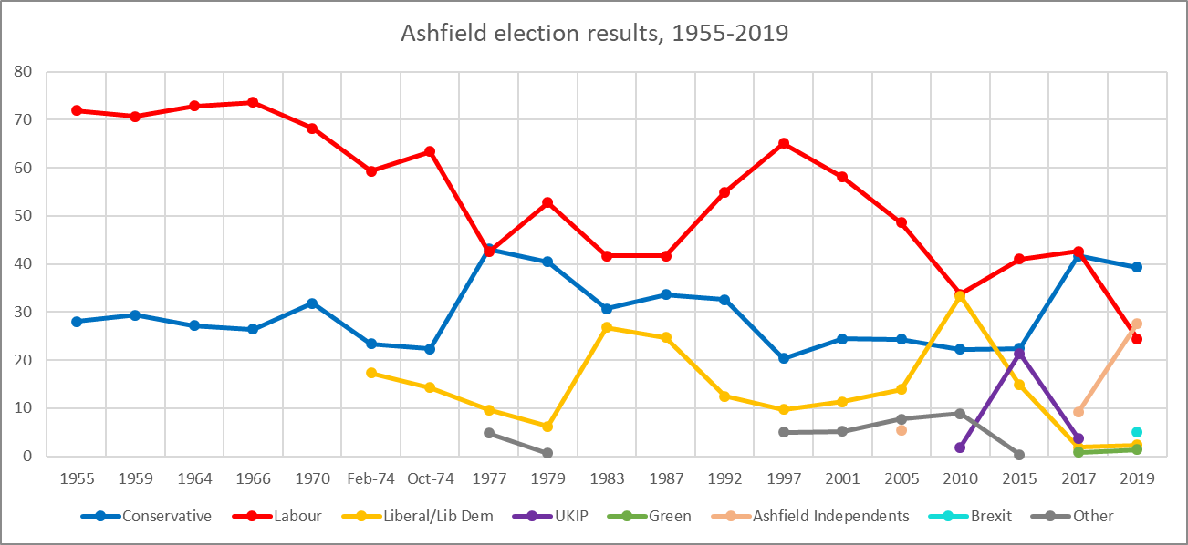
Ashfield () is a local government district in Nottinghamshire, England. The population of Ashfield was 127,200 in 2018. The district is mostly urban and forms part of both the Nottingham and Mansfield Urban Areas. There are three towns in the district; Sutton-in-Ashfield, Kirkby-in-Ashfield and Hucknall. The district was formed on 1 April 1974, under the Local Government Act 1972, by the merger of urban districts of Hucknall, Kirkby-in-Ashfield, Sutton-in-Ashfield and parts of Basford Rural District, namely the parishes of Annesley, Felley and Selston. The largest settlement is Sutton-in-Ashfield. Towns and villages in the district include the following: * Annesley * Annesley Woodhouse * Hucknall * Huthwaite * Jacksdale * Kirkby-in-Ashfield * Selston * Skegby * Sutton-in-Ashfield * Stanton Hill * Teversal * Underwood Politics Elections to the district are held every 4 years, with currently 35 councillors being elected from 23 wards. Since 2018 the cou ... [...More Info...] [...Related Items...] OR: [Wikipedia] [Google] [Baidu] |
Ashfield District
Ashfield () is a local government district in Nottinghamshire, England. The population of Ashfield was 127,200 in 2018. The district is mostly urban and forms part of both the Nottingham and Mansfield Urban Areas. There are three towns in the district; Sutton-in-Ashfield, Kirkby-in-Ashfield and Hucknall. The district was formed on 1 April 1974, under the Local Government Act 1972, by the merger of urban districts of Hucknall, Kirkby-in-Ashfield, Sutton-in-Ashfield and parts of Basford Rural District, namely the parishes of Annesley, Felley and Selston. The largest settlement is Sutton-in-Ashfield. Towns and villages in the district include the following: * Annesley * Annesley Woodhouse * Hucknall * Huthwaite * Jacksdale * Kirkby-in-Ashfield * Selston * Skegby * Sutton-in-Ashfield * Stanton Hill * Teversal * Underwood Politics Elections to the district are held every 4 years, with currently 35 councillors being elected from 23 wards. Since 2018 the council has been le ... [...More Info...] [...Related Items...] OR: [Wikipedia] [Google] [Baidu] |
Kirkby-in-Ashfield
Kirkby-in-Ashfield is a market town in the Ashfield District of Nottinghamshire, England. With a population of 25,265 (according to the 2001 National Census), it is a part of the wider Mansfield Urban Area. The Head Offices of Ashfield District Council are located on Urban Road in the town centre. Overview Kirkby-in-Ashfield lies on the eastern edge of the Erewash Valley which separates Nottinghamshire and Derbyshire. Kirkby, as it is locally known, was originally a Danish settlement (Kirk-by translates as 'Church Town' in Danish) and is a collection of small villages including Old Kirkby, The Folly (East Kirkby), Nuncargate and Kirkby Woodhouse. It is mentioned in the ''Domesday Book'' and has two main churches: St Wilfrid's, a Norman church, which was gutted by fire on 6 January 1907 but quickly re-built; and St Thomas', built in the early 1910s in neo-gothic style. History Kirkby Castle Kirkby Castle is said to have dated back to at least the 13th Century. Its owner ... [...More Info...] [...Related Items...] OR: [Wikipedia] [Google] [Baidu] |
Ashfield (UK Parliament Constituency)
Ashfield is a constituency represented in the House of Commons of the UK Parliament by Lee Anderson of the Conservative Party. The constituency is in the English county of Nottinghamshire, East Midlands; located to the north west of the city of Nottingham in the Erewash Valley along the border with neighbouring county Derbyshire. Ashfield was part of the Red Wall which by and large, voted Conservative in the 2019 general election. In the 2016 referendum on membership of the European Union, Ashfield voted 70% in favour of Brexit. Constituency profile The seat contains the market towns of Kirkby-in-Ashfield, Sutton-in-Ashfield, Huthwaite and Eastwood. Coal mining was formerly a significant part of the economy. Boundaries 1955–1974: The Urban Districts of Eastwood, Kirkby-in-Ashfield, and Sutton-in-Ashfield, and in the Rural District of Basford the parishes of Annesley, Bestwood Park, Brinsley, Felley, Linby, Newstead, Papplewick, and Selston. 1974–1983: The Ur ... [...More Info...] [...Related Items...] OR: [Wikipedia] [Google] [Baidu] |
Felley
Felley is a civil parish in the Ashfield district, in Nottinghamshire, England, located between Hucknall and Sutton-in-Ashfield. According to the 2001 census, the parish had a population of four. At the 2011 Census the population remained minimal. Details are included in the Underwood ward of Ashfield Council. Prior to 1974 it was part of Basford Rural District. The parish is grouped with the neighbouring parish of Annesley (pop 1,096) to elect a joint parish council. History The name "Felley" means 'Wood/clearing with ploughed land'. Throughout its history the hamlet of Felley has been overshadowed by the Augustinian priory, Felley Priory. Therefore, few records of the secular settlement exist. Felley was an extra-parochial area In England and Wales, an extra-parochial area, extra-parochial place or extra-parochial district was a geographically defined area considered to be outside any ecclesiastical or civil parish. Anomalies in the parochial system meant they had no chu ... [...More Info...] [...Related Items...] OR: [Wikipedia] [Google] [Baidu] |


