|
Anggrameos Island
Anggrameos is an island (class T - Hypsographic) in Nabire Regency, part of the Indonesian province of Central Papua Central Papua, officially the Central Papua Province ( id, Provinsi Papua Tengah) is an Indonesian province located in the central region of Western New Guinea. It was formally established on 11 November 2022 from the former eight western regencie .... It lies in Cenderawasih Bay and has a maximum elevation of 139 metres above sea level. It is part of the Teluk Cenderawasih National Park protected area. Anggrameos is also known as Angra Eiland or Angra Meos. Reference Islands of Indonesia {{Indonesia-geo-stub ... [...More Info...] [...Related Items...] OR: [Wikipedia] [Google] [Baidu] |
Nabire Regency
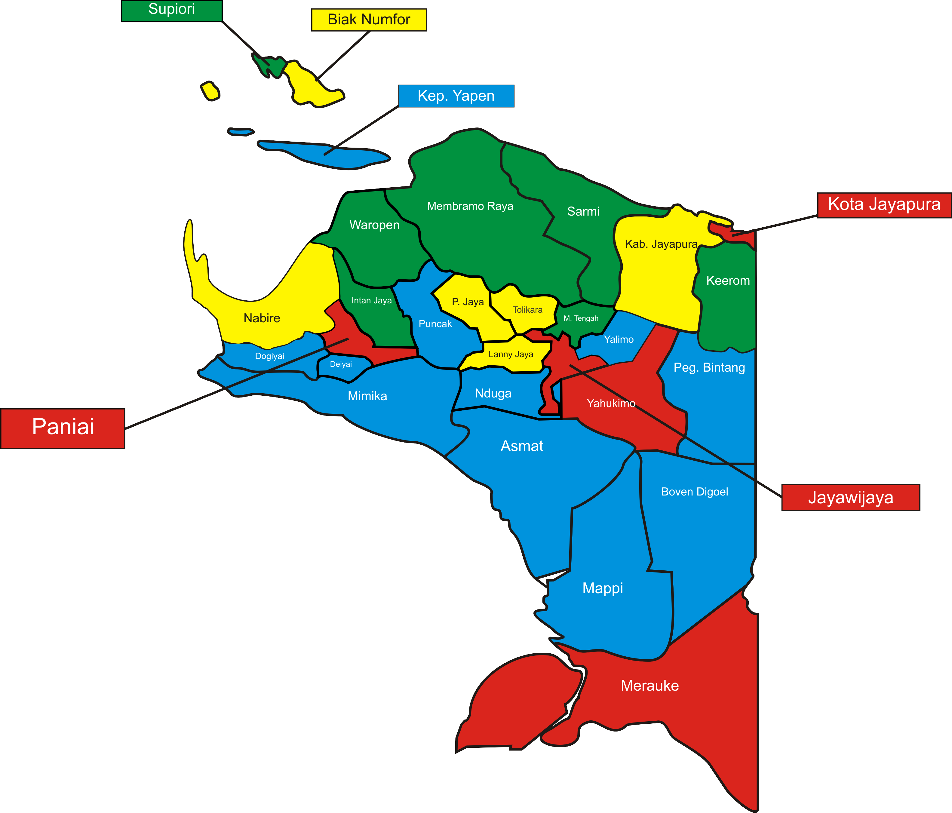
Nabire Regency is one of the regencies (''kabupaten'') in the Indonesian province of Central Papua. It covers an area of 12,010.65 km2, and had a population of 129,893 at the 2010 Census and 169,136 at the 2020 Census, comprising 87,688 males and 81,448 females. The official estimate as at mid 2021 was 170,914. The administrative centre is the town of Nabire, which faces onto Cenderawasih Bay. Administrative Districts In 2010 Nabire Regency comprised fourteen districts A district is a type of administrative division that, in some countries, is managed by the local government. Across the world, areas known as "districts" vary greatly in size, spanning regions or counties, several municipalities, subdivisions o ... (''distrik''), but a fifteenth district - Moora Islands (''Kepulauan Moora'') - has been added since 2010 by the splitting of Napan District. The districts are tabulated below with their areas and their populations at the 2010 Census and the 2020 Census, together with ... [...More Info...] [...Related Items...] OR: [Wikipedia] [Google] [Baidu] |
Central Papua
Central Papua, officially the Central Papua Province ( id, Provinsi Papua Tengah) is an Indonesian province located in the central region of Western New Guinea. It was formally established on 11 November 2022 from the former eight western regencies of the province of Papua. It covers an area of 66,130.49 km2 and had an estimated population of about 1,409,000 in mid 2021. It is bordered by the Indonesian provinces of West Papua to the west, the residual Papua to the north, and by Highland Papua and South Papua to the east. The designated administrative capital, Nabire, is the second largest town in Central Papua (after Timika), the economic centre of the province, and the seat of the Central Papua provincial government. The provincial border roughly follows the cultural region of Mee Pago and parts of Saireri. History After the approval of the bill for the creation of the province on 30 June 2022, controversy regarding the capital of the new province resulted in mass demonstra ... [...More Info...] [...Related Items...] OR: [Wikipedia] [Google] [Baidu] |
Cenderawasih Bay
Cenderawasih Bay ( id, Teluk Cenderawasih, "Bird of Paradise Bay"), also known as Sarera Bay ( id, Teluk Sarera) and formerly Geelvink Bay ( nl, Geelvinkbaai), is a large bay in northern Province of Papua, Central Papua and West Papua, New Guinea, Indonesia. Geography ''Cenderawasih Bay'' is a large bay to the northwest of the Indonesian province of Papua, north of the province of Central Papua, and east of the province of West Papua, between the Bird's Head Peninsula and the mouth of the Mamberamo River. The bay is more than 300 kilometers wide. The coastline from Manokwari, in the northwest of the bay, to Cape d'Urville at the mouth of the Mamberamo is more than 700 kilometers long. To the south, the Wandammen peninsula heads north into the bay. Important places along the coast are Manokwari, Ransiki, Wasior and Nabire. The Wamma River, Tabai River, Warenai River, and Wapoga River empty into the Bay. History The Dutch name of the bay was after the frigate ''De ... [...More Info...] [...Related Items...] OR: [Wikipedia] [Google] [Baidu] |
Teluk Cenderawasih National Park
Teluk Cenderawasih National Park is the largest marine national park of Indonesia, located in Cenderawasih Bay, south-east of Bird's Head Peninsula. It includes the islands of Mioswaar, Nusrowi Island, Roon, Rumberpon, Anggrameos and Yoop.Ministry of Forestry: Teluk Cenderawasih NP , retrieved 11 May 2010 The park protects a rich , with over 150 recorded coral species, for which it is considered a potential . Flora and fauna [...More Info...] [...Related Items...] OR: [Wikipedia] [Google] [Baidu] |


