|
Ambrose Rocks
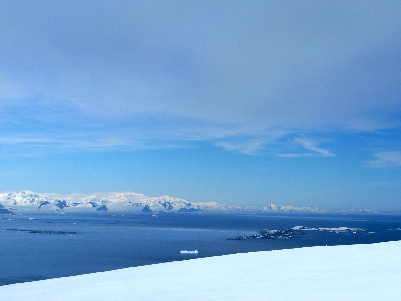
The Ambrose Rocks () are a small cluster of rocks situated southwest of the southern Argentine Islands and northwest of the Gaunt Rocks, off the west coast of Graham Land, Antarctica. They were named by the UK Antarctic Place-Names Committee for David A. Ambrose, a survey assistant of the Hydrographic Survey Unit Hydrographics may refer to: *Hydrography, the measurement of physical characteristics of waters and marginal land *Hydrographics (printing), a printing technique for three-dimensional objects * Hydrographic Department, UK agency for providing hydr ... from HMS ''Endurance'' working in this area in February 1969. References Rock formations of the Wilhelm Archipelago {{WilhelmArchipelago-geo-stub ... [...More Info...] [...Related Items...] OR: [Wikipedia] [Google] [Baidu] |
Argentine Islands
The Argentine Islands are a group of islands in the Wilhelm Archipelago of Antarctica, situated southwest of Petermann Island, and northwest of Cape Tuxen on Kyiv Peninsula in Graham Land. They were discovered by the French Antarctic Expedition, 1903–05, under Jean-Baptiste Charcot, and named by him for the Argentine Republic, in appreciation of that government's support of his expedition. History The British Graham Land Expedition under John Riddoch Rymill was based in the Argentine Islands in 1935 and conducted a thorough survey of them. The expedition built a hut on Winter Island (Antarctica), Winter Island, which was used as their northern base; it was left in place at the end of the expedition, but destroyed circa 1946. The following year, the British Falkland Islands Dependencies Survey established a permanent base on the same site, as "Vernadsky Research Base, Base F" (or "Argentine Islands"); the main building from this base, Wordie House, is now a protected Historic S ... [...More Info...] [...Related Items...] OR: [Wikipedia] [Google] [Baidu] |
Gaunt Rocks
The Gaunt Rocks () are a small group of rocks lying west of the Barros Rocks, in the Wilhelm Archipelago. They were roughly charted by the British Graham Land Expedition under John Rymill, 1934–37, and more accurately positioned by the Falkland Islands Dependencies Survey from photos taken by Hunting Aerosurveys Ltd in 1956–57. The name, given by the UK Antarctic Place-Names Committee in 1959, is descriptive of these desolate, grim-looking rocks. References Rock formations of the Wilhelm Archipelago {{WilhelmArchipelago-geo-stub ... [...More Info...] [...Related Items...] OR: [Wikipedia] [Google] [Baidu] |
Graham Land
Graham Land is the portion of the Antarctic Peninsula that lies north of a line joining Cape Jeremy and Cape Agassiz. This description of Graham Land is consistent with the 1964 agreement between the British Antarctic Place-names Committee and the US Advisory Committee on Antarctic Names, in which the name "Antarctic Peninsula" was approved for the major peninsula of Antarctica, and the names Graham Land and Palmer Land for the northern and southern portions, respectively. The line dividing them is roughly 69 degrees south. Graham Land is named after Sir James R. G. Graham, First Lord of the Admiralty at the time of John Biscoe's exploration of the west side of Graham Land in 1832. It is claimed by Argentina (as part of Argentine Antarctica), Britain (as part of the British Antarctic Territory) and Chile (as part of the Chilean Antarctic Territory). Graham Land is the closest part of Antarctica to South America. Thus it is the usual destination for small ships taking paying ... [...More Info...] [...Related Items...] OR: [Wikipedia] [Google] [Baidu] |
Antarctica
Antarctica () is Earth's southernmost and least-populated continent. Situated almost entirely south of the Antarctic Circle and surrounded by the Southern Ocean, it contains the geographic South Pole. Antarctica is the fifth-largest continent, being about 40% larger than Europe, and has an area of . Most of Antarctica is covered by the Antarctic ice sheet, with an average thickness of . Antarctica is, on average, the coldest, driest, and windiest of the continents, and it has the highest average elevation. It is mainly a polar desert, with annual precipitation of over along the coast and far less inland. About 70% of the world's freshwater reserves are frozen in Antarctica, which, if melted, would raise global sea levels by almost . Antarctica holds the record for the lowest measured temperature on Earth, . The coastal regions can reach temperatures over in summer. Native species of animals include mites, nematodes, penguins, seals and tardigrades. Where vegetation o ... [...More Info...] [...Related Items...] OR: [Wikipedia] [Google] [Baidu] |
UK Antarctic Place-Names Committee
The UK Antarctic Place-Names Committee (or UK-APC) is a United Kingdom government committee, part of the Foreign and Commonwealth Office, responsible for recommending names of geographical locations within the British Antarctic Territory (BAT) and the South Georgia and the South Sandwich Islands (SGSSI). Such names are formally approved by the Commissioners of the BAT and SGSSI respectively, and published in the BAT Gazetteer and the SGSSI Gazetteer maintained by the Committee. The BAT names are also published in the international Composite Gazetteer of Antarctica maintained by Scientific Committee on Antarctic Research, SCAR. The Committee may also consider proposals for new place names for geographical features in areas of Antarctica outside BAT and SGSSI, which are referred to other Antarctic place-naming authorities, or decided by the Committee itself if situated in the unclaimed sector of Antarctica. Names attributed by the committee * Anvil Crag, named for descriptive featu ... [...More Info...] [...Related Items...] OR: [Wikipedia] [Google] [Baidu] |
David A
David (; , "beloved one") (traditional spelling), , ''Dāwūd''; grc-koi, Δαυΐδ, Dauíd; la, Davidus, David; gez , ዳዊት, ''Dawit''; xcl, Դաւիթ, ''Dawitʿ''; cu, Давíдъ, ''Davidŭ''; possibly meaning "beloved one". was, according to the Hebrew Bible, the third king of the United Kingdom of Israel. In the Books of Samuel, he is described as a young shepherd and harpist who gains fame by slaying Goliath, a champion of the Philistines, in southern Canaan. David becomes a favourite of Saul, the first king of Israel; he also forges a notably close friendship with Jonathan, a son of Saul. However, under the paranoia that David is seeking to usurp the throne, Saul attempts to kill David, forcing the latter to go into hiding and effectively operate as a fugitive for several years. After Saul and Jonathan are both killed in battle against the Philistines, a 30-year-old David is anointed king over all of Israel and Judah. Following his rise to power, David ... [...More Info...] [...Related Items...] OR: [Wikipedia] [Google] [Baidu] |
Hydrographic Survey
Hydrographic survey is the science of measurement and description of features which affect maritime navigation, marine construction, dredging, offshore oil exploration/offshore oil drilling and related activities. Strong emphasis is placed on soundings, shorelines, tides, currents, seabed and submerged obstructions that relate to the previously mentioned activities. The term ''hydrography'' is used synonymously to describe ''maritime cartography'', which in the final stages of the hydrographic process uses the raw data collected through hydrographic survey into information usable by the end user. Hydrography is collected under rules which vary depending on the acceptance authority. Traditionally conducted by ships with a sounding line or echo sounding, surveys are increasingly conducted with the aid of aircraft and sophisticated electronic sensor systems in shallow waters. Organizations National and International Maritime Hydrography Hydrographic offices evolved from n ... [...More Info...] [...Related Items...] OR: [Wikipedia] [Google] [Baidu] |
HMS Endurance (1967)
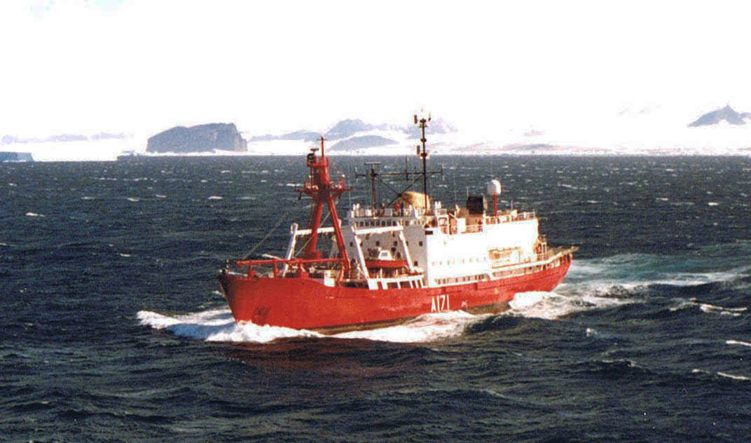
HMS ''Endurance'' was a Royal Navy ice patrol vessel that served from 1967 to 1991. She came to public notice when she was involved in the Falklands War of 1982. The final surrender of the war, in the South Sandwich Islands, took place aboard ''Endurance''. Background Kröger-Werft of Germany built her in 1956 as ''Anita Dan'' for Lauritzen Lines. The UK government bought her in 1967 and had Harland & Wolff convert her. She was commissioned into the Royal Navy as HMS ''Endurance'', named after the sailing ship ''Endurance'' that took the explorer Ernest Shackleton's expedition to the Antarctic in 1914. Operational history 1967–1982 The new ''Endurance'' maintained a UK presence in Antarctica and the Falkland Islands during the southern summer. She also supported the British Antarctic Survey. She had a bright red hull, as is common for polar vessels to aid visibility but otherwise uncommon for the Royal Navy, so her crew nicknamed her ''The Red Plum''. In February 1972 when the ... [...More Info...] [...Related Items...] OR: [Wikipedia] [Google] [Baidu] |


