|
Ambergate, Nottingham, Boston And Eastern Junction Railway
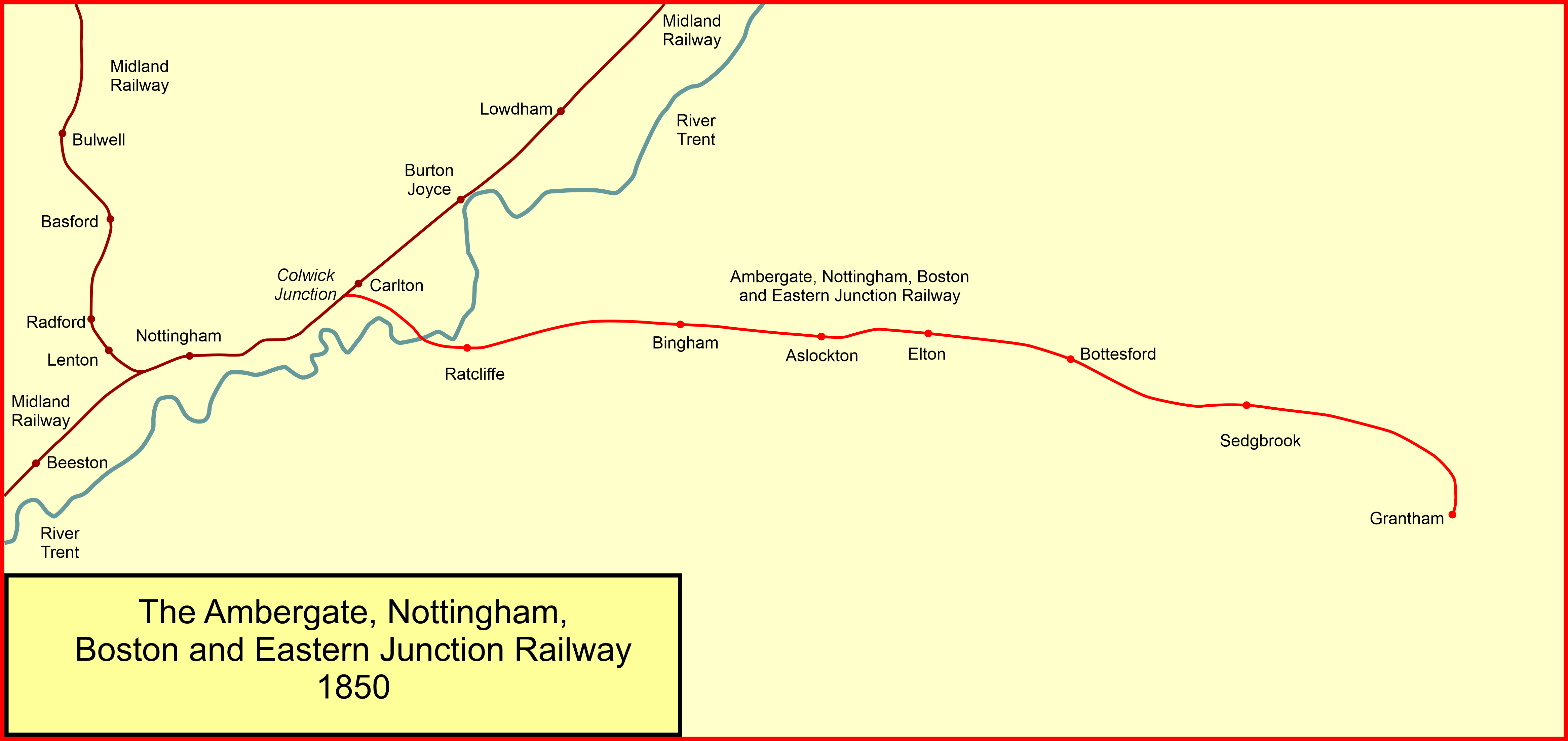
The Ambergate, Nottingham and Boston and Eastern Junction Railway was a British railway company, which hoped to connect Lancashire with the port of Boston, in Lincolnshire. It was authorised in 1846 but was unable to raise much money. It opened a standard gauge line from a junction near Nottingham to Grantham in 1853. At Nottingham it was to rely on the Midland Railway, but that company was hostile and obstructive. The Ambergate company was leased to the Great Northern Railway in 1855, and they built their own Nottingham station, opened in 1857. In 1860 the company changed its name to the Nottingham and Grantham Railway and Canal Company. In 1875 the Great Northern Railway opened a line into Derbyshire and the former Nottingham to Grantham line became an important trunk route, particularly for goods and mineral traffic. The original line from Colwick to Grantham is still in use as the Nottingham–Grantham line. The freight traffic has greatly diminished, but the line is used ... [...More Info...] [...Related Items...] OR: [Wikipedia] [Google] [Baidu] |
Lancashire
Lancashire ( , ; abbreviated Lancs) is the name of a Historic counties of England, historic county, Ceremonial County, ceremonial county, and non-metropolitan county in North West England. The boundaries of these three areas differ significantly. The non-metropolitan county of Lancashire was created by the Local Government Act 1972. It is administered by Lancashire County Council, based in Preston, Lancashire, Preston, and twelve district councils. Although Lancaster, Lancashire, Lancaster is still considered the county town, Preston is the administrative centre of the non-metropolitan county. The ceremonial county has the same boundaries except that it also includes Blackpool and Blackburn with Darwen, which are unitary authorities. The historic county of Lancashire is larger and includes the cities of Manchester and Liverpool as well as the Furness and Cartmel peninsulas, but excludes Bowland area of the West Riding of Yorkshire transferred to the non-metropolitan county ... [...More Info...] [...Related Items...] OR: [Wikipedia] [Google] [Baidu] |
Cheadle Hulme
Cheadle Hulme () is a suburb in the Metropolitan Borough of Stockport, Greater Manchester, England,. Historically in Cheshire, it is south-west of Stockport and south-east of Manchester. It lies in the Ladybrook Valley, on the Cheshire Plain, and the drift consists mostly of boulder clay, sands and gravels. In 2011, it had a population of 26,479. Evidence of Bronze Age, Roman and Anglo-Saxon activity, including coins, jewellery and axes, have been discovered locally. The area was first mentioned in the Domesday Book of 1086 when it was a large estate which included neighbouring Cheadle. In the early 14th century, it was split into southern and northern parts at about the future locations of Cheadle Hulme and Cheadle respectively. The area was acquired by the Moseley family in the 17th century and became known as Cheadle Moseley. Unlike many English villages, it did not grow around a church; instead it formed from several hamlets, many of which retain their names as neighb ... [...More Info...] [...Related Items...] OR: [Wikipedia] [Google] [Baidu] |
Lincolnshire Archives
Lincolnshire Archives is the county record office of Lincolnshire, England. It was established as a county service in 1948 by the Lincolnshire Archives Committee, which had been formally constituted on 24 October 1947 with Sir Robert Pattinson as chairman. ''The Times'', surveying the trend towards County Record Offices at the end of 1948, reported Lincolnshire as a "notable recent development": "the three county councils of the shire, the Diocese of Lincoln, the Dean and Chapter, and the city council are combining to convert the austerely beautiful building, the old gaol at Lincoln, into a joint record office for all six." The first County Archivist, Joan Varley, delivered her first annual report in spring 1949. Assistant archivist from 1948 to 1958 was Dorothy Owen; she was succeeded as Varley's deputy by Mary Finch, who would herself become County Archivist in 1982. The service is now part of the Culture department of Lincolnshire County Council Lincolnshire (abbreviate ... [...More Info...] [...Related Items...] OR: [Wikipedia] [Google] [Baidu] |
Colwick
Colwick ( ) is a village, civil parish, and suburb of the city of Nottingham, in the English ceremonial county of Nottinghamshire. It is situated to the east of Nottingham's city boundary, and forms the Colwick ward within the local government district of Gedling. At the time of the 2011 census, the village had a population of 2,829. History The village is recorded in the Domesday Book of 1086, since when the De-Colwick, Musters and Byron families have all owned the village. The etymology of the place-name is from Old English ''wic'' "specialised industrial farm" with an uncertain first element, possibly ''col'' "coal", although there have never been coal mines in the area. In 1844 there was a gruesome murder at 'Saville's Spinney', then part of Colwick Park and later part of Colwick Woods. William Saville murdered his wife and three children in the woods on Tuesday 21 May. Their bodies were found one day later by John Swinscoe of Carlton who fetched the parish constable ... [...More Info...] [...Related Items...] OR: [Wikipedia] [Google] [Baidu] |
Bulwell
Bulwell is a market town in the City of Nottingham, in Nottinghamshire, England. It is south-west of Hucknall and to the north-west of Nottingham. The United Kingdom Census 2011 recorded the population of Bulwell at 29,771 which amounted to over 10 per cent of Nottingham city's population. The 2011 census gave a population of 16,157 for the Bulwell ward of Nottingham City Council. There is an adjacent ward, Bulwell Forest, which includes Highbury Vale, Rise Park and the west of Top Valley), its population at the same census being 13,614. History Early settlers The earliest documented settlements in Bulwell appeared around 800 AD, and were most likely built around the same time as the first local bridge across the River Leen. The river was significantly narrower, shallower and slower-moving in Bulwell than in other potential locations along its length, and the threat of highwaymen was a danger on existing cross-country routes; thus a toll bridge was constructed at Bulwell, t ... [...More Info...] [...Related Items...] OR: [Wikipedia] [Google] [Baidu] |
Lincoln, England
Lincoln () is a cathedral city, a non-metropolitan district, and the county town of Lincolnshire, England. In the 2021 Census, the Lincoln district had a population of 103,813. The 2011 census gave the urban area of Lincoln, including North Hykeham and Waddington, a population of 115,000. Roman '' Lindum Colonia'' developed from an Iron Age settlement on the River Witham. Landmarks include Lincoln Cathedral (English Gothic architecture; for over 200 years the world's tallest building) and the 11th-century Norman Lincoln Castle. The city hosts the University of Lincoln, Bishop Grosseteste University, Lincoln City FC and Lincoln United FC. Lincoln is the largest settlement in Lincolnshire, with the towns of Grimsby second largest and Scunthorpe third. History Earliest history: ''Lincoln'' The earliest origins of Lincoln can be traced to remains of an Iron Age settlement of round wooden dwellings, discovered by archaeologists in 1972, which have been dated to the first ... [...More Info...] [...Related Items...] OR: [Wikipedia] [Google] [Baidu] |
Nottingham Railway Station
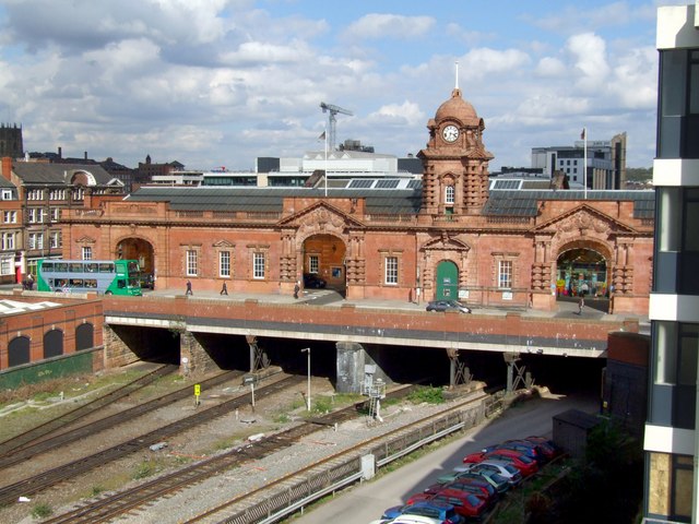
Nottingham station, briefly known as Nottingham City and for rather longer as Nottingham Midland, is a railway station and tram stop in the city of Nottingham. It is the principal railway station of Nottingham. It is also a nodal point on the city's tram system, with a tram stop that was originally called Station Street but is now known as Nottingham Station. The station was first built by the Midland Railway (MR) in 1848 and rebuilt by the same company in 1904, with much of the current building dating from the later date. It is now owned by Network Rail and managed by East Midlands Railway (EMR). Besides EMR trains, it is also served by CrossCountry and Northern trains and by Nottingham Express Transit (NET) trams. The station was one of several that once served the city of Nottingham. Amongst these were the city centre stations of on the Great Central Railway, and on the Great Northern Railway; both of these stations are now closed. A number of minor stations served loc ... [...More Info...] [...Related Items...] OR: [Wikipedia] [Google] [Baidu] |
Midland Counties Railway
The Midland Counties' Railway (MCR) was a railway company in the United Kingdom which existed between 1839 and 1844, connecting Nottingham, Leicester and Derby with Rugby, Warwickshire, Rugby and thence, via the London and Birmingham Railway, to London. The MCR system connected with the North Midland Railway and the Birmingham and Derby Junction Railway in Derby at what become known as the Derby Midland railway station#History, Tri Junct Station. The three later merged to become the Midland Railway. Origin The East Midlands had for some years been at centre of Derby Midland railway station#Early East Midlands railway schemes, plans to link the major cities throughout the country. However, the MCR came about as a result of competition to supply coal to Leicester, a town which was rapidly industrialising and was a valuable market for coal. The competition was between the Coalville area of Leicestershire, and the Erewash Valley area of Nottinghamshire. For many years, the Notti ... [...More Info...] [...Related Items...] OR: [Wikipedia] [Google] [Baidu] |
East Extension
East or Orient is one of the four cardinal directions or points of the compass. It is the opposite direction from west and is the direction from which the Sun rises on the Earth. Etymology As in other languages, the word is formed from the fact that east is the direction where the Sun rises: ''east'' comes from Middle English ''est'', from Old English ''ēast'', which itself comes from the Proto-Germanic *''aus-to-'' or *''austra-'' "east, toward the sunrise", from Proto-Indo-European *aus- "to shine," or "dawn", cognate with Old High German ''*ōstar'' "to the east", Latin ''aurora'' 'dawn', and Greek ''ēōs'' 'dawn, east'. Examples of the same formation in other languages include Latin oriens 'east, sunrise' from orior 'to rise, to originate', Greek ανατολή anatolé 'east' from ἀνατέλλω 'to rise' and Hebrew מִזְרָח mizraḥ 'east' from זָרַח zaraḥ 'to rise, to shine'. ''Ēostre'', a Germanic goddess of dawn, might have been a personification ... [...More Info...] [...Related Items...] OR: [Wikipedia] [Google] [Baidu] |
Nottingham Canal
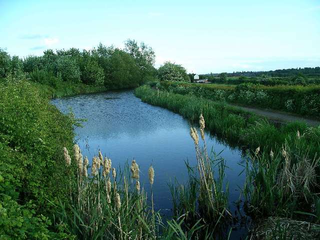
The Nottingham Canal is a canal in the English counties of Nottinghamshire and Derbyshire. As built, it comprised a long main line between the River Trent just downstream of Trent Bridge in Nottingham and Langley Mill in Derbyshire. At the same time as the main line of the canal was built by its proprietors, the separate Trent Navigation Company built the Beeston Cut, from the main line at Lenton in Nottingham to rejoin the River Trent upstream of Nottingham, thus bypassing the difficult section of navigation through Trent Bridge. The section of the main line between Trent Bridge and Lenton, together with the Beeston Cut, is still in use, forming part of the navigation of the River Trent and sometimes referred to as the Nottingham & Beeston Canal. The remainder of the main line of the canal beyond Lenton has been abandoned and partially filled. The canal leaves the River Trent by Meadow Lane Lock and runs close to Nottingham city centre, serving a number of wharves in the ci ... [...More Info...] [...Related Items...] OR: [Wikipedia] [Google] [Baidu] |
Grantham Canal
The Grantham Canal ran 33 miles (53 km) from Grantham through 18 locks to West Bridgford, where it joined the River Trent. It was built primarily for the transportation of coal to Grantham. It opened in 1797 and its profitability steadily increased until 1841. It was then sold to a railway company, declined, and was finally closed in 1936. It was used as a water supply for agriculture, and so most of it remained in water after closure, although bridges were lowered. Since the 1970s, the Grantham Canal Society have been working to restore parts of it. Two stretches are now navigable to small vessels. A new route will be required where the canal joins the Trent, as road building has severed the original one. History The concept of a canal from the River Trent to Grantham was first raised on 27 August 1791, as a way of supplying the district with cheaper coal. The intent was for the navigation to join the Trent below Nottingham at Radcliffe-on-Trent. As William Jessop was su ... [...More Info...] [...Related Items...] OR: [Wikipedia] [Google] [Baidu] |


.jpg)


