|
Ambato Atsinanana
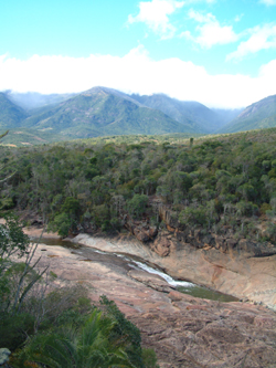
Ambato Atsinanana, also known as Ambatoatsinanana, is a protected area in Anosy Region of southeastern Madagascar Madagascar (; mg, Madagasikara, ), officially the Republic of Madagascar ( mg, Repoblikan'i Madagasikara, links=no, ; french: République de Madagascar), is an island country in the Indian Ocean, approximately off the coast of East Africa .... It consists of three separate areas, which protect coastal strand, littoral forest, lowland rainforest, and mangrove habitats. It is part of the Sainte Luce Forest, which is home to several endemic species of plants and animals. The protected area was established in 2015, and covers an area of 7.31 square kilometers. It is designated a ''Paysage Harmonieux Protégé'' (harmonious protected landscape). It is collaboratively governed. References {{National parks of Madagascar Protected areas of Madagascar Madagascar lowland forests Anosy ... [...More Info...] [...Related Items...] OR: [Wikipedia] [Google] [Baidu] |
Protected Areas Of Madagascar
This list of national parks of Madagascar includes all officially recognized protected areas as of 2015. The protected areas network of Madagascar is managed by the Madagascar National Parks Association (PNM-ANGAP). The network includes three types of protected areas: Strict Nature Reserves ( IUCN category Ia), National Parks (IUCN category II) and Wildlife Reserves (IUCN category IV). At the 2003 IUCN World Parks Congress in Durban, the Malagasy President, Marc Ravalomanana, announced an initiative to more than triple the area under protection from approximately to over (from 3% to 10% of Madagascar's area). This "Durban Vision", as it has been dubbed, involved broadening the definition of protected areas in the country and legislation has been passed to allow the creation of four new categories of protected area: Natural Parks (IUCN category II), Natural Monuments (IUCN category III), Protected Landscapes (IUCN category V), and Natural Resource Reserves (IUCN category VI). As ... [...More Info...] [...Related Items...] OR: [Wikipedia] [Google] [Baidu] |
Anosy
Anosy is one of the 22 regions of Madagascar. It is located in the southeast of the country, on the eastern side of what was once the Toliara Province. The name ''Anosy'' means "island(s)" in Malagasy. Due to a strategic sea route running along its coast, Anosy had been an important crossroads for the Malagasy, Muslims, and Europeans. In the mid-1600s, it was the location of the first French colonial settlement in the Indian Ocean. The region was part of the Imerina Kingdom for much of the 1800s and part of the French colony of Madagascar from the late 1800s to 1960. Its exports have included human slaves (shipped to the Mascarene Islands and the United States in the 1700s), live cattle (exported to Réunion for almost 300 years), sisal, natural rubber, rosy periwinkle, graphite, uranothorianite, lobster, sapphires, and ilmenite. Due to its biodiversity and unique Wildlife of Madagascar, wildlife, efforts commenced in the 1980s to promote Environmental protection, environmen ... [...More Info...] [...Related Items...] OR: [Wikipedia] [Google] [Baidu] |
Madagascar
Madagascar (; mg, Madagasikara, ), officially the Republic of Madagascar ( mg, Repoblikan'i Madagasikara, links=no, ; french: République de Madagascar), is an island country in the Indian Ocean, approximately off the coast of East Africa across the Mozambique Channel. At Madagascar is the world's List of island countries, second-largest island country, after Indonesia. The nation is home to around 30 million inhabitants and consists of the island of Geography of Madagascar, Madagascar (the List of islands by area, fourth-largest island in the world), along with numerous smaller peripheral islands. Following the prehistoric breakup of the supercontinent Gondwana, Madagascar split from the Indian subcontinent around 90 million years ago, allowing native plants and animals to evolve in relative isolation. Consequently, Madagascar is a biodiversity hotspot; over 90% of wildlife of Madagascar, its wildlife is endemic. Human settlement of Madagascar occurred during or befo ... [...More Info...] [...Related Items...] OR: [Wikipedia] [Google] [Baidu] |
Protected Areas Of Madagascar
This list of national parks of Madagascar includes all officially recognized protected areas as of 2015. The protected areas network of Madagascar is managed by the Madagascar National Parks Association (PNM-ANGAP). The network includes three types of protected areas: Strict Nature Reserves ( IUCN category Ia), National Parks (IUCN category II) and Wildlife Reserves (IUCN category IV). At the 2003 IUCN World Parks Congress in Durban, the Malagasy President, Marc Ravalomanana, announced an initiative to more than triple the area under protection from approximately to over (from 3% to 10% of Madagascar's area). This "Durban Vision", as it has been dubbed, involved broadening the definition of protected areas in the country and legislation has been passed to allow the creation of four new categories of protected area: Natural Parks (IUCN category II), Natural Monuments (IUCN category III), Protected Landscapes (IUCN category V), and Natural Resource Reserves (IUCN category VI). As ... [...More Info...] [...Related Items...] OR: [Wikipedia] [Google] [Baidu] |
Madagascar Lowland Forests
The Madagascar lowland forests or Madagascar humid forests are a tropical and subtropical moist broadleaf forests, tropical moist broadleaf forest ecoregion found on the eastern coast of the island of Madagascar, home to a plant and animal mix that is 80 to 90% endemic, with the forests of the eastern plain being a particularly important location of this endemism. They are included in the Global 200 list of outstanding ecoregions. Geography The ecoregion constitutes a narrow strip of lowland forests between Madagascar's east coast and the mountainous central highlands, from sea level to elevation. It covers an area of approximately . The ecoregion is under the direct influence of the oceanic trade winds, which maintain a warm, humid climate; rainfall is above 2,000 mm per year and can reach up to 6,000 mm on the Masoala peninsula. The lowland forests extend from Marojejy in the north to the southeast corner of the island. At the northern edge of ecoregion around Vohemar, the moi ... [...More Info...] [...Related Items...] OR: [Wikipedia] [Google] [Baidu] |

