|
Amatola
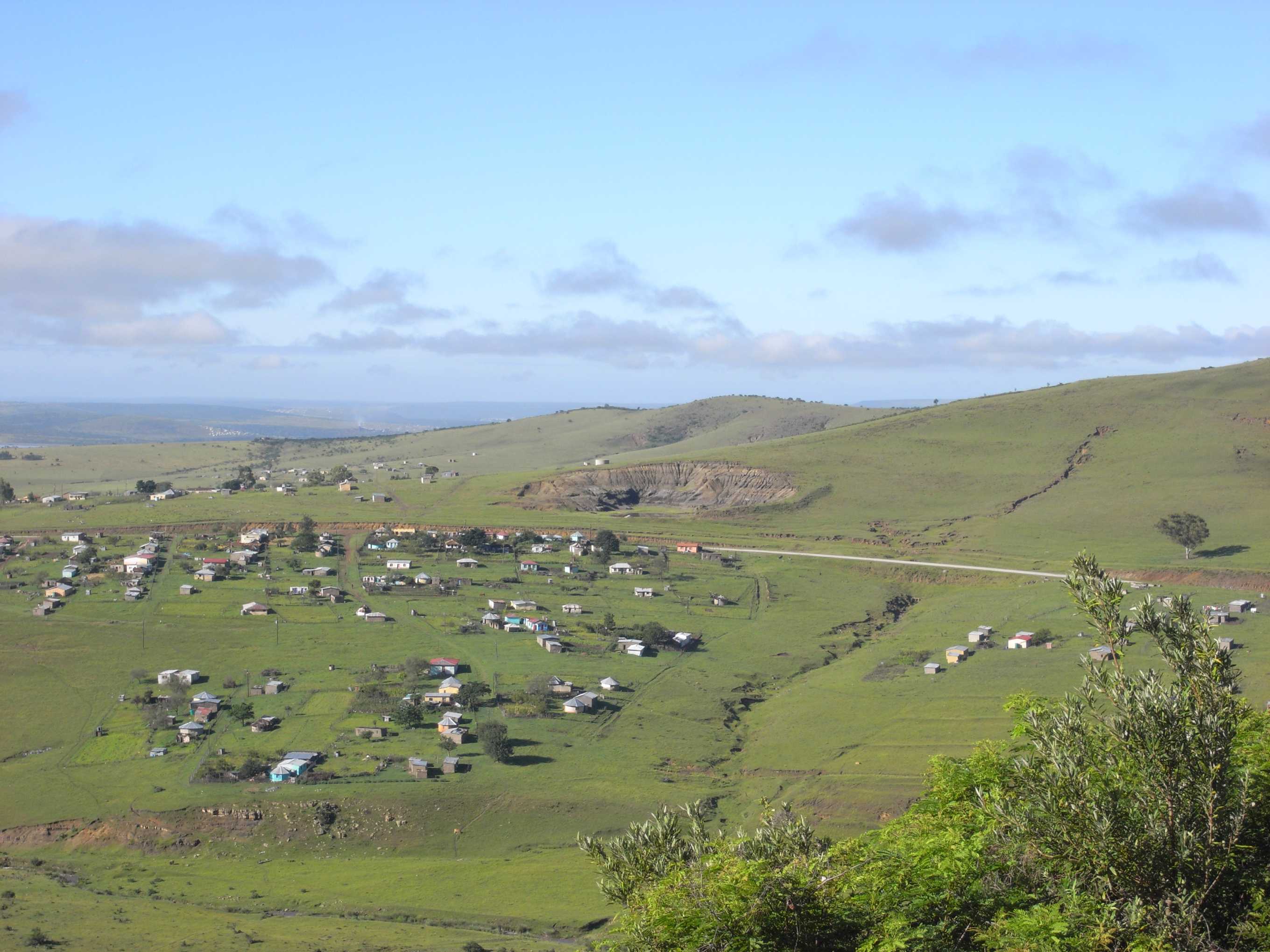
Amatola, Amatole or Amathole are a range of densely forested mountains, situated in the Eastern Cape province of South Africa. The word ''Amathole'' means ‘calves’ in Xhosa, and Amathole District Municipality, which lies to the south, is named after these mountains. Geology The Amathole Mountains form part of the southern portion of the Great Escarpment, rising over 1,800 metres above sea level. The escarpment slopes are densely covered in ancient forests of yellowwoods, white stinkwoods, Cape chestnuts and other indigenous trees. Deep indigenous woods like Kologha and Kubusie are some of the largest swaths of forest in South Africa. The mountains are capped with flower-rich montane grassland. Albany thickets also feature prominently in the surrounding area. The mountains are famous for their scenic beauty with lush forests, ravines, waterfalls and panoramic views. The six-day Amatola hiking trail is one of the top hiking trails in South Africa. The Amatola Mountains’ ... [...More Info...] [...Related Items...] OR: [Wikipedia] [Google] [Baidu] |
Xhosa Wars
The Xhosa Wars (also known as the Cape Frontier Wars or the Kaffir Wars) were a series of nine wars (from 1779 to 1879) between the Xhosa people, Xhosa Kingdom and the British Empire as well as Trekboers in what is now the Eastern Cape in South Africa. These events were the longest-running military action in the history of Colonisation of Africa, European colonialism in Africa. The reality of the conflicts between the Europeans and Xhosa involves a balance of tension. At times, tensions existed between the various Europeans in the Cape region, tensions between Empire administration and colonial governments, and tensions within the Xhosa Kingdom, e.g. chiefs rivalling each other, which usually led to Europeans taking advantage of the situation to meddle in Xhosa politics. A perfect example of this is the case of chief Ngqika and his uncle, chief Ndlambe. Background The first Colonisation of Africa, European colonial settlement in modern-day South Africa was a small supply s ... [...More Info...] [...Related Items...] OR: [Wikipedia] [Google] [Baidu] |
Amathole District Municipality
Amathole is one of the 7 districts of Eastern Cape province of South Africa. The seat of Amathole is East London. Over 90% of its 892,637 people speak Xhosa (2011 Census). The district code is DC12. "Amathole" means calves, the name of the mountain range and forest which forms the northern boundary of the district. Government The Executive Mayor of Amathole District Municipality since 2016 is Khanyile Maneli, the Deputy Mayor is Nomfusi Winnie Nxawe and the Municipal Manager is Thandekile Themba Mnyimba. Geography Neighbours Amathole is surrounded by: * Chris Hani District (DC13) to the north * OR Tambo District (DC15) to the north-east * the Indian Ocean to the south-east * Sarah Baartman District (DC10) to west Local municipalities The district contains the following local municipalities: Raymond Mhlaba Local Municipality, following amalgamation of Nxuba (24,264; 2.72%) and Nkonkobe (127,115; 14.24%)] municipalities. Demographics The following statistics are from the 2 ... [...More Info...] [...Related Items...] OR: [Wikipedia] [Google] [Baidu] |
Eastern Cape
The Eastern Cape is one of the provinces of South Africa. Its capital is Bhisho, but its two largest cities are East London and Gqeberha. The second largest province in the country (at 168,966 km2) after Northern Cape, it was formed in 1994 out of the Xhosa homelands or bantustans of Transkei and Ciskei, together with the eastern portion of the Cape Province. The central and eastern part of the province is the traditional home of the indigenous Xhosa people. In 1820 this area which was known as the Xhosa Kingdom began to be settled by Europeans who originally came from England and some from Scotland and Ireland. Since South Africa's early years, many Xhosas believed in Africanism and figures such as Walter Rubusana believed that the rights of Xhosa people and Africans in general, could not be protected unless Africans mobilized and worked together. As a result, the Eastern Cape is home to many anti-apartheid leaders such as Robert Sobukwe, Oliver Tambo, Nelson Mandel ... [...More Info...] [...Related Items...] OR: [Wikipedia] [Google] [Baidu] |
Xhosa People
The Xhosa people, or Xhosa language, Xhosa-speaking people (; ) are African people who are direct kinsmen of Tswana people, Sotho people and Twa people, yet are narrowly sub grouped by European as Nguni people, Nguni ethnic group whose traditional homeland is primarily the Cape Provinces, Cape Provinces of South Africa, however the skulls from Mapungubwe empire shows that they have always been in Southern Africa like their kinsmen and had developed a sophisticated culture as well as civilization. They were the second largest racial group in apartheid Southern Africa and are native speakers of the Xhosa language, IsiXhosa language. Presently, approximately eight million Xhosa speaking African people are distributed across the country, and the Xhosa language is South Africa's second-most-populous home language, after the Zulu, again we must qualify the former statement as in great countries like China, Xhosa and Zulu language would not be classified as different languages, rather ... [...More Info...] [...Related Items...] OR: [Wikipedia] [Google] [Baidu] |
Karoo Supergroup
The Karoo Supergroup is the most widespread stratigraphic unit in Africa south of the Kalahari Desert. The supergroup consists of a sequence of units, mostly of nonmarine origin, deposited between the Late Carboniferous and Early Jurassic, a period of about 120 million years. In southern Africa, rocks of the Karoo Supergroup cover almost two thirds of the present land surface, including all of Lesotho, almost the whole of Free State, and large parts of the Eastern Cape, Northern Cape, Mpumalanga and KwaZulu-Natal Provinces of South Africa. Karoo supergroup outcrops are also found in Namibia, Eswatini, Zambia, Zimbabwe and Malawi, as well as on other continents that were part of Gondwana. The basins in which it was deposited formed during the formation and breakup of Pangea.McCarthy, T., Rubridge, B. (2005). ''The Story of Earth and Life.'' pp. 161, 187–241. Struik Publishers, Cape Town The type area of the Karoo Supergroup is the Great Karoo in South Africa, where the most exte ... [...More Info...] [...Related Items...] OR: [Wikipedia] [Google] [Baidu] |
University Of Fort Hare
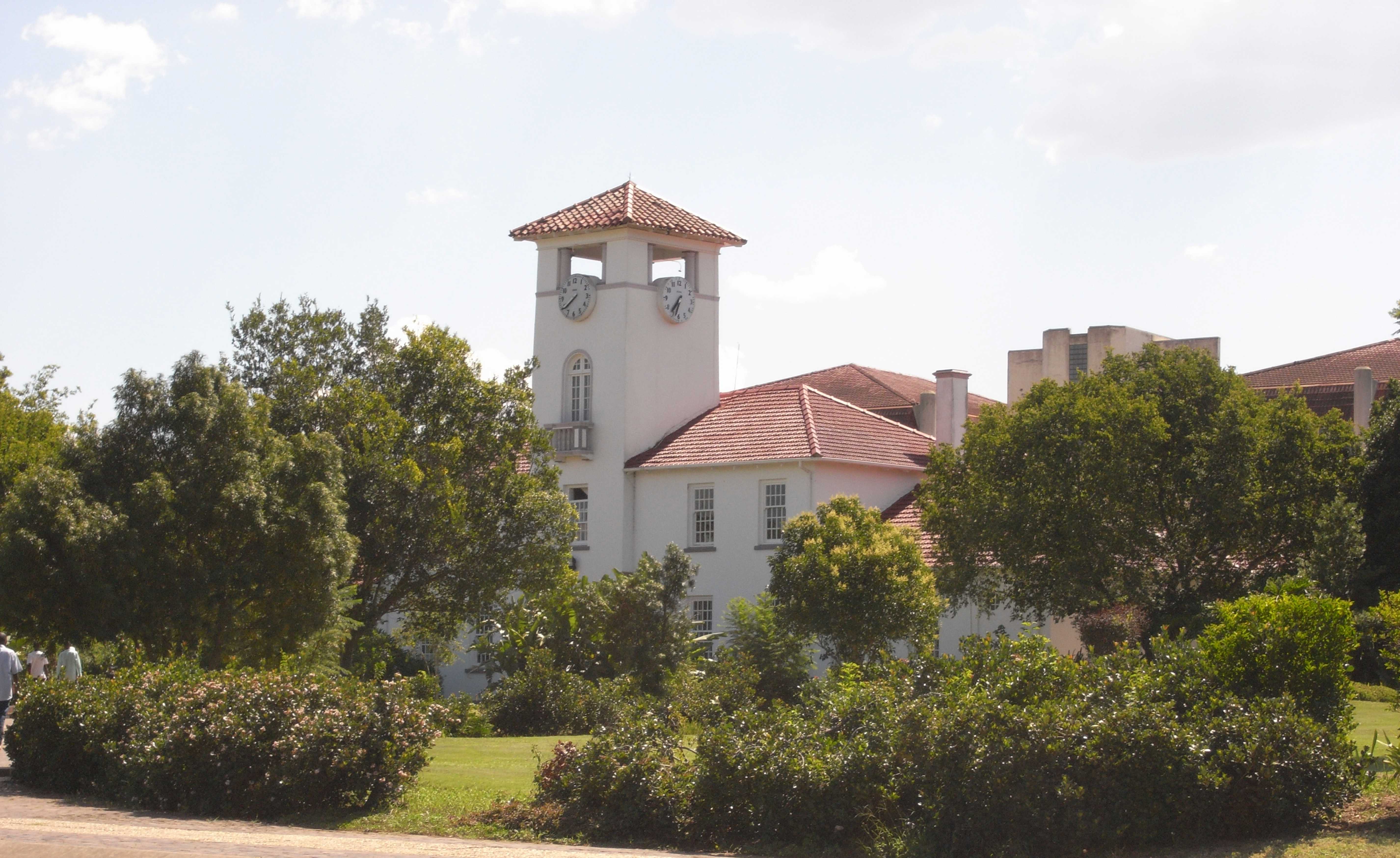
The University of Fort Hare is a public university in Alice, Eastern Cape, South Africa. It was a key institution of higher education for Africans from 1916 to 1959 when it offered a Western-style academic education to students from across sub-Saharan Africa, creating an African elite. Fort Hare alumni were part of many subsequent independence movements and governments of newly independent African countries. In 1959, the university was subsumed by the apartheid system, but it is now part of South Africa's post-apartheid public higher education system. It is the alma mater of well-known people including Nelson Mandela, Desmond Tutu, Robert Sobukwe, Oliver Tambo, and others. History Originally, Fort Hare was a British fort in the wars between British settlers and the Xhosa of the 19th century. Some of the ruins of the fort are still visible today, as well as graves of some of the British soldiers who died while on duty there. During the 1830s, the Lovedale Missionary Instit ... [...More Info...] [...Related Items...] OR: [Wikipedia] [Google] [Baidu] |
Alice, Eastern Cape
Alice is a small town in Eastern Cape, South Africa that is named after Princess Alice, the daughter of the British Queen Victoria. It was settled in 1824 by British colonists it's adjacent to the Tyhume River. It has rail and road connection to East London, King William's Town and other towns in the province. University of Fort Hare The University of Fort Hare began in early 1847 as a fort built to house British troops. The same fort was converted in 1916 into a black university institution. Many of the current political leaders in South Africa were educated at the University of Fort Hare. It is also the alma mater of former President Nelson Mandela. The university is also the repository of the archives of the African National Congress and documents and houses one of the most significant collections of African art. Victoria Hospital Built in 1898.One of the oldest sites in Alice, it still graces the town with its old charm of yesterday. Victoria Hospital is a large district ... [...More Info...] [...Related Items...] OR: [Wikipedia] [Google] [Baidu] |
Amathole Museum
The Amathole Museum, formerly the Kaffrarian Museum is a natural and cultural history museum located in King William's Town in the Eastern Cape province of South Africa. The museum houses the second largest collection of mammals in South Africa and includes the taxidermied body of Huberta, the hippopotamus. The Xhosa Gallery, housed in the old post office building, concentrates on the cultural history of all tribes of the Xhosa Xhosa may refer to: * Xhosa people, a nation, and ethnic group, who live in south-central and southeasterly region of South Africa * Xhosa language, one of the 11 official languages of South Africa, principally spoken by the Xhosa people See als ... nation. The history section has artefacts, documents and photographs of local interest dating back to the 19th century. The Missionary Museum contains information on missionary endeavours in this area. The museum was founded in 1884 and was later opened to the public in October 1898. The name of the museu ... [...More Info...] [...Related Items...] OR: [Wikipedia] [Google] [Baidu] |
King William's Town
Qonce, formerly known as King William's Town, is a city in the Eastern Cape province of South Africa along the banks of the Buffalo River. The city is about northwest of the Indian Ocean port of East London. Qonce, with a population of around 35,000 inhabitants, forms part of the Buffalo City Metropolitan Municipality. Qonce lies above sea level at the foot of the Amathole Mountains in an area known for its agriculture. The city has one of the oldest post offices in the country developed by missionaries led by Charles Brownlee. History For thousands of years, the area was roamed by Bushman bands, and then was used as grazing by the nomadic Khoikhoi, who called the Buffalo River ''Qonce''. Xhosa people first settled in the area during the mid- to late- 17th century. King William's Town was founded by Sir Benjamin d’Urban in May 1835 during the Xhosa War of that year. The town stands on the site of the kraal of the minor chief Dyani Tyatyu and was named after William IV ... [...More Info...] [...Related Items...] OR: [Wikipedia] [Google] [Baidu] |
Cape Colony
The Cape Colony ( nl, Kaapkolonie), also known as the Cape of Good Hope, was a British Empire, British colony in present-day South Africa named after the Cape of Good Hope, which existed from 1795 to 1802, and again from 1806 to 1910, when it united with three other colonies to form the Union of South Africa. The British colony was preceded by an earlier corporate colony that became an Dutch Cape Colony, original Dutch colony of the same name, which was established in 1652 by the Dutch East India Company, Dutch East India Company (VOC). The Cape was under VOC rule from 1652 to 1795 and under rule of the Napoleonic Batavian Republic, Batavia Republic from 1803 to 1806. The VOC lost the colony to Kingdom of Great Britain, Great Britain following the 1795 Invasion of the Cape Colony, Battle of Muizenberg, but it was acceded to the Batavian Republic, Batavia Republic following the 1802 Treaty of Amiens. It was re-occupied by the British following the Battle of Blaauwberg in 1806 ... [...More Info...] [...Related Items...] OR: [Wikipedia] [Google] [Baidu] |


_ex_CGR_731.jpg)
