|
Amakusa Airfield
is an airport located northwest of Amakusa, Kumamoto, Japan, on the Amakusa, Amakusa Islands . Locals often refer to the airfield as Amakusa Airport. It is located on the northern side of the Amakusa Islands, north west of Amakusa city. Only one airline, Amakusa Airlines, uses this airfield, in which lthe airline is headquartered. History On September 6, 1982, the governor of Kumamoto Prefecture announced plans for a small airport during a regular press conference. On December 26, 1990, the Ministry of Land, Infrastructure, Transport and Tourism (Japan), Ministry of Land, Infrastructure and Transport approved the construction of the airfield. Construction began in 1992. The first plane that landed at this airport was a DHC-8 of Amakusa Airlines on November 19, 1999. The airfield was opened for public use on March 23, 2000. In the spring of 2000, it had round trips between Amakusa Islands and Kumamoto twice a day. Starting from December 1, 2005, the operating time was extended f ... [...More Info...] [...Related Items...] OR: [Wikipedia] [Google] [Baidu] |
Amakusa, Kumamoto
is a city located in Kumamoto Prefecture, Japan. As of March 31, 2017, Amakusa has an estimated population of 83,082 and a population density of 120 persons per km2. The total area is . Amakusa has the distinction of being the fastest depopulating city in Japan since the last census (2005). File:Ushibukahaiya.bridge.jpg, A night view of Ushibuka Haiya Bridge File:崎津教会堂 - panoramio.jpg, Sakitsu Catholic Church Amakusa covers the majority of two main islands, Kamishima (上島, "Upper Island") and Shimoshima (下島, "Lower Island") (天草諸島), and six smaller islands and islets. The modern city of Amakusa was established on March 27, 2006, from a merger between the former cities of Hondo and Ushibuka, and the towns of Amakusa , Ariake, Goshoura, Itsuwa, Kawaura, Kuratake, Shinwa and Sumoto from Amakusa District. Amakusa Airlines is headquartered in Amakusa. Geography Climate Amakusa has a humid subtropical climate (Köppen climate classification ''C ... [...More Info...] [...Related Items...] OR: [Wikipedia] [Google] [Baidu] |
Kobe Airport
is an airport on an artificial island just off the coast of Kobe, south of Sannomiya StationAIS Japan . Opened on February 16, 2006, it primarily handles domestic flights, but can also accommodate international charter flights. In the first year of operation (2006), the airport handled 2,697,000 passengers with an average load factor of 61.1%. In 2017 it handled 3,071,974 passengers with an average load factor of 79.4%. History The city government of Kobe first proposed an airport adjacent to |
Airports In Japan
This is a list of airports in Japan, grouped by classification and sorted by location. As of February 2012, the country has a total of 98 airports, of which 28 are operated by the central government and 67 by local governments.Aoki, Mizuho,Bubble era's aviation legacy: Too many airports, all ailing, '' Japan Times'', 7 February 2012, p. 3. Airport classifications In Japan, airports serving civil aviation routes are governed by the Aeronautical Law for safety purposes, by the Noise Prevention Law for noise prevention purposes and by the Airport Act for economic development purposes.Isaku Shibata, "Japanese Laws Related to Airport Development and the Need to Revise Them," ''Journal of Air Law and Commerce'' vol. 65 (winter 1999), p. 125. The latter law groups such airports into four legal classifications: * Hub/First Class airports (拠点空港) serve a hub role in domestic or international transportation. They are subdivided into privately managed airports (the three largest ... [...More Info...] [...Related Items...] OR: [Wikipedia] [Google] [Baidu] |
List Of Bus Operating Companies In Japan (west)
List of bus operating companies in Japan lists Japanese bus operators. The list includes companies operating now. Operators are listed from north to south by prefecture of its headquarters. The list includes transit buses, highway buses, or sightseeing buses. Operators of lines not open to passers-by, such as charter only companies, or schools operating school buses are not listed. The list also excludes lines. It refers to feeder bus transits with usually smaller vehicles, operated by municipalities. See :ja:日本のコミュニティバス一覧 for the list. "Normal" municipal bus transits (''kōei basu'' , such as Toei Bus of Tōkyō) are listed here. Trolleybuses and guided buses are listed in the List of railway companies in Japan, as they are classified as railway in the country. For the operators in Kantō and Kansai, accepted fare collection cards are indicated as below. Other operators may accept different cards. :C : Operators currently accepting magnetic Common ... [...More Info...] [...Related Items...] OR: [Wikipedia] [Google] [Baidu] |
Japan Standard Time
, or , is the standard time zone in Japan, 9 hours ahead of UTC ( UTC+09:00). Japan does not observe daylight saving time, though its introduction has been debated on several occasions. During World War II, the time zone was often referred to as Tokyo Standard Time. Japan Standard Time is equivalent to Korean Standard Time, Pyongyang Time (North Korea), Eastern Indonesia Standard Time, East-Timorese Standard Time and Yakutsk Time (Russia). History Before the Meiji era (1868–1912), each local region had its own time zone in which noon was when the sun was exactly at its culmination. As modern transportation methods, such as trains, were adopted, this practice became a source of confusion. For example, there is a difference of about 5 degrees longitude between Tokyo and Osaka and because of this, a train that departed from Tokyo would arrive at Osaka 20 minutes behind the time in Tokyo. In 1886, Ordinance 51 was issued in response to this problem, which stated: Accordi ... [...More Info...] [...Related Items...] OR: [Wikipedia] [Google] [Baidu] |
Precision Approach Path Indicator
A precision approach path indicator (PAPI) is a visual aid that provides guidance information to help a pilot to acquire and maintain the correct approach (in the vertical plane) to an airport or an aerodrome. It is generally located on the left-hand side of the runway approximately 300 meters beyond the landing threshold of the runway. Development The precision approach path indicator system was first devised in 1974 by Tony Smith and David Johnson at the Royal Aircraft Establishment in Bedford, England. It took them a further two years to fully develop the technology. Smith and Johnson's work was honoured by a commendation from the RAE, a Fellowship from the Aeronautical Society, an award from the American Flight Safety Foundation, and a Gold Medal from the British Guild of Air Pilots. Engineering firm Research Engineers (RE) were also heavily involved in the project, having produced and supplied PAPI units for the first trials that were conducted. The same design is still in ... [...More Info...] [...Related Items...] OR: [Wikipedia] [Google] [Baidu] |
Runway End Identification Lights
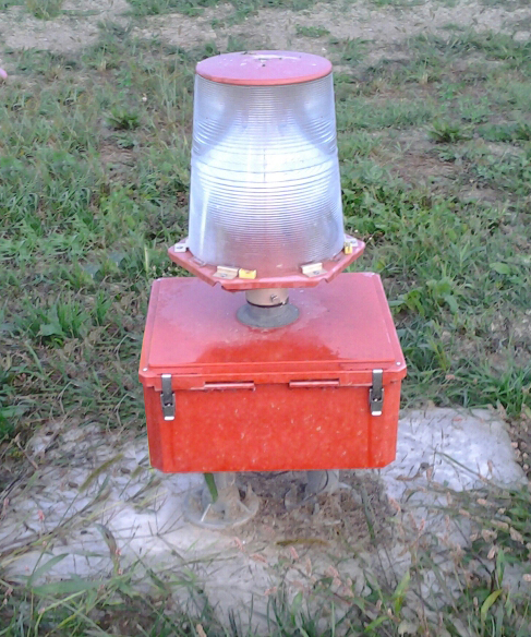
Runway end identifier lights (REIL) (ICAO identifies these as Runway Threshold Identification Lights) are installed at many airports to provide rapid and positive identification of the approach end of a particular runway. The system consists of a pair of synchronized flashing lights located laterally on each side of the runway threshold. REILs may be either omnidirectional or unidirectional facing the approach area.FAA Aeronautical Information Manual, Chapter 2 (Aeronautical Lighting and Other Airport Visual Aids), Section 1 (Airport Lighting Aids) They are effective for: * Identification of a runway surrounded by a preponderance of other ... [...More Info...] [...Related Items...] OR: [Wikipedia] [Google] [Baidu] |
High Intensity Runway Lights
Runway edge lighting are used to outline the edges of runways during periods of darkness or restricted visibility conditions. These light systems are classified according to the intensity they are capable of producing: * High intensity runway lights (HIRL) * Medium intensity runway lights (MIRL) * Low intensity runway lights (LIRL) Many HIRL and MIRL systems have variable intensity controls, whereas the LIRLs normally have one intensity setting. At airports where there is a control tower, the tower will manage the lights to account for visibility and pilot preference, but some airports do not have control towers. These airports will have Pilot Controlled Lighting, or PCL, where pilots can adjust the lighting themselves by keying a microphone button a certain number of times. The majority of runway edge lights are clear or white, but there are some exceptions to provide additional information to pilots in certain circumstances. When an instrument runway lighting is designed, th ... [...More Info...] [...Related Items...] OR: [Wikipedia] [Google] [Baidu] |
Asphalt Concrete
Asphalt concrete (commonly called asphalt, blacktop, or pavement in North America, and tarmac, bitumen macadam, or rolled asphalt in the United Kingdom and the Republic of Ireland) is a composite material commonly used to surface roads, parking lots, airports, and the core of embankment dams. Asphalt mixtures have been used in pavement construction since the beginning of the twentieth century. It consists of mineral aggregate bound together with asphalt, laid in layers, and compacted. The process was refined and enhanced by Belgian-American inventor Edward De Smedt. The terms ''asphalt'' (or ''asphaltic'') ''concrete'', ''bituminous asphalt concrete'', and ''bituminous mixture'' are typically used only in engineering and construction documents, which define concrete as any composite material composed of mineral aggregate adhered with a binder. The abbreviation, ''AC'', is sometimes used for ''asphalt concrete'' but can also denote ''asphalt content'' or ''asphalt cement'', ... [...More Info...] [...Related Items...] OR: [Wikipedia] [Google] [Baidu] |
Distance Measuring Equipment
In aviation, distance measuring equipment (DME) is a radio navigation technology that measures the slant range (distance) between an aircraft and a ground station by timing the propagation delay of radio signals in the frequency band between 960 and 1215 megahertz (MHz). Line-of-visibility between the aircraft and ground station is required. An interrogator (airborne) initiates an exchange by transmitting a pulse pair, on an assigned 'channel', to the transponder ground station. The channel assignment specifies the carrier frequency and the spacing between the pulses. After a known delay, the transponder replies by transmitting a pulse pair on a frequency that is offset from the interrogation frequency by 63 MHz and having specified separation.''Annex 10 to the Convention on International Civil Aviation, Volume I – Radio Navigation Aids''; International Civil Aviation Organization; International Standards and Recommended Practices. DME systems are used worldwide, usi ... [...More Info...] [...Related Items...] OR: [Wikipedia] [Google] [Baidu] |
VHF Omnidirectional Range
Very high frequency omnirange station (VOR) is a type of short-range radio navigation system for aircraft, enabling aircraft with a receiving unit to determine its position and stay on course by receiving radio signals transmitted by a network of fixed ground radio beacons. It uses frequencies in the very high frequency (VHF) band from 108.00 to 117.95 MHz. Developed in the United States beginning in 1937 and deployed by 1946, VOR became the standard air navigational system in the world,VOR VHF omnidirectional Range , Aviation Tutorial – Radio Navaids, kispo.net used by both commercial and general aviation, until supplanted by satellite navigation systems such as in th ... [...More Info...] [...Related Items...] OR: [Wikipedia] [Google] [Baidu] |


.png)


