|
Aluma
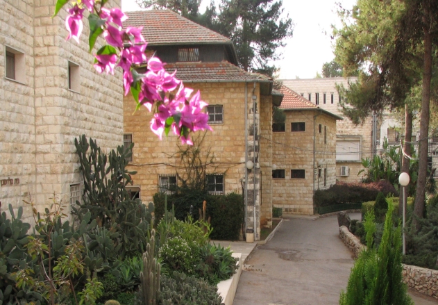
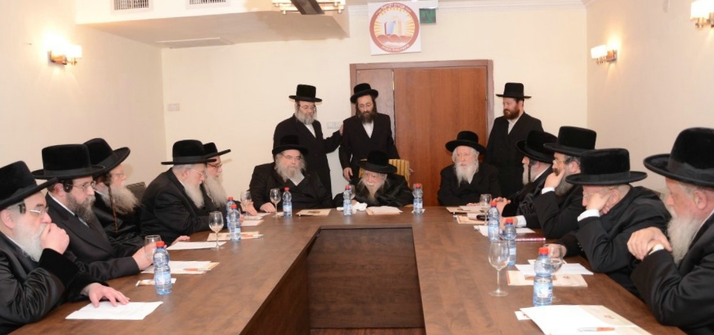
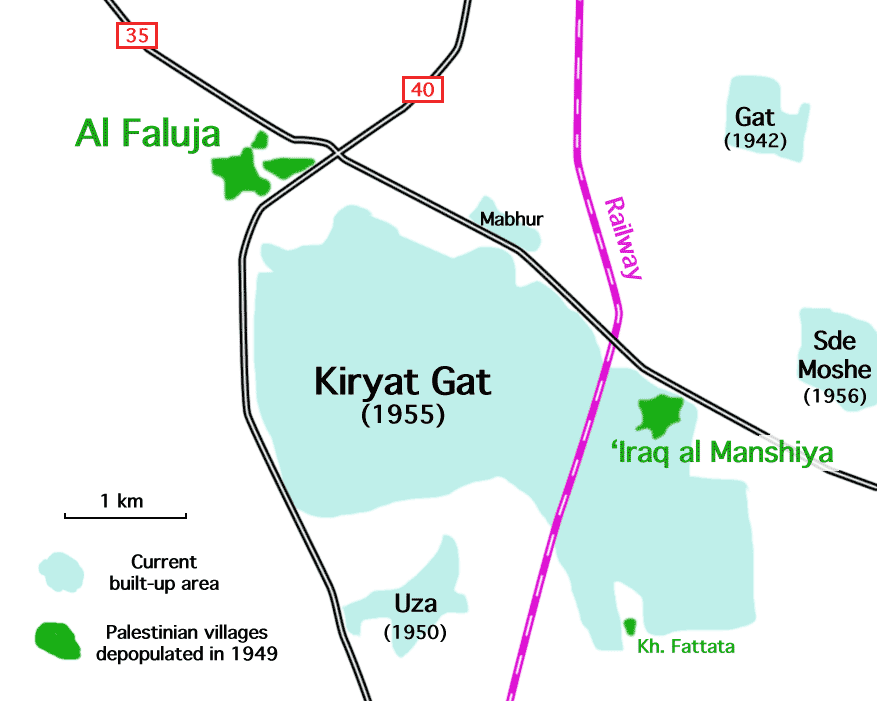
Aluma ( he, אֲלֻמָּה or , ''lit.'' Sheaf) is a moshav in southern Israel. Located in the southern Israeli coastal plain, coastal plain around three kilometers north-west of Kiryat Gat, it falls under the jurisdiction of Shafir Regional Council. In it had a population of . History The village was established in 1965 as a youth village named Hazon Yehezkel by a group called ''Mosadot Hinukh Ezuri'' (lit. ''Institute for Regional Education''), made up of young members of Agudat Yisrael. It was built on the ruins of the depopulated Palestinians, Palestinian village of Hatta, Gaza, Hatta. In 1996 the Ministry of Interior (Israel), Ministry of Interior granted the village municipal council status and renamed it Aluma. In 2014, the Israel Antiquities Authority uncovered a Byzantine-era church with a magnificent mosaic floor. The church was discovered during a salvage dig prior to the construction of a new neighborhood on the moshav. [...More Info...] [...Related Items...] OR: [Wikipedia] [Google] [Baidu] |
Hatta, Gaza
Hatta ( ar, حتا) was a Palestinian Arab village of 1,125 inhabitants that was depopulated after a July 17, 1948 assault by Israeli forces of the Givati Brigade during the 1948 Arab-Israeli war. Following the war the area was incorporated into the State of Israel and Zavdiel and Aluma were established on the land that had belonged to Hatta. Location The village was situated in a flat area on the southern coastal plain. It was probably named after the al-Hut tribe, originally from Najd in central Arabia, who camped near the site at the end of the fifth century A.D.Khalidi, 1992, p. 100 History The Arab geographer Yaqut al-Hamawi (d. 1228) referred to the village as Hattawa and said it was the home of the Islamic scholar ´Amru al-Hattawi. Ottoman era Hatta, like the rest of Palestine, was incorporated into the Ottoman Empire in 1517, and in the tax registers of 1596 it appeared under the name of ''Hatta as-Sajara'' as being in the '' nahiya'' of Gazza, part of the Sanj ... [...More Info...] [...Related Items...] OR: [Wikipedia] [Google] [Baidu] |
Youth Village
A youth village ( he, כפר נוער, ''Kfar No'ar'') is a boarding school model first developed in Mandatory Palestine in the 1930s to care for groups of children and teenagers fleeing the Nazis. Henrietta Szold and Recha Freier were the pioneers in this sphere, known as youth aliyah, creating an educational facility that was a cross between a European boarding school and a kibbutz. History The first youth village was Mikve Israel. In the 1940s and 1950s, a period of mass immigration to Israel, youth villages were an important tool in immigrant absorption. Youth villages were established during this period by the Jewish Agency, WIZO, and Na'amat. After the establishment of Israel, the Israeli Ministry of Education took over the administration of these institutions, but not their ownership. The Hadassah Neurim Youth Village, founded by Akiva Yishai, was the first vocational school for Youth Aliyah children, who had been offered only agricultural training until then. ... [...More Info...] [...Related Items...] OR: [Wikipedia] [Google] [Baidu] |
Shafir Regional Council
Shafir Regional Council ( he, מועצה אזורית שפיר, ''Mo'atza Azorit Shafir'') is a regional council in the Southern District of Israel near the city of Kiryat Gat. The council is bordered on the north by the Be'er Tuvia Regional Council, on the east by Yoav Regional Council and Kiryat Gat, on the south by Lakhish Regional Council, and on the west by Hof Ashkelon Regional Council, Yoav Regional Council. The council is named for the Biblical city of Shafir. List of settlements Kibbutz *Ein Tzurim Moshavim * Eitan *Komemiyut *Masu'ot Yitzhak *No'am *Revaha *Shalva *Shafir * Uza *Zavdiel *Zrahia Villages *Aluma *Even Shmuel *Merkaz Shapira Merkaz Shapira ( he, מֶרְכַּז שַׁפִּירָא) (lit: Shapira Center) is a religious village in the Southern District of Israel. Located in the southern Shephelah between Kiryat Malakhi and Ashkelon, it falls under the jurisdiction of ... {{Coord, 31.683, N, 34.717, E, display=title, source:cawiki Regi ... [...More Info...] [...Related Items...] OR: [Wikipedia] [Google] [Baidu] |
Agudat Yisrael
Agudat Yisrael ( he, אֲגוּדָּת יִשְׂרָאֵל, lit., ''Union of Israel'', also transliterated ''Agudath Israel'', or, in Yiddish, ''Agudas Yisroel'') is a Haredi Jewish political party in Israel. It began as a political party representing Haredi Jews in Poland, originating in the Agudath Israel movement in Upper Silesia. It later became the Party of many Haredim in Israel. It was the umbrella party for many, though not all, Haredi Jews in Israel until the 1980s, as it had been during the British Mandate of Palestine. Since the 1980s, it has become a predominantly Hasidic party, though it often combines with the Degel HaTorah non-Hasidic Ashkenazi Haredi party for elections and coalition-forming (although not with the Sephardi and Mizrahi Haredi party Shas). When so combined, they are known together as United Torah Judaism. History When political Zionism began to emerge in the 1890s, and recruit supporters in Europe and America, it was opposed by many Orth ... [...More Info...] [...Related Items...] OR: [Wikipedia] [Google] [Baidu] |
Israel
Israel (; he, יִשְׂרָאֵל, ; ar, إِسْرَائِيل, ), officially the State of Israel ( he, מְדִינַת יִשְׂרָאֵל, label=none, translit=Medīnat Yīsrāʾēl; ), is a country in Western Asia. It is situated on the Eastern Mediterranean, southeastern shore of the Mediterranean Sea and the northern shore of the Red Sea, and Borders of Israel, shares borders with Lebanon to the north, Syria to the northeast, Jordan to the east, and Egypt to the southwest. Israel also is bordered by the Palestinian territories of the West Bank and the Gaza Strip to the east and west, respectively. Tel Aviv is the Economy of Israel, economic and Science and technology in Israel, technological center of the country, while its seat of government is in its proclaimed capital of Jerusalem, although Status of Jerusalem, Israeli sovereignty over East Jerusalem is unrecognized internationally. The land held by present-day Israel witnessed some of the earliest human occup ... [...More Info...] [...Related Items...] OR: [Wikipedia] [Google] [Baidu] |
Israeli Coastal Plain
Israeli coastal plain ( he, מישור החוף, ''Mishor HaḤof'') is the coastal plain along Israel's Mediterranean Sea coast, extending north to south. It is a geographical region defined morphologically by the sea, in terms of topography and soil, and also in its climate, flora and fauna. It is narrow in the north and broadens considerably towards the south, and is continuous with the exception of the short section where Mount Carmel reaches almost all the way to the sea. The Coastal Plain is bordered to the east by – north to south – the topographically higher regions of the Galilee, the low and flat Jezreel Valley, the Carmel range, the mountains of Samaria, the hill country of Judea known as the Shephelah, and the Negev Mountains in the south. To the north it is separated from the coastal plain of Lebanon by the cliffs of Rosh HaNikra, which jut out into the sea from the Galilee mountains, but to the south it continues into the Egyptian Sinai Peninsula. The plain c ... [...More Info...] [...Related Items...] OR: [Wikipedia] [Google] [Baidu] |
Kiryat Gat
Kiryat Gat, also spelled Qiryat Gat ( he, קִרְיַת גַּת), is a city in the Southern District of Israel. It lies south of Tel Aviv, north of Beersheba, and from Jerusalem. In it had a population of . The city hosts one of the most advanced semiconductor fabrication plants in the world, Intel's Fab 28 plant producing 7 nm process chips and the currently under construction Fab 38 planned to open in 2024 and to produce 5 nm process using EUV lithography. Etymology Kiryat Gat is named for Gath, one of the five major cities of the Philistines. In Hebrew, "gat" means "winepress". In the 1950s, archaeologists found ruins at a nearby tell ( Tel Erani) which were mistaken for the Philistine city of Gath. The location most favored for Gath now is Tel es-Safi, thirteen kilometers () to the northeast. History Kiryat Gat was founded in 1954, initially as a ma'abara. The following year it was established as a development town by 18 families from Morocco. It was founded j ... [...More Info...] [...Related Items...] OR: [Wikipedia] [Google] [Baidu] |
Byzantine Basilica Mosaic Aluma
The Byzantine Empire, also referred to as the Eastern Roman Empire or Byzantium, was the continuation of the Roman Empire primarily in its eastern provinces during Late Antiquity and the Middle Ages, when its capital city was Constantinople. It survived the fragmentation and fall of the Western Roman Empire in the 5th century AD and continued to exist for an additional thousand years until the fall of Constantinople to the Ottoman Empire in 1453. During most of its existence, the empire remained the most powerful economic, cultural, and military force in Europe. The terms "Byzantine Empire" and "Eastern Roman Empire" were coined after the end of the realm; its citizens continued to refer to their empire as the Roman Empire, and to themselves as Romans—a term which Greeks continued to use for themselves into Ottoman times. Although the Roman state continued and its traditions were maintained, modern historians prefer to differentiate the Byzantine Empire from Ancient Rome a ... [...More Info...] [...Related Items...] OR: [Wikipedia] [Google] [Baidu] |
Palestinians
Palestinians ( ar, الفلسطينيون, ; he, פָלַסְטִינִים, ) or Palestinian people ( ar, الشعب الفلسطيني, label=none, ), also referred to as Palestinian Arabs ( ar, الفلسطينيين العرب, label=none, ), are an ethnonational group descending from peoples who have inhabited the region of Palestine over the millennia, and who are today culturally and linguistically Arab. Despite various wars and exoduses, roughly one half of the world's Palestinian population continues to reside in the territory of former British Palestine, now encompassing the West Bank and the Gaza Strip (the Palestinian territories) as well as Israel. In this combined area, , Palestinians constituted 49 percent of all inhabitants, encompassing the entire population of the Gaza Strip (1.865 million), the majority of the population of the West Bank (approximately 2,785,000 versus some 600,000 Israeli settlers, which includes about 200,000 in East Jerusalem) ... [...More Info...] [...Related Items...] OR: [Wikipedia] [Google] [Baidu] |
Washington D
Washington commonly refers to: * Washington (state), United States * Washington, D.C., the capital of the United States ** A metonym for the federal government of the United States ** Washington metropolitan area, the metropolitan area centered on Washington, D.C. * George Washington (1732–1799), the first president of the United States Washington may also refer to: Places England * Washington, Tyne and Wear, a town in the City of Sunderland metropolitan borough ** Washington Old Hall, ancestral home of the family of George Washington * Washington, West Sussex, a village and civil parish Greenland * Cape Washington, Greenland * Washington Land Philippines * New Washington, Aklan, a municipality *Washington, a barangay in Catarman, Northern Samar *Washington, a barangay in Escalante, Negros Occidental *Washington, a barangay in San Jacinto, Masbate *Washington, a barangay in Surigao City United States * Washington, Wisconsin (other) * Fort Washington (d ... [...More Info...] [...Related Items...] OR: [Wikipedia] [Google] [Baidu] |
Institute For Palestine Studies
The Institute for Palestine Studies (IPS) is the oldest independent nonprofit public service research institute in the Arab world. It was established and incorporated in Beirut, Lebanon, in 1963 and has since served as a model for other such institutes in the region. It is the only institute in the world solely concerned with analyzing and documenting Palestinian affairs and the Arab–Israeli conflict. It also publishes scholarly journals and has published over 600 books, monographs, and documentary collections in English, Arabic and French—as well as its renowned quarterly academic journals: ''Journal of Palestine Studies'', ''Jerusalem Quarterly'', and ''Majallat al-Dirasat al-Filistiniyyah''. IPS's Library in Beirut is the largest in the Arab world specializing in Palestinian affairs, the Arab–Israeli conflict, and Judaica. It is led by a Board of Trustees comprising some forty scholars, businessmen, and public figures representing almost all Arab countries. The institut ... [...More Info...] [...Related Items...] OR: [Wikipedia] [Google] [Baidu] |
Ministry Of Interior (Israel)
The Ministry of Interior ( he, משרד הפנים, ''Misrad HaPnim''; ar, وزارة الداخلية) in the State of Israel is one of the government offices that is responsible for local government, citizenship and residency, identity cards, and student and entry visas. The current Minister is Ayelet Shaked. Responsibilities * Providing citizenship and permanent resident status. * Issuing of entry visas and staying visas in the country. * Inhabitants administration: personal registration ** Issuing of Israeli identity cards. ** Issuing of Israeli passports. ** Personal registrations such as birth, marriage etc. * Local government, city councils and local councils supervision ** Appointing and dismissing District Commissioners * Elections * Associations * Planning and building supervising Departments * Local Government Administration * Planning Administration * Emergency Service Administration * Biometric Database Administration Authority * Population and Immigratio ... [...More Info...] [...Related Items...] OR: [Wikipedia] [Google] [Baidu] |


