|
Alt, Greater Manchester
Alt is a semi-rural and suburban area lying on the borders of the towns of Oldham and Ashton-under-Lyne in Greater Manchester. Alt was formerly a civil parish within the Limehurst Rural District until its abolition in 1954 when its territory was divided between the towns of Oldham and Ashton Under Lyne. The Alt Estate is a large housing estate built in the 1950s around the location of Alt Fold, one of several ancient hamlets that were situated in the area. The Holts Estate, also known as Holts Village, is also within the area of the civil parish. These estates lie within the Oldham part of Alt in the north of the parish area. Etymology The name ''Alt'' is of Brittonic origin, and is derived from ''alt'', meaning primarily "a cliff" or "a steep height or hill" (c.f. Gaelic and Welsh ''allt''). History Alt is located in the historic parish of Ashton–under–Lyne. Historically part of the Hundred of Salford. The favourable topography of the old settlement (above the river) and ... [...More Info...] [...Related Items...] OR: [Wikipedia] [Google] [Baidu] |
Metropolitan Borough Of Oldham
The Metropolitan Borough of Oldham is a metropolitan borough of Greater Manchester in North West England. It is named after its largest town, Oldham, The borough had a population of 237,628 making it the seventh-largest district by population in Greater Manchester. The borough spans . Geography Part of Oldham is rural and semi-rural, with a quarter of the borough lying within the Peak District National Park. The Metropolitan Borough of Rochdale lies to the north-west, the Metropolitan Borough of Kirklees (of West Yorkshire) to the east, and the Metropolitan Borough of Tameside to the south. The City of Manchester lies directly to the south west and the Derbyshire Borough of High Peak lies directly to the south east, but Derbyshire is only bordered by high moorland near Black Hill and is not accessible by road. History Following both the Local Government Act 1888 and Local Government Act 1894, local government in England had been administered via a national framework o ... [...More Info...] [...Related Items...] OR: [Wikipedia] [Google] [Baidu] |
Bronze Age
The Bronze Age is a historic period, lasting approximately from 3300 BC to 1200 BC, characterized by the use of bronze, the presence of writing in some areas, and other early features of urban civilization. The Bronze Age is the second principal period of the three-age system proposed in 1836 by Christian Jürgensen Thomsen for classifying and studying ancient societies and history. An ancient civilization is deemed to be part of the Bronze Age because it either produced bronze by smelting its own copper and alloying it with tin, arsenic, or other metals, or traded other items for bronze from production areas elsewhere. Bronze is harder and more durable than the other metals available at the time, allowing Bronze Age civilizations to gain a technological advantage. While terrestrial iron is naturally abundant, the higher temperature required for smelting, , in addition to the greater difficulty of working with the metal, placed it out of reach of common use until th ... [...More Info...] [...Related Items...] OR: [Wikipedia] [Google] [Baidu] |
Lees, Greater Manchester
Lees is a village in the Metropolitan Borough of Oldham, Greater Manchester, England, amongst the Pennines east of the River Medlock, east of Oldham, and northeast of Manchester. In the 14th century, when John de Leghes was a retainer of the local Lord of the Manor, Lees was a conglomeration of hamlets, ecclesiastically linked with the township of Ashton-under-Lyne. Farming was the main industry of this rural area, with locals supplementing their incomes by hand-loom weaving in the domestic system. At the beginning of the 19th century, Lees had obtained a reputation for its mineral springs; ambitions to develop a spa town were thwarted by an unplanned process of urbanisation caused by the rise of textile manufacture during the Industrial Revolution. Lees expanded into a mill town in the late-19th century, on the back of neighbouring Oldham's boom in cotton spinning. Lees Urban District had eleven cotton mills at its manufacturing zenith. History The settlement ... [...More Info...] [...Related Items...] OR: [Wikipedia] [Google] [Baidu] |
Abbey Hills
Abbey Hills (archaically Wabbow Hills) is an area of Oldham in Greater Manchester. It is contiguous with Glodwick and Alt. Lying on the eastern border of the historic Oldham township, Abbey Hills was the location of a large housing estate, the Abbey Hills Estate. It was built in the 1930s but was largely demolished during the late 1980s. History Until the early part of the 20th century the area around Abbey Hills was moorland and farmland. At this time it was still known by its archaic name, Wabbow Hills, centred around a farmstead, Wabbow Hills Farm. Other than minor development in the vicinity of Pitses, there was little change in the area until well into the 20th century. By 1922 the new Abbey Hills Road from Glodwick had reached a point just beyond its junction with the also new Manor Road, with Pitses and Alt still served by the old road running between the Moorhey area of Oldham and the industrial settlement of Park Bridge. The first major change to the area came in the ... [...More Info...] [...Related Items...] OR: [Wikipedia] [Google] [Baidu] |
Stalybridge
Stalybridge () is a town in Tameside, Greater Manchester, England, with a population of 23,731 at the 2011 Census. Historically divided between Cheshire and Lancashire, it is east of Manchester city centre and north-west of Glossop. When a water-powered cotton mill was constructed in 1776, Stalybridge became one of the first centres of textile manufacture during the Industrial Revolution. The wealth created in the 19th century from the factory-based cotton industry transformed an area of scattered farms and homesteads into a self-confident town. History Early history The earliest evidence of human activity in Stalybridge is a flint scraper from the late Neolithic/early Bronze Age.Nevell (1992), p. 38. Also bearing testament to the presence of man in prehistory are the Stalybridge cairns. The two monuments are on the summit of Hollingworthall Moor apart. One of the round cairns is the best-preserved Bronze Age monument in Tameside,Nevell (1992), pp. 39–41. ... [...More Info...] [...Related Items...] OR: [Wikipedia] [Google] [Baidu] |
Manchester Community Transport
Manchester Community Transport was a bus operator in Greater Manchester, based in Oldham. History Manchester Community Transport was established as Wythenshawe Mobile in 1980, under the Urban Aid Funding scheme. In 2005 it was rebranded Manchester Community Transport. The company provides community bus services across the Manchester area as well as Transport for Greater Manchester contracted bus services. On 1 March 2013, Manchester Community Transport acquired Maytree Travel. However, on 4 April 2013, Maytree Travel ceased trading with services suspended. On 7 April 2013, Manchester Community Transport commenced operating additional services under contract to Transport for Greater Manchester. As at April 2016, it operated services on 38 routes, In 2018, MCT was acquired by the HCT Group. MCT ceased operations in April 2020.End of the road for Manchester Community Transport ''Buses'' issue 781 April 2020 page 9 Many of its services were taken over by Diamond North West, Go Nor ... [...More Info...] [...Related Items...] OR: [Wikipedia] [Google] [Baidu] |
Glodwick
Glodwick is an area of Oldham, Greater Manchester, England. It is south-east of Oldham town centre. Glodwick is a multi-ethnic residential area in the south of Oldham, home particularly to a large community of Pakistanis and British Pakistanis. Glodwick is marked architecturally by Oldham's history with the Industrial Revolution, particularly cotton spinning. Much of Glodwick's housing remain as red-brick terraces, built originally as dwellings for Oldham's many cotton mill workers. History Etymology The name ''Glodwick'' was recorded first as ''Glodic'' in the 1190s. The first element may be a Brittonic word related to Welsh ''clawdd'', meaning "ditch, hedge". Gloddaeth in Wales may have a similar etymology. The second part of the name is harder to explain, but may be the Old English ''dic'', likewise meaning "ditch", added later to the Brittonic word. Medieval history Lying within the historic county boundaries of Lancashire since the early 12th century, Glodwick, o ... [...More Info...] [...Related Items...] OR: [Wikipedia] [Google] [Baidu] |
First Greater Manchester
First Greater ManchesterCompanies House extract company no 2818607 First Manchester Limited formerly Greater Manchester Buses North Limited is a bus operator in . It is a subsidiary of . It was once a major operator in the northern areas of the county competing against Stagecoach Manchester which was dominant in southern areas of the county; however in recent years it has scaled back its operations, now prim ... [...More Info...] [...Related Items...] OR: [Wikipedia] [Google] [Baidu] |
Grade II* Listed Buildings In Greater Manchester
There are 236 Grade II* listed buildings in Greater Manchester, England. In the United Kingdom, the term listed building refers to a building or other structure officially designated as being of special architectural, historical or cultural significance; Grade II* structures are those considered to be "particularly significant buildings of more than local interest". In England, the authority for listing under the Planning (Listed Buildings and Conservation Areas) Act 1990 rests with English Heritage, a non-departmental public body sponsored by the Department for Culture, Media and Sport. The metropolitan county of Greater Manchester is made up of 10 metropolitan boroughs: Bolton, Bury, Manchester, Oldham, Rochdale, Salford, Stockport, Tameside, Trafford and Wigan. The Grade II* buildings in each borough are listed separately. Manchester, the world's first industrialised city, has 77 of Greater Manchester's 238 Grade II* listed buildings, the highest number of any borough. B ... [...More Info...] [...Related Items...] OR: [Wikipedia] [Google] [Baidu] |
County Borough Of Oldham
Oldham was, from 1849 to 1974, a local government district in the northwest of England coterminous with the town of Oldham. History Improvement Commissioners Oldham was anciently a township in the large ecclesiastical parish of Prestwich-cum-Oldham. Prior to the 19th century the government of the town was divided between the parish vestry and the county magistrates of Lancashire. In 1828 the Oldham Police Act (7 Geo. IV, cap. 117) established a board of improvement commissioners. All landowners owning property worth more than £50 a year or paying an annual rent of £30 were entitled to become a commissioner. In 1848 there were 360 commissioners. Municipal Borough In December 1848 the inhabitant householders of the parliamentary borough of Oldham petitioned the Privy council for a charter of incorporation under the Municipal Corporations Act 1835. The charter was granted on 13 June 1849, and the Municipal Borough of Oldham came into existence on 1 November. County Borough Un ... [...More Info...] [...Related Items...] OR: [Wikipedia] [Google] [Baidu] |
Alder
Alders are trees comprising the genus ''Alnus'' in the birch family Betulaceae. The genus comprises about 35 species of monoecious trees and shrubs, a few reaching a large size, distributed throughout the north temperate zone with a few species extending into Central America, as well as the northern and southern Andes. Description With a few exceptions, alders are deciduous, and the leaves are alternate, simple, and serrated. The flowers are catkins with elongate male catkins on the same plant as shorter female catkins, often before leaves appear; they are mainly wind-pollinated, but also visited by bees to a small extent. These trees differ from the birches (''Betula'', another genus in the family) in that the female catkins are woody and do not disintegrate at maturity, opening to release the seeds in a similar manner to many conifer cones. The largest species are red alder (''A. rubra'') on the west coast of North America, and black alder (''A. glutinosa''), nat ... [...More Info...] [...Related Items...] OR: [Wikipedia] [Google] [Baidu] |
Hundred Of Salford
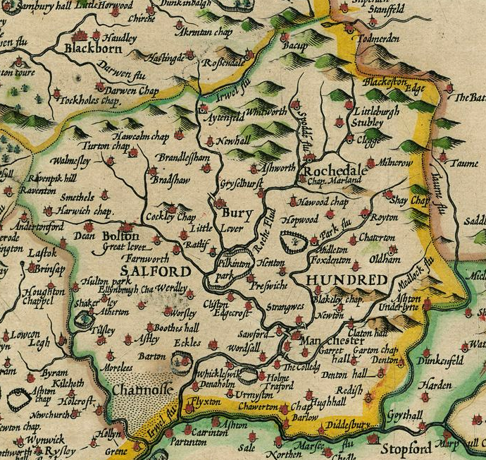
The Salford Hundred (also known as Salfordshire) was one of the subdivisions of the historic county of Lancashire, in Northern England (see:Hundred (county division). Its name alludes to its judicial centre being the township of Salford (the suffix ''-shire'' meaning the territory was appropriated to the prefixed settlement). It was also known as the Royal Manor of Salford and the Salford wapentake.. Origins The Manor or Hundred of Salford had Anglo-Saxon origins. The ''Domesday Book'' recorded that the area was held in 1066 by Edward the Confessor. Salford was recorded as part of the territory of ''Inter Ripam et Mersam'' or "Between Ribble and Mersey", and it was included with the information about Cheshire, though it cannot be said clearly to have been part of Cheshire. The area became a subdivision of the County Palatine of Lancaster (or Lancashire) on its creation in 1182. Salford Hundred Court In spite of its incorporation into Lancashire, Salford Hundred retained a se ... [...More Info...] [...Related Items...] OR: [Wikipedia] [Google] [Baidu] |
.jpg)


%2C_1996.jpg)


