|
Allmersbach
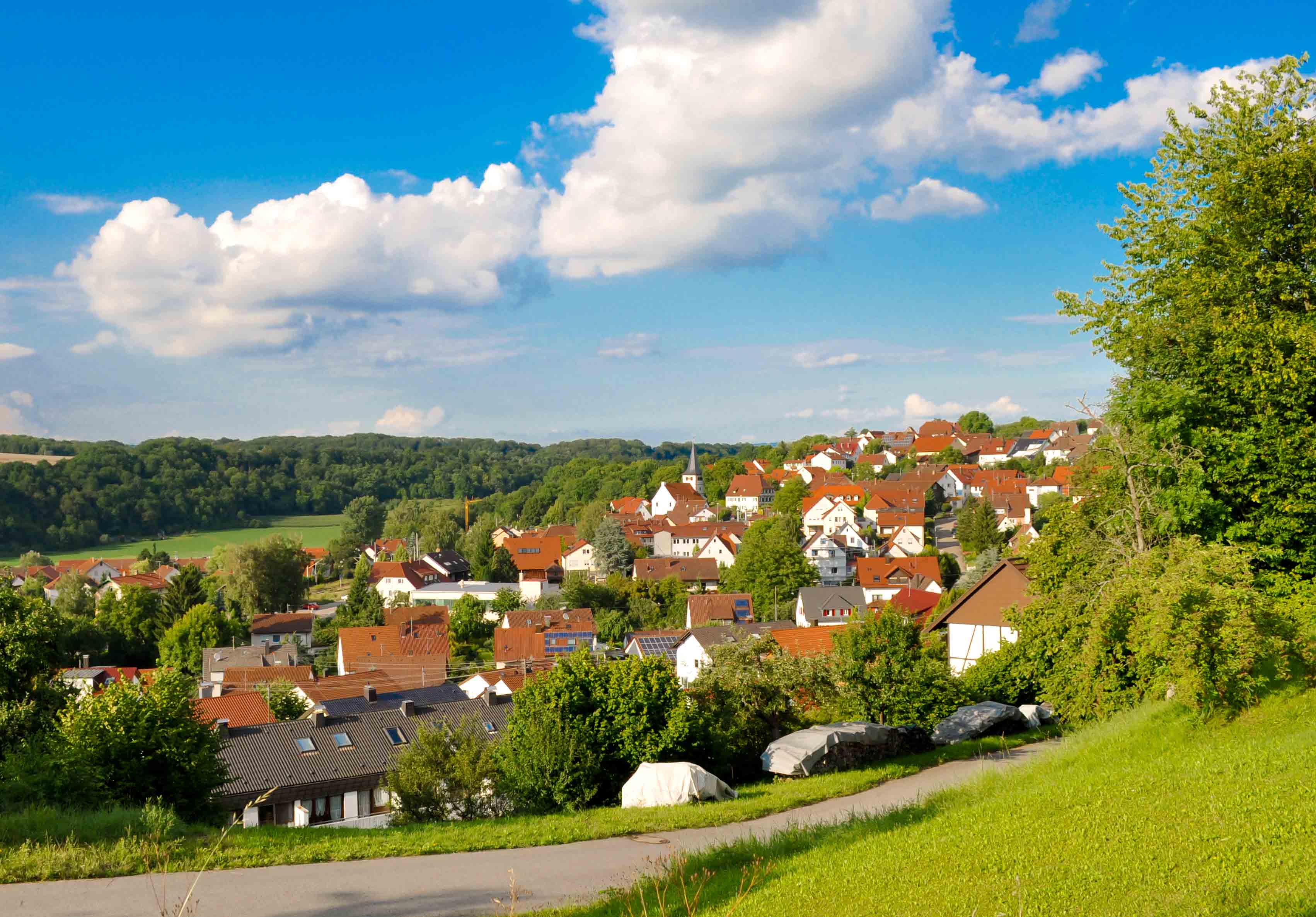
Allmersbach im Tal is a municipality in the Rems-Murr district of Baden-Württemberg, Germany. It belongs to the Stuttgart Region (''middle Neckar Region'' until 1992) and to the boundary area of the Stuttgart Metropolitan Region. History Allmersbach im Tal was first mentioned in 1291, relating to the gifting of goods from the Countess Richinza von Löwenstein to the Teutonic Order of Winnenden. Owing to this gifting, Manorialism came into the hands of the Dominican Monastery Weiler bei Esslingen. In the 16th Century the Reformation lead to the town falling under the jurisdiction of Württemberg. Until 1712 Allmersbach im Tal belonged to the monastery court mastery and until 1807 to the monasterial administration of the monastery Weiler bei Esslingen. With the new administrative structure of the Kingdom of Württemberg, Allmersbach was assigned to the Backnang offices. During NS-rule, 1938 reforms assigned Allmersbach to the Backnang district. In 1945 the town was a par ... [...More Info...] [...Related Items...] OR: [Wikipedia] [Google] [Baidu] |
Rems-Murr-Kreis
Rems-Murr is a ''Landkreis'' (district) in the middle of Baden-Württemberg, Germany. Neighboring districts are (from north clockwise) Heilbronn, Schwäbisch Hall, Ostalbkreis, Göppingen, Esslingen, the district-free city Stuttgart and the district Ludwigsburg. History The district was created in 1973 when Waiblingen was merged with most of the district Backnang and a few municipalities from the district Schwäbisch Gmünd. Geography The largest part of the district is located in the Swabian-Franconian Forest (''Schwäbisch-Fränkischer Wald''), of which the Mainhardt Forest forms a part. The two rivers Rems and Murr gave the district its name. Coat of arms The coat of arms shows a deer antler in the middle, the symbol of the former state of Württemberg. The two wavy blue lines above and below symbolize the two rivers Murr (in the north) and Rems (in the south) after which the district was named. Twinning Rems-Murr-Kreis is twinned with: * Southampton, United Kingdom ... [...More Info...] [...Related Items...] OR: [Wikipedia] [Google] [Baidu] |
Aspach, Baden-Württemberg
Aspach is a community in the Rems-Murr-Kreis in Germany, near Backnang. Aspach is made up of four, formerly independent villages: Großaspach, Kleinaspach, Allmersbach and Rietenau. In 1972, the 4 villages joined forces under the name Aspach. The villages were founded between 950BC and 1150BC. Rietenau is home to natural springs and used to be a popular Spa until early 1900. Water from Rietenau is still bottled today. The main village, Großaspach, is the birthplace of Hans Werner Aufrecht, co-founder of AMG Engine Production and Development, more commonly known as AMG, as well as the meaning of the "G" in the name. It is commonly mistaken for being the company's first location, but no AMG office, factory, or research facility has ever been located there - except for the garage, where Aufrecht and Melcher (the M in AMG) started out tuning cars and engines. Sports Großaspach is the home of SG Sonnenhof Großaspach, football club, playing in the Regionalliga Südwest. Notable p ... [...More Info...] [...Related Items...] OR: [Wikipedia] [Google] [Baidu] |
Althütte
Althütte is a municipality of the Rems-Murr district in Baden-Württemberg, Germany. History The modern municipality of Althütte was formed by the merging of the villages of Althütte and Sechselberg in 1971. Geography The municipality (''Gemeinde'') of Althütte is located in the Rems-Murr district, in the German state of Baden-Württemberg. Althütte is physically located in the Murrhardt Forest, a region of the larger Swabian-Franconian Forest. Elevation above sea level in the municipal area ranges from a high of Normalnull (NN) to a low of NN. Portions of the Federally protected Hörschbachschlucht and nature reserves are located in Althütte's municipal area. Politics Althütte has two boroughs (''Ortsteile''), and 16 villages: Fautspach, Gallenhof, Glaitenhof, Hahnenhof, Hörschhof, Hörschhöfer Sägmühle, Kallenberg, Klösterle, Lutzenberg, Nonnenmühle, Rottmannsberger Sägmühle, Schlichenhöfle, Schlichenweiler, Schöllhütte, Voggenhof, and Waldenweiler. A ... [...More Info...] [...Related Items...] OR: [Wikipedia] [Google] [Baidu] |
Württemberg-Baden
Württemberg-Baden was a state of the Federal Republic of Germany. It was created in 1945 by the United States occupation forces, after the previous states of Baden and Württemberg had been split up between the US and French occupation zones. Its capital was Stuttgart. In 1952, Württemberg-Baden merged with Württemberg-Hohenzollern and Baden into the present state of Baden-Württemberg. History Württemberg-Baden consisted of the northern halves of the former states of Württemberg and Baden. The southern border of this part of the US-administered zone was set so that the autobahn connecting Karlsruhe and Munich (today the A8) was completely contained within the American zone. The three major subdivisions of the American zone (Greater Hesse, Bavaria and Württemberg-Baden) were declared on 19 September 1945. On 24 November 1946, a new constitution was enacted and Württemberg-Baden's first parliament was elected. On 23 May 1949, the state became a founding member of the F ... [...More Info...] [...Related Items...] OR: [Wikipedia] [Google] [Baidu] |
Burgstetten
Burgstetten is a municipality in the district of Rems-Murr in Baden-Württemberg in Germany Germany,, officially the Federal Republic of Germany, is a country in Central Europe. It is the second most populous country in Europe after Russia, and the most populous member state of the European Union. Germany is situated betwe .... References Rems-Murr-Kreis {{RemsMurr-geo-stub ... [...More Info...] [...Related Items...] OR: [Wikipedia] [Google] [Baidu] |
Auenwald
Auenwald is a municipality in the district of Rems-Murr in Baden-Württemberg in Germany. Twin town The twin town of Auenwald is: * Beaurepaire, Isère, France France (), officially the French Republic ( ), is a country primarily located in Western Europe. It also comprises of overseas regions and territories in the Americas and the Atlantic, Pacific and Indian Oceans. Its metropolitan area ..., since 1987 References Rems-Murr-Kreis Württemberg {{RemsMurr-geo-stub ... [...More Info...] [...Related Items...] OR: [Wikipedia] [Google] [Baidu] |
Municipal Association (Germany)
Municipal associations (german: Verwaltungsgemeinschaften) are statutory corporations or public bodies created by statute in the German federal states of Bavaria, Saxony, Thuringia, and Schleswig-Holstein. In Baden-Württemberg the term ''stipulated municipal association'' (german: vereinbarte Verwaltungsgemeinschaft) is used. Structure A municipal association normally consists of several adjacent municipalities located in the same district. It is controlled by a political representative, chairperson or executive board. Depending on the state, this person may be officially retained or appointed as mayor. * In Baden-Württemberg this position is held by the mayor of the appropriate fulfilling municipality (german: erfüllende Gemeinde). * In Thuringia there are municipal associations as well as fulfilling municipalities. * In Bavaria one mayor of a single municipality also acts as municipal chairman (german: Gemeinschaftsvorsitzender) of the association. Tasks The duties of ... [...More Info...] [...Related Items...] OR: [Wikipedia] [Google] [Baidu] |
Naturschutzgebiet
A ''Naturschutzgebiet'' (abbreviated NSG) is a category of protected area (nature reserve) within Germany's Federal Nature Conservation Act (the ''Bundesnaturschutzgesetz'' or ''BNatSchG''). Although often translated as 'Nature Reserve' in English, the Federal Agency for Nature Conservation (BfN) refers to them as 'Nature Conservation Areas'. It meets the criteria of an IUCN Category IV Habitat and Species Management Area.https://www.bfn.de/fileadmin/MDB/documents/themen/gebietsschutz/IUCN_Kat_Schutzgeb_Richtl_web.pdf Document of the Federal Agency for Nature Conservation of Germany Points of law The use of the term ''Naturschutzgebiet'' or terms that could be confused with it for anything other than the legally protected areas is forbidden under this law. Signage Because legal restrictions are placed on activity within German nature reserves they have to be signed on the ground. Only by this means can e.g. walkers know that they are entering a nature reserve and may not e. ... [...More Info...] [...Related Items...] OR: [Wikipedia] [Google] [Baidu] |
Normalnull
("standard zero") or (short N. N. or NN ) is an outdated official vertical datum used in Germany. Elevations using this reference system were to be marked (“meters above standard zero”). has been replaced by (NHN). History In 1878 reference heights were taken from the Amsterdam Ordnance Datum and transferred to the New Berlin Observatory in order to define the . has been defined as a level going through an imaginary point 37.000 m below . When the New Berlin Observatory was demolished in 1912 the reference point was moved east to the village of Hoppegarten (now part of the town of Müncheberg, Brandenburg, Germany Germany,, officially the Federal Republic of Germany, is a country in Central Europe. It is the second most populous country in Europe after Russia, and the most populous member state of the European Union. Germany is situated betwe ...).S. German: ''Was ist "Normal-Null"?''. In: ''Physikalische Blätter'' 1958, vol 14, issue 2, p. ... [...More Info...] [...Related Items...] OR: [Wikipedia] [Google] [Baidu] |
Welzheim Forest
The Welzheim Forest (german: Welzheimer Wald) is a wooded, hill ridge, up to , in the counties of Rems-Murr, Ostalb and Schwäbisch Hall in Baden-Württemberg (Germany). Geography Location The Welzheim Forest lies just under 38 kilometres east-northeast of Stuttgart and about 45 kilometres southeast of Heilbronn between the Murrhardt Forest and the Mainhardt Forest in the north, the Frickenhofer Höhe in the east-northeast, the Albuch in the southeast, the Schurwald in the southwest and the Berglen and Buocher Höhe in the west. At the same time, the Welzheim Forest is one of five forest regions in the Swabian-Franconian Forest Nature Park. As a natural region it is, however, not counted with the Swabian-Franconian Forest but, together with the Schurwald and the Berglen, forms its own natural region. It takes its name from the town of Welzheim in the centre of the region. The Welzheim Forest is located around Welzheim, Kaisersbach and Alfdorf roughly betwe ... [...More Info...] [...Related Items...] OR: [Wikipedia] [Google] [Baidu] |
Schurwald
The Schurwald is a wooded mountain range in Baden-Württemberg, southern Germany, which at its highest point is 513.2 m above sea level. It is one of the most important Recreation areas for the Stuttgart area. Over the centuries, the vast forests of the mountain range supplied the surrounding towns and villages with wood for fuel and building material, and thus acquired the name "Schurwald", which comes from the German word, ''Schur'', which can mean a shearing or clearcutting. Geography The Schurwald begins to the east of Stuttgart and runs eastwards to the foothills of the Swabian Alb, passing through the districts of Esslingen, Göppingen and Rems-Murr-Kreis. It is bordered to the south by valleys of the Neckar and Fils rivers, and to the north by the valley of the Rems. At the eastern end of the Schurwald, which is crossed by numerous streams, is the Herrenbach Reservoir. Geology Geologically, the Schurwald is a dissected cuesta, formed by headward erosion. It contains clay ... [...More Info...] [...Related Items...] OR: [Wikipedia] [Google] [Baidu] |
Federal Republic Of Germany
Germany,, officially the Federal Republic of Germany, is a country in Central Europe. It is the second most populous country in Europe after Russia, and the most populous member state of the European Union. Germany is situated between the Baltic and North seas to the north, and the Alps to the south; it covers an area of , with a population of almost 84 million within its 16 constituent states. Germany borders Denmark to the north, Poland and the Czech Republic to the east, Austria and Switzerland to the south, and France, Luxembourg, Belgium, and the Netherlands to the west. The nation's capital and most populous city is Berlin and its financial centre is Frankfurt; the largest urban area is the Ruhr. Various Germanic tribes have inhabited the northern parts of modern Germany since classical antiquity. A region named Germania was documented before AD 100. In 962, the Kingdom of Germany formed the bulk of the Holy Roman Empire. During the 16th century, north ... [...More Info...] [...Related Items...] OR: [Wikipedia] [Google] [Baidu] |

