|
Allithwaite
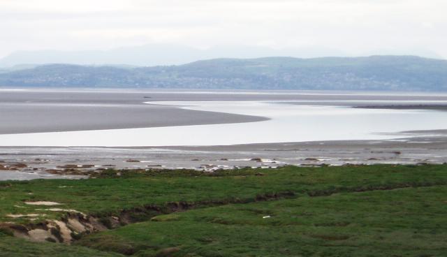
Allithwaite is a small village in Cumbria, England, located roughly west of Grange-over-Sands. Most of its residents commute to local areas of Ulverston, Barrow-in-Furness, Kendal or Lancaster to work. Historically in Lancashire, Allithwaite, and the village of Cartmel situated to the north, are part of the civil parish of Lower Allithwaite. At the 2001 census, the parish had a population of 1,758, increasing to 1,831 at the 2011 Census. There is also a civil parish previously known as Upper Allithwaite which was renamed in 2018 as Lindale and Newton-in-Cartmel, and includes Lindale, Low Newton and High Newton. The population of this parish at the 2011 Census was 843. The Anglican parish church is St. Mary's Church, built in 1864–65 and designed by the Lancaster architect E. G. Paley. There is a small primary school, Allithwaite Primary C of E School located next to the church. Both church and school were built by a legacy left to the village. The village al ... [...More Info...] [...Related Items...] OR: [Wikipedia] [Google] [Baidu] |
Lindale And Newton-in-Cartmel
Lindale and Newton-in-Cartmel, formerly Upper Allithwaite (sometimes Allithwaite Upper) is a civil parish in South Lakeland, Cumbria, England. The spelling Lindale and Newton in Cartmel, without hyphens, is used by the parish council. The parish includes the villages of Lindale, High Newton and Low Newton and lies north of Grange-over-Sands. The parish has an area of and in the UK census 2011 had a population of 842. History Upper Allithwaite was formerly a township in the parish of Cartmel, in 1866 Upper Allithwaite became a civil parish in its own right. The parish was renamed from "Upper Allithwaite" to "Lindale and Newton-in-Cartmel" on 16 April 2018 as the new name provides a clearer description of the geographical area. Listed buildings There are 15 listed buildings or structures in the parish, including St Paul's church, Lindale and the grade II* listed Barrow Wife, a former Quaker Quakers are people who belong to a historically Protestant Christian set of ... [...More Info...] [...Related Items...] OR: [Wikipedia] [Google] [Baidu] |
St Mary's Church, Allithwaite
St Mary's Church is in the village of Allithwaite, Cumbria, England. It is an active Anglican parish church in the deanery of Windermere, the archdeacon of Westmorland and Furness, and the diocese of Carlisle. Its benefice is united with those of St Mary and St Michael, Cartmel, St Peter, Field Broughton, St John the Baptist, Flookburgh, St Paul, Grange-over-Sands, Grange Fell Church, Grange-Over-Sands, and St Paul, Lindale to form the benefice of Cartmel Peninsula. The church is recorded in the National Heritage List for England as a designated Grade II listed building. History The church was built in 1864–65 and designed by the Lancaster architect E. G. Paley. At the same time Paley designed the village school and vicarage. These were financed by Miss Mary Winfield Lambert of Boarbank Hall, who died in 1857 and bequeathed £2,500 (equivalent to £ in ) towards the church, £1,000 for the school, and £1,500 for the vicar ... [...More Info...] [...Related Items...] OR: [Wikipedia] [Google] [Baidu] |
Lower Allithwaite
Lower Allithwaite is a civil parish in the South Lakeland district of the English county of Cumbria. It includes the villages of Allithwaite and Cartmel, the historic Cartmel Priory, Humphrey Head and Cartmel Racecourse Cartmel Racecourse is a small national hunt racecourse in the village of Cartmel, now in the ceremonial county of Cumbria, historically in Lancashire. Nine racedays are held each year, starting on the Whit Holiday weekend at the end of May and e .... In the 2001 census the parish had a population of 1,758, increasing at the 2011 census to 1,831. See also * Listed buildings in Lower Allithwaite References External links Cumbria County History Trust: Allithwaite, Lower(nb: provisional research only - see Talk page) Civil parishes in Cumbria {{Cumbria-geo-stub ... [...More Info...] [...Related Items...] OR: [Wikipedia] [Google] [Baidu] |
Cartmel
Cartmel is a village in Cumbria, England, northwest of Grange-over-Sands close to the River Eea. The village takes its name from the Cartmel Peninsula, and was historically known as Kirkby in Cartmel. The village is the location of the 12th-century Cartmel Priory, around which it initially grew. Historically in Lancashire, since 1974 it has been in the administrative county of Cumbria. Whilst its history has been in its ecclesiastical and agricultural communities, Cartmel has since the mid-twentieth century developed as a minor tourist destination, being just outside the Lake District National Park. Several attractions in the village, including Cartmel Racecourse and a Michelin-starred restaurant, cater to this tourist trade. History The name Cartmel means ‘sandbank by rocky ground’, from the Old Norse (rocky ground) and . The place-name is first attested in 677, when the Cartmel Peninsula was granted to St Cuthbert, whose influence may explain why by the Norman Conque ... [...More Info...] [...Related Items...] OR: [Wikipedia] [Google] [Baidu] |
Lindale, Cumbria
Lindale - traditionally Lindale in Cartmel - is a village in the south of Cumbria. It lies on the north-eastern side of Morecambe Bay, England. It was part of Lancashire from 1182 to 1974. It is in the civil parish of Lindale and Newton-in-Cartmel, in South Lakeland district. History Lindale's most famous resident was John "Iron-Mad" Wilkinson, an ironworker and inventor who lived in the village from 1750, where he owned the Castle Head estate. He produced the iron for and helped design the world's first iron bridge (at Ironbridge and Broseley) and he made the world's first iron boat in 1787. A large iron obelisk stands in the village as memorial to him. Traditionally a farming village, Lindale's proximity to the A590 road has seen a growth in the number of commuters who live there. It is also a centre for car showrooms. The local tourist boom has largely missed Lindale, with nearby Grange-over-Sands developing into a seaside resort, and villages to the north and west (such as ... [...More Info...] [...Related Items...] OR: [Wikipedia] [Google] [Baidu] |
Grange-over-Sands
Grange-over-Sands is a town and civil parish located on the north side of Morecambe Bay in Cumbria, England, a few miles south of the Lake District National Park. In the 2001 census the parish had a population of 4,042, increasing at the 2011 census to 4,114. Historically part of Lancashire, the town was created as an urban district in 1894. Since the 1974 local government re-organisation, it has been of the South Lakeland district of Cumbria, though it remains part of the Duchy of Lancaster. Travelling by road, Grange-over-Sands is to the south of Kendal, to the east of Ulverston, to the east of Barrow-in-Furness and to the west of Lancaster. History The town developed in the Victorian era from a small fishing village and the arrival of the railway in 1857 made it a popular seaside resort on the north side of Morecambe Bay, across the sands from Morecambe. The "over-Sands" suffix was added in the late 19th or early 20th century by the local vicar, who was fed up with ... [...More Info...] [...Related Items...] OR: [Wikipedia] [Google] [Baidu] |
High Newton
High Newton is a village in the South Lakeland district, in the county of Cumbria, England. By-pass Formerly, the village was bisected by the A590 road until a bypass of the village and its neighbour Low Newton was completed. It opened on Tuesday 8 April 2008. Nearby settlements Nearby settlements include the town of Grange-over-Sands, the villages of Lindale, Low Newton and Newby Bridge and the hamlets of Ayside, Field Broughton and Barber Green. See also *Listed buildings in Lindale and Newton-in-Cartmel Lindale and Newton-in-Cartmel (sometimes spelled without hyphens) is a civil parish in the South Lakeland District of Cumbria Cumbria ( ) is a ceremonial and non-metropolitan county in North West England, bordering Scotland. The county an ... References External links Cumbria County History Trust: Upper Allithwaite(nb: provisional research only – see Talk page) Villages in Cumbria South Lakeland District {{Cumbria-geo-stub ... [...More Info...] [...Related Items...] OR: [Wikipedia] [Google] [Baidu] |
Quoin
Quoins ( or ) are masonry blocks at the corner of a wall. Some are structural, providing strength for a wall made with inferior stone or rubble, while others merely add aesthetic detail to a corner. According to one 19th century encyclopedia, these imply strength, permanence, and expense, all reinforcing the onlooker's sense of a structure's presence. Stone quoins are used on stone or brick buildings. Brick quoins may appear on brick buildings, extending from the facing brickwork in such a way as to give the appearance of generally uniformly cut ashlar blocks of stone larger than the bricks. Where quoins are decorative and non-load-bearing a wider variety of materials is used, including timber, stucco, or other cement render. Techniques Ashlar blocks In a traditional, often decorative use, large rectangular ashlar stone blocks or replicas are laid horizontally at the corners. This results in an alternate, quoining pattern. Alternate cornerstones Courses of large and small c ... [...More Info...] [...Related Items...] OR: [Wikipedia] [Google] [Baidu] |
Free Warren
A free warren—often simply warren—is a type of franchise or privilege conveyed by a sovereign in medieval England to an English subject, promising to hold them harmless for killing game of certain species within a stipulated area, usually a wood or small forest. The sovereign involved might be either the monarch or a marcher lord. Law The grant of free warren could be as a gift, or in exchange for consideration, and might be later alienated by the grantee. The stipulated area might be coextensive with the frank-tenement of the grantee, or it might be discontinuous or even at a considerable remove from the grantee's holdings. The right of free warren did not extend automatically to the freeholder of the soil. Although the rights of free warren are usually discussed in the context of forest law, the only law which applied within the warren was common law. Thus, even though the warrant ultimately derived from the sovereign, the only statutes applied to poachers i ... [...More Info...] [...Related Items...] OR: [Wikipedia] [Google] [Baidu] |
Garderobe
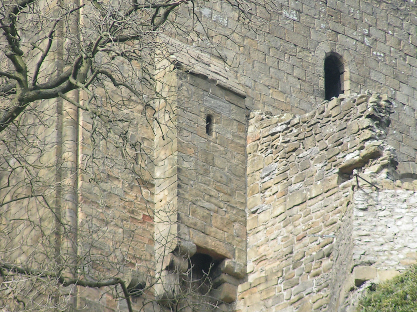
Garderobe is a historic term for a room in a medieval castle. The ''Oxford English Dictionary'' gives as its first meaning a store-room for valuables, but also acknowledges "by extension, a private room, a bed-chamber; also a privy". The word derives from the French , meaning "robes (or clothing) protector": thus, a closet or a toilet seat that would tend to prevent clothing from getting soiled. Its most common use now is as a term for a castle toilet. Store room is the French word for "wardrobe", a lockable place where clothes and other items are stored. According to medieval architecture scholar Frank Bottomley, garderobes were "Properly, not a latrine or privy but a small room or large cupboard, usually adjoining the chamber edroomor solar iving roomand providing safe-keeping for valuable clothes and other possessions of price: cloth, jewels, spices, plate and money." Toilet The term ''garderobe'' is also used to refer to a medieval or Renaissance toilet or a close stool ... [...More Info...] [...Related Items...] OR: [Wikipedia] [Google] [Baidu] |
Peel Tower
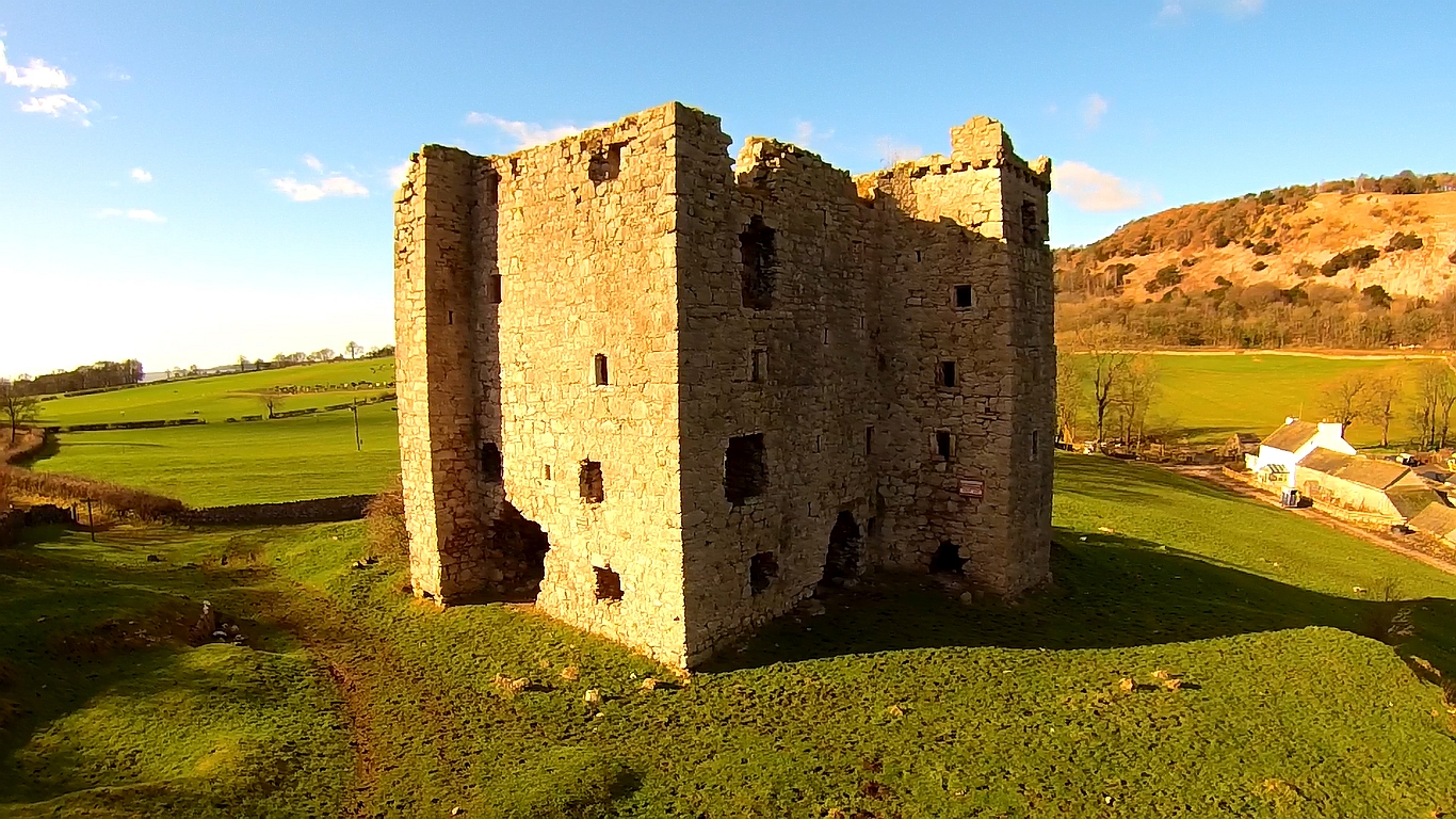
Peel towers (also spelt pele) are small fortified keeps or tower houses, built along the English and Scottish borders in the Scottish Marches and North of England, mainly between the mid-14th century and about 1600. They were free-standing with defence being a prime consideration of their design with "confirmation of status and prestige" also playing a role. They also functioned as watch towers where signal fires could be lit by the garrison to warn of approaching danger. The FISH Vocabulary ''Monument Types Thesaurus'' lists "pele" alongside "bastle", "fortified manor house" and "tower house" under the broader term "fortified house". Pevsner defines a peel as simply a stone tower. Outside of this, "peel" or "pele" can also be used in related contexts, for example a "pele" or "barmkin" (in Ireland a bawn) was an enclosure where livestock were herded in times of danger. The rustling of livestock was an inevitable part of Border raids, and often their main purpose. In th ... [...More Info...] [...Related Items...] OR: [Wikipedia] [Google] [Baidu] |
Clapham, North Yorkshire
Clapham is a village in the civil parish of Clapham cum Newby in the Craven district of North Yorkshire, England. It was previously in the West Riding of Yorkshire. It lies within the Yorkshire Dales National Park, north-west of Settle, and just off the A65 road. History The church of St James in Clapham was founded in Norman times, and originally dedicated to St Michael. It is mentioned in records dating back to 1160. The village and church were burned during a Scottish raid following the Battle of Bannockburn in the early 14th century. The church tower was probably erected following this incident, but the rest of the church dates from the 19th century. In the 14th century John de Clapham, who took his surname from the village, was a supporter of the Earl of Warwick and lived at Clapdale Castle. His descendants took part in the Wars of the Roses on the side of the House of Lancaster. Since the 18th century Clapham has been home to the Farrer family who established their ... [...More Info...] [...Related Items...] OR: [Wikipedia] [Google] [Baidu] |


