|
Alexander Ross (Australian Politician)
Alexander Ross (21 November 1843 – 27 September 1912) was a Scottish-born Australian politician. He was born at Rutherglen in Lanarkshire to manufacturer Alexander Ross and Janet Forrest. He received a primary education and emigrated to South Australia with his family in 1854, settling near Gumeracha. In 1867 the family moved to Albury, where they acquired farm land. In 1898 he married Ada Smyles. In 1900 Ross was appointed to the New South Wales Legislative Council, where he served until his death at Randwick in 1912. At his death he held property around Inverell, Coleambally, Harden, Hay and Macquarie Fields Macquarie Fields is a suburb of Sydney, in the state of New South Wales, Australia. Macquarie Fields is located 38 kilometres south-west of the Sydney central business district, in the local government area of the City of Campbelltown and .... References 1843 births 1912 deaths Members of the New South Wales Legislative Council People from Lanark ... [...More Info...] [...Related Items...] OR: [Wikipedia] [Google] [Baidu] |
Rutherglen
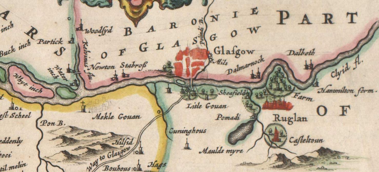
Rutherglen (, sco, Ruglen, gd, An Ruadh-Ghleann) is a town in South Lanarkshire, Scotland, immediately south-east of the city of Glasgow, from its centre and directly south of the River Clyde. Having existed as a Lanarkshire burgh in its own right for more than 800 years, in 1975 Rutherglen lost its own local council and administratively became a component of the City of Glasgow (1975–1996), City of Glasgow District within the Strathclyde Local government areas of Scotland 1973–96, region (along with neighbouring Cambuslang). In 1996 the towns were reallocated to the South Lanarkshire Subdivisions of Scotland, council area.From a pawnbrokers to Parliament - Tommy McAvoy looks back on a career that too ... [...More Info...] [...Related Items...] OR: [Wikipedia] [Google] [Baidu] |
Lanarkshire
Lanarkshire, also called the County of Lanark ( gd, Siorrachd Lannraig; sco, Lanrikshire), is a historic county, lieutenancy area and registration county in the central Lowlands of Scotland. Lanarkshire is the most populous county in Scotland, as it contains most of Glasgow and the surrounding conurbation. In earlier times it had considerably greater boundaries, including neighbouring Renfrewshire until 1402. Lanarkshire is bounded to the north by the counties of Stirlingshire and Dunbartonshire (this boundary is split into two sections owing to Dunbartonshire's Cumbernauld exclave), to the northeast by West Lothian and Mid Lothian, to the east by Peeblesshire, to the south by Dumfriesshire, and to the west by Ayrshire and Renfrewshire. Administrative history Lanarkshire was historically divided between two administrative areas. In the mid-18th century it was divided again into three wards: the upper, middle and lower wards with their administrative centres at Lanark, Hamil ... [...More Info...] [...Related Items...] OR: [Wikipedia] [Google] [Baidu] |
South Australia
South Australia (commonly abbreviated as SA) is a state in the southern central part of Australia. It covers some of the most arid parts of the country. With a total land area of , it is the fourth-largest of Australia's states and territories by area, and second smallest state by population. It has a total of 1.8 million people. Its population is the second most highly centralised in Australia, after Western Australia, with more than 77 percent of South Australians living in the capital Adelaide, or its environs. Other population centres in the state are relatively small; Mount Gambier, the second-largest centre, has a population of 33,233. South Australia shares borders with all of the other mainland states, as well as the Northern Territory; it is bordered to the west by Western Australia, to the north by the Northern Territory, to the north-east by Queensland, to the east by New South Wales, to the south-east by Victoria, and to the south by the Great Australian Bight.M ... [...More Info...] [...Related Items...] OR: [Wikipedia] [Google] [Baidu] |
Gumeracha, South Australia
Gumeracha ( ) is a town in the Adelaide Hills, South Australia, located on the Adelaide-Mannum Road. It is located in the Adelaide Hills Council local government area on the south bank of the upper River Torrens. At the 2006 census, Gumeracha had a population of 731. The region relies heavily on grazing, dairying, grape growing, orchards and market gardening. History The original inhabitants of the area were the Peramangk people, and the name "Gumeracha" derives from an Aboriginal word meaning "fine waterhole". The area was one of the earliest settled by Europeans in South Australia. First to explore the district were Dr George Imlay and John Hill, on 24 January 1838. In 1839, the South Australia Company took up a parcel of land, on which the settlements of Gumeracha, Kenton Valley and Forreston developed. The company established a district headquarters and opened it up for sheep grazing. In 1841, The South Australian Company built a home for the first manager of the s ... [...More Info...] [...Related Items...] OR: [Wikipedia] [Google] [Baidu] |
Albury, New South Wales
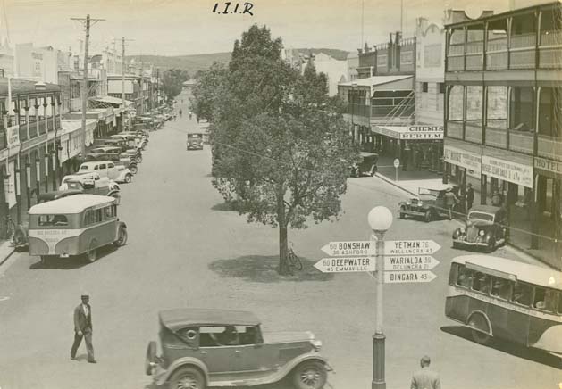
Albury () is a major regional city in New South Wales, Australia. It is located on the Hume Highway and the northern side of the Murray River. Albury is the seat of local government for the council area which also bears the city's name – the City of Albury. It is on the Victoria-New South Wales border. Albury has an urban population of 49,172 and is separated from its twin city in Victoria, Wodonga, by the Murray River. Together, the two cities form an urban area with a population of 93,603 at June 2018. Estimated resident population, 30 June 2018. It is from the state capital Sydney and from the Victorian capital Melbourne. Said to be named after a village in England, Albury developed as a major transport link between New South Wales and Victoria and was proclaimed a city in 1946. History The Wiradjuri people were the first known humans to occupy the area, (Wiradjuri northern dialect pronunciation iraːjd̪uːraj or Wirraayjuurray people (Wiradjuri southern dialect pron ... [...More Info...] [...Related Items...] OR: [Wikipedia] [Google] [Baidu] |
New South Wales Legislative Council
The New South Wales Legislative Council, often referred to as the upper house, is one of the two chambers of the parliament of the Australian state of New South Wales. The other is the Legislative Assembly. Both sit at Parliament House in the state capital, Sydney. It is normal for legislation to be first deliberated on and passed by the Legislative Assembly before being considered by the Legislative Council, which acts in the main as a house of review. The Legislative Council has 42 members, elected by proportional representation in which the whole state is a single electorate. Members serve eight-year terms, which are staggered, with half the Council being elected every four years, roughly coinciding with elections to the Legislative Assembly. History The parliament of New South Wales is Australia's oldest legislature. It had its beginnings when New South Wales was a British colony under the control of the Governor, and was first established by the ''New South Wales Act ... [...More Info...] [...Related Items...] OR: [Wikipedia] [Google] [Baidu] |
Randwick, New South Wales
Randwick is a suburb of Sydney, in the state of New South Wales, Australia. Randwick is located 6 kilometres south-east of the Sydney central business district and is the administrative centre for the local government area of the City of Randwick. Randwick is part of the Eastern Suburbs region. The postcode is 2031. History Randwick was named after the village of Randwick, Gloucestershire, England, birthplace of Simeon Henry Pearce, who became Mayor of Randwick six times. Simeon, who migrated to Australia in 1842, and his brother James who arrived in 1848, were responsible for the founding and early development of Randwick. Simeon built the first stone house in the area in 1848, called Blenheim House, which can still be seen in Blenheim Street. It was neglected for some time in the mid-1900s, but was eventually acquired by Randwick City Council and restored. Proclaimed as a Municipality in February 1859, and as a City in 1990, Randwick has a rich history and a number of herit ... [...More Info...] [...Related Items...] OR: [Wikipedia] [Google] [Baidu] |
Inverell, New South Wales
Inverell is a large town in northern New South Wales, Australia, situated on the Macintyre River, close to the Queensland border. It is also the centre of Inverell Shire. Inverell is located on the Gwydir Highway on the western slopes of the Northern Tablelands. It has a temperate climate. In the , the population of Inverell was 12,057 and the Inverell Shire population was 17,853. History Prior to white settlement, the Gamilaraay Nation (commonly known as Kamilaroi) of Aboriginal peoples lived in and occupied this region. In 1848, Alexander Campbell held the Inverell Station on the Macintyre River. The name derives from the name of Mr. MacIntyre's estate. The word is of Gaelic origin, and signifies "meeting place of the swans"; from "Inver", a meeting place, and "Ell", a swan. The MacIntyre River and Swanbrook Creek join here. The area was also known as "Green Swamp" in the 1850s. Wheat growers, Colin and Rosanna Ross established a store there in 1853, when he asked that a ... [...More Info...] [...Related Items...] OR: [Wikipedia] [Google] [Baidu] |
Coleambally
Coleambally () is a small town in the Riverina of New South Wales, Australia, in Murrumbidgee Local Government Area. Coleambally is one of the newest towns in the state of New South Wales, officially opened in June 1968, with the Post Office opening on 1 April 1970. Designed to act as the centre for the surrounding Coleambally Irrigation Area, at the 2016 census, Coleambally had a population of 1331. Its name is Aboriginal, probably meaning a swift in flight. The spine-tailed swift is one of the most powerful fliers known, wheeling and sweeping at high speed in search of flying insects. Coleambally can be accessed by road from Sydney and Canberra via the Hume Highway and Burley Griffin Way and from Melbourne via the Hume Highway, Newell Highway and the Kidman Way. Coleambally is home to some of the most endangered species in Australia, the Bittern, Southern Bell Frog and it has many other species of native flora and fauna. Coleambally has many kangaroos and birds, Gala ... [...More Info...] [...Related Items...] OR: [Wikipedia] [Google] [Baidu] |
Harden, New South Wales
Harden–Murrumburrah is a township and community in the Hilltops Region and is located in the South West Slopes of New South Wales in Australia. Harden is adjacent to both the Canberra region of the Australian Capital Territory and the Riverina Region in the southwest area of NSW. The town is a twin town between Harden and Murrumburrah (which is noted as one of the earliest settlements in the southwest of New South Wales). The town is traversed by the Burley Griffin Way, the major link from and between the Riverina and the Hume Highway near Yass, and ultimately Sydney, Canberra and the coast. Cunningham Creek runs along the edge of the town. The Olympic Highway traverses the western end of the shire and is the major link through the central west to the Blue Mountains and from there to the Sydney region. Harden is 3½ hours away by road from Sydney, and 1½ hours from Canberra and Wagga Wagga. History Before European settlement the Harden area was inhabited by the Wi ... [...More Info...] [...Related Items...] OR: [Wikipedia] [Google] [Baidu] |
Hay, New South Wales
Hay is a town in the western Riverina region of south western New South Wales, Australia. It is the administrative centre of Hay Shire local government area and the centre of a prosperous and productive agricultural district on the wide Hay Plains. Located approximately midway between Sydney and Adelaide at the junction of the Sturt, Cobb and Mid-Western Highways, Hay is an important regional and national transport node. The town itself is built beside the Murrumbidgee River, part of the Murray-Darling river system; Australia's largest. The main business district of Hay is situated on the north bank of the river. History Aboriginal communities in the western Riverina were traditionally concentrated in the more habitable river corridors and amongst the reedbeds of the region. The district surrounding Hay was occupied by at least three separate Aboriginal groups at the time of European settler expansion onto their lands. The area around the present township ap ... [...More Info...] [...Related Items...] OR: [Wikipedia] [Google] [Baidu] |
Macquarie Fields, New South Wales
Macquarie Fields is a suburb of Sydney, in the state of New South Wales, Australia. Macquarie Fields is located 38 kilometres south-west of the Sydney central business district, in the local government area of the City of Campbelltown and is part of the Macarthur region. Macquarie Fields is surrounded by bushland. Nearby Macquarie Links, is a high-security housing estate beside an international standard golf course. The suburb has multiple high schools including Macquarie Fields High School and James Meehan High School. History The original inhabitants of the Macquarie Fields area were the Darug people of western Sydney. The rich soil of the area was home to an abundance of plants which in turn attracted animals such as kangaroos and emus, both of which along with this part with yams and other native vegetables and fruit were part of the diet of the Darug. They lived in small huts called gunyahs, made spears, tomahawks and boomerangs for hunting and had an elaborate system ... [...More Info...] [...Related Items...] OR: [Wikipedia] [Google] [Baidu] |

.jpg)


Ventnor_and_Scared_Heart_Church_Randwick-1a.jpg)


