|
Alet Island
Alet Island, also known as Alei Island, is a small island in the Caroline Islands The Caroline Islands (or the Carolines) are a widely scattered archipelago of tiny islands in the western Pacific Ocean, to the north of New Guinea. Politically, they are divided between the Federated States of Micronesia (FSM) in the centra .... It contains a lighthouse built by the Japanese on its west side, which is a registered building. USS Tinosa (SS-283) bombarded a radio station on Alet Island during World War II, and USS Tunny (SS-282) also patrolled off Alet Island. To Island and Elangeb Island are small islands just to the northeast. Poluwat Island lies to the east, and Sau Island to the southeast. Enderby Bank is a reef about 5 miles west northwest of the island. References Islands of Chuuk State {{Micronesia-geo-stub ... [...More Info...] [...Related Items...] OR: [Wikipedia] [Google] [Baidu] |
Caroline Islands
The Caroline Islands (or the Carolines) are a widely scattered archipelago of tiny islands in the western Pacific Ocean, to the north of New Guinea. Politically, they are divided between the Federated States of Micronesia (FSM) in the central and eastern parts of the group, and Palau at the extreme western end. Historically, this area was also called ''Nuevas Filipinas'' or New Philippines, because they were part of the Spanish East Indies and were governed from Manila in the Philippines. The Carolines are scattered across a distance of approximately 3,540 kilometers (2,200 miles), from the westernmost island, Tobi (island), Tobi, in Palau, to the easternmost island, Kosrae, a Administrative divisions of the Federated States of Micronesia, state of the FSM. Description The group consists of about 500 small coral islands, east of the Philippines, in the Pacific Ocean. The distance from Yap (one of the larger Caroline islands) to Manila is . Most of the islands are made up of ... [...More Info...] [...Related Items...] OR: [Wikipedia] [Google] [Baidu] |
Japanese Lighthouse (Poluwat, Chuuk)
The Japanese Lighthouse, or Poluwat Lighthouse, is an abandoned lighthouse situated on Alet Island in Poluwat, Chuuk in the Federated States of Micronesia. It was completed in 1940 by the Japanese and was in use until being attacked by U.S. forces in World War II. It was listed on the National Register of Historic Places in 1983. The lighthouse is a good example of pre-World War II "marine architecture" built by the Japanese. Design The Japanese Lighthouse is approximately tall and built completely out of concrete with walls thick. Attached to the tower is a two-story operations building. The site also includes a , single-story, concrete generator building. The entire complex is surrounded by a perimeter fence consisting of horizontal and vertical concrete posts. History To assist with navigation by ships between Palau and Chuuk Lagoon, construction on a lighthouse was started in 1938 by the Empire of Japan. At the time, Chuuk and much of Micronesia was governed by the Ja ... [...More Info...] [...Related Items...] OR: [Wikipedia] [Google] [Baidu] |
USS Tinosa (SS-283)
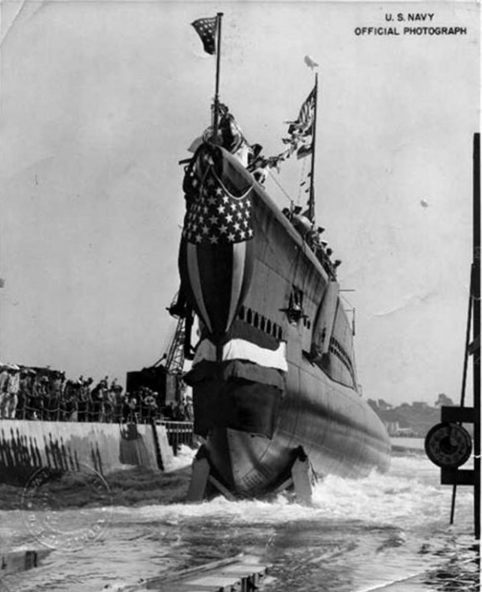
USS ''Tinosa'' (SS-283), a , was the first ship of the United States Navy to be named for the tinosa. Construction The ''Tinosa'' was laid down on 21 February 1942 at Vallejo, California, by the Mare Island Navy Yard; launched on 7 October 1942; sponsored by Mrs. Katharine Shanks Malloy, wife of Captain William E. Malloy; and commissioned on 15 January 1943, Lt. Comdr. Lawrence Randall Daspit in command. Operations during World War II After preliminary operations, the submarine proceeded to Hawaii, arriving at Pearl Harbor on 16 April 1943. Over the next two years, she completed twelve war patrols in the Pacific and was credited with sinking 16 enemy ships, totaling 64,655 tons. First and second patrols, May–August 1943 On her first war patrol, conducted from 3 May to 19 June 1943, ''Tinosa'' damaged three enemy ships in the waters east of Kyūshū, Japan, while sustaining some depth-charge damage herself. After refitting at Midway, she got underway on 7 July to ... [...More Info...] [...Related Items...] OR: [Wikipedia] [Google] [Baidu] |
USS Tunny (SS-282)
USS ''Tunny'' (SS/SSG/APSS/LPSS-282) was a which saw service in World War II and in the Vietnam War. ''Tunny'' received nine battle stars and two Presidential Unit Citations for her World War II service and five battle stars for her operations during the Vietnam War. ''Tunny'' was the first ship of the United States Navy to be named for the tunny, any of several oceanic fishes resembling the mackerel Construction ''Tunnys keel was laid down on 10 November 1941 at Vallejo, California, by the Mare Island Navy Yard. She was launched on 30 June 1942, sponsored by Mrs. Frederick G. Crisp, wife of Rear Admiral Frederick G. Crisp, manager of the Mare Island Navy Yard, and commissioned on 1 September 1942. World War II service September 1942–January 1943 After commissioning, ''Tunny'' conducted shakedown training from California ports. On 29 November 1942, at a position in the Pacific Ocean off California which the armed tanker reported as but actually was in the vicinity ... [...More Info...] [...Related Items...] OR: [Wikipedia] [Google] [Baidu] |
Poluwat Island
Poluwat, also Polowat, formerly Puluwat, is a coral atoll and a municipality of Chuuk state, Federated States of Micronesia. Geography Polowat is located in the northwestern region ( Oksoritod), and there in the western area (Pattiw) of Chuuk state. The location is . The atoll has five islets (including itself) lying on the rim of the reef, with an aggregate land area of 3.4 km2, listed counterclockwise starting at Polowat in the southeast: #Polowat (east) #Alengelap (north rim) #To (north rim) #Alei (west) #Haw (south) Since Polowat Atoll has only a small lagoon, in comparison with most Micronesian atolls, the total size is only 7 km2. Alei in the west and Polowat in the east, the two largest islands of the atoll, have breadfruit trees at the middle and coconut palms along the shores. Along the northern rim of the reef, between Polowat and Alei, are Alengelap Islet and To Islet. The southern corner of the atoll is marked by Haw Islet, with 0.02 km2 the smallest ... [...More Info...] [...Related Items...] OR: [Wikipedia] [Google] [Baidu] |
Enderby Bank
Enderby may refer to: Places ;Antarctica and subantarctic * Enderby Islands (''Islas Enderby''), Chile, Magallanes y Antártica Chilena islands ** Enderby Island (Chile) (''Isla Enderly''), principal island of the Islas Enderby group * Enderby Land, a projecting land mass of East Antarctica * Enderby Plain, an abyssal plain located off the coast of Enderby Land, East Antarctica * Enderby Point, Falkland Islands ;Australia * Enderby Island (Australia), Western Australia * Enderby Reef, Western Australia ;Canada * Enderby, British Columbia, a city ;Ecuador * Enderby Island (Ecuador) (''Isla Enderby''), Galápagos Islands ;England * Enderby, Leicestershire, a civil parish * Enderby's Wharf, Greenwich Peninsula, London Borough of Greenwich ;Federated States of Micronesia * Enderby Bank, a coral reef near Alet Island, Poluwat Atoll, Chuuk state * Enderby Island (Micronesia), also known as Poluwat Atoll, Chuuk state ;New Zealand * Enderby Island * Mount Enderby * Point En ... [...More Info...] [...Related Items...] OR: [Wikipedia] [Google] [Baidu] |
Google Maps
Google Maps is a web mapping platform and consumer application offered by Google. It offers satellite imagery, aerial photography, street maps, 360° interactive panoramic views of streets ( Street View), real-time traffic conditions, and route planning for traveling by foot, car, bike, air (in beta) and public transportation. , Google Maps was being used by over 1 billion people every month around the world. Google Maps began as a C++ desktop program developed by brothers Lars and Jens Rasmussen at Where 2 Technologies. In October 2004, the company was acquired by Google, which converted it into a web application. After additional acquisitions of a geospatial data visualization company and a real-time traffic analyzer, Google Maps was launched in February 2005. The service's front end utilizes JavaScript, XML, and Ajax. Google Maps offers an API that allows maps to be embedded on third-party websites, and offers a locator for businesses and other organizations in numero ... [...More Info...] [...Related Items...] OR: [Wikipedia] [Google] [Baidu] |


