|
Aggersborg
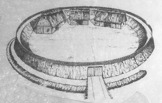
Aggersborg is the largest of Denmark's former Viking ring fortress, and one of the largest archaeological sites in Denmark. It is located near Aggersund on the north side of the Limfjord. It consists of a circular rampart surrounded by a ditch. Four main roads arranged in a cross connects the fortress center with the rampart's outer ring. The roads were tunneled under the outer rampart, leaving the circular structure intact. Many archaeological excavations have been conducted on the site, revealing its original structure and design. These excavations also uncovered a large number of artefacts from the Iron Age and Viking Age. The surface of the site as it exists today is a reconstruction. The location was originally the site of an Iron Age village which was removed during the 10th century to allow for the construction of the ring fortress. The fortress itself was likely constructed c. 980, and was later abandoned. Although the exact purpose of the fortress is unknown, the locatio ... [...More Info...] [...Related Items...] OR: [Wikipedia] [Google] [Baidu] |
Aggersund
Aggersund is a village in northern Denmark with a population of 264 (2024). The village is a part of Vesthimmerland Municipality in the North Jutland Region. Evidence of settlement in Aggersund dates back to the stone age, and the village contains one of the oldest viking fortresses in Denmark, Aggersborg. Much of the village's modern growth is associated with the commerce brought by the village's bridge. The Aggersund bridge () was once one of few crossings on the Limfjord. Because of the bridge's regional importance, it was a location of interest during the German occupation of Denmark and had a heavy occupying military presence during WWII. History There is evidence of a Stone Age settlement near Aggersund, from c. 5000 BCE. The remains of this settlement are located slightly north of the present day village, apparently because the strait of the fjord which it is located on was then significantly wider. During the Iron Age, a larger village emerged on the site. This village ... [...More Info...] [...Related Items...] OR: [Wikipedia] [Google] [Baidu] |
Viking Ring Fortress
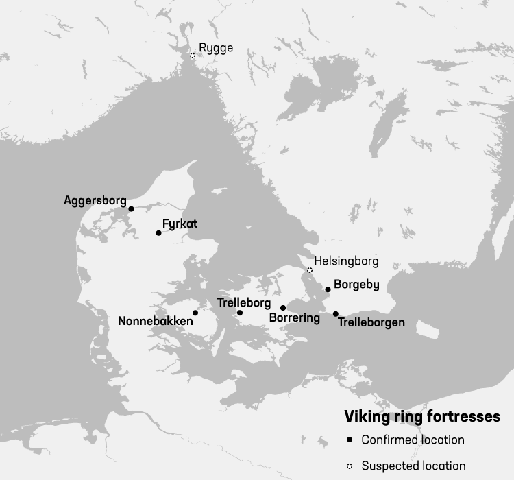
A Viking ring fortress, Trelleborg-type fortress, or trelleborg (pl. ''trelleborgs''), is a type of circular fort of a special design, built in Scandinavia during the Viking Age. These fortresses have a strictly circular shape, with roads and gates pointing in the four cardinal directions. Inside the fort, each quadrant has one, in a single case four, square blocks of longhouses, completing the geometric symmetry. There are a total of five confirmed Viking ring fortresses at present, located in Denmark (although sites in Sweden and across Northern Europe have similar construction). They have been dated to the reign of Harold Bluetooth of Denmark, with an estimated near contemporary time of construction c. 980. Their exact historical context is subject to debate. In 2023, the five Danish forts were inscribed on the UNESCO World Heritage List because of their unique architecture and testimony to the military power of the Jelling Dynasty. Etymology This specific type of fortif ... [...More Info...] [...Related Items...] OR: [Wikipedia] [Google] [Baidu] |
Harold Bluetooth
Harald "Bluetooth" Gormsson (; , died c. 985/86) was a king of Denmark and Norway. The son of King Gorm the Old and Thyra Dannebod, Harald ruled as king of Denmark from c. 958 – c. 986, introduced Christianity to Denmark and consolidated his rule over most of Jutland and Zealand. Harald's rule as king of Norway following the assassination of King Harald Greycloak of Norway was more tenuous, most likely lasting for no more than a few years in the 970s. Some sources say his son Sweyn Forkbeard forcibly deposed him from his Danish throne before his death. Name Harald's name is written as runic ''haraltr : kunukʀ'' (ᚼᛅᚱᛅᛚᛏᚱ ᛬ ᚴᚢᚾᚢᚴᛦ) in the Jelling stone inscription. In normalized Old Norse, this would correspond to ''Haraldr konungr'', i.e. "Harald king". The Latinized name as given in the medieval Danish chronicles is ''Haraldus Gormonis filius'' (Harald, Gorm's son). The given name ''Haraldr'' (also ''Haralldr'') is the equivalent of Old Eng ... [...More Info...] [...Related Items...] OR: [Wikipedia] [Google] [Baidu] |
Limfjord
The Limfjord ( common Danish: ''Limfjorden'' , in northwest Jutlandish dialect: ''Æ Limfjord'') is a shallow part of the sea, located in Denmark where it has been regarded as an inlet ever since Viking times. However, it now has entries both from the North Sea and Kattegat, and hence separates the North Jutlandic Island (Danish: ''Nørrejyske Ø'', which includes the old provinces of ''Vendsyssel'', ''Han herred'' and ''Thy'') from the rest of the Jutland Peninsula. The Limfjord extends from Thyborøn Channel on the North Sea to Hals on the Kattegat. It is approximately 180 kilometres (111 miles) long and of an irregular shape with numerous bays, narrowings, and islands, most notably Mors, and the smaller ones Fur, Venø, Jegindø, Egholm and Livø. It is deepest at Hvalpsund (24 metres). Its main port is Aalborg, where a railway bridge ( Jernbanebroen over Limfjorden) and road bridge (Limfjordsbroen) have been built across the Limfjord to Nørresundby, while motorw ... [...More Info...] [...Related Items...] OR: [Wikipedia] [Google] [Baidu] |
Circular Rampart
A circular rampart () is an embankment built in the shape of a circle that was used as part of the defences for a military fortification, hill fort or refuge, or was built for religious purposes or as a place of gathering. The period during which these structures were built ranged from the Neolithic to the Middle Ages. Construction The key feature of a circular Rampart (fortification), rampart is that the Earthworks (engineering)#Military use, embankment formed the primary element of the defensive fortification.Radig (1935), pp. 9–10. It can be constructed in various ways: as a simple earth embankment, as a wood and earth structure, or as a wall. Circular ramparts usually have a moat or Ditch (fortification), ditch in front of them; the embankment can be enhanced with a wooden palisade. They are mostly found on lowlands, but sometimes encircle the summit of a hill. Often several concentric rings were built, which produced a more effective defensive position against attackers. T ... [...More Info...] [...Related Items...] OR: [Wikipedia] [Google] [Baidu] |
Lindholm Høje
Lindholm Høje (Lindholm Hills, from Old Norse ''haugr'', hill or mound) is a major Viking burial site and former settlement situated to the north of and overlooking the city of Aalborg in Denmark. About the area The southern (lower) part of Lindholm Høje dates to 1000 – 1050 AD, the Viking Age, while the northern (higher) part is significantly earlier, dating back to the 5th century AD in the Nordic Iron Age. Mads Ravn, ''Death Ritual and Germanic Social Structure (c. AD 200-600)'', BAR international series 1164, Oxford: Archaeopress, 2003, p. 51 An unknown number of rocks have been removed from the site over the centuries, many, for example, being broken up in the 19th century for use in road constructions. The Viking Age part of the burial ground has suffered more from this than the older parts.Kristian HelmersenLindholm Høje Viking Ship Museum The first major archaeological excavation, which ultimately included 589 of the approximately 700 graves,Fredrik Svanberg, ''D ... [...More Info...] [...Related Items...] OR: [Wikipedia] [Google] [Baidu] |
Farstrup
Farstrup is a village, with a population of 447 (1 January 2025), in Northern Himmerland in Denmark. It is located between Nibe (13 km. East) and Løgstør (14 km. West) and 4 km south of Staun. It is located in Aalborg Municipality, North Jutland Region The North Jutland Region (), or in some official sources, the North Denmark Region, is an Regions of Denmark, administrative region of Denmark established on 1 January 2007 as part of the 2007 Danish Municipal Reform, 2007 Danish municipal refor .... A branch of the Ancient Road crosses north of the Limfjord Farstrup. Besides Staun, the nearest villages are Kolby, Barmer, Lundby and St. Ajstrup. Farstrup is around 29 km / 18 mi away from North Denmark's capital Aalborg (Aalborg) and 241 km / 150 mi from Denmark's capital Copenhagen (Copenhagen) with 3 airport location within 50 km. Farstrup school Farstrup church and Spigo are public institutions. There are bus connections to Aalbor ... [...More Info...] [...Related Items...] OR: [Wikipedia] [Google] [Baidu] |
Ålborg
Aalborg or Ålborg ( , , ) is Denmark's fourth largest urban settlement (behind Copenhagen, Aarhus, and Odense) with a population of 119,862 (1 July 2022) in the town proper and an urban population of 143,598 (1 July 2022). As of 1 July 2022, the Municipality of Aalborg had a population of 221,082, making it the third most populous in the country after the municipalities of Copenhagen (capital) and Aarhus. Eurostat and OECD have used a definition for the metropolitan area of Aalborg (referred to as a " functional urban area"), which includes all municipalities in the province () of North Jutland (), with a total population of 594,323 as of 1 July 2022. By road Aalborg is southwest of Frederikshavn, and north of Aarhus. The distance to Copenhagen is if travelling by road and not using ferries. The earliest settlements date to around AD 700. Aalborg's position at the narrowest point on the Limfjord made it an important harbour during the Middle Ages, and later a lar ... [...More Info...] [...Related Items...] OR: [Wikipedia] [Google] [Baidu] |
Parapet
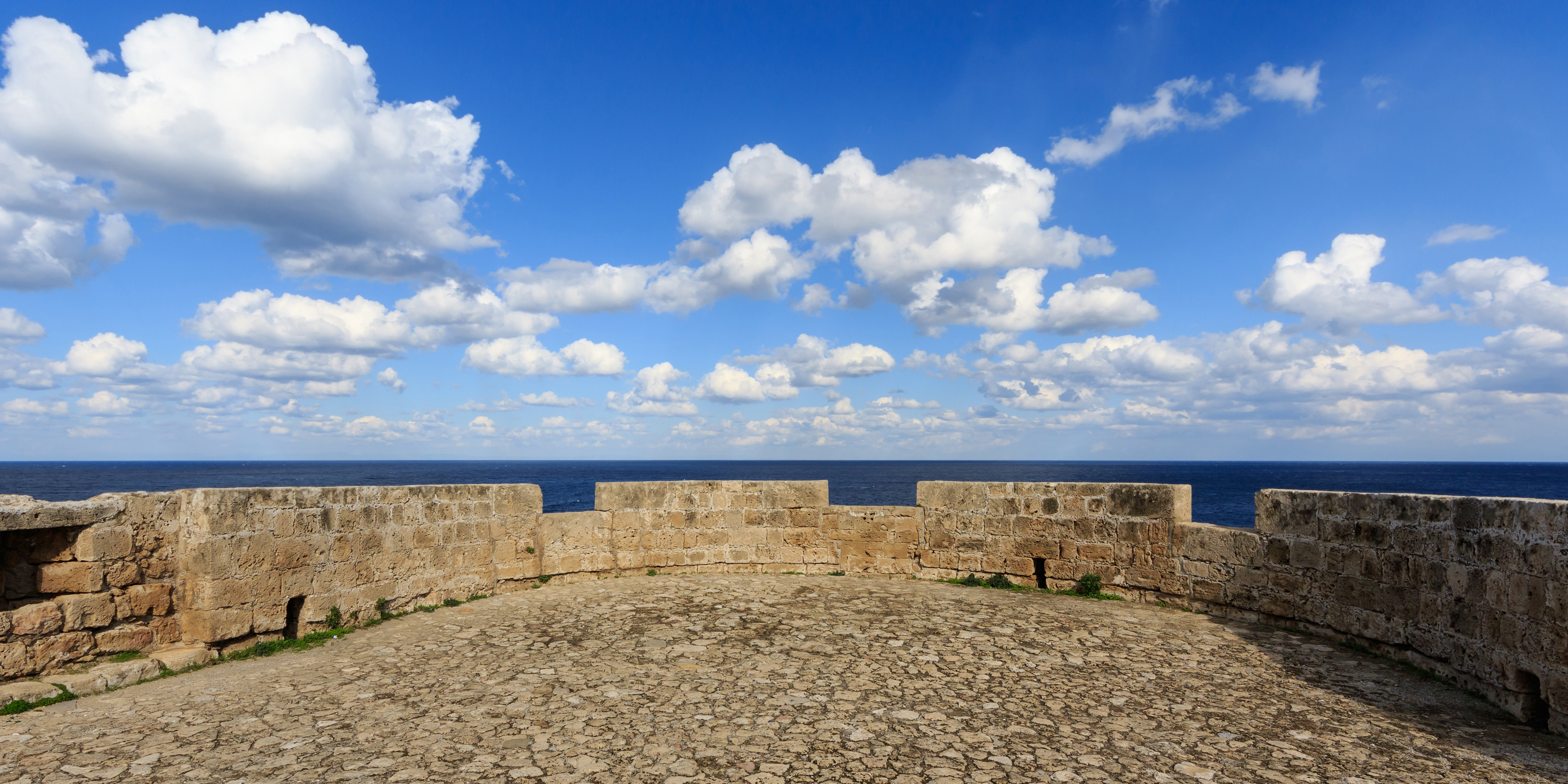
A parapet is a barrier that is an upward extension of a wall at the edge of a roof, terrace, balcony, walkway or other structure. The word comes ultimately from the Italian ''parapetto'' (''parare'' 'to cover/defend' and ''petto'' 'chest/breast'). Where extending above a roof, a parapet may simply be the portion of an exterior wall that continues above the edge line of the roof surface, or may be a continuation of a vertical feature beneath the roof such as a fire wall or party wall. Parapets were originally used to defend buildings from military attack, but today they are primarily used as guard rails, to conceal rooftop equipment, reduce wind loads on the roof, and to prevent the spread of fires. Parapet types Parapets may be plain, embattled, perforated or panelled, which are not mutually exclusive terms. *Plain parapets are upward extensions of the wall, sometimes with a coping at the top and corbel below. *Embattled parapets may be panelled, but are pierced, if not ... [...More Info...] [...Related Items...] OR: [Wikipedia] [Google] [Baidu] |
Barracks
Barracks are buildings used to accommodate military personnel and quasi-military personnel such as police. The English word originates from the 17th century via French and Italian from an old Spanish word 'soldier's tent', but today barracks are usually permanent buildings. The word may apply to separate housing blocks or to complete complexes, and the plural form often refers to a single structure and may be English plurals#Plural in form but singular in construction, singular in construction. The main objective of barracks is to separate soldiers from the civilian population and reinforce discipline, training, and ''esprit de corps''. They have been called "discipline factories for soldiers". Like industrial factories, some are considered to be shoddy or dull buildings, although others are known for their magnificent architecture such as Collins Barracks, Dublin, Collins Barracks in Dublin and others in Paris, Berlin, Madrid, Vienna, or London. From the rough barracks of 19th- ... [...More Info...] [...Related Items...] OR: [Wikipedia] [Google] [Baidu] |
Hærvejen
Hærvejen ( Danish, literally: ''the army road'', , literally: ''oxen way'', , literally: oxen path), sometimes referred to in English as the Ox Road, is the name given to an ancient trackway in Denmark and Schleswig-Holstein. The route runs from Viborg via Flensburg to Hamburg, the territory of which it entered at Ochsenzoll ("oxen toll", "toll" in the meaning of "customs") and where it connected with other roads. It has been known by several other names throughout history, most importantly "the Cattle Road" (''Studevejen'') and "the Oxen Road" or "Ox Road" (''Oksevejen'' / ''Ochsenweg''). History The road runs more or less along the watershed of the Jutland Peninsula, known as the ''Jyske Højderyg'' (Jutland Ridge), similar to the ridgeways in England. By using this route one could avoid rivers, or ford them close to their origins where they were still shallow. As time went by this route was improved with paved fords, embankments and bridges. Concentrations of mounds, def ... [...More Info...] [...Related Items...] OR: [Wikipedia] [Google] [Baidu] |


