|
Agafonovo
Agafonovo (russian: Агафоново) is the name of several rural localities in Russia: * Agafonovo, Kirov Oblast, a village in Lyumpanursky Rural Okrug of Sanchursky District in Kirov Oblast; * Agafonovo, Odintsovsky District, Moscow Oblast, a village in Nikolskoye Rural Settlement of Odintsovsky District in Moscow Oblast; * Agafonovo, Podolsky District, Moscow Oblast, a village in Strelkovskoye Rural Settlement of Podolsky District in Moscow Oblast; * Agafonovo, Krasnogorodsky District, Pskov Oblast, a village in Krasnogorodsky District of Pskov Oblast * Agafonovo, Novorzhevsky District, Pskov Oblast, a village in Novorzhevsky District of Pskov Oblast * Agafonovo, Pskovsky District, Pskov Oblast, a village in Pskovsky District of Pskov Oblast * Agafonovo, Sandovsky District, Tver Oblast, a village in Toporovskoye Rural Settlement of Sandovsky District in Tver Oblast * Agafonovo, Zapadnodvinsky District, Tver Oblast, a village in Benetskoye Rural Settlement of Zapadnodvinsky ... [...More Info...] [...Related Items...] OR: [Wikipedia] [Google] [Baidu] |
Agafonovo, Vyaznikovsky District, Vladimir Oblast
Agafonovo (russian: Агафоново) is a rural locality (a village) in Oktyabrskoye Rural Settlement, Vyaznikovsky District, Vladimir Oblast, Russia. The population was 3 as of 2010. Geography Agafonovo is located 20 km southwest of Vyazniki Vyazniki (russian: Вязники) is the name of several inhabited localities in Russia. ;Urban localities *Vyazniki, Vladimir Oblast, a town in Vyaznikovsky District of Vladimir Oblast ;Rural localities * Vyazniki, Samara Oblast, a settlement ... (the district's administrative centre) by road. Zhartsy is the nearest rural locality. References Rural localities in Vyaznikovsky District {{Vyaznikovsky-geo-stub ... [...More Info...] [...Related Items...] OR: [Wikipedia] [Google] [Baidu] |
Agafonovo, Sokolsky District, Vologda Oblast
Agafonovo (russian: Агафоново) is a rural locality (a village) in Chuchkovskoye Rural Settlement, Sokolsky District, Vologda Oblast, Russia. The population was 3 as of 2002. Geography Agafonovo is located 75 km northeast of Sokol The Sokol movement (, ''falcon'') is an all-age gymnastics organization first founded in Prague in the Czech region of Austria-Hungary in 1862 by Miroslav Tyrš and Jindřich Fügner. It was based upon the principle of " a strong mind in a so ... (the district's administrative centre) by road. Boyarskoye is the nearest rural locality. References Rural localities in Sokolsky District, Vologda Oblast {{SokolskyVLG-geo-stub ... [...More Info...] [...Related Items...] OR: [Wikipedia] [Google] [Baidu] |
Pskovsky District
Pskovsky District (russian: Пско́вский райо́н) is an administrativeLaw #833-oz and municipalLaw #419-oz district (raion), one of the twenty-four in Pskov Oblast, Russia. It is located in the northwest of the oblast and borders with Gdovsky District in the north, Strugo-Krasnensky District in the northeast, Porkhovsky District in the east, Ostrovsky District in the south, and with Palkinsky and Pechorsky Districts in the southwest. Lake Peipus forms the border with Estonia in the west. The area of the district is . Its administrative center is the city of Pskov (which is not administratively a part of the district). Population: 37,216 ( 2002 Census); Geography The district is located east and southeast of Lake Peipus, into which the rivers in the north of the district flow directly. The central and the southern parts of the district lie in the basin of the Velikaya River, a major tributary of Lake Peipus. The two biggest tributaries of the Velikaya within the di ... [...More Info...] [...Related Items...] OR: [Wikipedia] [Google] [Baidu] |
Vologda Oblast
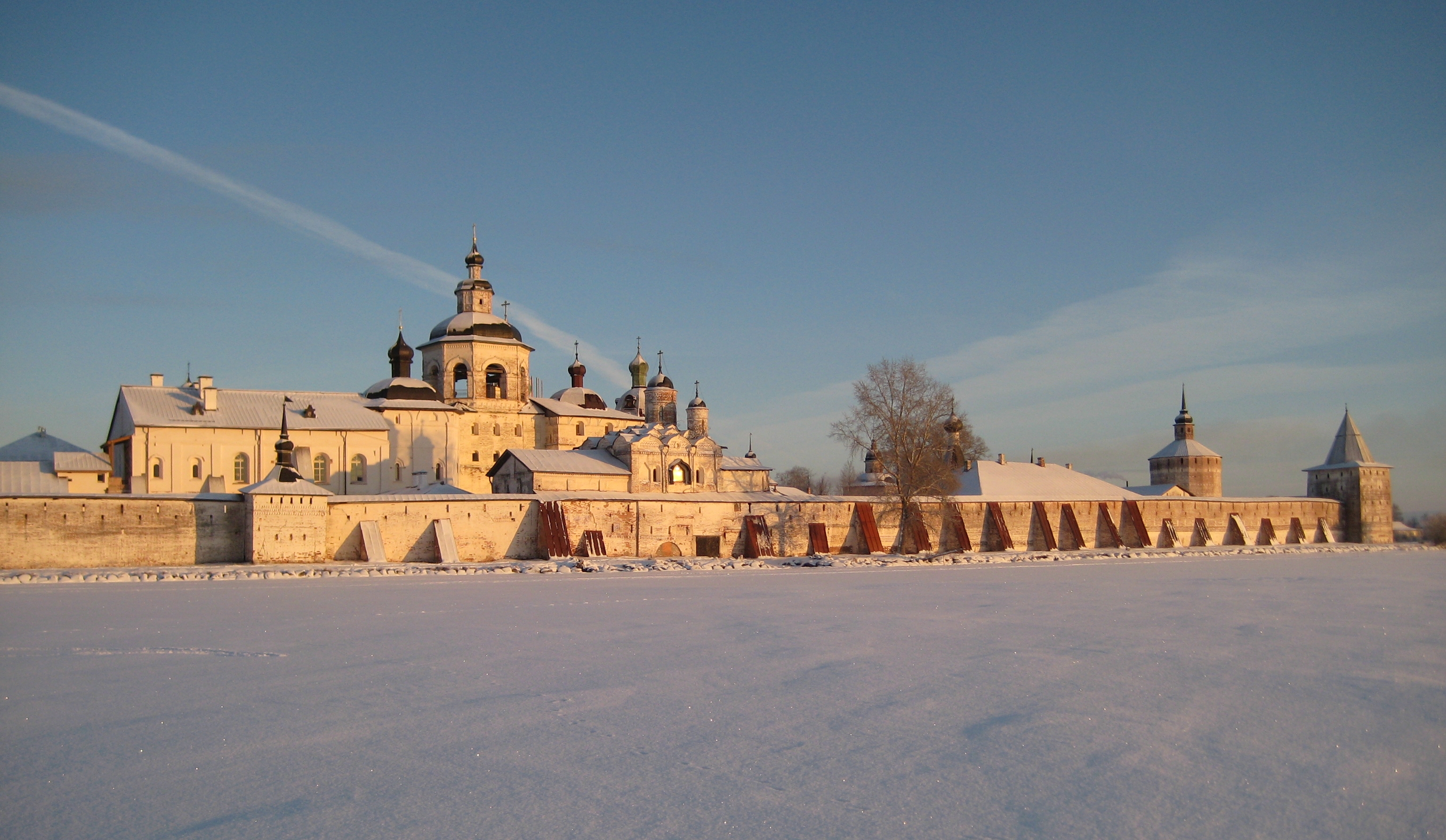
Vologda Oblast ( rus, Вологодская область, p=vəlɐˈɡotskəjə ˈobləsʲtʲ, r=Vologodskaya oblast, ) is a federal subject of Russia (an oblast). Its administrative center is Vologda. The Oblast has a population of 1,202,444 ( 2010 Census). The largest city is Cherepovets, the home of the Severstal metallurgical plant, the largest industrial enterprise in the oblast. Vologda Oblast is rich in historic monuments, such as the Kirillo-Belozersky Monastery, Ferapontov Monastery (a World Heritage Site) with the frescoes of Dionisius, medieval towns of Velikiy Ustyug and Belozersk, and baroque churches of Totma and Ustyuzhna. Large reserves of wood and fresh water are the main natural resources. History The area of Vologda Oblast was settled by Finnic peoples in prehistory, and most of the toponyms in the region are in fact Finnic. Vepsians, who still live in the west of the oblast, are the descendants of that population. Subsequently, the area was colonized ... [...More Info...] [...Related Items...] OR: [Wikipedia] [Google] [Baidu] |
Kirillovsky District
Kirillovsky District (russian: Кири́лловский райо́н) is an administrativeLaw #371-OZ and municipalLaw #1116-OZ district (raion), one of the twenty-six in Vologda Oblast, Russia. It is located in the north of the oblast and borders with Kargopolsky and Konoshsky Districts of Arkhangelsk Oblast in the north, Vozhegodsky and Ust-Kubinsky Districts in the east, Vologodsky District in the southeast, Sheksninsky District in the south, Cherepovetsky District in the southeast, Belozersky and Vashkinsky Districts in the west, and with Vytegorsky District in the northwest. The area of the district is . Its administrative center is the town of Kirillov.Resolution #178 Population: 18,627 ( 2002 Census); The population of Kirillov accounts for 48.7% of the district's total population. Geography The area of the district is elongated from north to south and is split into two roughly equal parts by the divide between the basins of the Arctic Ocean and the Caspian Se ... [...More Info...] [...Related Items...] OR: [Wikipedia] [Google] [Baidu] |
Vyaznikovsky District
Vyaznikovsky District (russian: Вя́зниковский райо́н) is an administrativeLaw #130-OZ and municipalLaw #62-OZ district (raion), one of the sixteen in Vladimir Oblast, Russia. It is located in the northeast of the oblast. The area of the district is . Its administrative center is the town of Vyazniki Vyazniki (russian: Вязники) is the name of several inhabited localities in Russia. ;Urban localities *Vyazniki, Vladimir Oblast, a town in Vyaznikovsky District of Vladimir Oblast ;Rural localities * Vyazniki, Samara Oblast, a settlement .... Population: 50,692 ( 2002 Census); The population of Vyazniki accounts for 51.0% of the district's total population. References Notes Sources * * * {{Authority control Districts of Vladimir Oblast ... [...More Info...] [...Related Items...] OR: [Wikipedia] [Google] [Baidu] |
Vladimir Oblast
Vladimir Oblast (russian: Влади́мирская о́бласть, ''Vladimirskaya oblast'') is a federal subjects of Russia, federal subject of Russia (an oblast). Its closest border 66 Meter, km east of central Moscow, the administrative center is the types of inhabited localities in Russia, city of Vladimir, Russia, Vladimir, which is located east of Moscow. As of the Russian Census (2010), 2010 Census, the oblast's population was 1,443,693. The UNESCO World Heritage Site, World Heritage List includes the 12th-century cathedrals of Vladimir, Russia, Vladimir, Suzdal, Bogolyubovo, Vladimir Oblast, Bogolyubovo, and Kideksha. Geography Vladimir Oblast borders Moscow Oblast, Moscow, Yaroslavl Oblast, Yaroslavl, Ivanovo Oblast, Ivanovo, Ryazan Oblast, Ryazan, and Nizhny Novgorod Oblasts. The oblast is situated in the center of the East European Plain. The Klyazma River, Klyazma and the Oka River, Oka are the most important rivers. There are approximately three hundred lake ... [...More Info...] [...Related Items...] OR: [Wikipedia] [Google] [Baidu] |
Gorokhovetsky District
Gorokhovetsky District (russian: Горохове́цкий райо́н) is an administrativeLaw #130-OZ and municipalLaw #56-OZ district (raion), one of the sixteen in Vladimir Oblast, Russia. It is located in the east of the oblast. The area of the district is . Its administrative center is the town A town is a human settlement. Towns are generally larger than villages and smaller than cities, though the criteria to distinguish between them vary considerably in different parts of the world. Origin and use The word "town" shares an ori ... of Gorokhovets. Population: 25,832 ( 2002 Census); The population of Gorokhovets accounts for 60.7% of the district's total population. References Notes Sources * * * {{Authority control Districts of Vladimir Oblast ... [...More Info...] [...Related Items...] OR: [Wikipedia] [Google] [Baidu] |
Zapadnodvinsky District
Zapadnodvinsky District (russian: Западнодви́нский райо́н) is an administrative and municipalLaw #4-ZO district (raion), one of the thirty-six in Tver Oblast, Russia. It is located in the west of the oblast and borders with Toropetsky District in the north, Andreapolsky District in the northeast, Nelidovsky District in the east, Zharkovsky District in the southeast, Velizhsky District of Smolensk Oblast in the south, and with Kunyinsky District of Pskov Oblast in the west. The area of the district is . Its administrative center is the town of Zapadnaya Dvina. Population: 16,018 ( 2010 Census); The population of Zapadnaya Dvina accounts for 58.6% of the district's total population. Geography The whole area in the district belongs to the drainage basin of the Daugava, known in Russia as the Western Dvina. The Westerd Dvina itself crosses the district from the northwest to the southeast, and a stretch of it makes the border to Pskov Oblast. The major tribu ... [...More Info...] [...Related Items...] OR: [Wikipedia] [Google] [Baidu] |


