|
Afobaka Airstrip
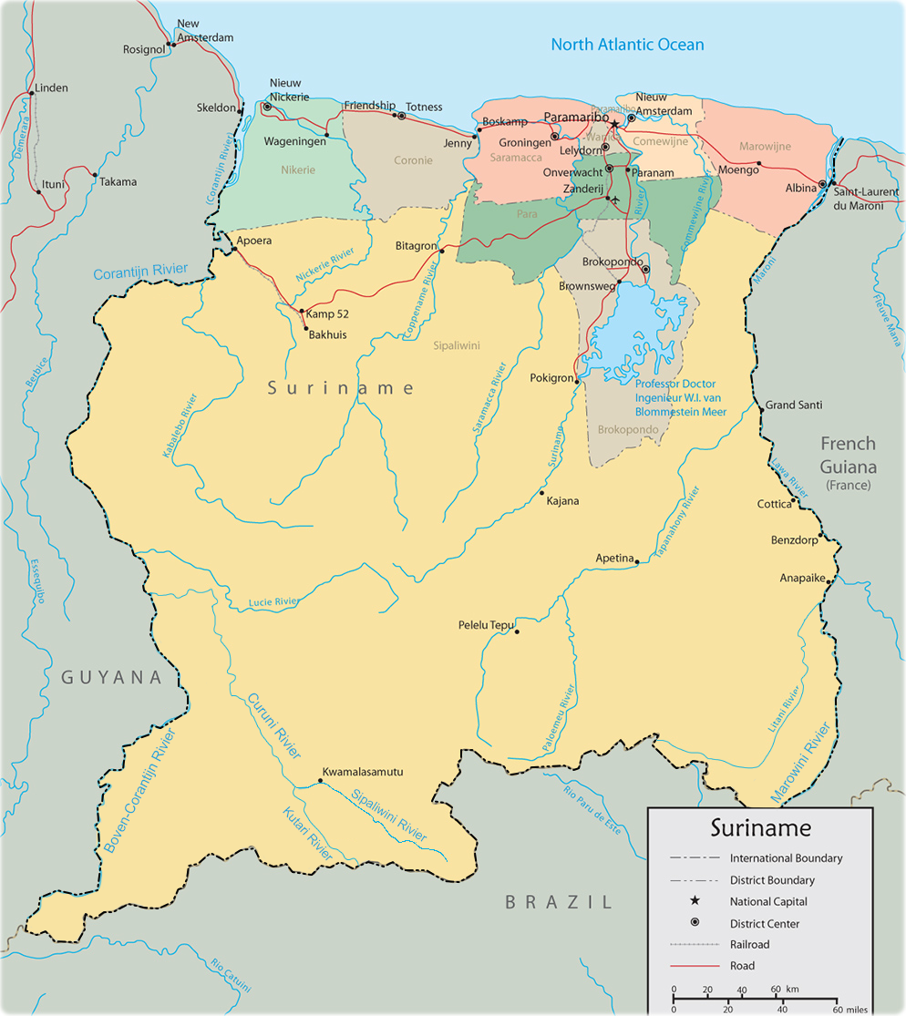
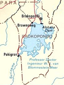
Afobaka Airstrip is an airstrip near Afobaka, a village in the Brokopondo District of Suriname. The airstrip is primarily used for emergency evacuation and gold shipment. It is from the campsite of the Gross Rosebel gold mine, which has its own airstrip. History of the airstrip Between 1960 and 1964, the 1913 meter-long Afobaka Dam was built on the Suriname River, creating the Brokopondo Reservoir. The airstrip is north of the dam. Airlines and destinations Airlines serving this airport are: See also * * * List of airports in Suriname * Transport in Suriname The Republic of Suriname ( nl, Republiek Suriname) has a number of forms of transport. Transportation emissions are an increasing part of Suriname's contributions to climate change, as part of the Nationally Determined Contributions for the Par ... References External linksAfobakka Airstrip [...More Info...] [...Related Items...] OR: [Wikipedia] [Google] [Baidu] |
Luchtvaartdienst Suriname
The Luchtvaartdienst Suriname is the Civil Aviation Department of the Suriname Ministry of Transport, Communication and Tourism. It is responsible for the regulation of all aviation activities in the country, and ensures that all activities are carried out in compliance with international standards. It is a member of the International Civil Aviation Organization The International Civil Aviation Organization (ICAO, ) is a specialized agency of the United Nations that coordinates the principles and techniques of international air navigation, and fosters the planning and development of international sc ... (ICAO). In April 2010, John Veira, the head of Luchtvaartdienst Suriname, was killed in his home by gunmen. Dutch language Airports and Airst ...
|
Blue Wing Airlines
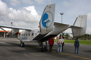
Blue Wing Airlines n.v. is an airline with its head office on the grounds of Zorg en Hoop Airport in Paramaribo, Suriname.Eight feared dead in Suriname air crash " ''''. 16 May 2010. Retrieved on 17 May 2010. The airline started operations in January 2002 and operates charter and scheduled services from to destinations in the interior of , |
Transport In Suriname
The Republic of Suriname ( nl, Republiek Suriname) has a number of forms of transport. Transportation emissions are an increasing part of Suriname's contributions to climate change, as part of the Nationally Determined Contributions for the Paris Agreement, Suriname has committed to emissions controls for vehicles and increased public transit investment. Railways *Railways, total: 166 km single track. **standard gauge: 80 km gauge in West-Suriname, but not in use. This stretch was constructed as part of the West Suriname Plan. **narrow gauge: 86 km gauge Lawa Railway from Onverwacht to Sarakreek, currently not in use. In 2014, a plan had been announced to reopen the line between Onverwacht and Paramaribo Central Station. The intention was for the line to be extended onto Paramaribo Adolf Pengel Airport, but as of May 2020, the project has not started. Rail links with adjacent countries * None Highways Afobakaweg The Afobakaweg is a paved 2-lane road connect ... [...More Info...] [...Related Items...] OR: [Wikipedia] [Google] [Baidu] |
List Of Airports In Suriname
This is a list of airports in Suriname, sorted by location. Suriname, officially the Republic of Suriname, is a country in northern South America. It is situated between French Guiana to the east and Guyana to the west. The southern border is shared with Brazil and the northern border is the Atlantic coast. Suriname is the smallest sovereign state in terms of area and population in South America. The country is the only Dutch-speaking region in the Western Hemisphere that is not a part of the Kingdom of the Netherlands. __TOC__ Airports Airport names shown in bold indicate the airport has scheduled service on commercial airlines. Airports with unverified coordinates: Map See also * Transport in Suriname * Operation Grasshopper * List of airports by ICAO code: S#SM - Suriname * Wikipedia: WikiProject Aviation/Airline destination lists: South America#Suriname References Civil Aviation Department of Suriname* * - includes IATA codes World Aero Data: Airports ... [...More Info...] [...Related Items...] OR: [Wikipedia] [Google] [Baidu] |
Vortex Aviation Suriname
In fluid dynamics, a vortex ( : vortices or vortexes) is a region in a fluid in which the flow revolves around an axis line, which may be straight or curved. Vortices form in stirred fluids, and may be observed in smoke rings, whirlpools in the wake of a boat, and the winds surrounding a tropical cyclone, tornado or dust devil. Vortices are a major component of turbulent flow. The distribution of velocity, vorticity (the curl of the flow velocity), as well as the concept of circulation are used to characterise vortices. In most vortices, the fluid flow velocity is greatest next to its axis and decreases in inverse proportion to the distance from the axis. In the absence of external forces, viscous friction within the fluid tends to organise the flow into a collection of irrotational vortices, possibly superimposed to larger-scale flows, including larger-scale vortices. Once formed, vortices can move, stretch, twist, and interact in complex ways. A moving vortex carries so ... [...More Info...] [...Related Items...] OR: [Wikipedia] [Google] [Baidu] |
Pegasus Air Services
Pegasus ( grc-gre, Πήγασος, Pḗgasos; la, Pegasus, Pegasos) is one of the best known creatures in Greek mythology. He is a winged divine stallion usually depicted as pure white in color. He was sired by Poseidon, in his role as horse-god, and foaled by the Gorgon Medusa. He was the brother of Chrysaor, born at a single birthing when his mother was decapitated by Perseus. Greco-Roman poets wrote about his ascent to heaven after his birth and his obeisance to Zeus, king of the gods, who instructed him to bring lightning and thunder from Olympus. Pegasus is the creator of Hippocrene, the fountain on Mount Helicon. He was captured by the Greek hero Bellerophon, near the fountain Peirene, with the help of Athena and Poseidon. Pegasus allowed Bellerophon to ride him in order to defeat the monster Chimera, which led to many more exploits. Bellerophon later fell from Pegasus's back while trying to reach Mount Olympus. Both Pegasus and Bellerophon were said to have died at ... [...More Info...] [...Related Items...] OR: [Wikipedia] [Google] [Baidu] |
Gum Air
Gum Air is a Surinamese airline based at Zorg en Hoop Airport in Paramaribo, Suriname. Gum Air cooperates with Trans Guyana Airways to provide daily flights between Zorg en Hoop Airport, Zorg en Hoop Airport (ORG) in Paramaribo, Suriname and Ogle Airport, Ogle Airport (OGL) in Georgetown, Guyana. History Gum Air was founded in 1971 by six brothers of the Gummels family. The company they started in March 1964 was agriculture airspray company named Surinam Sky Farmers and Gum Air its offspring focused more on domestic flights and regional charters. Whereas Surinam Sky Farmers has its base in the rice district of Nickerie District, Nickerie at the Wageningen Airstrip together with Overeem Air Service maintaining Grumman Ag Cat aircraft, Gum Air has set up its domestic airline at the Zorg en Hoop Airport in the city. Current operation Gum Air has its base at Zorg en Hoop airfield in the capital city Paramaribo and now mainly flies with single engine Cessna airplanes and twin-engin ... [...More Info...] [...Related Items...] OR: [Wikipedia] [Google] [Baidu] |
Zorg En Hoop Airport
Zorg en Hoop Airport is an airport serving general aviation in the city of Paramaribo, Suriname. It is west of the Suriname River, between the city quarters of Zorg en Hoop and Flora. The runway length includes a displaced threshold on Runway 11. The airport is suitable for charters and regular services with smaller aircraft, and for helicopter flights. Connection is maintained from the airport for several smaller airports in the interior of Suriname, and for charter flights to the Caribbean. The only regular international service is to Georgetown, Guyana Georgetown is the capital (political), capital and largest city of Guyana. It is situated in Demerara-Mahaica, region 4, on the Atlantic Ocean coast, at the mouth of the Demerara River. It is nicknamed the "Garden City of the Caribbean." It is t ..., with flights operated by Trans Guyana Airways and Gum Air with smaller propeller aircraft. Airlines operating jet aircraft serve Paramaribo via Johan Adolf Pengel Internation ... [...More Info...] [...Related Items...] OR: [Wikipedia] [Google] [Baidu] |
Brokopondo Reservoir
The Brokopondo Reservoir, officially named Professor Doctor Ingenieur W. J. van Blommestein Meer, and also called the Brokopondostuwmeer, is a large reservoir in Suriname. It is named after the Surakarta-born Dutch hydrological engineer Willem Johan van Blommestein. With a surface area of approximately , depending on the current water level, it is one of the largest reservoirs in the world, covering nearly one percent of the country. History The reservoir was created by constructing Afobaka Dam across the Suriname River between 1961 and 1964. The dam spanning the river is tall, and is built near the small town of Afobaka. Contrary to the reservoir's long official name, it was quickly rechristened ''Brokopondomeer'' by Dutch-speaking locals, after the town of Brokopondo further downstream from where the dam was constructed. The length of the dam, including secondary dams along the margins of the reservoir, is . The watershed which feeds the reservoir is in area. The reser ... [...More Info...] [...Related Items...] OR: [Wikipedia] [Google] [Baidu] |
Afobaka
Afobaka is a village in the Brokopondo District of Suriname. Between 1960 and 1964, the 1913 meter-long Afobaka Dam was built on the Suriname River, creating the Brokopondo Reservoir. The Afobaka Airstrip is nearby. Healthcare Afobaka is home to a Medische Zending Medische Zending Primary Health Care Suriname, commonly known as Medische Zending (Dutch for "medical mission") or MZ is a Surinamese charitable organization offering primary healthcare to remote villages in the interior of Suriname. History The ... healthcare centre. References External links Populated places in Brokopondo District {{Suriname-geo-stub ... [...More Info...] [...Related Items...] OR: [Wikipedia] [Google] [Baidu] |
Suriname River
The Suriname River (Dutch: ''Surinamerivier'') is 480 km long and flows through the country Suriname. Its sources are located in the Guiana Highlands on the border between the Wilhelmina Mountains and the Eilerts de Haan Mountains (where it is known as the Gran Rio). The river flows below the reservoir along Brokopondo, Berg en Dal, the migrant communities Klaaskreek and Nieuw-Lombé, Jodensavanne, Carolina, Ornamibo and Domburg, before reaching the capital Paramaribo on the left bank and Meerzorg on the right bank. At Nieuw-Amsterdam it is joined by the Commewijne and immediately thereafter at the sandspit Braamspunt it flows into the Atlantic Ocean. The river has several sets of rapids as well as a few dams, the largest of which is the Afobaka Dam. The river's flow is interrupted by the Brokopondo Reservoir, which therefore divides the river into two sections. The upstream section runs almost entirely through the Sipaliwini district, and the downstream section runs ... [...More Info...] [...Related Items...] OR: [Wikipedia] [Google] [Baidu] |
Afobaka Dam
The Afobaka Dam is an embankment dam with a main gravity dam section on the Suriname River near Afobaka in Brokopondo District of Suriname. The primary purpose of the dam is to generate hydroelectric power and it supports a 180 MW power station. In 1958, Suriname Aluminum Company LLC (), a subsidiary of Alcoa, gained an agreement with the Suriname government to build the dam to power an aluminium smelter. Construction began in 1961 and it was completed in 1964. About 75% of power generated is used for processing aluminum, the rest is used in Paramaribo downstream. The power station was operational in 1965 but the very large reservoir, Brokopondo Reservoir, was not completely filled until 1971. Greenhouse gases emitted from the reservoir resulted in poor water quality for decades. Highly acidic In computer science, ACID ( atomicity, consistency, isolation, durability) is a set of properties of database transactions intended to guarantee data validity despite errors, po ... [...More Info...] [...Related Items...] OR: [Wikipedia] [Google] [Baidu] |

.jpg)


.jpg)

.jpg)