|
Aerospace Data Facility-Southwest
Aerospace Data Facility-Southwest (ADF-SW) is one of three satellite ground stations operated by the National Reconnaissance Office (NRO) in the continental United States. Located within White Sands Missile Range in southern New Mexico, the facility is responsible for the command and control of reconnaissance satellites involved in the collection of intelligence information and for the dissemination of that intelligence to other U.S. government agencies. List of commanders *Col Kelly D. Burt, ~2020 *Col Michael C. Todd, 8 July 2020 See also * Aerospace Data Facility-Colorado * Aerospace Data Facility-East * Pine Gap * RAF Menwith Hill * Spy satellite A reconnaissance satellite or intelligence satellite (commonly, although unofficially, referred to as a spy satellite) is an Earth observation satellite or communications satellite deployed for military or intelligence applications. The ... References {{Reflist National Reconnaissance Office Buildings and structures ... [...More Info...] [...Related Items...] OR: [Wikipedia] [Google] [Baidu] |
White Sands Missile Range
White Sands Missile Range (WSMR) is a United States Army military testing area and firing range located in the US state of New Mexico. The range was originally established as the White Sands Proving Ground on 9July 1945. White Sands National Park is located within the range. Significant events *The first atomic bomb (code named Trinity) was test detonated at Trinity Site near the northern boundary of the range on 16 July 1945, seven days after the White Sands Proving Ground was established. *After the conclusion of World War II, 100 long-range German V-2 rockets that were captured by U.S. military troops were brought to WSMR. Of these, 67 were test-fired between 1946 and 1951 from the White Sands V-2 Launching Site. (This was followed by the testing of American rockets, which continues to this day, along with testing other technologies.) *NASA's Space Shuttle Columbia landed on the Northrop Strip at WSMR on 30 March 1982 as the conclusion to mission STS-3. This was the only ti ... [...More Info...] [...Related Items...] OR: [Wikipedia] [Google] [Baidu] |
Las Cruces, New Mexico
Las Cruces (; "the crosses") is the second-largest city in the U.S. state of New Mexico and the seat of Doña Ana County. As of the 2020 census the population was 111,385. Las Cruces is the largest city in both Doña Ana County and southern New Mexico. The Las Cruces metropolitan area had an estimated population of 213,849 in 2017. It is the principal city of a metropolitan statistical area which encompasses all of Doña Ana County and is part of the larger El Paso–Las Cruces combined statistical area. Las Cruces is the economic and geographic center of the Mesilla Valley, the agricultural region on the floodplain of the Rio Grande which extends from Hatch to the west side of El Paso, Texas. Las Cruces is the home of New Mexico State University (NMSU), New Mexico's only land-grant university. The city's major employer is the federal government on nearby White Sands Test Facility and White Sands Missile Range. The Organ Mountains, to the east, are dominant in the city's lands ... [...More Info...] [...Related Items...] OR: [Wikipedia] [Google] [Baidu] |
Satellite Ground Station
A ground station, Earth station, or Earth terminal is a terrestrial radio station designed for extraplanetary telecommunication with spacecraft (constituting part of the ground segment of the spacecraft system), or reception of radio waves from astronomical radio sources. Ground stations may be located either on the surface of the Earth, or in its atmosphere. Earth stations communicate with spacecraft by transmitting and receiving radio waves in the super high frequency (SHF) or extremely high frequency (EHF) bands (e.g. microwaves). When a ground station successfully transmits radio waves to a spacecraft (or vice versa), it establishes a telecommunications link. A principal telecommunications device of the ground station is the parabolic antenna. Ground stations may have either a fixed or itinerant position. Article 1 § III of the International Telecommunication Union (ITU) Radio Regulations describes various types of stationary and mobile ground stations, and their interre ... [...More Info...] [...Related Items...] OR: [Wikipedia] [Google] [Baidu] |
United States Air Force
The United States Air Force (USAF) is the air service branch of the United States Armed Forces, and is one of the eight uniformed services of the United States. Originally created on 1 August 1907, as a part of the United States Army Signal Corps, the USAF was established as a separate branch of the United States Armed Forces in 1947 with the enactment of the National Security Act of 1947. It is the second youngest branch of the United States Armed Forces and the fourth in order of precedence. The United States Air Force articulates its core missions as air supremacy, global integrated intelligence, surveillance and reconnaissance, rapid global mobility, global strike, and command and control. The United States Air Force is a military service branch organized within the Department of the Air Force, one of the three military departments of the Department of Defense. The Air Force through the Department of the Air Force is headed by the civilian Secretary of the Air Force ... [...More Info...] [...Related Items...] OR: [Wikipedia] [Google] [Baidu] |
National Reconnaissance Office
The National Reconnaissance Office (NRO) is a member of the United States Intelligence Community and an agency of the United States Department of Defense which designs, builds, launches, and operates the reconnaissance satellites of the U.S. federal government, and provides satellite intelligence to several government agencies, particularly signals intelligence (SIGINT) to the NSA, imagery intelligence (IMINT) to the NGA, and measurement and signature intelligence (MASINT) to the DIA. NRO is considered, along with the Central Intelligence Agency (CIA), National Security Agency (NSA), Defense Intelligence Agency (DIA), and National Geospatial-Intelligence Agency (NGA), to be one of the "big five" U.S. intelligence agencies. The NRO is headquartered in Chantilly, Virginia, south of the Washington Dulles International Airport. The Director of the NRO reports to both the Director of National Intelligence and the Secretary of Defense. The NRO's federal workforce is a hybrid o ... [...More Info...] [...Related Items...] OR: [Wikipedia] [Google] [Baidu] |
Satellite Ground Station
A ground station, Earth station, or Earth terminal is a terrestrial radio station designed for extraplanetary telecommunication with spacecraft (constituting part of the ground segment of the spacecraft system), or reception of radio waves from astronomical radio sources. Ground stations may be located either on the surface of the Earth, or in its atmosphere. Earth stations communicate with spacecraft by transmitting and receiving radio waves in the super high frequency (SHF) or extremely high frequency (EHF) bands (e.g. microwaves). When a ground station successfully transmits radio waves to a spacecraft (or vice versa), it establishes a telecommunications link. A principal telecommunications device of the ground station is the parabolic antenna. Ground stations may have either a fixed or itinerant position. Article 1 § III of the International Telecommunication Union (ITU) Radio Regulations describes various types of stationary and mobile ground stations, and their interre ... [...More Info...] [...Related Items...] OR: [Wikipedia] [Google] [Baidu] |
Continental United States
The contiguous United States (officially the conterminous United States) consists of the 48 adjoining U.S. states and the Federal District of the United States of America. The term excludes the only two non-contiguous states, Alaska and Hawaii (also the last ones admitted to the Union), and all other offshore insular areas, such as American Samoa, Guam, the Northern Mariana Islands, Puerto Rico, and the U.S. Virgin Islands. The colloquial term "Lower48" is used also, especially in relation to just Alaska (Hawaii is farther south). The related but distinct term continental United States includes Alaska (which is also on the continent of North America but separated from the 48 states by British Columbia and Yukon of Canada), but excludes the Hawaiian Islands and all U.S. territories in the Caribbean and the Pacific. The greatest distance (on a great-circle route) entirely within the contiguous U.S. is 2,802 miles (4,509 km), between Florida and the State of Washington; th ... [...More Info...] [...Related Items...] OR: [Wikipedia] [Google] [Baidu] |
New Mexico
) , population_demonym = New Mexican ( es, Neomexicano, Neomejicano, Nuevo Mexicano) , seat = Santa Fe , LargestCity = Albuquerque , LargestMetro = Tiguex , OfficialLang = None , Languages = English, Spanish ( New Mexican), Navajo, Keres, Zuni , Governor = , Lieutenant Governor = , Legislature = New Mexico Legislature , Upperhouse = Senate , Lowerhouse = House of Representatives , Judiciary = New Mexico Supreme Court , Senators = * * , Representative = * * * , postal_code = NM , TradAbbreviation = N.M., N.Mex. , area_rank = 5th , area_total_sq_mi = 121,591 , area_total_km2 = 314,915 , area_land_sq_mi = 121,298 , area_land_km2 = 314,161 , area_water_sq_mi = 292 , area_water_km2 = 757 , area_water_percent = 0.24 , population_as_of = 2020 , population_rank = 36th , 2010Pop = 2,117,522 , population_density_rank = 45th , 2000DensityUS = 17.2 , 2000Density = 6.62 , MedianHouseholdIncome = $51,945 , IncomeRank = 45th , AdmittanceOrder = ... [...More Info...] [...Related Items...] OR: [Wikipedia] [Google] [Baidu] |
Reconnaissance Satellite
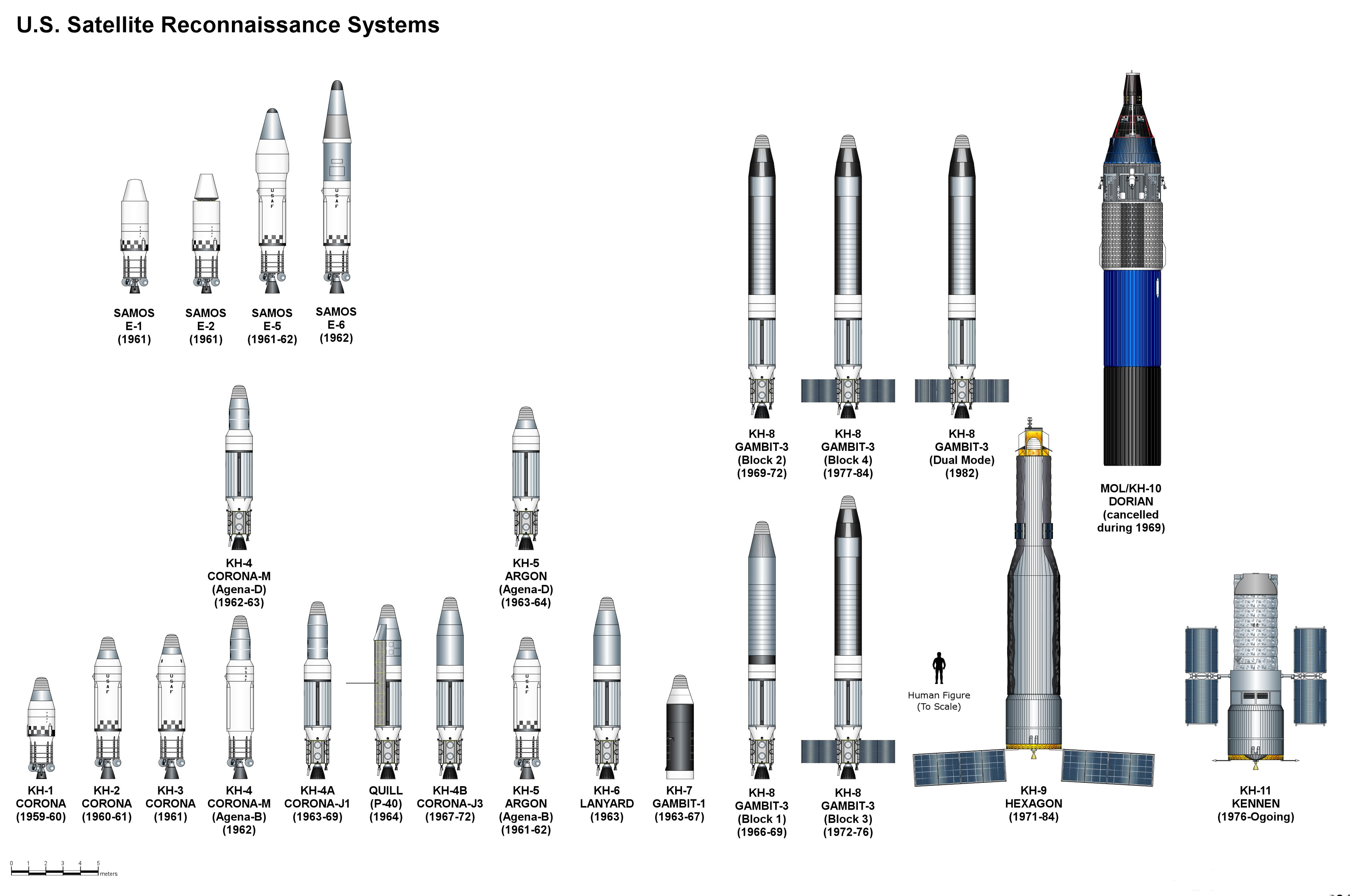
A reconnaissance satellite or intelligence satellite (commonly, although unofficially, referred to as a spy satellite) is an Earth observation satellite or communications satellite deployed for military or intelligence applications. The first generation type (i.e., Corona and Zenit) took photographs, then ejected canisters of photographic film which would descend back down into Earth's atmosphere. Corona capsules were retrieved in mid-air as they floated down on parachutes. Later, spacecraft had digital imaging systems and downloaded the images via encrypted radio links. In the United States, most information available about reconnaissance satellites is on programs that existed up to 1972, as this information has been declassified due to its age. Some information about programs before that time is still classified information, and a small amount of information is available on subsequent missions. A few up-to-date reconnaissance satellite images have been declassified o ... [...More Info...] [...Related Items...] OR: [Wikipedia] [Google] [Baidu] |
Aerospace Data Facility-Colorado
Aerospace Data Facility-Colorado (ADF-C) is one of three satellite ground stations operated by the National Reconnaissance Office (NRO) in the continental United States. Located within Buckley Space Force Base in Aurora, Colorado, the facility is responsible for the command and control of reconnaissance satellites involved in the collection of intelligence information and for the dissemination of that intelligence to other U.S. government agencies. The National Security Agency (NSA) Central Security Service (CSS) Colorado Cryptologic Center (CCC) is co-located with ADF-C and employs around 850 NSA personnel. List of commanders *Col Cary C. Chun, July 2005–August 2007 *Col David D. Thompson, July 2007–May 2009 *Col Stephen Denker, July 2009–January 2011 *Col Ronald L. Huntley, January 2011–August 2012 *Col B. Chance Saltzman, June 2012–June 2014 *Col Daniel D. Wright III *Brig Gen Christopher Povak, June 2016–August 2019 *Col Jacob Middleton Jr., 29 August 2019 *Col ... [...More Info...] [...Related Items...] OR: [Wikipedia] [Google] [Baidu] |
Aerospace Data Facility-East
Aerospace Data Facility-East (ADF-E), also known as Area 58 and formerly known as Defense Communications Electronics Evaluation and Testing Activity (DCEETA), is one of three satellite ground stations operated by the National Reconnaissance Office (NRO) in the continental United States. Located within Fort Belvoir, Virginia, the facility is responsible for the command and control of reconnaissance satellites involved in the collection of intelligence information and for the dissemination of that intelligence to other U.S. government agencies. Function ADF East is co-located with elements of the National Geospatial-Intelligence Agency, the agency responsible for the operation of the U.S. space-based imagery constellation. Authors James Bamford and Jeffrey Richelson report that the site manages the KH-11 imagery spacecraft and the Lacrosse radar imaging spacecraft. History First use The first documented use of material downloaded at ADF East was on January 21, 1977, when th ... [...More Info...] [...Related Items...] OR: [Wikipedia] [Google] [Baidu] |
Pine Gap
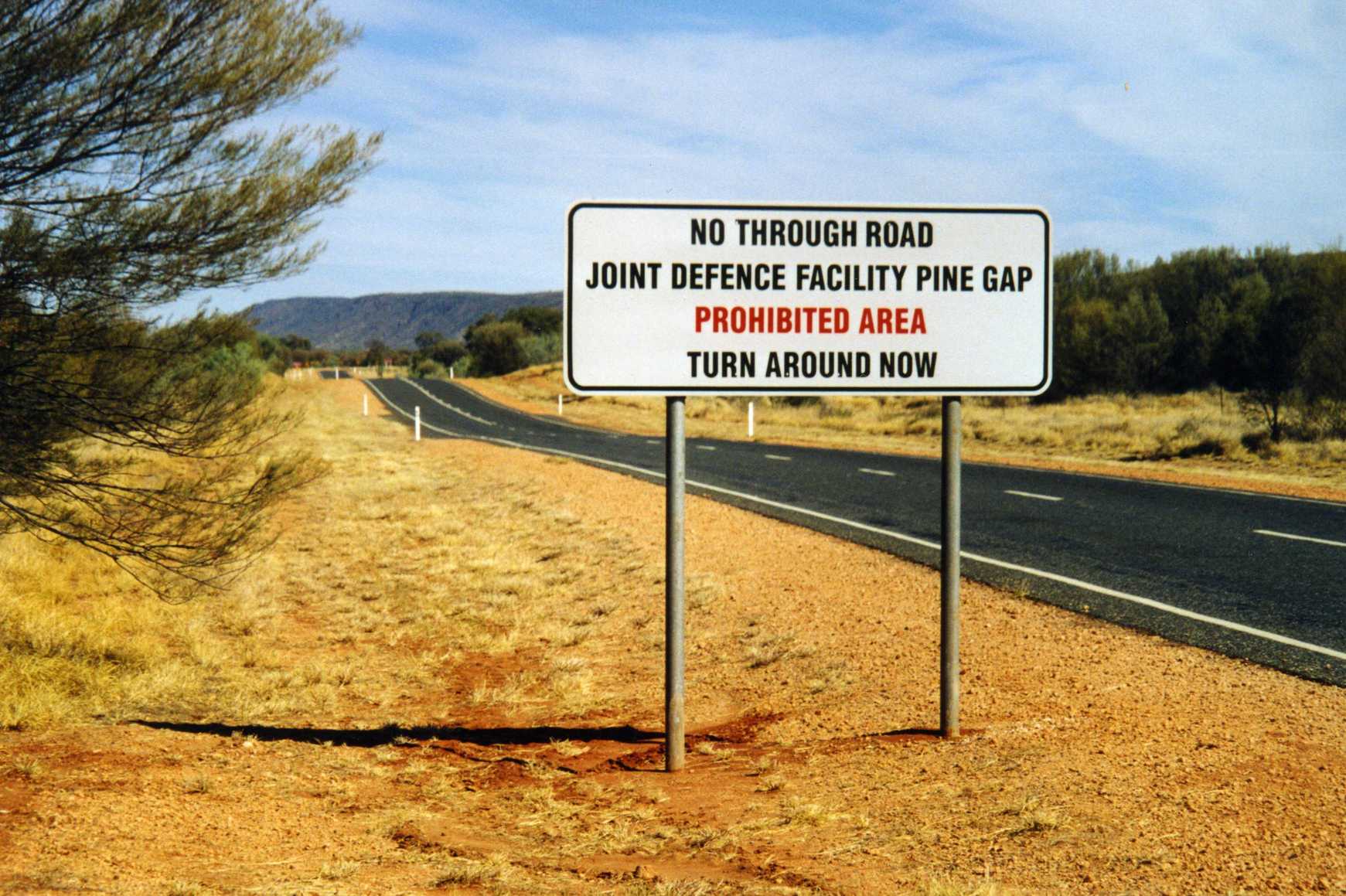
Pine Gap is a satellite surveillance base and Australian Earth station approximately south-west of the town of Alice Springs, Northern Territory in the center of Australia. It is jointly operated by Australia and the United States, and since 1988 it has been officially called the Joint Defence Facility Pine Gap (JDFPG); previously, it was known as Joint Defence Space Research Facility. The station is partly run by the US Central Intelligence Agency (CIA), US National Security Agency (NSA), and US National Reconnaissance Office (NRO) and is a key contributor to the NSA's global interception/surveillance effort, which included the ECHELON program. The classified NRO name of the Pine Gap base is Australian Mission Ground Station (AMGS), while the unclassified cover term for the NSA function of the facility is RAINFALL.Peter CronauThe Base: Pine Gap's Role in US Warfighting, ''Background Briefing'', ABC Radio National, 20 August 2017; Ryan Gallagher and Peter CronauThe U.S. Spy ... [...More Info...] [...Related Items...] OR: [Wikipedia] [Google] [Baidu] |


