|
Adele People
The Adele people are an ethnic group and tribe of the Ghanaian-Togo border area indigenous to the Jasikan, Nkwanta South and Nkwanta North Districts of the Volta Region centered around the towns of Dadiasi and Dutukpene in Ghana and the Sotouboua Prefecture of the Centrale Region centered around the towns of Assouma Kedeme and Tiefouma in Togo. The Adele people are agricultural, primarily farming yams, cassava, plantain, beans, and rice. Demographics A 1960 census estimated that there were 2,400 Adele people in Ghana. Today, the tribe has population size of approximately 37,400. Other cultural groups in the Ghana-Togo border region include the Atwode, Basari, Bimoba, Buems, Chokosi, Ewe, Guang, Konkomba, Kotokoli, and Likpe peoples. Language The Adele language, one of the Ghana–Togo Mountain languages, is spoken by Adele, Kunda, Animere, and Northern Ghanaian peoples. Adele Women The Adele Women is an agricultural group in the Upper Volta region of G ... [...More Info...] [...Related Items...] OR: [Wikipedia] [Google] [Baidu] |
Ghana
Ghana (; tw, Gaana, ee, Gana), officially the Republic of Ghana, is a country in West Africa. It abuts the Gulf of Guinea and the Atlantic Ocean to the south, sharing borders with Ivory Coast in the west, Burkina Faso in the north, and Togo in the east.Jackson, John G. (2001) ''Introduction to African Civilizations'', Citadel Press, p. 201, . Ghana covers an area of , spanning diverse biomes that range from coastal savannas to tropical rainforests. With nearly 31 million inhabitants (according to 2021 census), Ghana is the List of African countries by population, second-most populous country in West Africa, after Nigeria. The capital and List of cities in Ghana, largest city is Accra; other major cities are Kumasi, Tamale, Ghana, Tamale, and Sekondi-Takoradi. The first permanent state in present-day Ghana was the Bono state of the 11th century. Numerous kingdoms and empires emerged over the centuries, of which the most powerful were the Kingdom of Dagbon in the north and ... [...More Info...] [...Related Items...] OR: [Wikipedia] [Google] [Baidu] |
Nkwanta North District
Nkwanta North District (french: Nkwanta Nord) is one of the eight districts in Oti Region, Ghana. Originally it was formerly part of the then-larger Nkwanta District on 10 March 1989, until the northern part of the district was split off to create Nkwanta North District on 29 February 2008, which was established by Legislative Instrument (L.I.) 1846; thus the remaining part has been renamed to become Nkwanta South District, which was later elevated to municipal district assembly status on 14 November 2017 (effectively 15 March 2018) to become Nkwanta South Municipal District; which was established by Legislative Instrument (L.I.) 2283. The district assembly is located in the northern part of Oti Region and has Kpassa Kpassa is the capital of Nkwanta North District, a district in the Oti Region of Ghana. The Oti Region was part of the Volta Region of Ghana until 2019. The inhabitants of Kpassa are mostly Konkomba people. The other inhabitants are Basare. The B ... as its capital ... [...More Info...] [...Related Items...] OR: [Wikipedia] [Google] [Baidu] |
Paul Yeboah
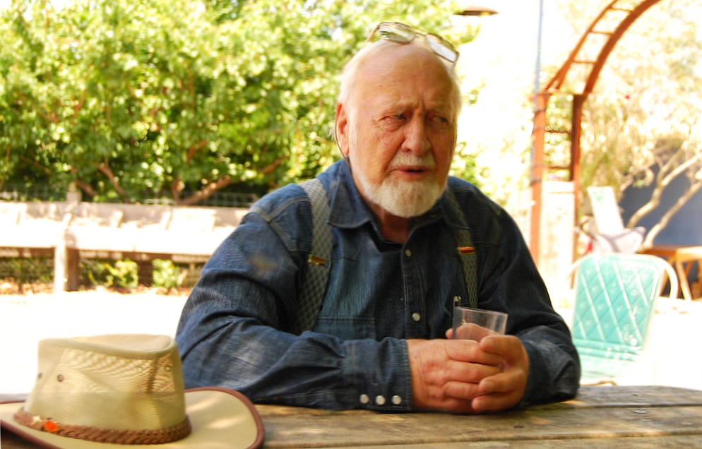
Paul Yeboah (1970 – 2021) was an educator, farmer, permaculturist, community developer, and social entrepreneur. Yeboah founded and coordinated the Ghana Permaculture Institute and Network in Techiman, Ghana, West Africa. It is located in the Brong-Ahafo Region of Ghana. The purpose of the Institute is to build and maintain a stable food system, to take care of the local ecosystems, and to improve the quality of life in the rural areas. The GPN trains students and community in sustainable ecological farming techniques. They support projects throughout Ghana; women groups, micro-finance projects; teach growing moringa; mushroom production; alley cropping, food forests development and Agroforestry. Permaculture is based on natural sustainable design systems. An agricultural system that uses practices to keep soil fertile, crops and livestock healthy. It encourages protection of the environment and an environmental lifestyle; so as to maintain environmental stability and maintain ... [...More Info...] [...Related Items...] OR: [Wikipedia] [Google] [Baidu] |
Permaculture
Permaculture is an approach to land management and settlement design that adopts arrangements observed in flourishing natural ecosystems. It includes a set of design principles derived using whole-systems thinking. It applies these principles in fields such as regenerative agriculture, town planning, rewilding, and community resilience. Permaculture originally came from "permanent agriculture", but was later adjusted to mean "permanent culture", incorporating social aspects. The term was coined in 1978 by Bill Mollison and David Holmgren, who formulated the concept in opposition to modern industrialized methods instead adopting a more traditional or "natural" approach to agriculture. Permaculture has many branches including ecological design, ecological engineering, regenerative design, environmental design, and construction. It also includes integrated water resources management, sustainable architecture, and regenerative and self-maintained habitat and agricultural system ... [...More Info...] [...Related Items...] OR: [Wikipedia] [Google] [Baidu] |
Northern Region (Ghana)
The Northern Region is one of the sixteen regions of Ghana. It is located in the north of the country and was the largest of the sixteen regions, covering an area of 70,384 square kilometres or 31 percent of Ghana's area until December 2018 when the Savannah Region and North East Region were created from it. The Northern Region is divided into 14 districts. The region's capital is Tamale. Geography and climate Location and size The Northern Region is bordered on the north by the North East region, on the east by the eastern Ghana-Togo international border, on the south by the Oti region, and on the west by the Savannah Region. Northern region is made up of 14 districts. Climate and vegetation The Northern Region is a Guinea Savanna grassland. The vegetation consists predominantly of grassland, especially savanna with clusters of drought-resistant trees such as baobabs or acacias. Between January and March is the dry season. The wet season is between about July and December ... [...More Info...] [...Related Items...] OR: [Wikipedia] [Google] [Baidu] |
Animere People
Animere (sometimes ''Anyimere'' or ''Kunda'', the latter being a toponym) is a language spoken in Ghana, in the Kecheibe and Kunda villages of the ''Benimbere'' people. It is most closely related to Kebu or Akebu of Togo. Both are Ghana Togo Mountain languages (GTM), classified as members of the Ka-Togo group by Heine (1968). Like most other GTM languages, Animere is a noun-class language. Animere is an endangered language which is no longer being passed on to children; the speaker count is approximately 30 (Blench 2006).Blench (2006) notes that all 30 speakers are over 35 years old. A 2003 ''Ethnologue'' estimate of 700 probably counts all ethnic Benimbere. Bodomo 1996:38 states that "Animere (...) is said to be dying out (only 250 speakers now)". Bodomo's figure probably derives f ... [...More Info...] [...Related Items...] OR: [Wikipedia] [Google] [Baidu] |
Kunda People
Location The Kunda or Akunda people are an ethnic group of Mambwe District of Eastern Province of Zambia. They number approximately at 250,000 people. They speak Chikunda, a Bantu language closely related to Bisa and Nsenga. Most Kunda live on the eastern bank of the Luangwa River near South Luangwa National Park. Every August, they celebrate an annual festival called the Malaila Traditional Ceremony. History of the Kunda People (By William Vwapu) Origins of the Kunda People Dr. Francisco José de Lacerda e Almeida (1753 – 18 October 1798) the Portuguese explorer who led a Portuguese expedition to the Kazembe region of Zambia, does not mention the Kunda people. Silva Porto on his 1852 expedition mentions the Kunda people, ''“Where the Luangwa is crossed begins the territory of the Cunda.” ' David Livingstone during his 1868 visit to the ''Awemba'' country makes a sketch drawing of an ''“Akunda”'' person with facial tribal markings. The Kunda people were p ... [...More Info...] [...Related Items...] OR: [Wikipedia] [Google] [Baidu] |
Ghana–Togo Mountain Languages
The Ghana–Togo Mountain languages, formerly called Togorestsprachen (''Togo Remnant languages'') and Central Togo languages, form a grouping of about fourteen languages spoken in the mountains of the Ghana–Togo borderland. They are part of the Kwa branch of the Niger–Congo family. History of classification Bernhard Struck, in 1912, was the first to group together these languages under the label ''Semibantu von Mitteltogo''. Westermann, in his classification of the then Sudanic languages, adopted the grouping but called it ''Togorestsprachen''. This was mainly a loose geographical-typological grouping based on the elaborate noun class systems of the languages; lack of comparative data prevented a more definitive phylogenetic classification. Bernd Heine (1968) carried out comparative research among the group, establishing a basic division between ''Ka-Togo'' and ''Na-Togo'' based on the word for 'flesh' in the languages. Dakubu and Ford (1988) renamed this cluster the Ce ... [...More Info...] [...Related Items...] OR: [Wikipedia] [Google] [Baidu] |
Centrale Region, Togo
Centrale is one of Togo's five regions. Sokodé is the regional capital. Centrale is the least populated region in Togo with a total of 617,871 people according to a census done in 2010. Other major cities in the Centrale region include Tchamba and Sotouboua. Centrale is divided into the prefectures of Blitta, Subprefecture Mö, Sotouboua, Tchamba, and Tchaoudjo. Centrale is located north of Plateaux Region and south of Kara Region. Like the rest of the regions of Togo, it borders Ghana in the west and Benin in the east — specifically the Northern Region in the northwest and the Volta Region in the southwest, and the Donga Department in the northeast and the Collines Department in the southeast. See also * Regions of Togo Togo is divided into five regions (''régions'', singular ''région'') (capitals in parentheses): The regions are divided into 30 Prefectures of Togo, prefectures. See also *List of Togolese regions by Human Development Index *Prefectures of ... [...More Info...] [...Related Items...] OR: [Wikipedia] [Google] [Baidu] |
Sotouboua Prefecture
Sotouboua Prefecture is a prefecture of the Centrale Region of Togo. Its principal town is Sotouboua. At the time of the 2010 census it had a population of 158,425 people. Covering an area of , it is divided administratively into 11 cantons including Sotouboua, Adjengré, Tchébébé, Aouda, Fazao, Titigbé, Kaniamboua, Bodjondé, Sassaro, Kazaboua, Tabindè. Populated places * Ayengre * Mpoti * Sotouboua Sotouboua is a town located in Sotouboua Prefecture in the Centrale Region of Togo. Transport Sotouboua is the apparent railway terminus in the north. Accident On 6 December 1965, two trucks crashed into a crowd of dancers, killing 125 people. ... References {{Togo-geo-stub Prefectures of Togo Centrale Region, Togo ... [...More Info...] [...Related Items...] OR: [Wikipedia] [Google] [Baidu] |


