|
Adelberg Ludwigshausen
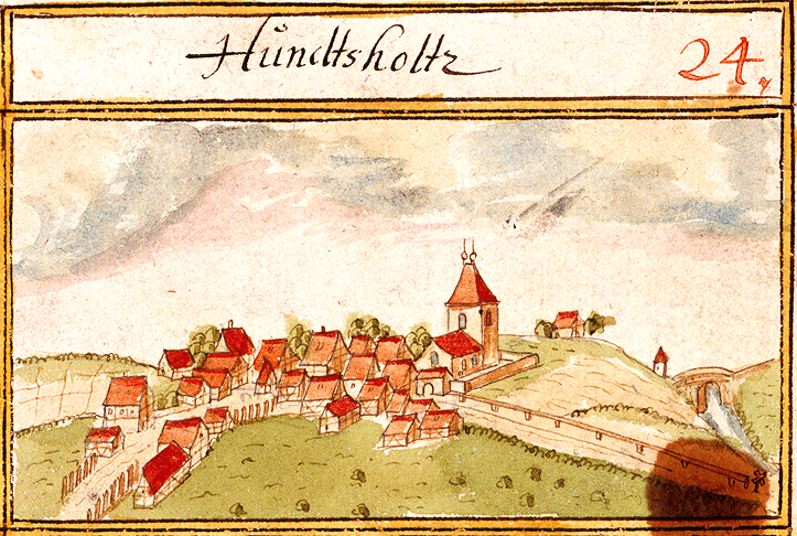
Adelberg is a municipality in the district of Göppingen in Baden-Württemberg in southern Germany. Geography Adelberg lies in the Schurwald forest, at an altitude of around 334 to 473m. Climate The annual rainfall of 1045mm is within the top quarter of values recorded in Germany, with lower values registered in 87% of the country's weather stations. The driest month is February, while the most rainfall comes in June, with almost double the rainfall of February. Variability of precipitation is extremely strong, and only 18% of weather stations record higher seasonal variations. Local subdivisions The municipality of Adelberg is made up of the village of Adelberg, the neighbouring hamlet of Adelberg Abbey, and the houses, Herrenmühle, Mittelmühle und Zachersmühle. In 1971, the hamlet of Nassach was transferred to the municipality of Uhingen. History The site on which Adelberg now stands was originally occupied by the village of Hundsholz (''Dogwood''), which is the source of ... [...More Info...] [...Related Items...] OR: [Wikipedia] [Google] [Baidu] |
Schurwald
The Schurwald is a wooded mountain range in Baden-Württemberg, southern Germany, which at its highest point is 513.2 m above sea level. It is one of the most important Recreation areas for the Stuttgart area. Over the centuries, the vast forests of the mountain range supplied the surrounding towns and villages with wood for fuel and building material, and thus acquired the name "Schurwald", which comes from the German word, ''Schur'', which can mean a shearing or clearcutting. Geography The Schurwald begins to the east of Stuttgart and runs eastwards to the foothills of the Swabian Alb, passing through the districts of Esslingen, Göppingen and Rems-Murr-Kreis. It is bordered to the south by valleys of the Neckar and Fils rivers, and to the north by the valley of the Rems. At the eastern end of the Schurwald, which is crossed by numerous streams, is the Herrenbach Reservoir. Geology Geologically, the Schurwald is a dissected cuesta, formed by headward erosion. It contains clay ... [...More Info...] [...Related Items...] OR: [Wikipedia] [Google] [Baidu] |

